The best road cycling routes in Tucurrique
3.0
(1)
217
riders
5
rides
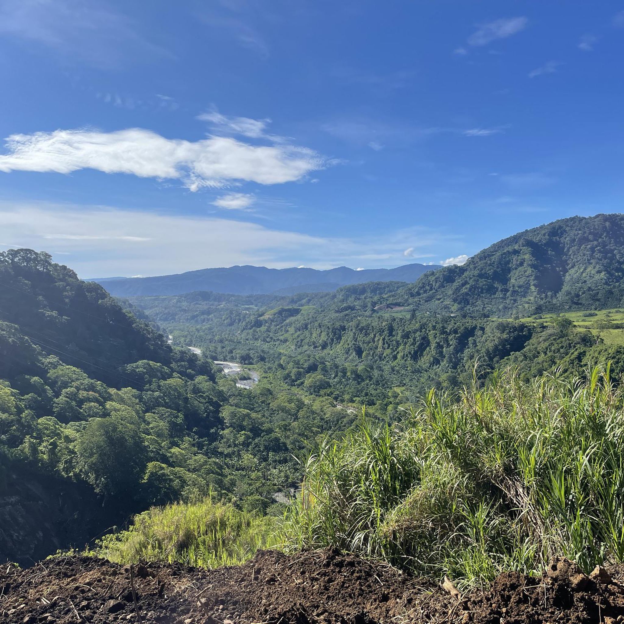
Road cycling routes in Tucurrique, Costa Rica, are characterized by diverse terrain and significant elevation changes. The region features a landscape of lush tropical forests, extensive sugarcane and coffee plantations, and prominent rivers like the Pejibaye. Cyclists can expect challenging routes with substantial elevation gain, often traversing scenic valleys and offering distant views of the Turrialba Volcano. The area's topography provides a demanding environment for road cyclists.
Best road cycling routes in Tucurrique
- The most popular road cycling route is…
Last updated: July 2, 2026
103
riders
112km
06:22
2,340m
2,340m
Hard road ride. Very good fitness required. Mostly well-paved surfaces and easy to ride.
3.0
(1)
67
riders
136km
07:35
2,640m
2,640m
Hard road ride. Very good fitness required. Mostly well-paved surfaces and easy to ride.

Sign up for free
26
riders
96.9km
05:22
1,790m
1,790m
Hard road ride. Very good fitness required. Mostly well-paved surfaces and easy to ride.
17
riders
130km
07:00
2,100m
2,100m
Hard road ride. Very good fitness required. Some segments of this route may be unpaved and difficult to ride.
6
riders
102km
06:16
2,460m
2,460m
Hard road ride. Very good fitness required. Mostly well-paved surfaces and easy to ride.
Our route recommendations are based on thousands of hikes, rides, and runs completed by other people on komoot.
Start today with a free account
Your next adventure awaits.
Login or Signup
Popular around Tucurrique

Tips from the Community

Bring plenty of water, a spare tire, food, and tools. Much of the trail is gravel, and the terrain is very tricky for maneuvering a bike. Adjust your brakes well.
0
0

Going in the summer helps you appreciate the place.
0
1
The place is very spacious, it is recommended to go in summer for good photos, completely pedalable. You can see the video "Basilica de los Angeles" on our Official Channel "BIKERS COSTA RICA" https://www.facebook.com/reel/1191863962050845
0
1

A green oasis. One of the largest in the city.
2
0

Here you will find peace and relaxation
0
0


Frequently Asked Questions
How many road cycling routes are available in Tucurrique?
This guide details 5 challenging road cycling routes in Tucurrique. The komoot community has explored over 200 routes in the broader area, indicating a wide variety of options for cyclists.
What is the typical terrain and difficulty for road cycling in Tucurrique?
Road cycling in Tucurrique is characterized by diverse and challenging terrain, featuring significant elevation gains often exceeding 1,500 feet, with some routes having over 7,600 feet of ascent. Routes are mostly on paved surfaces and wind through lush tropical forests, sugarcane, and coffee plantations. All routes listed in this guide are rated as difficult, requiring very good fitness.
Are there any routes that offer extensive views or pass by notable landmarks?
Yes, many routes offer impressive views. For instance, the Cabra Negra Espresso Bar – Cristo de Sabanilla loop from Turrialba winds through agricultural lands with extensive views of surrounding valleys. Distant views of the majestic Turrialba Volcano are also common from many points along the routes.
What kind of natural features can I expect to see along the road cycling routes?
The routes frequently traverse areas rich in natural beauty. You'll encounter lush tropical forests, extensive coffee and sugarcane plantations, and views of prominent rivers like the Pejibaye River. The picturesque Orosi Valley also forms a scenic backdrop for many rides. You might even spot local wildlife such as sloths, iguanas, monkeys, and toucans, especially near riverbanks.
Are there any specific attractions or points of interest near the cycling routes?
Yes, the region offers several points of interest. Cyclists can pass by or visit the scenic Orosi Valley, the Cachí artificial lake, or even a waterfall when river levels permit. The Río Orisí in Tapantí National Park is another notable natural feature.
What do other road cyclists enjoy most about road cycling in Tucurrique?
The komoot community highly rates the road cycling experience in Tucurrique, with an average score of 3.0 stars. Cyclists often praise the challenging climbs, the stunning views of lush plantations, and the unique experience of riding through diverse terrain with glimpses of the Pejibaye River and Orosi Valley.
Are there any loop trails for road cycling in Tucurrique?
Yes, several routes in Tucurrique are designed as loops. For example, the Cachi Dam – Christ the Redeemer Statue loop from San Juan Norte and the Copatchi – Beautiful View loop from Noche Buena are popular circular options, allowing you to start and end at the same point.
What is the best season to go road cycling in Tucurrique?
While specific seasonal recommendations are not provided, the region's tropical climate suggests that conditions can vary. It's advisable to check local weather forecasts before your ride, especially concerning rainfall, as lush forests and rivers are prominent features.
Are there any routes suitable for advanced road cyclists seeking a significant challenge?
Absolutely. All the routes in this guide are rated as difficult and are ideal for advanced road cyclists. The Alto Gracias a Dios loop from Turrialba, for instance, features over 2,400 meters of elevation gain over 102 kilometers, offering a substantial test of endurance.
What are the road conditions like for cycling in Tucurrique?
The road cycling routes in Tucurrique are generally on mostly paved surfaces. However, given the challenging terrain and significant elevation changes, cyclists should be prepared for varied road quality and steep inclines. Some very challenging sections may even require dismounting and pushing your bike.
Can I find cafes or places to rest along the road cycling routes?
While specific cafes are not detailed for every route, the Cabra Negra Espresso Bar – Cristo de Sabanilla loop from Turrialba starts near a known espresso bar, suggesting that some routes may have access to refreshments. It's always a good idea to carry sufficient water and snacks, especially on longer, more remote sections.
Are there any routes that pass by the Cachi Dam?
Yes, the Cachi Dam – Christ the Redeemer Statue loop from San Juan Norte is a prominent route that includes the Cachi Dam. Another option is the Christ the Redeemer Statue – Cachi Dam loop from Estación Santiago, which also features the dam.
Most popular routes in Tucurrique
Most popular attractions in Tucurrique

Get inspired with the komoot mobile app


Explore more
Browse the best Road cycling routes in other regions.
