The best road cycling routes in Bogotá D.C.
4.7
(602)
13,378
riders
48
rides
Road cycling in Bogotá D.C. is characterized by its high-altitude setting within the Andes Mountains, offering diverse terrain from challenging mountain passes to scenic countryside. The region features prominent hills like Monserrate and the Eastern Hills, alongside unique páramo ecosystems. An extensive network of over 335 miles (540 km) of permanent bike lanes, known as Ciclorutas, facilitates urban and suburban cycling. This geographical blend provides varied road cycling experiences, from demanding climbs to more accessible routes.
Best road cycling routes in Bogotá D.C.
- The most popular road cycling route is Salitre–Guasquita Climb – Alto de La Cuchilla loop from Estación 15, a 71.5 miles (115.0 km) trail that takes 6 hours 15 minutes to complete. This difficult route features significant elevation gain through high-altitude terrain.
- Another top favourite among local road cyclists is Alto del Vino – Alto del Vino Rest Stop loop from E11 - Calle 145 con Carrera 145, a moderate 43.5 miles (69.9 km) path. This route offers scenic views and is a popular climb for many cyclists.
- Local road cyclists also love the Alto de Patios – View of Bogotá from Patios loop from Estación 10, a 61.1 miles (98.3 km) trail leading through the iconic Alto de Patios climb, often completed in about 6 hours 34 minutes.
- Road cycling in Bogotá D.C. is defined by Andean mountain climbs, extensive urban Ciclorutas, and surrounding páramo landscapes. The network offers options for various ability levels, including easy, moderate, and difficult routes.
- The routes in Bogotá D.C. are highly rated by the komoot community with an average score of 4.8 stars from over 450 reviews. More than 7,000 road cyclists have used komoot to explore Bogotá D.C.'s varied terrain.
Last updated: June 29, 2026
4.9
(20)
1,180
riders
115km
06:15
2,330m
2,330m
Hard road ride. Very good fitness required. Mostly well-paved surfaces and easy to ride.
4.8
(142)
1,045
riders
66.2km
03:17
710m
710m
Moderate road ride. Good fitness required. Mostly well-paved surfaces and easy to ride.

Sign up for free
4.6
(10)
635
riders
98.3km
06:34
2,850m
2,850m
Hard road ride. Very good fitness required. Some segments of this route may be unpaved and difficult to ride.
4.7
(36)
744
riders
23.4km
01:24
530m
530m
Moderate road ride. Good fitness required. Mostly well-paved surfaces and easy to ride.
5.0
(4)
402
riders
131km
06:33
1,860m
1,860m
Hard road ride. Very good fitness required. Mostly well-paved surfaces and easy to ride.
Get access to more routes and recommendations from other explorers.
Sign up for free
Already have an account?
Our route recommendations are based on thousands of hikes, rides, and runs completed by other people on komoot.
Start today with a free account
Your next adventure awaits.
Login or Signup




Tips from the Community

A safe place to train!!!
0
0

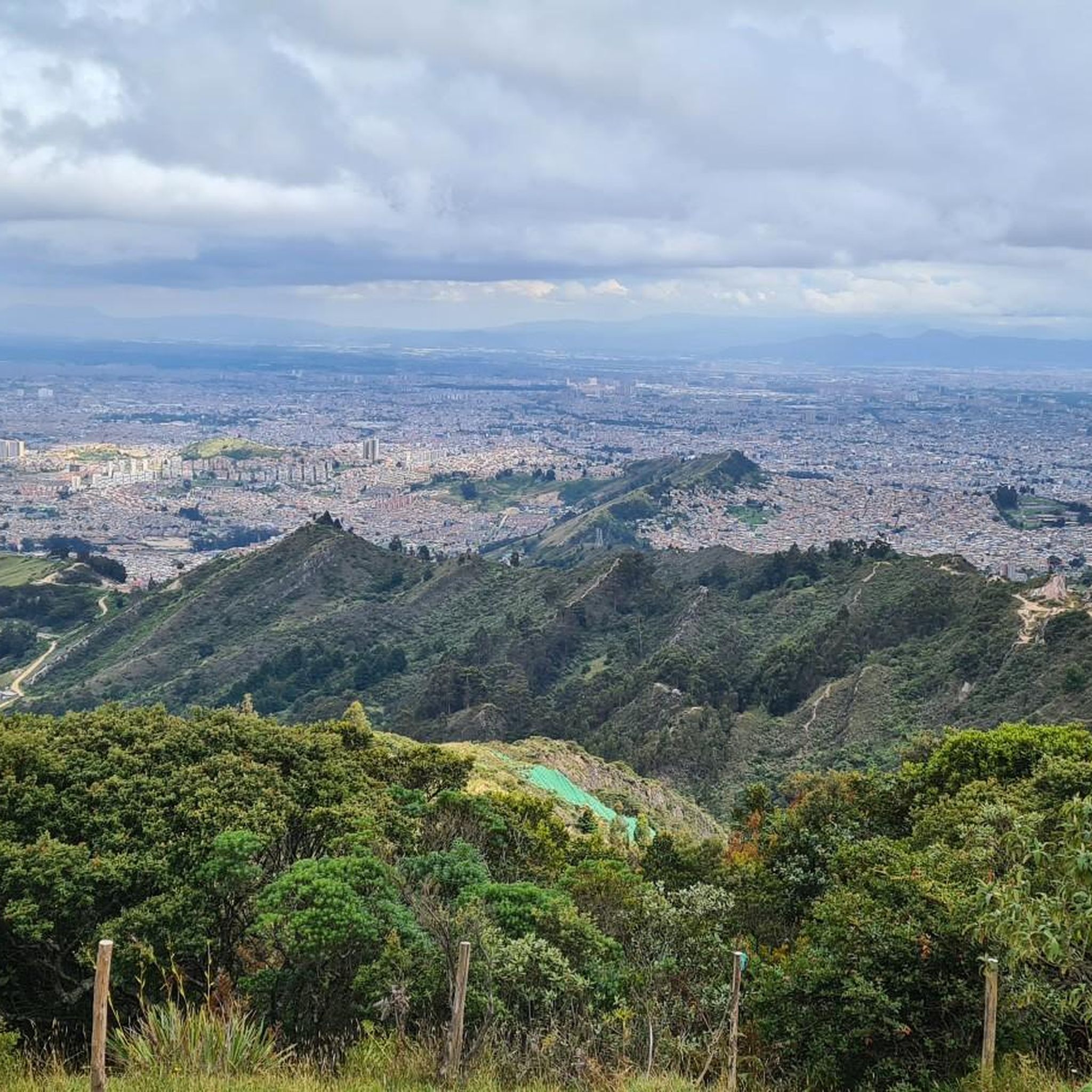
Alto de los Patios offers countless dining options to enjoy Bogotá's sporting atmosphere. The area is usually very busy.
1
0

Perfect for starting out or training, the plan to get there develops your resistance
0
0

Beautiful scenery and medium difficulty. For gravel or mountain biking.
0
0


It is the most frequented peak by cyclists in all of Colombia. Egan Bernal has the PR
0
0

It is a route to relax... little slope, flat, constant... here you can go out to Villeta and La Vega, municipalities of Cundinamarca... the weather can vary.
0
0
Frequently Asked Questions
How many road cycling routes are available in Bogotá D.C.?
Bogotá D.C. offers a wide variety of road cycling experiences, with over 50 routes available on komoot. These routes cater to different skill levels, including easy, moderate, and difficult options, allowing cyclists to explore the region's diverse terrain.
What kind of terrain can I expect on road cycling routes in Bogotá D.C.?
Road cycling in Bogotá D.C. is characterized by its high-altitude setting within the Andes Mountains. You can expect diverse terrain, from challenging mountain passes and significant climbs like the iconic Alto de Patios, to scenic countryside roads and extensive urban bike lanes known as Ciclorutas. The surrounding areas also feature unique páramo ecosystems and lush forests.
Are there road cycling routes suitable for beginners in Bogotá D.C.?
Yes, Bogotá D.C. offers routes suitable for beginners. There are 11 easy road cycling routes available on komoot. Additionally, the city's extensive network of over 540 kilometers of permanent bike lanes, known as Ciclorutas, provides accessible and safer options for those new to road cycling or looking for a more relaxed ride.
What are some challenging road cycling routes in Bogotá D.C.?
For experienced cyclists seeking a challenge, Bogotá D.C. has 26 difficult routes. Notable challenging routes include the Salitre–Guasquita Climb – Alto de La Cuchilla loop from Estación 15, which covers 115 km with significant elevation gain, and the Alto de Patios – View of Bogotá from Patios loop from Estación 10, featuring the renowned Alto de Patios climb.
What landmarks and natural features can I see along road cycling routes in Bogotá D.C.?
Many routes offer stunning views and pass by significant landmarks. You might encounter the challenging Patios Summit, enjoy panoramic views from Monserrate Hill, or pass through the Alto del Boquerón. Natural features include the lush Andes mountains, unique páramo ecosystems, and reservoirs like the View of Embalse San Rafael.
Are there any loop road cycling routes in Bogotá D.C.?
Yes, many road cycling routes in Bogotá D.C. are designed as loops, offering a convenient way to start and end your ride at the same point. Examples include the Alto del Vino – Alto del Vino Rest Stop loop from E11 - Calle 145 con Carrera 145 and the View of Bogotá from Patios – Patios Summit loop from Calle 45.
What is the best time of year to go road cycling in Bogotá D.C.?
Bogotá D.C.'s high-altitude location in the Andes provides a mild, year-round climate ideal for outdoor activities. While the weather can be unpredictable, the city generally experiences two rainy seasons (April-May and October-November) and two drier seasons (December-March and July-August). The drier periods often offer more consistent conditions for road cycling, with cool, crisp air and clear views.
What should I wear for road cycling in Bogotá D.C.'s high altitude?
Due to Bogotá's high altitude, temperatures can vary, and conditions can change quickly. It's advisable to dress in layers, even on sunny days. A windbreaker or light rain jacket is recommended, as are arm and leg warmers, especially for early morning rides or descents. Sunscreen and sunglasses are also essential due to the increased UV exposure at altitude.
How can I access road cycling routes using public transport in Bogotá D.C.?
Bogotá has an extensive public transport system, including the TransMilenio bus rapid transit. While bikes are generally not allowed inside TransMilenio buses during peak hours, some stations and routes may have specific provisions or bike parking facilities. The city's vast Ciclorutas network also connects various parts of the city, making it easier to cycle to the start of many routes from urban areas. For specific route access, it's best to check local transport guidelines.
What do other road cyclists enjoy most about road cycling in Bogotá D.C.?
The road cycling routes in Bogotá D.C. are highly rated by the komoot community, with an average score of 4.8 stars from over 450 reviews. Cyclists often praise the challenging Andean mountain climbs, the extensive urban Ciclorutas, and the stunning views of the surrounding páramo landscapes and city. The vibrant cycling culture and the unique experience of the weekly Ciclovía are also frequently highlighted.
Are there family-friendly road cycling routes in Bogotá D.C.?
While many routes involve significant climbs, the extensive network of Ciclorutas within Bogotá D.C. offers excellent family-friendly options. These dedicated bike lanes provide a safe and enjoyable environment for cyclists of all ages, connecting various parks and green spaces like Simon Bolivar Park. For routes outside the city, look for easier, flatter sections or designated recreational paths.
Where can I find places to eat or get coffee near road cycling routes in Bogotá D.C.?
Many popular road cycling routes, especially those leading to or passing through municipalities like La Calera and Guasca, have cafes and small restaurants where cyclists can refuel. The Alto de Patios climb, for instance, is well-known for its summit area where vendors offer snacks and coffee. Within the city, the 'cycling district' in Barrios Unidos and areas along the Ciclorutas also offer numerous options for food and drinks.
Most popular attractions in Bogotá D.C.

Get inspired with the komoot mobile app


