The best cycling routes around Pen-Y-Bont-Fawr
4.9
(37)
595
riders
38
rides
Touring cycling around Pen-Y-Bont-Fawr offers diverse landscapes in the upper Tanat Valley of Powys, Wales. The region is characterized by the majestic Berwyn Mountains, expansive Lake Vyrnwy, and scenic river valleys formed by the River Tanat and River Barrog. Cyclists will encounter a mix of forests, steep hills, and routes extending into the Eryri / Snowdonia National Park.
Best touring cycling routes around Pen-Y-Bont-Fawr
- The most popular touring cycling route is Llyn Efyrnwy / Lake Vyrnwy to Llyn Tegid / Bala Lake high pass loop — Eryri / Snowdonia National Park, a 34.4 miles (55.4 km) trail that takes 3 hours 45 minutes to complete. This difficult route traverses a high pass between two significant Welsh lakes within the national park.
- Another top favourite among local touring cyclists is Around Llyn Llanwddyn, a moderate 11.3 miles (18.2 km) path. This route offers a scenic loop around Lake Vyrnwy, showcasing the reservoir's natural beauty.
- Local touring cyclists also love the Lake Vyrnwy Loop from Llanrhaeadr-ym-Mochnant, a 29.2 miles (47.0 km) trail leading through the Lake Vyrnwy area, often completed in about 3 hours 20 minutes.
- Touring cycling around Pen-Y-Bont-Fawr is defined by the Berwyn Mountains, Lake Vyrnwy, and varied river valleys. The network offers options for different ability levels, from moderate loops to more challenging climbs.
- The routes in Pen-Y-Bont-Fawr are highly rated by the komoot community with an average score of 4.9 stars from over 30 reviews. More than 600 touring cyclists have used komoot to explore Pen-Y-Bont-Fawr's varied terrain.
Last updated: July 8, 2026
4.6
(18)
215
riders
Embark on a challenging touring bicycle loop from Llyn Efyrnwy / Lake Vyrnwy to Llyn Tegid / Bala Lake, traversing the high passes of Eryri / Snowdonia National Park. This difficult route spans 34.4 miles (55.4 km) and features a substantial elevation gain of 3059 feet (932 metres), requiring very good fitness and typically taking around 3 hours and 45 minutes to complete. You will cycle through dense woodlands, open moorland, and past the expansive reservoir of Lake Vyrnwy, experiencing a landscape of mountains, valleys, and tranquil countryside.
While largely on paved surfaces, be prepared for some unpaved sections where you might need to push your bike. The route includes demanding climbs into the surrounding hills, notably the Hirnant Pass and Bwlch y Groes, which is the highest road pass in Wales. Expect very steep roads and descents, especially near Lake Vyrnwy and Rhiwargor. This loop is best enjoyed during daylight hours when the weather is clear, allowing you to fully appreciate the panoramic views across the Welsh landscape.
This trail is notable for connecting two iconic Welsh lakes via a high mountain pass, offering a true sense of frontier wildness and raw natural beauty. Bwlch y Groes, reaching 1800 feet (546 metres), is not only a challenging climb but also historically significant as a pilgrim route. You will also pass the impressive dam and distinctive straining tower of Lake Vyrnwy, and experience the charming, Welsh-speaking town of Bala by Llyn Tegid, Wales's largest natural lake.
4.9
(16)
216
riders
18.2km
01:08
200m
200m
Embark on a moderate touring bicycle ride around Llyn Llanwddyn, also known as the Lake Vyrnwy circuit, a popular route in Powys, Wales. This 11.3 miles (18.2 km) trail takes about 1 hour and 8 minutes to complete, featuring a manageable 652 feet (199 metres) of elevation gain. You will follow well-maintained country lanes, offering consistent views of the water and surrounding dense forests, with the impressive Vyrnwy Dam as a key landmark. The landscape is tranquil, set within the southern foothills of the Berwyn Mountains, providing a picturesque cycling experience.
Planning your visit is straightforward, with amenities available to enhance your ride. You can find cafes and refreshment stops, especially near the dam and other visitor areas, perfect for a break. If you do not have your own bike, bike hire is available at Llanwddyn, located at the southern end of the lake. The route is generally accessible, making it an ideal choice for a scenic day out on two wheels.
The Around Llyn Llanwddyn trail is highly regarded, boasting an average rating of 4.9 stars from many reviews, highlighting its consistent and stunning views. The Lake Vyrnwy area is not just beautiful; it is also a national nature reserve and a Site of Special Scientific Interest (SSSI), jointly managed by the RSPB. This makes it an important location for birdwatching and enjoying diverse wildlife, adding another layer of interest to your touring bicycle adventure.

Sign up for free
8
riders
47.0km
03:20
750m
750m
Cycle a difficult 29.2-mile (47.0 km) loop around Lake Vyrnwy in Eryri / Snowdonia National Park, gaining 2448 feet (746 metres).
5.0
(1)
4
riders
33.4km
02:31
620m
620m
Hard bike ride. Very good fitness required. Mostly paved surfaces. Suitable for all skill levels.
36
riders
21.5km
01:41
300m
300m
Moderate bike ride. Good fitness required. Mostly paved surfaces. Suitable for all skill levels.
Get access to more routes and recommendations from other explorers.
Sign up for free
Already have an account?
Our route recommendations are based on thousands of hikes, rides, and runs completed by other people on komoot.
Start today with a free account
Your next adventure awaits.
Login or Signup

Tips from the Community

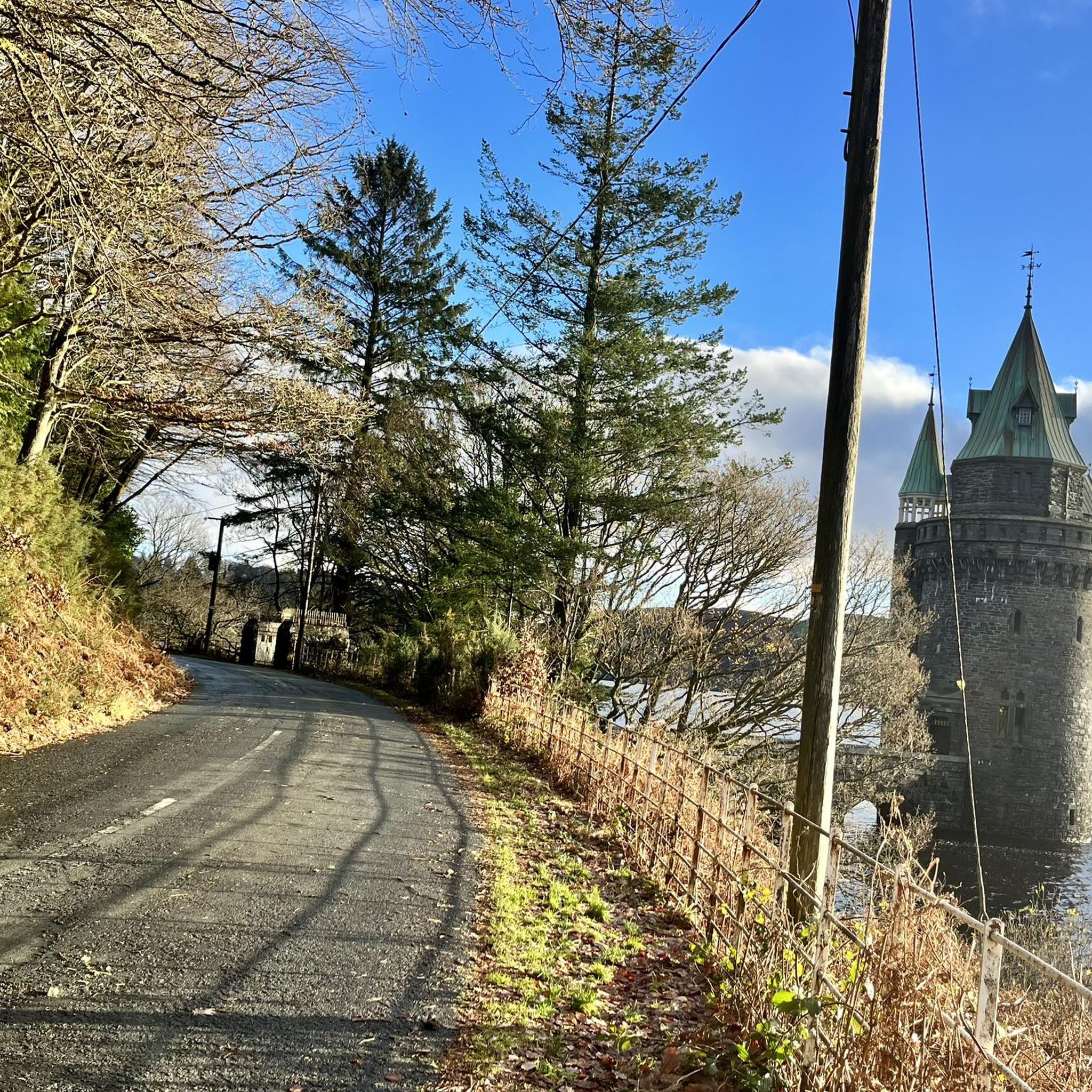
Lake Vyrnwys straining tower! Lovely place and gives it that fairy tale vibe. One of my special places is Vyrnwy.
0
0

Gorgeous area. Be aware the road/trail on the south side (including access to/from Llanymawddwy) are currently closed due to damage from storm Darragh. See https://www.hdcymru.co.uk/our-visitor-sites/lake-vyrnwy/storm-darragh/ for more details.
0
0


There is a little cafe above the main car park for a coffee and cake after the "gift shop" labelled walks. As usual, Komoot makes the walk easier than using signposts - remember to download to the phone app. Kayaking/canoeing around the lake is only possible for about half of it due to a protected bird sanctuary.
0
0

Bala is a town and community in Gwynedd, Wales. Formerly an urban district, Bala lies in the historic county of Merionethshire at the north end of Bala Lake. it has a wonderful village style feeling, and everyone speaks Welsh, which is truly amazing to hear. They have some good shops and supermarkets. They have tiny little petrol stations on the curb, and they attendant comes out and serves you. Great roads in this area and some can be very steep in these parts, plenty of cyclists and motorcycles well worth a ride.
4
0
The Straining Tower at Lake Vyrnwy is an intake tower built to extract water from the lake. The tower stands on the north shore of Lake Vyrnwy, near the village of Llanwddyn, in Powys, Wales. The Lake Vyrnwy dam project was designed to provide a water supply to the city of Liverpool and work on the dam began in 1881. On its completion 11 years later, the lake was the largest reservoir in Europe and water was drawn from it into the straining tower and carried to Liverpool on a 110km-long aqueduct. The engineers for the project were Thomas Hawksley and George Frederick Deacon, although the straining tower was entirely Deacon's design. The tower is constructed in a Gothic Revival style, purportedly based on the tower of the castle at Chillon, Switzerland. It draws heavily on the contemporaneous work of William Burges, whose Cardiff Castle and Castell Coch are clear influences. The straining tower is a Grade I listed building.
3
0
Fantastic place with some nice pubs in the area great views and some great climbs
0
0
The Straining Tower at Lake Vyrnwy is an intake tower built to extract water from the lake. The tower stands on the north shore of Lake Vyrnwy, near the village of Llanwddyn, in Powys, Wales. The Lake Vyrnwy dam project was designed to provide a water supply to the city of Liverpool and work on the dam began in 1881. On its completion 11 years later, the lake was the largest reservoir in Europe and water was drawn from it into the straining tower and carried to Liverpool on a 110km-long aqueduct. The engineers for the project were Thomas Hawksley and George Frederick Deacon, although the straining tower was entirely Deacon's design. The tower is constructed in a Gothic Revival style, purportedly based on the tower of the castle at Chillon, Switzerland. It draws heavily on the contemporaneous work of William Burges, whose Cardiff Castle and Castell Coch are clear influences. The straining tower is a Grade I listed building
5
0
Frequently Asked Questions
How many touring cycling routes are available around Pen-Y-Bont-Fawr?
There are 38 touring cycling routes around Pen-Y-Bont-Fawr. These routes offer a diverse range of experiences, from moderate loops to challenging climbs through the Berwyn Mountains and around Lake Vyrnwy.
Are there any easy touring cycling routes suitable for beginners or families?
Yes, while many routes are moderate to difficult, there is at least one easy touring cycling route. For a moderate, scenic option, consider the Around Llyn Llanwddyn loop, which is 18.2 km (11.3 miles) and offers beautiful views of Lake Vyrnwy.
What are the most challenging touring cycling routes in the area?
For experienced cyclists seeking a challenge, routes like the Llyn Efyrnwy / Lake Vyrnwy to Llyn Tegid / Bala Lake high pass loop are ideal. This difficult 55.4 km (34.4 miles) route traverses a high pass within Eryri / Snowdonia National Park. Another demanding option is the Lake Vyrnwy Loop from Llanrhaeadr-ym-Mochnant, covering 47.0 km (29.2 miles) with significant elevation changes.
What natural attractions can I see while cycling around Pen-Y-Bont-Fawr?
The region is rich in natural beauty. You can cycle past the impressive Lake Vyrnwy Dam, explore the scenic Lake Vyrnwy itself, and discover stunning waterfalls. The majestic Pistyll Rhaeadr, one of Britain's tallest waterfalls, is a notable highlight, as is Rhiwargor Waterfall.
Are there any circular touring cycling routes around Pen-Y-Bont-Fawr?
Yes, many of the routes are circular, allowing you to start and end in the same location. A popular moderate circular route is Around Llyn Llanwddyn, which circles Lake Vyrnwy. For a more challenging option, consider the Lake Vyrnwy Dam – Lake Vyrnwy and Dam loop from Lake Vyrnwy.
What do other touring cyclists say about the routes in Pen-Y-Bont-Fawr?
The touring cycling routes around Pen-Y-Bont-Fawr are highly regarded by the komoot community, with an average score of 4.9 stars from over 30 reviews. Cyclists frequently praise the diverse landscapes, the challenging climbs in the Berwyn Mountains, and the picturesque scenery around Lake Vyrnwy.
Can I find routes that take me into Eryri / Snowdonia National Park?
Absolutely. The broader region encompasses parts of Eryri / Snowdonia National Park. A notable route that ventures into the park is the difficult Llyn Efyrnwy / Lake Vyrnwy to Llyn Tegid / Bala Lake high pass loop, offering mountainous terrain and extensive trail networks.
What kind of terrain can I expect on touring cycling routes in this area?
The terrain around Pen-Y-Bont-Fawr is varied. You can expect a mix of paved surfaces, particularly around Lake Vyrnwy, as well as more demanding unpaved segments, especially in the mountainous areas. Routes often feature steep hills, forests, and scenic river valleys formed by the River Tanat and River Barrog.
Are there any routes that offer views of the Berwyn Mountains?
Many routes in the area provide stunning views of the majestic Berwyn Mountains. The region is defined by this range, and routes often incorporate its foothills and passes. While not a specific route, the Cadair Bronwen Summit Cairn is a prominent feature within the Berwyns, offering expansive vistas.
Are there any routes that follow the River Vyrnwy?
Yes, you can find routes that follow the River Vyrnwy. The River Vyrnwy loop from Abertridwr is a difficult 33.4 km (20.7 miles) route that traces the river, offering a different perspective of the local landscape.
What is the best time of year to go touring cycling in Pen-Y-Bont-Fawr?
The best time for touring cycling in Pen-Y-Bont-Fawr is generally during the warmer, drier months, typically from late spring to early autumn (May to September). During this period, you'll experience more favorable weather conditions for exploring the diverse landscapes, including the Berwyn Mountains and Lake Vyrnwy.
Most popular attractions around Pen-Y-Bont-Fawr

Get inspired with the komoot mobile app


Explore more
Browse the best Cycling routes in other regions.
