The best walks and hikes in Upper Puntledge River Woodlands
4.5
(144)
1,138
hikers
34
hikes
Hiking in Upper Puntledge River Woodlands offers diverse landscapes, including river views along the Puntledge River and extensive forest cover with towering conifers. The area features a unique Puntledge Bog, accessible via boardwalk, and natural attractions like Nymph Falls. This region is characterized as a rainforest, with old trees covered in thick green moss, providing varied terrain for outdoor activities.
Best hiking trails in Upper Puntledge River Woodlands
- The most popular hiking route is Century Sam Lake — Strathcona Provincial…
Last updated: August 31, 2026
19
hikers
11.0km
04:35
560m
560m
Hard hike. Good fitness required. Sure-footedness, sturdy shoes and alpine experience required.
7
hikers
3.34km
00:54
50m
50m
Hike the easy 2.1-mile Medicine Bowls trail to discover unique rock pools and waterfalls in the Comox Valley, British Columbia.

Sign up for free
1
hikers
3.78km
01:01
40m
40m
Easy hike. Great for any fitness level. Easily-accessible paths. Suitable for all skill levels.
5.0
(8)
73
hikers
11.0km
04:43
650m
650m
Hard hike. Good fitness required. Sure-footedness, sturdy shoes and alpine experience required.
8
hikers
13.7km
06:27
940m
940m
Hard hike. Very good fitness required. Sure-footedness, sturdy shoes and alpine experience required.
Get access to more routes and recommendations from other explorers.
Sign up for free
Already have an account?
Our route recommendations are based on thousands of hikes, rides, and runs completed by other people on komoot.
Start today with a free account
Your next adventure awaits.
Login or Signup

Tips from the Community

The trail leading up to Medicine Bowls is a rough 4x4 road. It's an easy walk, or if you have a high-clearance vehicle, you could attempt to drive it. Once you reach the end of the road, look for a trail that leads to the river. There are no signs on the trail, but it's pretty easy to follow.
0
0
Formed by the Browns River, the Medicine Bowls are a stunning set of waterfalls flowing over smooth, naturally carved rock bowls.
0
0
Unless you have a high-clearance vehicle, you will need to park here. The road up is privately owned by a logging company and only has public access on the weekend. The gate gets locked at 6 p.m., so make sure you allow plenty of time on the return hike to avoid getting locked in.
0
0
Century Sam Lake sits below the Comox Glacier, surrounded by Black Cat Mountain and Mount Arthur Evans. Keep an eye out for a hidden trail along the edge of the lake. This trail leads to a beautiful ice cave. Due to the dangerous nature of ice caves, please use caution and do not enter the caves.
0
0

Stretching roughly 800 kilometres from Victoria in the south to Cape Scott in the north, the Vancouver Island Trail links existing paths and forestry roads through forests, mountains, and coastline. Near Cumberland, the trail follows forested terrain along Comox Lake, offering peaceful views and access to lakeside rest spots. It’s part of Canada’s national trail network, designed for experienced hikers looking to explore Vancouver Island’s diverse landscapes.
0
0
Located on the eastern shore of Comox Lake, Cumberland Lake Park is a popular spot for swimming, kayaking, and picnicking. The park features a sandy beach, designated swimming area, and a small campground surrounded by forested hills. It’s a great place to cool off after hiking or to spend a relaxed afternoon by the water.
0
0
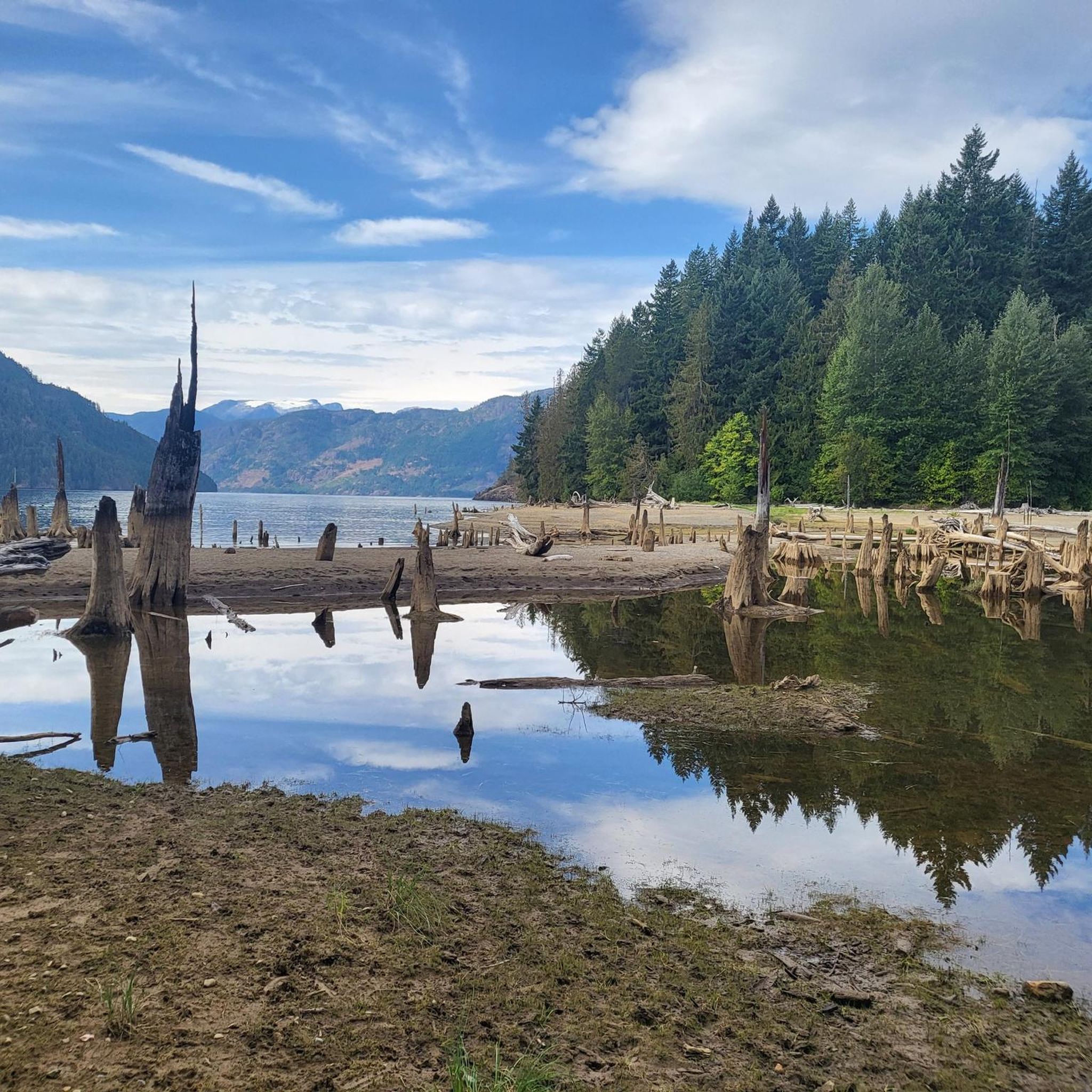
A glacier-fed reservoir near Cumberland, Comox Lake stretches over 16 square kilometres and reaches depths of more than 100 metres. Its clear blue water and mountain backdrop make it a scenic stop along the Vancouver Island Trail, with quiet shoreline spots ideal for a break or photo stop. Anglers can fish for rainbow and cutthroat trout, but should check current local regulations before casting a line.
0
0

Comox Lake is a freshwater lake on Vancouver Island, near Courtenay and Cumberland. It is ideal for swimming, kayaking, paddleboarding, boating, and fishing for rainbow trout and salmon. There are camping areas with basic services and picnic areas with tables and grills. The trails around the lake are perfect for hiking and mountain biking, connecting to Cumberland's trail network. Bird watching and wildlife such as deer and bear are common. Facilities include bathrooms and boat ramps. The best time to visit is spring and summer. Camping reservations are recommended during peak season and follow safety recommendations for water activities and hiking.
1
0
Frequently Asked Questions
How many hiking trails are available in Upper Puntledge River Woodlands?
The Upper Puntledge River Woodlands offers a network of over 25 hiking trails. These routes cater to various preferences, from easy riverside strolls to more challenging forest ascents, ensuring there's something for every hiker.
What types of landscapes can I expect to see while hiking here?
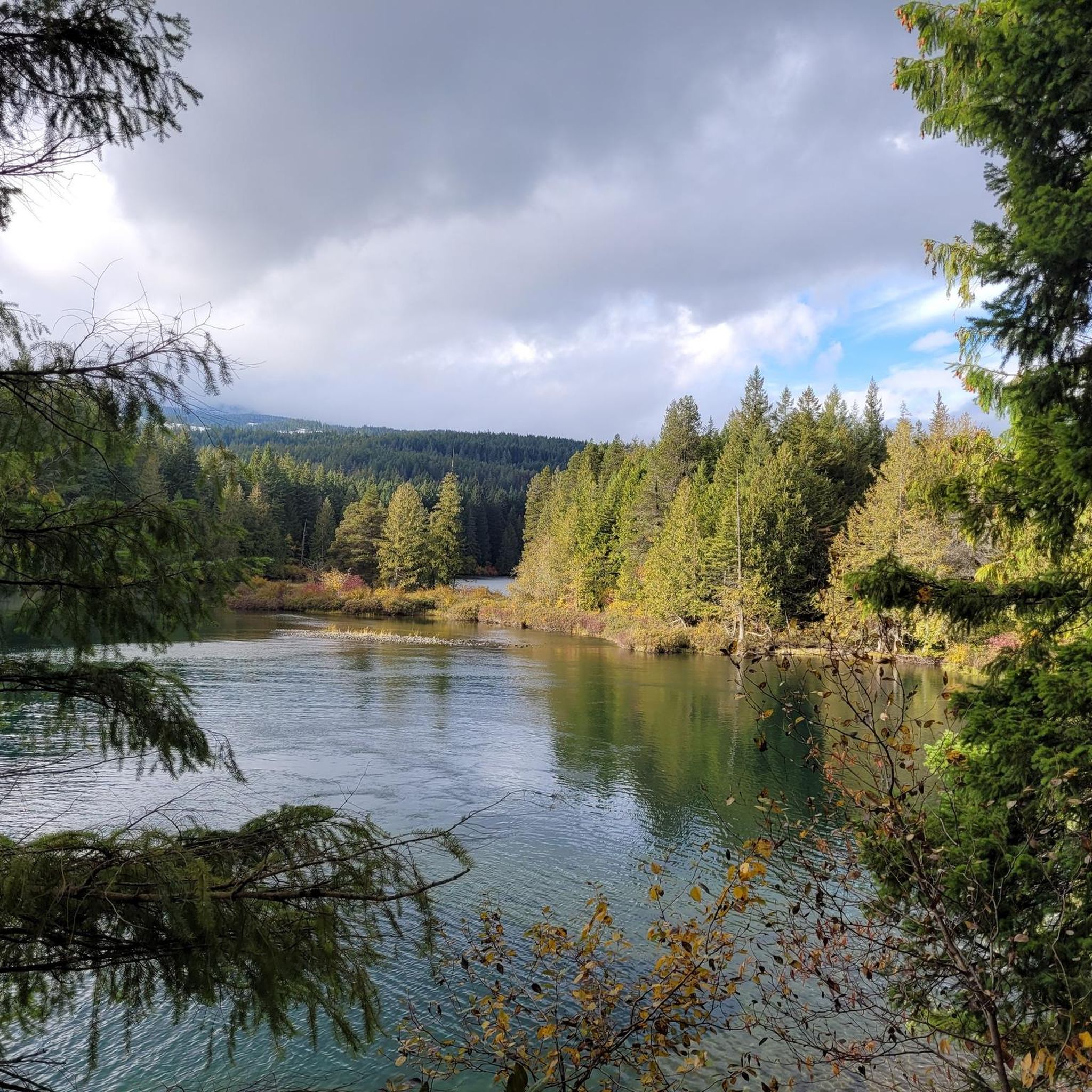
Hikers in Upper Puntledge River Woodlands can expect diverse landscapes, including beautiful river views along the Puntledge River, extensive second-growth forest with towering conifers, and a vibrant understory. The area is characterized as a rainforest, with old trees covered in thick green moss, adding to its natural beauty. You might also encounter the unique Puntledge Bog.
Are there any easy trails suitable for beginners or casual walkers?
Yes, there are several easy trails perfect for beginners or those seeking a relaxed walk. For instance, the Medicine Bowls route is an easy 3.3 km path with minimal elevation change. The River Trail West (5.5 km) and River Trail East (4 km) also offer gentle riverside walks with beautiful views.
Are the trails in Upper Puntledge River Woodlands dog-friendly?
While many trails in the Upper Puntledge River Woodlands are popular with dog owners, it's always best to check local signage for specific regulations regarding pets, especially in sensitive ecological areas like the Puntledge Bog. Generally, dogs are welcome on leash on most multi-use trails.
What are some family-friendly hiking options in the area?
For families, the shorter, easier trails are ideal. The Comox Lake via Vancouver Island Trail is a 3.8 km trail leading through forest and along the lake, often completed in about an hour. The Twin Lakes Trail is an even shorter, easy 600-meter walk. The Comox Lake Dam Picnic Area also provides a convenient starting point with facilities.
Where can I park when visiting the Upper Puntledge River Woodlands trails?
The **Comox Lake Dam Picnic Area** serves as a central hub and offers ample parking. This location is a convenient starting point for many trails. Additionally, the Upper Puntledge Hatchery also provides access to trails and parking facilities.
Are there any circular walks available?
Yes, the area features several options for circular walks. The Region Research mentions a 1.7 km Loop Trail that offers lake, forest, and river views, including a log bridge. Many of the trails, like the Bevan Trail, also offer options for creating shorter loops.
What natural attractions or points of interest can I see along the trails?
Hikers can explore several natural attractions. **Nymph Falls** is a prominent feature with its own trails. The unique **Puntledge Bog**, accessible via a winding boardwalk on the east side of the river, is home to unusual plants like bog cranberry and round-leaved sundew. You'll also find beautiful river views, large white pine trees, and in early spring, spectacular wildflowers.
What is the best time of year to hike in Upper Puntledge River Woodlands?
The Upper Puntledge River Woodlands is beautiful year-round, but early spring is particularly special when the forest floor comes alive with spectacular wildflowers such as Oregon-grape, Western trillium, and Calypso orchid. The diverse forest and river views are enjoyable in all seasons.
What do other hikers say about the trails in Upper Puntledge River Woodlands?
The trails in Upper Puntledge River Woodlands are highly regarded by the komoot community, with an average rating of 4.8 stars from over 100 reviews. Hikers often praise the diverse terrain, beautiful river views, and the well-maintained trail system that includes boardwalks and log bridges.
Are there any challenging hikes for experienced trekkers?
Yes, for experienced trekkers, there are more challenging options. The Century Sam Lake — Strathcona Provincial Park route is a difficult 11.0 km trail with significant elevation gain through varied terrain. Other difficult routes include those with substantial elevation changes, providing a good workout.
Is there a trail that offers views of Comox Lake?
Yes, the Comox Lake via Vancouver Island Trail provides views along the lake. Additionally, the Comox Lake Dam Picnic Area offers a viewpoint and beach access, making it a great spot to enjoy the lake scenery before or after a hike.
Most popular routes in Upper Puntledge River Woodlands

Get inspired with the komoot mobile app


Explore more
Browse the best Hikes in other regions.
