The best road cycling routes around Penalva De Alva
4.8
(4)
273
riders
17
rides
Road cycling routes around Penalva De Alva are characterized by challenging climbs and descents through a mountainous landscape. The region features significant elevation changes, with routes often leading to high viewpoints and through areas like Serra da Estrela. Road cyclists can expect varied terrain, including winding roads that traverse hills and valleys.
Best road cycling routes around Penalva De Alva
- The most popular road cycling route is Epic climb to Monte Colcurinho - Loop tour, a 32.2 miles (51.8 km) trail that takes 3 hours 11 minutes to complete. This route features a substantial ascent to Monte Colcurinho, offering panoramic views.
- Another top favourite among local road cyclists is Covão do Ferro Lagoon – Serra da Estrela loop from São Gião, a difficult 50.3 miles (81.0 km) path. This route explores the high-altitude terrain of Serra da Estrela, passing by Covão do Ferro Lagoon.
- Local road cyclists also love the Vale de Loriga Viewpoint – Serra da Estrela loop from Vide e Cabeça, a 34.5 miles (55.6 km) trail leading through the mountainous Serra da Estrela region, often completed in about 3 hours 31 minutes.
- Road cycling around Penalva De Alva is defined by challenging mountain climbs, scenic viewpoints, and routes through the Serra da Estrela. The network offers options for different ability levels, though many routes feature significant elevation gain.
- The routes in Penalva De Alva are highly rated by the komoot community with an average score of 4.75 stars from over 4 reviews. More than 260 road cyclists have used komoot to explore Penalva De Alva's varied terrain.
Last updated: May 28, 2026
14
riders
51.8km
03:12
1,370m
1,370m
Hard road ride. Very good fitness required. Mostly well-paved surfaces and easy to ride.
4.8
(4)
123
riders
81.0km
05:00
2,120m
2,120m
Hard road ride. Very good fitness required. Mostly well-paved surfaces and easy to ride.

Sign up for free
13
riders
55.8km
03:33
1,650m
1,650m
Hard road ride. Very good fitness required. Mostly well-paved surfaces and easy to ride.
14
riders
50.3km
02:47
900m
900m
Hard road ride. Very good fitness required. Some segments of this route may be unpaved and difficult to ride.
13
riders
Moderate road ride. Good fitness required. Some segments of this route may be unpaved and difficult to ride.
Get access to more routes and recommendations from other explorers.
Sign up for free
Already have an account?
Our route recommendations are based on thousands of hikes, rides, and runs completed by other people on komoot.
Start today with a free account
Your next adventure awaits.
Login or Signup
Popular around Penalva De Alva

Tips from the Community

The Torre is the highest point of Continental Portugal, at 1,993 meters above sea level. It is located in the heart of the Serra da Estrela Natural Park and serves as the dividing line between the municipalities of Seia, Manteigas, and Covilhã. To reach the round 2,000 meters, King D. João VI had a stone monument built at the top of the plateau in the early 19th century.👍🥾
0
0

Sabugueiro, the village vying for the title of highest in Portugal, is also one of the most authentic ambassadors of mountain life. Among granite houses and comforting flavors (cheese, sausages, roast kid, and honey), you can find the warmth of blankets and burel coats and the company of the faithful Serra da Estrela mountain dogs. Surrounding waterfalls, streams, and lakes remind you that here, nature is as generous as the table.
3
0
Piódão belongs to the network of Historic Villages of Portugal. The town (village) of Piódão, the urban center and the parish headquarters, has been classified as a Property of Public Interest since 1978.[3] Pedestrian trails of extraordinary beauty.👍🥾🦯
4
0

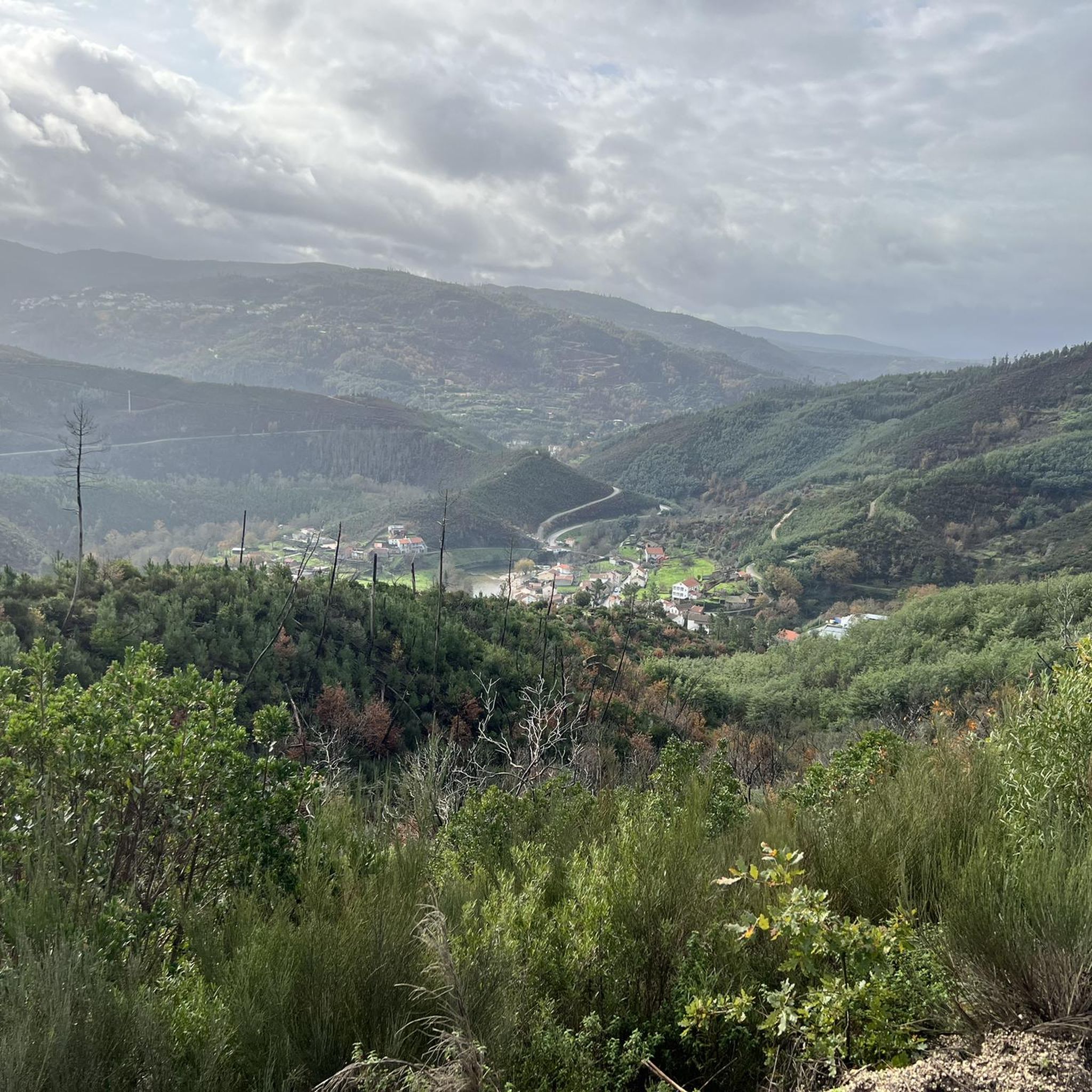
This area has been hit by a serious forest fire in recent weeks.
2
2

Piódão is a particularly well-preserved, historic village worth a visit. If you're looking for peace and quiet and enjoy hiking, you've come to the right place. Although the historic village of Piódão doesn't hold any particular significance in Portugal's history, it has recently become an increasingly popular tourist attraction, perhaps due to its beautiful location in the Serra do Açor.
5
2
The Serra da Estrela Natural Park is something truly special. This 1,000-square-kilometer park, spread across six municipalities, was the first and currently the largest protected natural park in Portugal. It is home to the highest point on the Portuguese mainland, the country's only ski slope, the source of two important rivers, and a fascinating, alpine-like landscape formed by glaciers.
5
1
Serra da Estrela Cheese is a Portuguese cheese made from sheep's milk and has a protected designation of origin. The earliest mention of this cheese dates back to the 12th century, making it the oldest Portuguese cheese. It is one of the most famous sheep's milk cheeses in the world. I recommend it 👍 Wikipedia
1
0
At exactly 1993 meters above sea level, Torre is the highest point in mainland Portugal, where the only ski resort is located. The landscape on the upper plateau of the Serra da Estrela is like a sprinkling of granite rocks over low scrub and patches of snow and ice, which the sun threatens to melt soon in the summer and which always returns the following winter. In winter, it sometimes becomes inaccessible.
6
0
Frequently Asked Questions
What is the general difficulty level of road cycling routes in Penalva De Alva?
Road cycling in Penalva De Alva is characterized by challenging climbs and descents through a mountainous landscape, particularly within the Serra da Estrela region. Many routes feature significant elevation changes, making them suitable for experienced riders. While there are no routes explicitly rated as 'easy' in our selection, you will find a mix of moderate and difficult options.
Are there any beginner-friendly road cycling routes in Penalva De Alva?
The road cycling routes around Penalva De Alva are generally quite demanding, with significant elevation gains and challenging terrain. Our current selection does not feature routes specifically rated as 'easy'. Most options are categorized as moderate to difficult, requiring a good level of fitness and cycling experience.
What are the typical distances and durations for road cycling routes in Penalva De Alva?
Routes in Penalva De Alva vary in length and duration. For example, the Epic climb to Monte Colcurinho - Loop tour is about 32 miles (51.8 km) and takes around 3 hours 11 minutes. Longer routes, like the Covão do Ferro Lagoon – Serra da Estrela loop from São Gião, stretch to over 50 miles (81 km) and can take more than 5 hours to complete, reflecting the challenging terrain.
What challenging road cycling routes are available for experienced riders?
Experienced riders seeking a challenge will find plenty in Penalva De Alva. The Epic climb to Monte Colcurinho - Loop tour offers a substantial ascent and panoramic views. Another demanding option is the Covão do Ferro Lagoon – Serra da Estrela loop from São Gião, which explores the high-altitude terrain of Serra da Estrela. The Vale de Loriga Viewpoint – Serra da Estrela loop from Vide e Cabeça also provides a significant test with its mountainous profile.
Are there any circular road cycling routes in Penalva De Alva?
Yes, many of the road cycling routes in Penalva De Alva are designed as loops, allowing you to start and finish at the same point. Examples include the popular Epic climb to Monte Colcurinho - Loop tour and the Miradouro do Penedo Cabana loop from Bobadela, which offers a challenging ride with scenic rewards.
What can I see along the road cycling routes in Penalva De Alva?
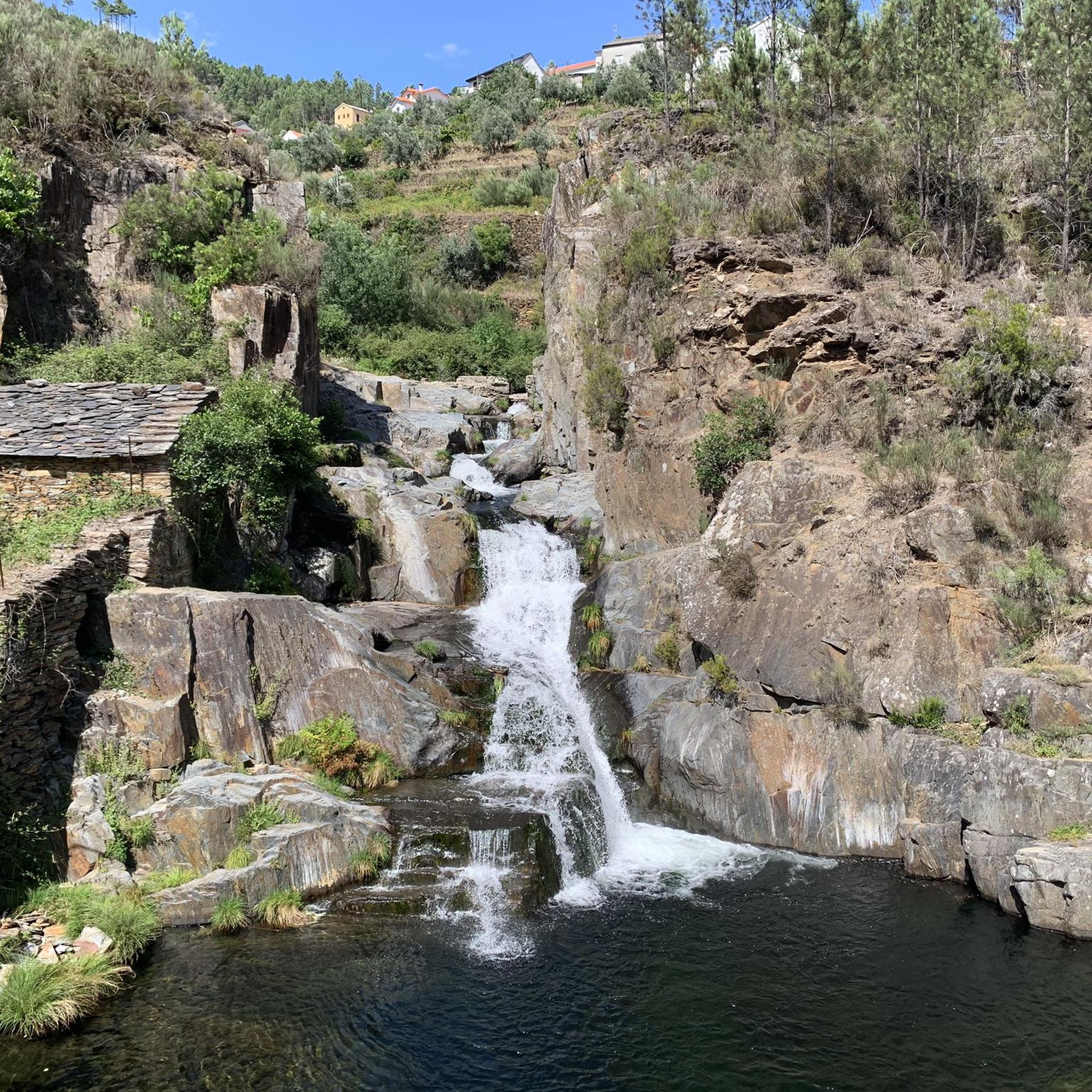
Road cycling routes in Penalva De Alva often pass through stunning natural landscapes and near historical sites. You might encounter natural monuments like the Poço da Broca de Serapitel waterfall or the View of the Loriga Terraces. Some routes also lead near charming settlements such as the Historical Village of Piódão or the ancient Roman Bridge of Sumes.
Are there any scenic viewpoints along the road cycling routes?
Absolutely. The mountainous terrain of Penalva De Alva provides numerous opportunities for breathtaking views. Routes often lead to high vantage points, such as the View of the Loriga Terraces, offering panoramic vistas of the surrounding valleys and the Serra da Estrela landscape. The Epic climb to Monte Colcurinho is particularly known for its expansive views.
What do other road cyclists enjoy the most about road cycling in Penalva De Alva?
The area is highly rated by the komoot community, with an average score of 4.75 stars from over 4 reviews. Road cyclists often praise the challenging mountain climbs, the scenic viewpoints, and the diverse terrain that characterizes the routes through the Serra da Estrela. Many appreciate the sense of accomplishment after tackling the significant elevation gains.
What is the best time of year for road cycling in Penalva De Alva?
The best time for road cycling in Penalva De Alva is typically during the spring (April to June) and autumn (September to October) months. During these periods, the weather is generally milder, with pleasant temperatures for tackling the climbs. Summers can be quite hot, especially at lower elevations, while winters can bring cold temperatures and even snow at higher altitudes in the Serra da Estrela, making conditions more challenging.
How many road cycling routes are available in Penalva De Alva?
There are over 18 road cycling routes available around Penalva De Alva, offering a variety of distances and difficulty levels. These routes are predominantly categorized as moderate to difficult, reflecting the region's mountainous characteristics.
Are there any waterfalls or natural swimming spots accessible from the road cycling routes?
Yes, some road cycling routes in the region pass near beautiful natural attractions. You might find yourself close to the Poço da Broca de Serapitel waterfall or the Poço Fundeiro Waterfall. The area also features natural swimming pools, such as the one near the Waterfall and natural swimming pool in Parque Natural da Serra da Estrela, which can be a refreshing stop on a warm day.
Are there any moderate road cycling routes for those looking for a less extreme challenge?
While many routes are difficult, there are moderate options available. The Anta do Pinheiro dos Abraços loop from Oliveira do Hospital e São Paio de Gramaços is a good example, offering a 35.3-mile (56.8 km) ride with less extreme elevation gain compared to the most challenging mountain routes, making it a solid choice for those seeking a substantial but not overly strenuous ride.
Most popular routes around Penalva De Alva
Most popular attractions around Penalva De Alva

Get inspired with the komoot mobile app


Explore more
Browse the best Road cycling routes in other regions.
