The best running trails in La Garita Wilderness
6
runners
6
runs
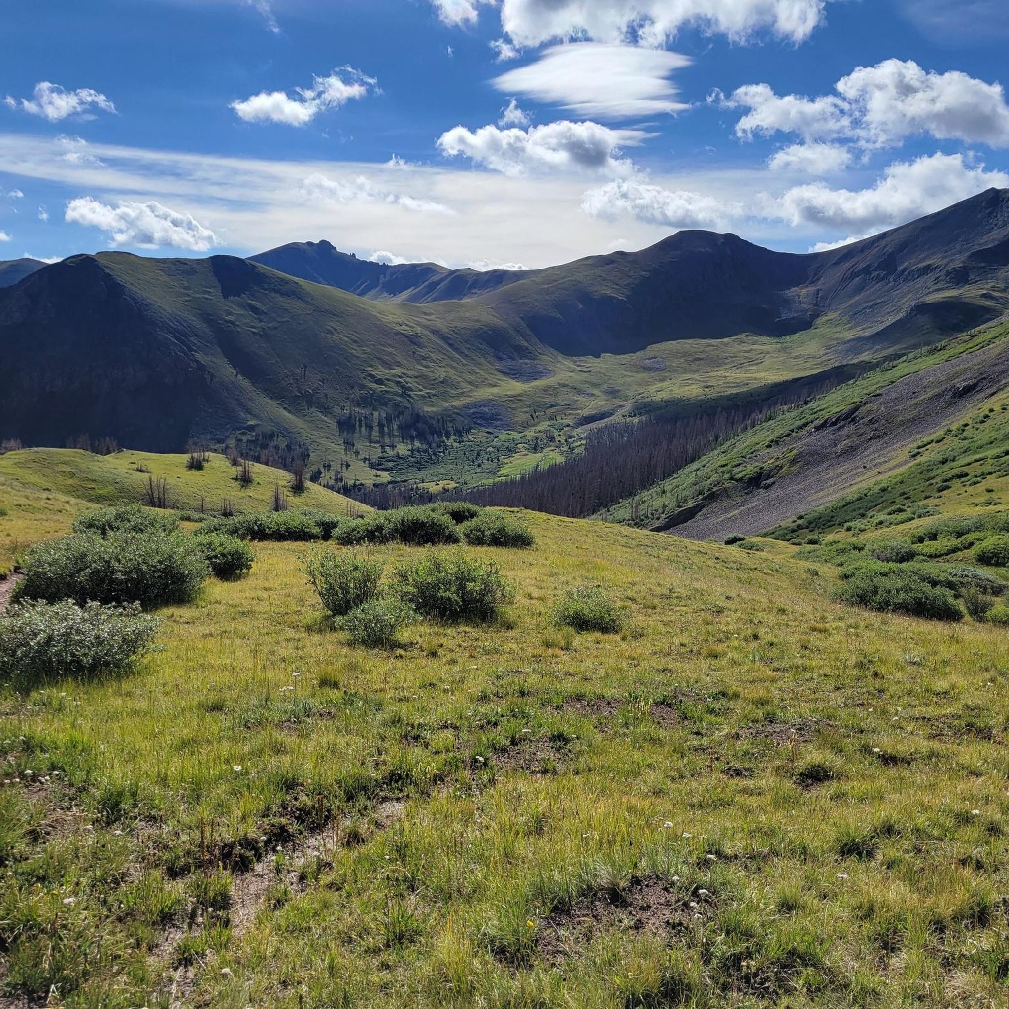
Jogging in La Garita Wilderness offers routes through a 129,626-acre expanse in Colorado, characterized by diverse landscapes. The region features broad subalpine meadows, ancient spruce and fir forests, and high-elevation terrain along the Continental Divide. Volcanic formations contribute to unique geological features, including vertical basalt columns and eroded ash formations. Rushing streams and beaver ponds are also present throughout the wilderness.
Best jogging routes in La Garita Wilderness
- The most popular jogging route is Colorado Trail: Segment 22 — Rio Grande National Forest, a 34.1 miles (54.8 km) trail that takes 7 hours 27 minutes to complete. This difficult route features significant elevation gain through varied terrain.
- Another top favourite among local runners is Snow Mesa — Gunnison National Forest, a difficult 10.3 miles (16.5 km) path. This route traverses open alpine areas, offering expansive views.
- Local runners also love the Colorado Trail: Segment 21 — La Garita Wilderness, a 29.1 miles (46.8 km) trail leading through high-elevation wilderness, often completed in about 6 hours 52 minutes.
- Jogging in La Garita Wilderness is defined by alpine meadows, dense forests, and high-elevation segments of the Continental Divide Trail. The network offers options for experienced runners seeking challenging routes.
- The guide includes highly-rated routes that showcase the best of the region's landscape. More than 9 runners have used komoot to explore La Garita Wilderness's varied terrain.
Last updated: May 28, 2026
2
runners
54.8km
07:27
1,720m
1,720m
Colorado Trail: Segment 22 offers a challenging jogging experience, covering 34.1 miles (54.8 km) with a substantial 5642 feet (1720 metres) of elevation gain. This difficult route, estimated to take 7 hours and 27 minutes, leads you through varied terrain in the Rio Grande National Forest. You will traverse rocky jeep roads and wide, grassy highlands, often above the treeline, with views of prominent peaks like Redcloud Peak and Sunshine Peak.
Planning your visit requires careful preparation, as water sources are extremely scarce and unreliable along this segment; you must carry all the water you need. Be aware that after approximately mile 10, the trail is entirely exposed above the treeline, offering no cover from sudden weather changes or storms. The best time to jog this route is typically from June to October, as lingering snow can make earlier attempts difficult.
This segment is renowned for reaching the highest point on the entire Colorado Trail, located near Coney Summit, making it a truly unique section. As you jog, you might also discover remnants of old mining towns, adding a historical layer to the incredible high-altitude scenery. The extensive alpine areas and wildflower-laden meadows contribute to its reputation as one of the most beautiful parts of the Colorado Trail.
16.5km
02:18
530m
530m
Embark on a challenging jogging adventure along a segment of the Colorado Trail, a difficult route spanning 10.3 miles (16.5 km). You will gain 1723 feet (525 metres) in elevation, with an estimated duration of 2 hours and 17 minutes. Expect varied terrain as you jog through pine forests and rugged mountain passes, with expansive alpine meadows and stunning views of the Rocky Mountains, especially from viewpoints like Snow Mesa.
Planning your visit is essential due to the trail's high elevation. Large sections at higher altitudes can be difficult because of deep snow during winter months. The practical season for jogging this route is primarily from July through September, as severe weather, including violent thunderstorms, can occur in the afternoons above the timberline. Always check conditions before you go.
This segment of the Colorado Trail is nestled within the vast Gunnison National Forest, offering a true high-country experience. In season, you might encounter abundant wildlife and a profusion of wildflowers, adding to the dynamic scenery. The trail's demanding nature and remote setting make it a notable challenge for experienced joggers seeking a deep immersion in the Rocky Mountain wilderness.

Sign up for free
46.8km
06:52
1,990m
1,990m
Colorado Trail: Segment 21 offers a difficult jogging experience across 29.1 miles (46.8 km) with a significant 6536 feet (1992 metres) of elevation gain. You can expect to spend around 6 hours and 52 minutes on this route, traversing challenging high-altitude terrain. As you jog, you will pass through lush forests and wildflower-laden meadows, eventually reaching the dramatic 3.3-mile Snow Mesa, an open tundra expanse that provides sweeping views.
When planning your visit, be aware that accessing the trailhead at San Luis Pass can be difficult, sometimes requiring a 4x4 vehicle. Spring Creek Pass offers more accessible parking options if you prefer. The exposed Snow Mesa section provides no shelter from the elements, so always check weather conditions carefully before you go, as quick-moving storms are a real possibility.
This segment of the Colorado Trail is known for its demanding nature and high-altitude exposure, making it best suited for experienced trail runners. Much of the route climbs above 12,000 feet, offering magnificent vistas of distant peaks and striking red rock formations. Keep an eye out for local wildlife like deer, elk, and marmots as you make your way through the stunning La Garita Wilderness.
18.4km
02:37
720m
720m
Embark on the Cannibal Plateau Trail for a challenging jogging experience through varied high-altitude terrain. This difficult route spans 11.5 miles (18.4 km) and involves a significant elevation gain of 2373 feet (723 metres), typically completed in about 2 hours and 36 minutes. As you ascend, you will traverse dirt roads, open meadows, and forested sections before reaching the expansive tundra above the timberline, offering sweeping views of the San Juan Mountain Range.
To make the most of your jogging adventure, plan your visit between July and September when conditions are most favorable. Be prepared for high-altitude exercise, as the trail begins around 11,050 feet and climbs to 12,360 feet. The initial part of the route follows a dirt road that is also accessible to ATVs, motorcycles, and bikes, though vehicle traffic is generally light.
The Cannibal Plateau Trail is nestled within the vast Gunnison National Forest, providing a unique perspective on the region's dramatic geology. From the higher elevations, you can clearly see the impressive Slumgullion Earthflow, a notable geological feature, alongside distant peaks like Uncompahgre Peak and Matterhorn Peak. This route offers a distinct opportunity to experience the rugged beauty and expansive vistas of Colorado's high country.
2
runners
15.1km
01:47
540m
540m
Hard run. Very good fitness required. Mostly paved surfaces. Suitable for all skill levels.
Our route recommendations are based on thousands of hikes, rides, and runs completed by other people on komoot.
Start today with a free account
Your next adventure awaits.
Login or Signup





Tips from the Community

San Luis Pass is located in a ditch between two steep climbs along the Colorado Trail. San Luis Peak is not visible from here.
2
0
Spring Creek Pass is the access point for hikers of the Colorado Trail/Continental Divide Trail to get into Lake City - unique hiker town. The hitch might not be too easy, but it is worth the wait. The trailhead has plenty of parking and a pit toilet.
0
0

Here you will encounter a confluence of different singletrack trails and gravel roads. About a mile up the gravel road to the north is Carson, an old, well-preserved ghost town. Section 22 of the Colorado Trail runs east, and section 23 heads south. The Continental Divide Trail follows the same route as the CT.
0
0
Here you will encounter a confluence of different singletrack trails and gravel roads. About a mile up the gravel road to the north is Carson, an old well-preserved ghost town. Section 22 of the Colorado Trail runs east, and section 23 heads south. The Continental Divide Trail follows the same route as the CT.
0
0
San Luis Peak towers over the pass. The trail to the east heads along the CDT / section 20 of the Colorado Trail, and the trail west starts section 21 of the CT to Spring Creek Pass. You can also run south along the Willow Creek Trail, which becomes Willow Creek Road as you descend into Creede.
0
2
There is a camping area with a picnic table and restrooms at the trailhead. The pass sits at over 10,800 feet and provides access to both the Colorado Trail and Continental Divide Trail, which overlap either side of the pass. The easterly direction takes you along section 21 of the CT, and the westerly trail takes you on section 22.
0
0
This high mesa sits above treeline and is completely open with sweeping views of Baldy Cinco and Uncompahgre in the distance. The trail is almost completely flat nontechnical packed dirt singletrack once you ascend the mesa. Willow Creek Pond is a great scenic turn-around point at the eastern end of this segment.
0
0
Cannibal Plateau is actually just north of here. Though many of them are not marked online, there are dozens of miles of trails winding across the unique volcanic plateaus north of here near Devil's Lake and adventuring into the Powderhorn Wilderness. If you wish to make a loop from here, you can follow the Brush Creek Trail down the valley toward Deer Lakes and Cebolla Creek Road.
0
0
Frequently Asked Questions
How many running routes are available in La Garita Wilderness?
This guide details 7 running routes within La Garita Wilderness. The wilderness itself boasts an extensive trail system of approximately 175 miles, offering numerous opportunities for trail running.
What kind of terrain can I expect on the running trails in La Garita Wilderness?
Runners can expect diverse terrain, from broad subalpine meadows and ancient spruce and fir forests to high-elevation segments along the Continental Divide. The landscape features unique volcanic formations, rushing streams, and beaver ponds. While some areas offer gentle alpine terrain, many routes involve uneven ground and significant elevation gain, catering to experienced runners.
Are there any challenging routes for experienced trail runners?
Yes, La Garita Wilderness is known for its challenging routes. All 7 routes in this guide are rated as difficult, featuring significant elevation changes and high-elevation wilderness. For example, the Colorado Trail: Segment 21 — La Garita Wilderness is a demanding 29.1-mile trail through high-elevation terrain.
What natural features or landmarks can I see while running in La Garita Wilderness?
The wilderness offers stunning natural features. You can experience the vastness of the Continental Divide, encounter rushing streams and beaver ponds, and witness unique volcanic formations. Notable points of interest include San Luis Pass and various saddles like Saddle and Saddle below San Luis Peak, which offer expansive views. The Wheeler Geologic Area, with its eroded volcanic ash formations, is also a significant attraction within the wilderness.
Are there any routes that are part of longer national trails?
Absolutely. Approximately 35 miles of the Continental Divide traverse the wilderness, and parts of the Colorado Trail and Continental Divide National Scenic Trail (CDT) follow this divide. Routes like Colorado Trail: Segment 22 — Rio Grande National Forest and Colorado Trail: Segment 21 — La Garita Wilderness are segments of these iconic long-distance trails.
What is the best time of year for trail running in La Garita Wilderness?
The best time for trail running is typically during the warmer months when trails are free of snow and accessible. Given the high-elevation terrain, conditions can vary significantly with seasons. Summer and early fall generally offer the most favorable weather for exploring the extensive trail system.
Can I bring my dog on the running trails?
La Garita Wilderness is generally dog-friendly, but it's crucial to check specific regulations for each trail and to always keep your dog on a leash to protect wildlife and ensure a pleasant experience for all users. Always practice Leave No Trace principles.
What kind of wildlife might I encounter while running?
The gentle alpine terrain and pristine forests of La Garita Wilderness provide an ideal habitat for abundant wildlife. Runners might spot elk, mule deer, bighorn sheep, and beavers, offering unique opportunities for wildlife viewing during your run.
Are there any circular running routes in the area?
Yes, there are options for circular routes. For instance, the Willow Creek Drainage Pond loop from Creede offers a 15-kilometer circular path, allowing you to start and finish at the same point.
Where can I find parking for the trailheads?
Specific parking information varies by trailhead. Generally, trailheads for routes entering the wilderness, especially those along the Colorado Trail or leading to major attractions, will have designated parking areas. It's advisable to research the specific trailhead for your chosen route in advance.
What do other runners enjoy most about the trails in La Garita Wilderness?
Runners frequently praise the stunning natural beauty and the challenging nature of the trails. The expansive views from high elevations, the serene alpine meadows, and the opportunity to traverse segments of the Continental Divide are often highlighted as favorite aspects of running in this wilderness.
Are there any less-known running spots worth exploring?
While routes like the Colorado Trail segments are popular, the vast 129,626-acre wilderness and its 175 miles of trails offer many opportunities for exploration beyond the most frequented paths. Trails through areas like Wason Park and Silver Park, characterized by ancient spruce and fir forests, provide serene and less-trafficked options for a peaceful run.
Most popular routes in La Garita Wilderness
Most popular attractions in La Garita Wilderness

Get inspired with the komoot mobile app


