The best road cycling routes around Sherando
5.0
(7)
313
riders
31
rides
Road cycling around Sherando features a landscape characterized by rolling hills, dense forests, and scenic valleys, providing varied terrain for cyclists. The region includes numerous climbs and descents, with elevations that offer panoramic views of the surrounding natural environment. Road surfaces vary, encompassing both well-maintained roads and quieter routes through rural areas. This area is known for its natural beauty and offers a mix of challenging ascents and more gradual routes.
Best road cycling routes around Sherando
- The most popular…
Last updated: June 25, 2026
23
riders
70.1km
03:36
1,130m
1,130m
Hard road ride. Very good fitness required. Mostly well-paved surfaces and easy to ride.
5.0
(1)
23
riders
34.8km
01:59
780m
780m
Moderate road ride. Good fitness required. Mostly well-paved surfaces and easy to ride.

Sign up for free
8
riders
90.4km
04:54
1,820m
1,820m
Hard road ride. Very good fitness required. Mostly well-paved surfaces and easy to ride.
20
riders
61.3km
03:50
1,550m
1,550m
Hard road ride. Very good fitness required. Some segments of this route may be unpaved and difficult to ride.
16
riders
Moderate road ride. Good fitness required. Some segments of this route may be unpaved and difficult to ride.
Get access to more routes and recommendations from other explorers.
Sign up for free
Already have an account?
Our route recommendations are based on thousands of hikes, rides, and runs completed by other people on komoot.
Start today with a free account
Your next adventure awaits.
Login or Signup


Tips from the Community

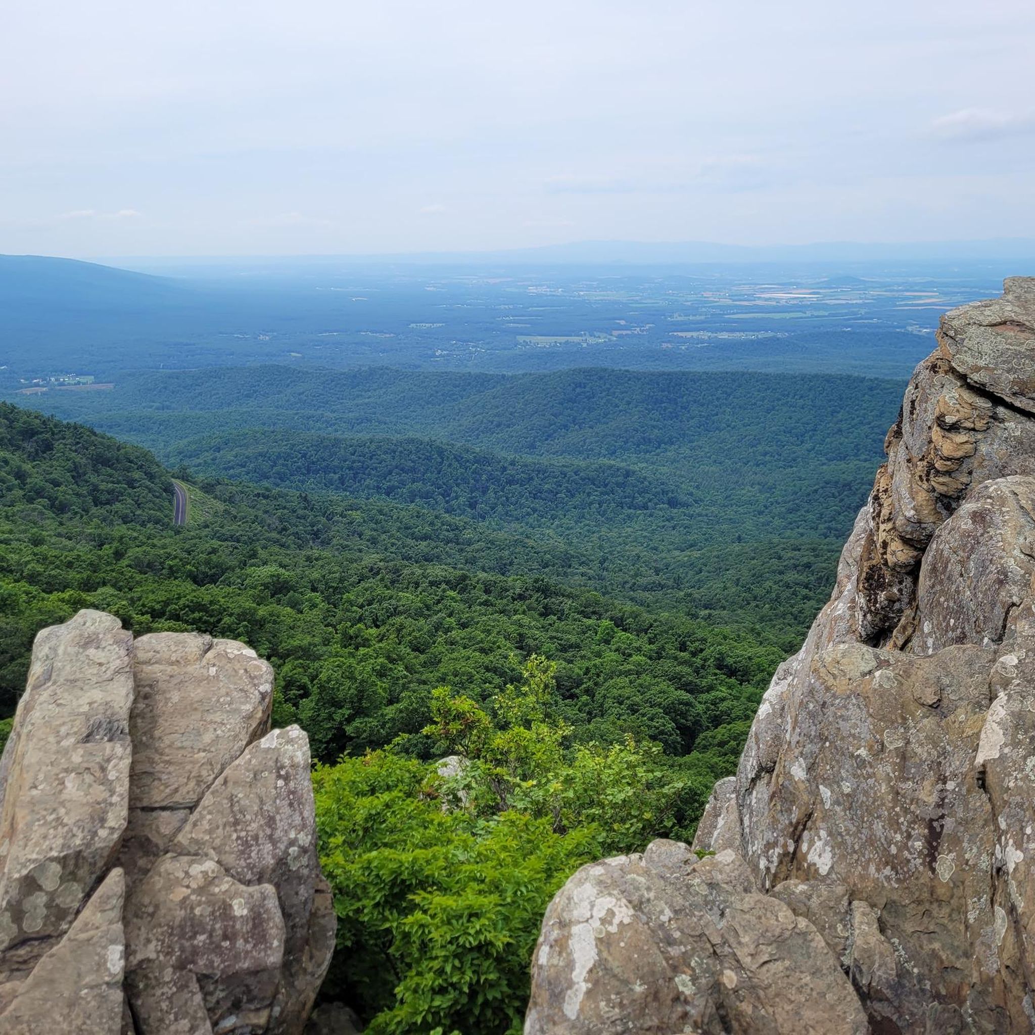
Boston Knob Overlook is located at Milepost 38.8 on the Blue Ridge Parkway and offers a small view from the singular picnic table at the pull-off (the view could be better, but there is a giant tree blocking most of the view). This isn't the best view on the parkway, but it is located in the middle of a section that doesn't have a ton of pull-offs.
0
0
Ravens Roost Overlook is at Milepost 10.7 on the Blue Ridge Parkway and is one of the most popular overlooks in this part of Virginia. From an elevation of 3,200 feet, you can look down into the old farming valley and along mountain ridges running perpendicular to the parkway.
0
0
Located at Milepost 1.5 and at an elevation of 2,148 feet on the Blue Ridge Parkway, Rockfish Valley Overlook is a more popular stop than the nearby Afton Overlook. The Rockfish Valley Overlook is a little more than 200 feet higher in elevation and offers a wide open view of Rockfish Valley with a mountainous backdrop.
0
0
Located just 0.2 miles into the parkway, Afton Overlook is the first official overlook on the Blue Ridge Parkway. Like many of the overlooks of the parkway, this view is of the nearby town. As you climb and descend through the mountains, you get many more views of the network of valleys, rivers, and towns that help make up this unique region of the country. The Blue Ridge Parkway is a 469 mile paved highway through the states of Virginia and North Carolina. The road is extremely popular for cyclists, cars, and motorcycles, so you should always exercise caution biking on the roadways. Being maintained by the National Park Service, the Blue Ridge Parkway is known for its overlooks and access to natural and wilderness areas. Only paved roads (no paths or trails) are open to bikes within the boundaries of the parkway, and you can expect to see other visitors at most overlooks, trailheads, and campgrounds. Biking any section of the Blue Ridge Parkway offers an immersion into Southern Appalachia. Taking on the entire road in a multi-day push is an extreme undertaking for serious cyclists; that being said, any section of the parkway can be doable for cyclists with some road biking experience and the right gear.
1
0
The Slacks Overlook Trail peers over the 20-minute Cliff area on the Blue Ridge Parkway. There are great views of the Copelands Rocks to the south and Upper Sherando Lake to the north.
0
0

It's worth parking your bike at the visitor center to hike the short walk to the top of Humpback Rocks. The views over the parkway are spectacular. The visitor center has exhibitions on historic mountain farming life that are also worth checking out.
0
0
Leave your bike at the start of the trail and hike 1.2 miles (1.9 km) to the magnificent White Rock Falls. The views are just as impressive as the falls.
0
0
The Shenandoah Valley is steeped in history and culture. It's a great place to explore the magnificent outdoors on a network of scenic trails. You can hike, bike, kayak, canoe and ski in the region.
0
0
Frequently Asked Questions
How many road cycling routes are available around Sherando?
There are over 30 road cycling routes available around Sherando on komoot, offering a diverse range of experiences for cyclists of all levels. The region is known for its rolling hills, dense forests, and scenic valleys.
Are there easy road cycling routes suitable for beginners in Sherando?
While many routes in Sherando feature elevation changes, there is at least one easy road cycling route available. The region offers options for various ability levels, so beginners can find suitable paths, though they might involve some gradual climbs.
What kind of terrain can I expect on road cycling routes in Sherando?
Road cycling around Sherando is characterized by rolling hills, forested valleys, and numerous scenic overlooks. You'll encounter both challenging ascents and more gradual routes, with road surfaces varying from well-maintained roads to quieter rural paths.
What are some challenging road cycling routes for experienced riders in Sherando?
For experienced riders seeking a challenge, Sherando offers 16 difficult routes. A notable option is the Ravens Roost Overlook to Boston Knob Overlook, a 56.2-mile trail with significant elevation gain, often completed in about 4 hours 53 minutes. Another challenging ride is Shenandoah Valley, which spans 43.5 miles and features extensive views.
Are there any scenic viewpoints along the road cycling routes in Sherando?
Yes, Sherando's road cycling routes are known for their panoramic views. Many routes feature overlooks that provide expansive vistas of the surrounding natural environment. For example, the Afton Overlook to Ravens Roost Overlook route offers consistent elevation changes and stunning overlooks. You can also visit specific viewpoints like Ravens Roost Overlook or Afton Overlook.
What do other road cyclists enjoy most about road cycling in Sherando?
The road cycling routes in Sherando are highly rated by the komoot community, with an average score of 5.0 stars from over 7 reviews. Cyclists often praise the varied terrain, the challenging ascents, and the beautiful panoramic views from the numerous overlooks.
Are there any loop road cycling trails in Sherando?
Yes, Sherando offers several loop road cycling trails. An example is the White Rock Falls – Slacks Overlook Trail loop from Wintergreen, a 38.1-mile difficult route. Another option is the Rockfish Valley Overlook – Afton Overlook loop from Dobie Mountain, covering 41.9 miles.
What natural attractions can I see near the road cycling routes?
Beyond the cycling, you can explore several natural attractions. Consider visiting Shamokin Falls or White Rock Falls. For more scenic views, Three Ridges Mountain Overlook is also nearby.
How long do road cycling routes near Sherando typically take to complete?
The duration of road cycling routes in Sherando varies significantly based on distance and elevation. For instance, the Afton Overlook to Ravens Roost Overlook route, at 21.6 miles, takes approximately 1 hour 58 minutes, while the longer Ravens Roost Overlook to Boston Knob Overlook (56.2 miles) can take around 4 hours 53 minutes.
Are there any historical sites or points of interest near Sherando's cycling routes?
Yes, in addition to natural beauty, you can find historical points of interest. The Humpback Rocks Visitor Center is a notable historical site in the vicinity, offering insights into the area's heritage.
What is the best season for road biking in Sherando?
Sherando's varied terrain makes it enjoyable across multiple seasons. Spring and fall generally offer pleasant temperatures and vibrant scenery, with autumn showcasing spectacular fall foliage. Summer can be warm, but higher elevations provide cooler air. Winter cycling is possible, though conditions may vary with snow and ice, especially on higher roads.
Most popular routes around Sherando
Most popular attractions around Sherando

Get inspired with the komoot mobile app


Explore more
Browse the best Road cycling routes in other regions.
