The best cycling routes around Columbia Heights
4.3
(214)
2,079
riders
121
rides
Touring cycling around Columbia Heights offers routes that feature diverse natural landscapes, including the Mississippi River and Rice Creek. The area is characterized by a network of trails winding through woodlands, prairies, and alongside various lakes. Cyclists can experience both scenic river views and stretches of open natural areas.
Best touring cycling routes around Columbia Heights
- The most popular touring cycling route is Mississippi River and Rice Creek West Trail Loop, a 28.0 miles (45.0 km) trail that takes 2 hours 38 minutes to complete. This moderate route offers diverse scenery with views of the Mississippi River and Rice Creek.
- Another top favourite among local touring cyclists is Rice Creek Regional Trail Loop, an easy 13.0 miles (20.8 km) path. This trail winds through prairies and woodlands, providing scenic views of Rice Creek and several lakes.
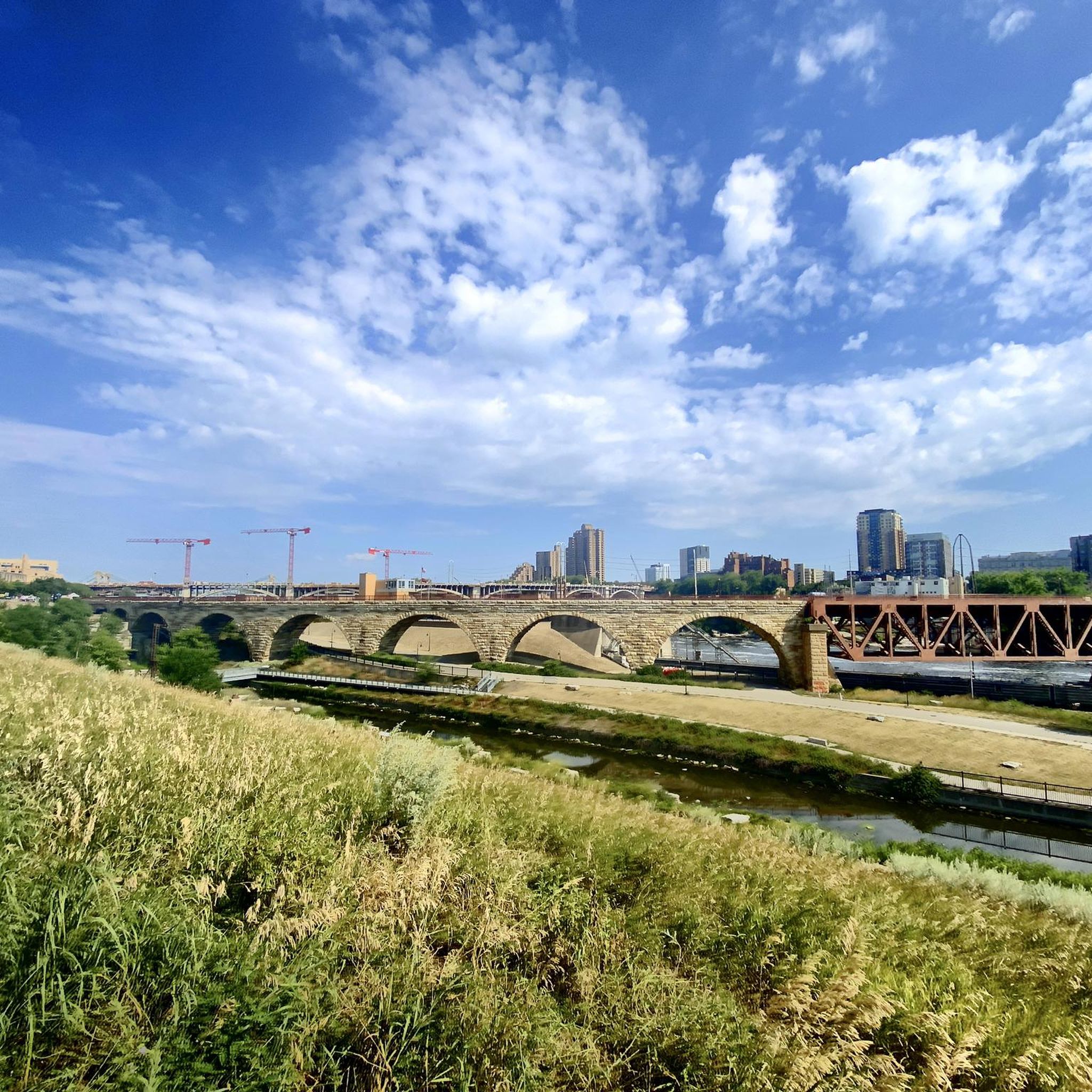
- Local touring cyclists also love the Stone Arch Bridge – Boom Island Park loop from Fridley, a 19.2 miles (30.9 km) trail leading through urban and riverside landscapes, often completed in about 1 hour 49 minutes.
- Touring cycling around Columbia Heights is defined by Mississippi River views, Rice Creek, and a mix of lakes and woodlands. The network offers options for various ability levels, from easy paved routes to more challenging segments.
- The routes in Columbia Heights are highly rated by the komoot community with an average score of 4.4 stars from over 130 reviews. More than 1,100 touring cyclists have used komoot to explore Columbia Heights's varied terrain.
Last updated: June 29, 2026
2.0
(1)
2
riders
20.8km
01:14
90m
90m
If you're looking for a pleasant and accessible touring cycling experience, the Rice Creek Regional Trail Loop delivers a delightful journey through Minnesota's varied landscapes. You'll pedal past restored prairies, through mesic woodlands, and alongside riparian marshes, with scenic views of Rice Creek and tranquil lakes like Long Lake Park. The route is mostly paved, offering a smooth ride, and provides opportunities to spot local wildlife such as white-tailed deer and various bird species.
This easy 13.0-mile (20.8 km) loop, with a modest 309 feet (94 metres) of elevation gain, typically takes around 1 hour and 13 minutes to complete, making it ideal for a casual outing. The trail is generally well-maintained, though some sections might be unpaved or recently resurfaced. While signage can occasionally be inconsistent, maps are available to help with navigation, and amenities like cafes and restrooms are accessible in nearby urban areas.
The Rice Creek Regional Trail system is notable for its excellent connectivity, linking through Anoka and Ramsey counties and several cities. This allows for the creation of various loop routes and extensions, making it a versatile option for touring cyclists. The trail celebrates diverse ecosystems, from open meadows with wildflowers to thickly wooded sections, providing a rich natural experience right on the edge of the Twin Cities metro area.
4.0
(1)
1
riders
45.0km
02:38
210m
210m
The Mississippi River and Rice Creek West Trail Loop offers a varied touring cycling experience, weaving through serene woodland along Rice Creek before opening up to more developed areas and connecting with the mighty Mississippi River. You'll navigate rolling hills and some challenging inclines, especially in the valleys of the Rice Creek floodplain, making for an engaging ride. The route, which is a moderate 27.9 miles (45.0 km) with 694 feet (212 metres) of elevation gain, takes approximately 2 hours and 38 minutes to complete.
This loop is easily accessible from the Minneapolis/St. Paul area, linking several local parks like Long Lake Park and Silverwood Park, which often provide amenities such as parking and restrooms. While no specific permits are required, planning your visit during spring or fall can enhance the experience, particularly for birdwatching enthusiasts.
Beyond the diverse terrain, the trail is a fantastic spot for wildlife observation, especially during migration seasons when you might spot eagles, herons, and pelicans. Its connectivity between the Rice Creek West Regional Trail and the Mississippi River Trail makes it a notable route for exploring the region's natural and urban interfaces.

Sign up for free
4.7
(3)
19
riders
30.9km
01:49
110m
110m
Easy bike ride. Great for any fitness level. Mostly paved surfaces. Suitable for all skill levels.
3.0
(1)
9
riders
32.0km
01:52
130m
130m
Easy bike ride. Great for any fitness level. Mostly paved surfaces. Suitable for all skill levels.
6
riders
28.0km
01:37
120m
120m
Easy bike ride. Great for any fitness level. Mostly paved surfaces. Suitable for all skill levels.
Get access to more routes and recommendations from other explorers.
Sign up for free
Already have an account?
Our route recommendations are based on thousands of hikes, rides, and runs completed by other people on komoot.
Start today with a free account
Your next adventure awaits.
Login or Signup


Tips from the Community

The St. Anthony Parkway Bridge crosses over the busy BNSF Northtown Rail Yard. Originally built in 1925 as a five-span Warren truss bridge, it was replaced in 2016 with a modern steel truss structure that honors its historic predecessor. Today, the bridge includes an interpretive plaza with preserved truss elements and great views of the rail yard, providing an insight into the area's industrial history.
0
0

This 8-acre park consists of three islands located in the Mississippi River. While Chase Island is accessible on foot, the other two can be reached by water or enjoyed from a distance. The park earned its name from its founder's quote, "Where Peace Is A Way of Life Every Hour of Every Day for All Those Willing to Share the Experience."
0
0

From here, you can see the Water Power Park on the Mississippi River’s East Channel—an impressive structure that harnesses the power of this mighty river.
0
0

The Rice Creek Regional Trail near Mounds View is split into a northern and a western section. The northern section follows the name-giving Rice Creek and encircles two little ponds while passing through woodlands and open meadows.
1
0

The Rice Creek West Regional Trail is a 4-mile-long trail that connects Creekview Park with Locke County Park. The trail is full paved and takes you through beautiful woodland scenery.
0
0

The former mill district of Minneapolis is now a very popular neighborhood with restaurants, the Guthrie Theater and residential buildings.
0
0

Long Lake Park is a popular park in St Paul. There are sandy beach areas and several trails to choose from within the park. There are also restrooms and picnic areas.
0
0
Frequently Asked Questions
What kind of terrain can I expect on touring cycling routes around Columbia Heights?
The touring cycling routes around Columbia Heights, Minnesota, offer a diverse range of terrain. You'll find trails winding through woodlands, prairies, and alongside various lakes. Many routes feature scenic views of the Mississippi River. The area includes both paved surfaces suitable for all skill levels and some unpaved sections with significant elevation gains for more experienced riders.
Are there family-friendly touring cycling routes in Columbia Heights?
Yes, Columbia Heights offers several family-friendly touring cycling routes. Many trails feature mostly paved surfaces and are considered easy, making them suitable for all skill levels. An excellent option is the Rice Creek Regional Trail Loop, an easy 13.0-mile path that winds through prairies and woodlands, providing scenic views of Rice Creek and several lakes.
What natural features can I see while cycling around Columbia Heights?
Cyclists in Columbia Heights can enjoy a variety of natural features. Many routes offer scenic views of the Mississippi River. You'll also encounter Rice Creek, numerous lakes, and extensive woodlands and prairies. Specific highlights include Como Lake, Lake of the Isles, and the View of the Mississippi River.
When is the best time of year to go touring cycling in Columbia Heights?
The most popular months for touring cycling around Columbia Heights are May and August. During these months, the weather is generally favorable for outdoor activities, allowing cyclists to fully enjoy the diverse landscapes, including river views, woodlands, and prairies.
What are some notable landmarks or attractions along the cycling routes?
While cycling around Columbia Heights, you can explore various attractions and natural landmarks. You might pass by Como Lake, Lake of the Isles, and the Eloise Butler Wildflower Garden and Bird Sanctuary. The North Mississippi Regional Park also offers scenic views of the Mississippi River.
Are there any circular touring cycling routes available?
Yes, there are several excellent circular touring cycling routes. For instance, the Mississippi River and Rice Creek West Trail Loop is a moderate 28.0-mile route offering diverse scenery. Another popular option is the Rice Creek Regional Trail Loop, an easy 13.0-mile path that winds through prairies and woodlands.
How many touring cycling routes are there in the Columbia Heights area?
There are over 120 touring cycling routes available around Columbia Heights. These routes cater to various fitness levels, with 81 easy routes, 40 moderate routes, and 3 difficult routes, ensuring options for every type of cyclist.
What do other touring cyclists say about the routes in Columbia Heights?
The touring cycling routes in Columbia Heights are highly rated by the komoot community, with an average score of 4.4 stars from over 130 reviews. Cyclists often praise the diverse scenery, including the Mississippi River views, Rice Creek, and the mix of lakes and woodlands. Over 1,100 touring cyclists have used komoot to explore the varied terrain.
Are there routes with significant elevation changes for a more challenging ride?
Yes, while many routes are easy, there are options with more significant elevation changes for those seeking a challenge. For example, the Stone Arch Bridge – View of Saint Anthony Falls loop from Columbia Heights is a moderate 28.9-mile route with an elevation gain of approximately 277 meters, offering a more demanding experience.
Can I find routes that offer views of the Mississippi River?
Absolutely. Many touring cycling routes in and around Columbia Heights offer stunning views of the Mississippi River. The Mississippi River and Rice Creek West Trail Loop is a prime example, providing diverse scenery with prominent river views. You can also find the View of the Mississippi River highlight along some paths.
Are there any easy, paved routes suitable for beginners?
Yes, Columbia Heights offers numerous easy, paved routes perfect for beginners or those looking for a relaxed ride. The Long Lake loop from New Brighton is an easy 19.9-mile route that provides a comfortable cycling experience. The Rice Creek Regional Trail Loop is another easy option, winding through scenic natural areas.
Most popular attractions around Columbia Heights

Get inspired with the komoot mobile app


Explore more
Browse the best Cycling routes in other regions.
