The best walks and hikes around Östra Lagnö
4.8
(27)
125
hikers
16
hikes
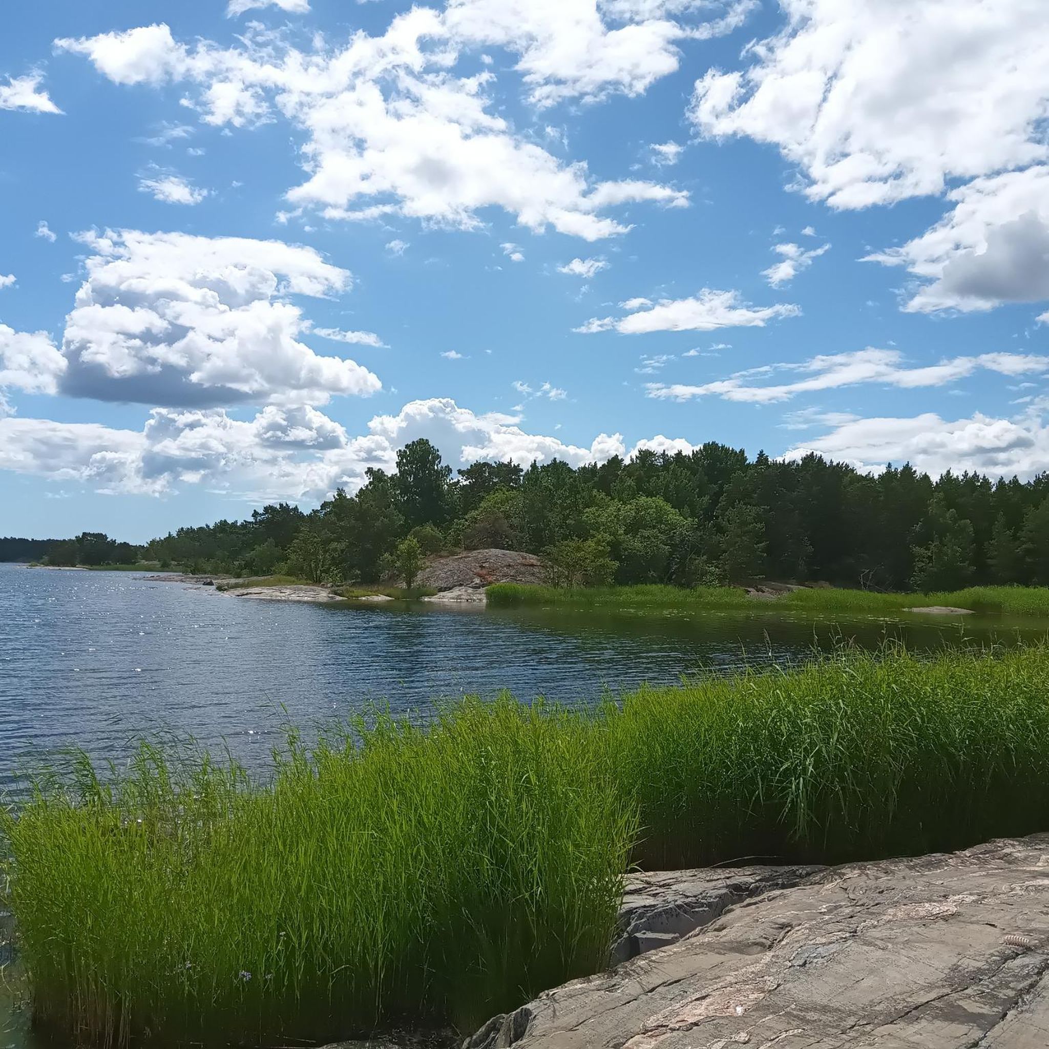
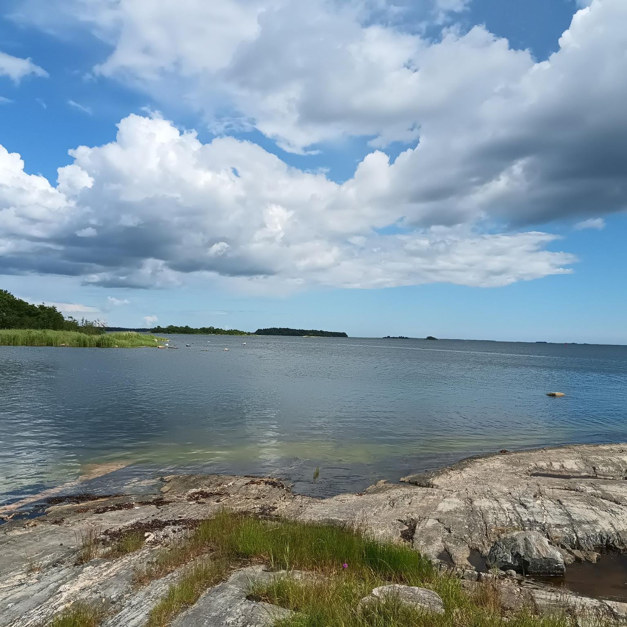
Hiking around Östra Lagnö offers diverse landscapes within the Stockholm Archipelago, characterized by its position facing the Åland Sea. The region features a blend of smooth, wave-washed coastal rocks, sparse pine forests on rocky outcrops, and inland meadows. Geological formations include cliffs polished by inland ice, striped with black diabase and red feldspar rocks. This varied terrain provides a range of hiking experiences from coastal views to sheltered forest paths.
Best hiking trails around Östra Lagnö
- The most popular hiking…
Last updated: May 14, 2026
4.5
(2)
12
hikers
6.42km
01:39
30m
30m
Easy hike. Great for any fitness level. Easily-accessible paths. Suitable for all skill levels.
5.0
(1)
3
hikers
Easy hike. Great for any fitness level. Easily-accessible paths. Suitable for all skill levels.

Sign up for free
5.0
(2)
20
hikers
9.79km
02:32
50m
50m
Moderate hike. Good fitness required. Easily-accessible paths. Suitable for all skill levels.
Moderate hike. Good fitness required. Easily-accessible paths. Suitable for all skill levels.
Easy hike. Great for any fitness level. Easily-accessible paths. Suitable for all skill levels.
Get access to more routes and recommendations from other explorers.
Sign up for free
Already have an account?
Our route recommendations are based on thousands of hikes, rides, and runs completed by other people on komoot.
Start today with a free account
Your next adventure awaits.
Login or Signup
Popular around Östra Lagnö
Tips from the Community

Storträsket is one of the few freshwater lakes on Ingmarsö and is surrounded by mixed forest and wetland edges. Although it is shallow, it isn't typically used for swimming. It makes for a nice quiet inland spot.
1
0
This bench is thoughtfully placed for a beautiful view of the sheltered bay of Bockviks. It's placed on a tiny rocky islet known as a Kobbe.
1
0
The Ingmarsö B&B is on the site of Norrgården, the island's oldest farm dating back to the 17th century. Accommodation is provided in two residential building with a total of 16 beds in six rooms. The site also features a farm shop, local museum, and soon a dairy also.
1
0
Femsund lies within a protected and calm bay, and features a long (private) shoreline of jetties and docks and a sandy beach making for an ideal swim spot.
2
0
The bakery requires a small detour off the main SAT loop. The reward is a wonderful selection of freshly baked bread, sweet buns and cookies. You can take-away, or the restaurant Bagarbordet offers 3-course meals, pizza nights and occasional BBQ's in summer. An essential stop!
1
0
The rowboats are an unusual feature for those hiking the SAT. On each side of the strait between Finnhamn and Ingmarsö a rowboat is provided courtesy of the Archipelago Foundation. To ensure that there is always a rowboat on each side, you must row back and forth three times: once to fetch the other rowboat, once to tow it back to the side you came from (you must leave it there), and once more to row back and continue your hike. Don't take the boats out for a longer excursion, as you may leave someone stranded on the other island!
1
0
"Paradisviken" translates to Paradise Bay, a fitting name for such an idyllic spot. The beach provides a family-friendly area for sunbathing and the sheltered calm waters are ideal for swimming. The surrounding area includes rocky outcrops and forest, so there is plenty to explore if the beach life gets too relaxing. Directly on the beach is a classic beachside kiosk called "Ragnar's". Along with refreshments, you can hire kayaks, rowboats and SUPs from here.
2
0
The rowboats are an unusual feature for those hiking the SAT. On each side of the strait between Finnhamn and Ingmarsö a rowboat is provided courtesy of the Archipelago Foundation. To ensure that there is always a rowboat on each side, you must row back and forth three times: once to fetch the other rowboat, once to tow it back to the side you came from (you must leave it there), and once more to row back and continue your hike. Don't take the boats out for a longer excursion, as you may leave someone stranded on the other island!
1
0
Frequently Asked Questions
What kind of hiking trails can I expect in Östra Lagnö?
Östra Lagnö offers a diverse range of hiking experiences, from easy walks to moderate routes. You'll find coastal paths with smooth, wave-washed rocks and expansive views over the Åland Sea, as well as sheltered forest paths through pine forests and meadows. The area is known for its unique blend of archipelago scenery and inland nature.
Are there any easy hiking trails suitable for beginners or families in Östra Lagnö?
Yes, Östra Lagnö has many easy trails perfect for beginners or families. Out of nearly 20 routes, 13 are rated as easy. For a pleasant and accessible option, consider the Hiking loop from Östra Lagnö, which is 4.0 miles (6.4 km) long and takes about 1 hour 39 minutes to complete. Some trails within the Själbottna-Östra Lagnö nature reserve are even adapted for wheelchair users.
Can I bring my dog on the hiking trails in Östra Lagnö?
Generally, dogs are welcome on trails in Östra Lagnö, especially within the nature reserve. However, it's always best to keep them on a leash to protect wildlife, particularly during nesting seasons, and to respect other hikers. Always check local signage for any specific restrictions.
Are there any circular or loop trails in Östra Lagnö?
Yes, Östra Lagnö features several circular routes. A popular option is the Moss-Covered Forest Walk – Menschheitsstein South Blidö loop from Klubben, an easy 3.5 miles (5.6 km) path that guides you through beautiful moss-covered forests.
What are the best times of year to go hiking in Östra Lagnö?
The best time to hike in Östra Lagnö is typically from spring to autumn (May to October) when the weather is mild and the natural beauty is at its peak. Spring brings blooming wildflowers, while autumn offers vibrant foliage and opportunities for berry and mushroom picking. Summer is ideal for combining hiking with swimming.
What kind of natural features or wildlife can I see while hiking?
Östra Lagnö boasts diverse natural features. You'll encounter smooth, wave-washed rocks, sparse pine forests, and inland meadows. Geologically, the cliffs are polished by inland ice, striped with black diabase and light red feldspar. The skerries east of Skakroksudden are known for rich birdlife, including oystercatchers, gulls, and various seabirds. You might also spot an old, self-rejuvenating yew tree stand at Brännholmen.
Is there public transport available to reach the hiking areas in Östra Lagnö?
Yes, Östra Lagnö is well-connected and accessible by public transport. You can reach the area by bus and ferry, making it convenient for visitors without a car. For detailed travel information, you might check local public transport schedules.
Where can I park my car if I drive to Östra Lagnö for hiking?
Östra Lagnö is readily accessible by car, and there are usually designated parking areas available near trailheads or within the nature reserve. Look for signs indicating visitor parking upon arrival. Specific parking information for individual routes can often be found on komoot tour pages or local visitor information sites.
Are there any places to eat or get refreshments near the hiking trails?
While Östra Lagnö itself is more focused on natural experiences, the broader archipelago offers amenities. For example, the Paradisviken Beach – Finnhamns Krog loop from Dragedet leads towards Finnhamn, where you can find Finnhamns Krog (inn/restaurant). It's advisable to carry your own snacks and water, especially on longer hikes.
Can I go swimming after a hike in Östra Lagnö?
Absolutely! Östra Lagnö offers many opportunities for wild swimming. The coastal areas provide sheltered natural harbors and beaches, perfect for a refreshing dip after your hike. Look for accessible spots along the trails, especially during warmer months.
What do other hikers say about the trails in Östra Lagnö?
The hiking routes in Östra Lagnö are highly rated by the komoot community, with an average score of 4.8 stars from more than 20 reviews. Hikers often praise the varied terrain, from coastal views to peaceful forest paths, and the well-maintained nature of the trails.
Are there any longer hiking opportunities or connections to other trails?
Yes, Östra Lagnö is part of the larger Stockholm Archipelago Trail, a 270 km long path spanning 20 islands. This offers opportunities for longer excursions and island hopping via public ferries. Sections like Finnhamn are accessible from Östra Lagnö, providing further hiking possibilities, such as the Finnhamn (Central Archipelago) — Stockholm Archipelago Trail.

Get inspired with the komoot mobile app


Explore more
Browse the best Hikes in other regions.
