The best mountain hikes around Tarn Hows
4.3
(4)
31
hikers
11
hikes
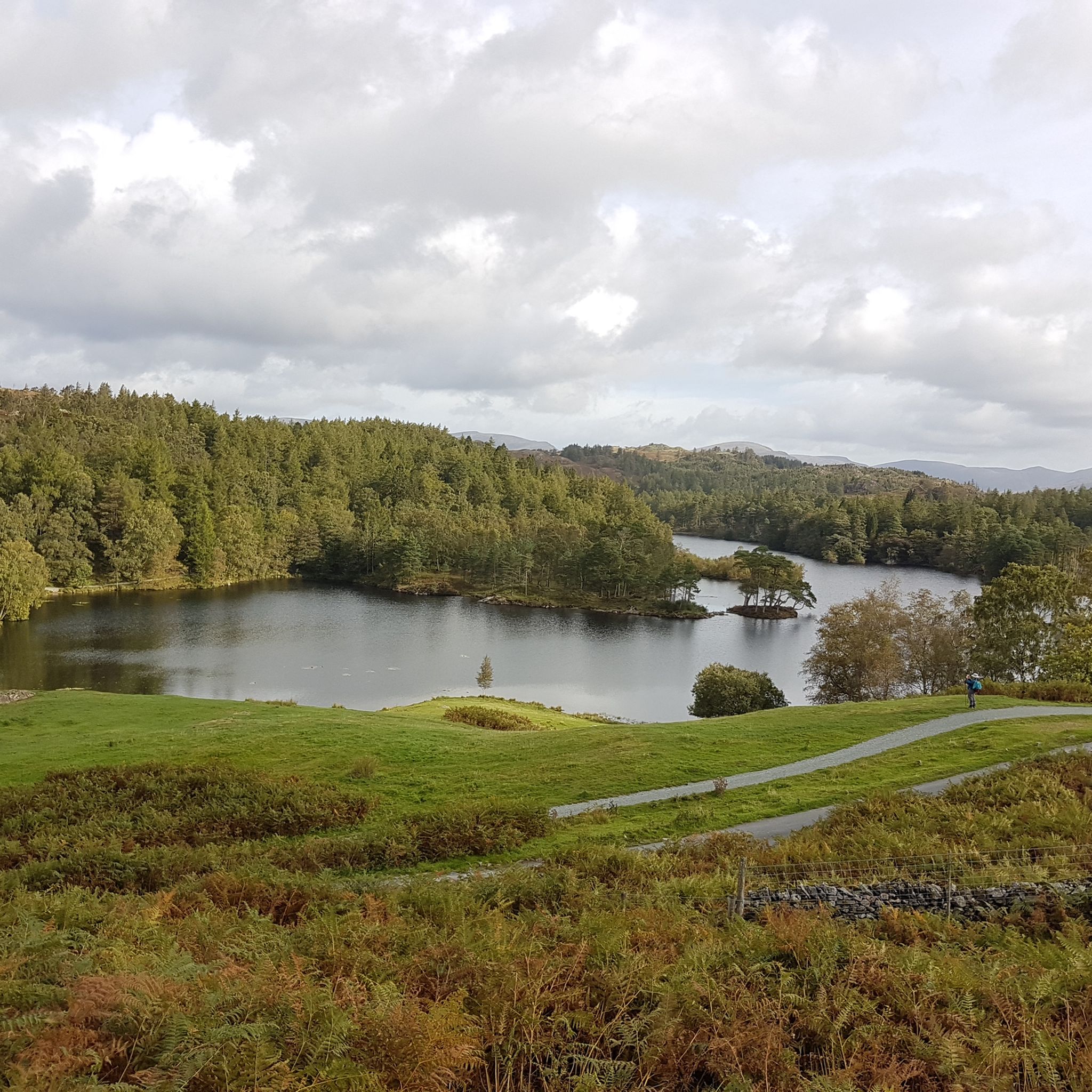
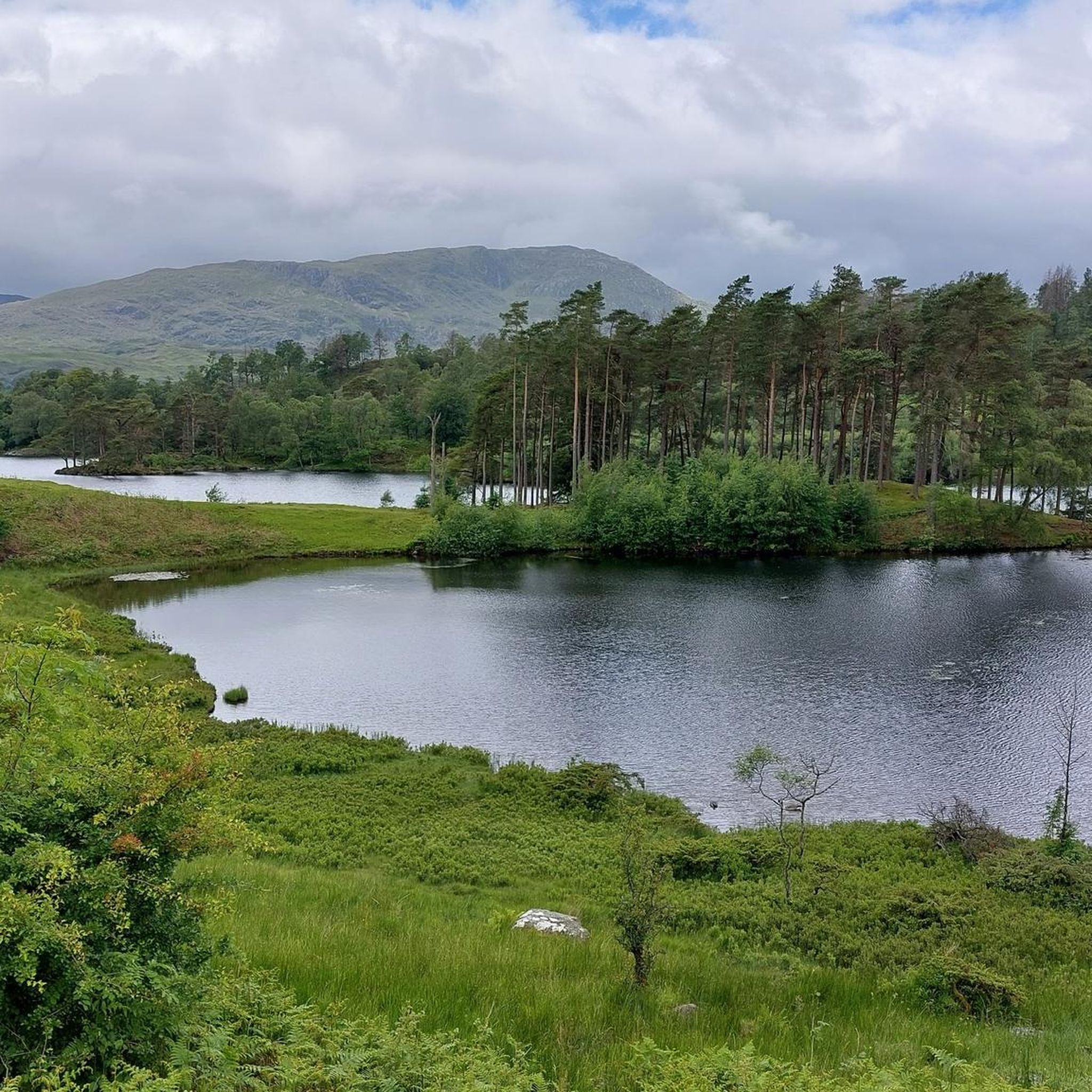
Mountaineering around Tarn Hows, located in the Lake District, offers routes through a landscape characterized by rolling fells, ancient woodlands, and picturesque tarns. The region features a mix of open moorland, rocky ascents, and forested valleys, providing varied terrain for mountaineers. Elevations typically include prominent fells that offer expansive views of the surrounding Cumbrian countryside.
Best mountaineering routes around Tarn Hows
- The most popular mountaineering route is Coniston Waterfall – Old Man of Coniston summit loop from Coniston, a…
Last updated: September 28, 2026
5.0
(2)
7
hikers
10.5km
04:18
700m
700m
Moderate mountaineering route. Good fitness required. Mostly accessible paths. Sure-footedness required.
3
hikers
11.5km
03:47
500m
500m
Moderate mountaineering route. Good fitness required. Easily-accessible paths. Suitable for all skill levels.

3.0
(1)
8
hikers
6.10km
02:56
610m
610m
Hard mountaineering route. Good fitness required. Sure-footedness, sturdy shoes and alpine experience required.
5
hikers
12.3km
05:06
740m
740m
Hard mountaineering route. Very good fitness required. Sure-footedness, sturdy shoes and alpine experience required.
5.0
(1)
4
hikers
14.1km
05:43
850m
850m
Hard mountaineering route. Very good fitness required. Sure-footedness, sturdy shoes and alpine experience required.
Get access to more routes and recommendations from other explorers.
Already have an account?
Our route recommendations are based on thousands of hikes, rides, and runs completed by other people on komoot.
Start today with a free account
Your next adventure awaits.


Tips from the Community

Stepped climb up, with a tougher climb near the top. Easier descent on stepped paths.
0
0


To describe this mountain, here is a quote: "Although cruelly scarred and disfigured by the quarries, the Old Man has retained a dignified bearing and still lifts his proud and venerable head to the sky. His tears flow quietly into Low Water and Goats Water, two beautiful mountain tarns, whence they eventually... find their way to Coniston Water, bathing his ancient feet." Alfred Wainwright, "A Pictorial Guide to the Lakeland Fells, Book Four: The Southern Fells"
5
0
A beautiful waterfall, but difficult to view in the summer due to dense vegetation.
7
0

Bowfell has got a great hikers' pedigree for a reason. It has a distinctive, pyramid-shaped peak, and at 902 metres (2,959 feet), it is England's sixth-highest mountain. It is noted for the great scramble that is the climber's traverse. From its rocky, boulder-strewn top you have sweeping panoramic views across to Scafell Pike and the Langdale valley.
0
0
Crinkle Crags is a proper, rugged, craggy, undulating 859-metre mountain summit. The actual summit section is referred to as the 'Long Top'. The mountain massif itself has a series of five rocky undulations that create a number of other distinct tops, and they are all great little scrambly outings in their own way. There is also the 'Bad Step' on the southern approach to Long Top. This is a short but infamous rocky micro-scramble. If you like rock, Crinkle Crags is your place to be.
0
0
Great Knott is a 696-metre (2,283 feet) peak that sits on the ridge connecting Bowfell to Esk Pike. Its position on this rugged and dramatic ridgeline gives you outstanding views of the Langdale Valley and up towards Crinkly Crags. It is one of the UK's designated Nuttalls.
1
0
Great Langdale is a spectacular, U-shaped glacial valley in the heart of the Lake District National Park, renowned for its dramatic fells, waterfalls, and world-class hiking trails. Dominated by the iconic Langdale Pikes, it is the ultimate playground for outdoor enthusiasts.
6
0
Frequently Asked Questions
How many mountaineering routes are there around Tarn Hows?
There are 16 mountaineering routes available around Tarn Hows. These routes offer a variety of experiences, from moderate ascents to more challenging, technical climbs.
Are there any easy mountaineering routes around Tarn Hows for beginners?
While the routes around Tarn Hows are generally considered moderate to difficult, there are options that might suit those looking for a less strenuous experience. For instance, the area features rolling fells and picturesque tarns, offering paths that are less technically demanding than summit attempts. It's always recommended to check the specific route details for elevation and distance to match your fitness level.
What are the typical durations for mountaineering routes in Tarn Hows?
Mountaineering routes around Tarn Hows vary in length and duration. For example, the Coniston Waterfall – Old Man of Coniston summit loop from Coniston typically takes around 4 hours 18 minutes to complete. Shorter routes, like the Slate Bridge Over Stream – Jack's Rake loop from Great Langdale, can be completed in about 3 hours 18 minutes, while longer, more challenging routes can take upwards of 6 hours.
Are there family-friendly mountaineering options near Tarn Hows?
The mountaineering routes around Tarn Hows are generally rated as moderate to difficult, often involving significant elevation gain and rugged terrain. While the immediate area of Tarn Hows itself offers easier walks, the mountaineering routes are better suited for families with older children who have experience with longer, more challenging hikes. Always check the route difficulty and length before setting out with children.
Can I bring my dog on mountaineering routes in Tarn Hows?
Many of the trails in the Lake District, including those around Tarn Hows, are dog-friendly. However, it's crucial to keep dogs on a lead, especially in areas with livestock or ground-nesting birds. Some routes may involve stiles or rocky sections that could be challenging for dogs. Always check local signage and be prepared to clean up after your pet.
What is the best time of year for mountaineering in Tarn Hows?
The best time for mountaineering around Tarn Hows is typically from late spring to early autumn (May to October). During these months, the weather is generally milder, and the trails are less likely to be affected by snow or ice. The fells are vibrant, and visibility for views is often at its best. However, weather in the Lake District can change rapidly, so always be prepared for all conditions.
What are the conditions like for winter mountaineering around Tarn Hows?
Winter mountaineering around Tarn Hows can be challenging and requires appropriate experience and equipment. Conditions can include snow, ice, strong winds, and reduced visibility. Routes like the Bowfell Summit – Esk Pike Summit loop from Great Langdale become significantly more demanding. It's essential to have winter mountaineering gear, navigation skills, and to check mountain weather forecasts and avalanche reports before attempting routes in winter.
Are there circular mountaineering routes available around Tarn Hows?
Yes, many of the mountaineering routes around Tarn Hows are circular, allowing you to start and finish at the same point. Examples include the popular Wansfell Pike – Stock Ghyll Woods loop from Ambleside and the challenging Vertical Rock Face Climb – Gunson Knott (822 m) loop from Great Langdale. Circular routes are convenient for parking and offer varied scenery throughout your journey.
Where can I find parking for mountaineering routes near Tarn Hows?
Parking is available at various points near the trailheads for mountaineering routes around Tarn Hows. For routes starting near Coniston, there are car parks in the village. For routes originating from Ambleside or Great Langdale, designated parking areas are usually available, though they can fill up quickly during peak season. Always check for parking availability and any associated fees beforehand.
Is public transport available to access mountaineering routes in Tarn Hows?
Public transport options are available to reach some starting points for mountaineering routes around Tarn Hows. Buses connect major towns like Ambleside and Coniston, which serve as access points for several trails. However, access to more remote trailheads might be limited, so planning your journey in advance using local bus schedules is advisable.
What kind of equipment is recommended for mountaineering in this area?
For mountaineering around Tarn Hows, essential equipment includes sturdy hiking boots, waterproof and windproof clothing, layers for warmth, a map and compass (or GPS device), sufficient water and snacks, and a first-aid kit. Depending on the season and specific route, additional gear like trekking poles, headlamps, and even ice axes or crampons for winter conditions may be necessary. Always be prepared for changeable mountain weather.
Are there any pubs or places to eat near the routes after a hike?
Yes, after a day of mountaineering, you'll find several welcoming pubs and eateries in the nearby villages. Coniston, Ambleside, and Great Langdale, which are common starting points for many routes, offer a range of options from traditional Lakeland pubs serving hearty meals to cafes for lighter refreshments. These are perfect for relaxing and refueling.
What wildlife might I encounter on the trails around Tarn Hows?
The diverse landscape around Tarn Hows, with its fells, woodlands, and tarns, supports a variety of wildlife. You might spot native red deer, various bird species including buzzards and peregrine falcons soaring overhead, and smaller mammals like red squirrels in forested areas. Keep an eye out for local sheep and Herdwick sheep, which are iconic to the Lake District landscape.
What do other mountaineers enjoy most about the routes in Tarn Hows?
The mountaineering routes around Tarn Hows are highly rated by the komoot community, with an average score of 4.7 stars. Reviewers often praise the stunning panoramic views from the fells, the varied terrain that keeps hikes interesting, and the sense of accomplishment from reaching prominent summits. The blend of open moorland, ancient woodlands, and picturesque tarns is frequently highlighted as a major draw.
Are there any less-known or 'hidden gem' routes to explore?
While the popular routes are well-loved, the broader Lake District area surrounding Tarn Hows offers many less-trafficked paths for those seeking solitude. Exploring routes that venture slightly off the main peaks or into quieter valleys can reveal hidden waterfalls, secluded tarns, and unique rock formations. Consulting detailed maps and local guides can help uncover these quieter, yet equally rewarding, mountaineering experiences.
Most popular routes around Tarn Hows

Get inspired with the komoot mobile app


Explore more
Browse the best Mountain Hikes & Routes in other regions.
