The best walks and hikes around Tunstall Reservoir
4.5
(355)
2,321
hikers
153
hikes
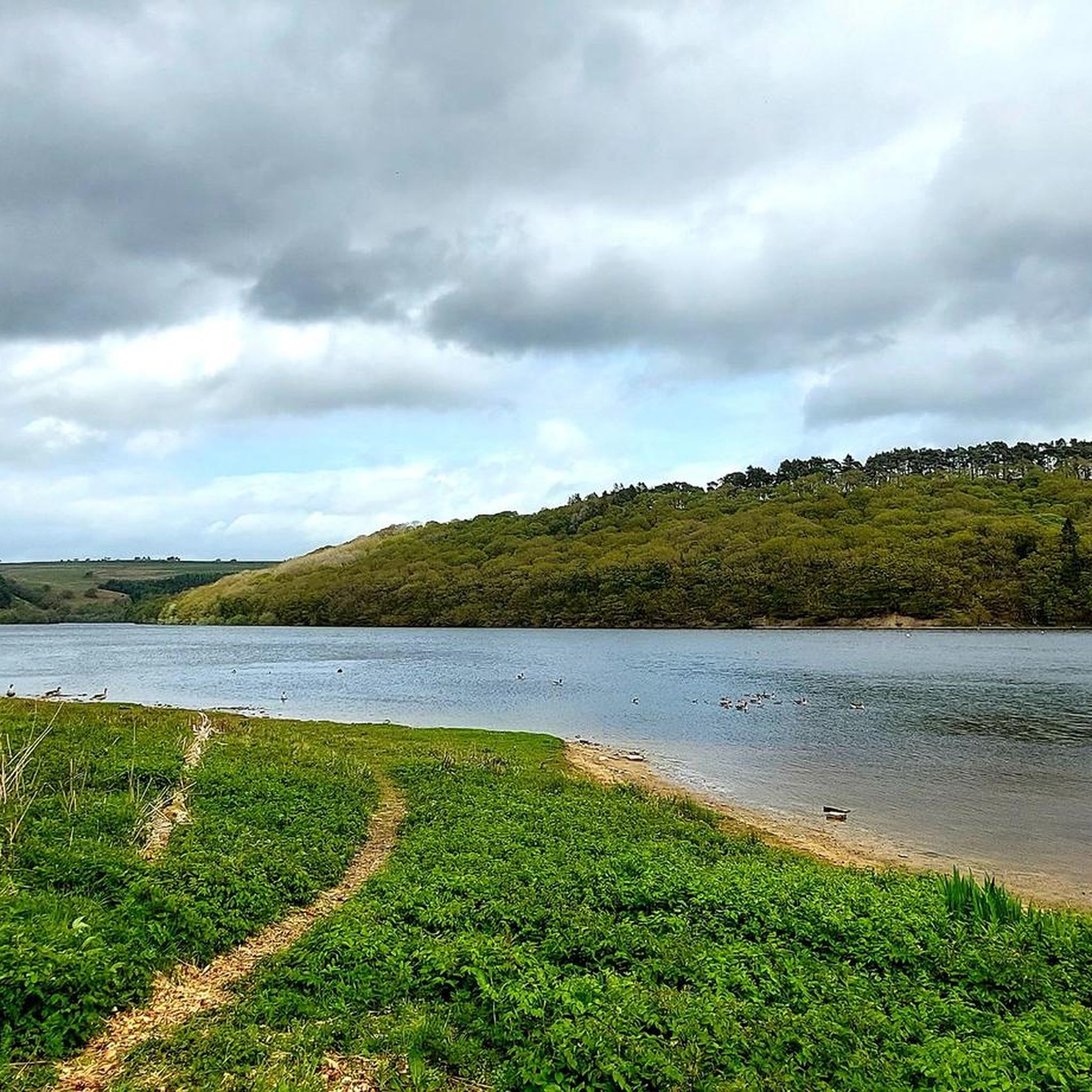
Hiking around Tunstall Reservoir offers diverse landscapes within the North Pennines National Landscape, featuring serene woodlands, open fields, and rolling countryside. The reservoir itself, completed in 1879, is a central feature, with paths winding along its shores and through surrounding forests. Waskerley Beck feeds into the reservoir, and its course is followed by several trails. Backstone Bank Wood, an ancient area, adds historical and natural interest to the region's terrain.
Best hiking trails around Tunstall Reservoir
- The most popular hiking route is Tunstall Reservoir Circular Walk, a 2.0 miles (3.2 km) trail that takes 50 minutes to complete. This easy route offers scenic views around the reservoir.
- Another top favourite among local hikers is Path Along Waskerley Beck – Tunstall Reservoir loop from Sand Edge Common, a moderate 7.9 miles (12.8 km) path. This trail follows the Waskerley Beck and provides varied terrain through woodlands and open areas.
- Local hikers also love the Tunstall Reservoir loop from Sand Edge Common, a 3.2 miles (5.1 km) trail leading through woodlands and open fields, often completed in about 1 hour 30 minutes.
- Hiking around Tunstall Reservoir is defined by woodlands, open fields, and the reservoir itself, with paths often following Waskerley Beck. The network offers options for various ability levels, from easy strolls to moderate loops.
- The routes in Tunstall Reservoir are highly rated by the komoot community with an average score of 4.5 stars from over 300 reviews. More than 2,200 hikers have used komoot to explore Tunstall Reservoir's varied terrain.
Last updated: July 7, 2026
4.5
(13)
126
hikers
3.16km
00:50
30m
30m
Easy hike. Great for any fitness level. Easily-accessible paths. Suitable for all skill levels.
4.5
(4)
19
hikers
12.8km
03:38
290m
290m
Moderate hike. Good fitness required. Easily-accessible paths. Suitable for all skill levels.

Sign up for free
5.0
(2)
11
hikers
7.58km
02:05
130m
120m
Moderate hike. Good fitness required. Easily-accessible paths. Suitable for all skill levels.
4.0
(6)
30
hikers
6.01km
01:45
160m
160m
Easy hike. Great for any fitness level. Easily-accessible paths. Suitable for all skill levels.
5.0
(2)
9
hikers
12.5km
03:34
280m
280m
Moderate hike. Good fitness required. Easily-accessible paths. Suitable for all skill levels.
Get access to more routes and recommendations from other explorers.
Sign up for free
Already have an account?
Our route recommendations are based on thousands of hikes, rides, and runs completed by other people on komoot.
Start today with a free account
Your next adventure awaits.
Login or Signup
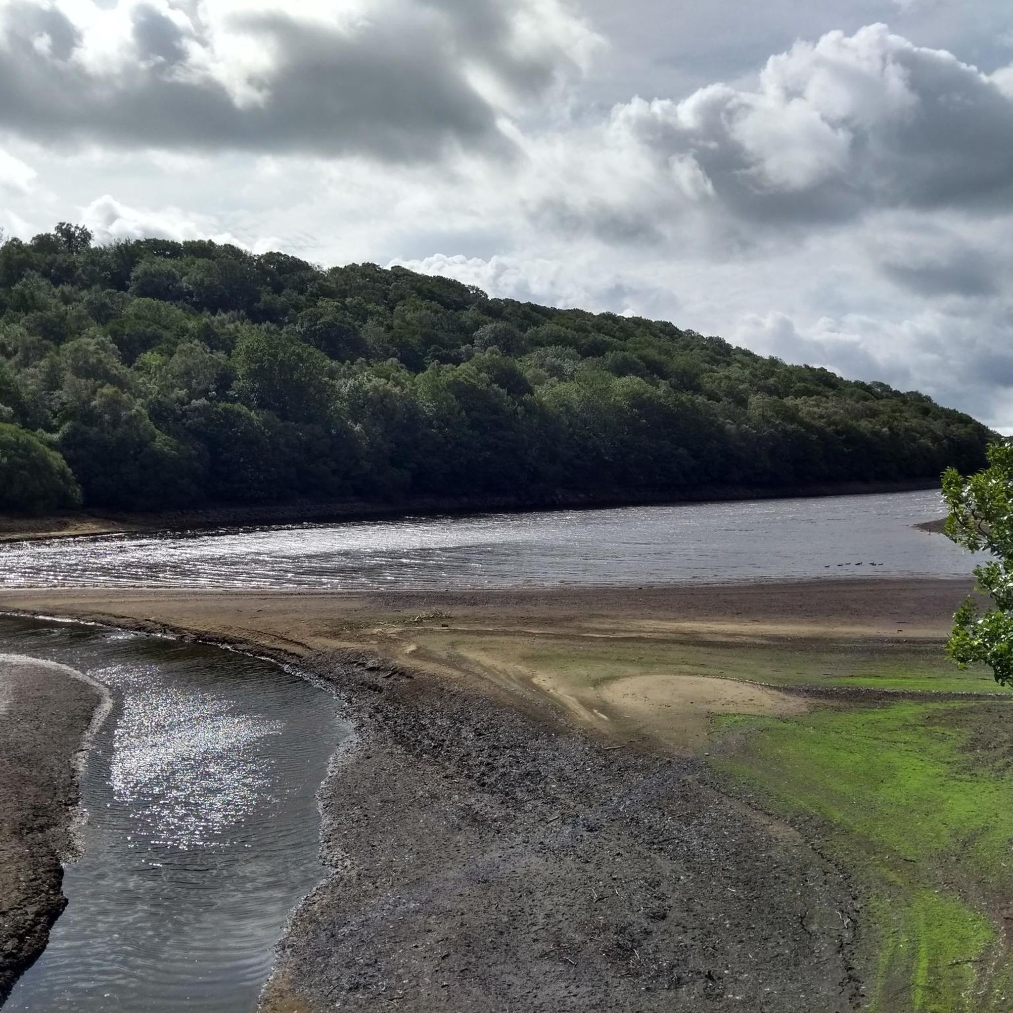
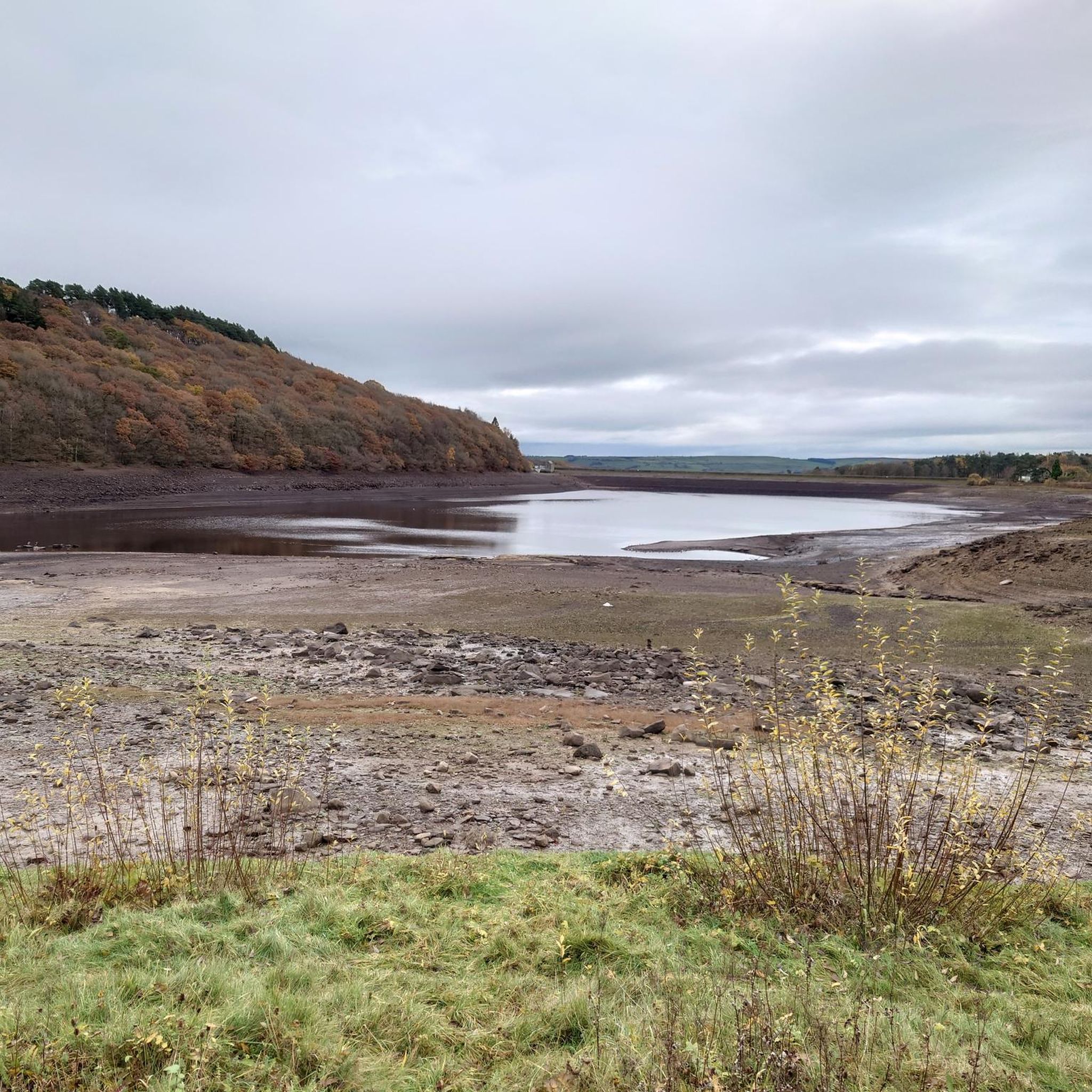
Tips from the Community


lovely walk around the reservoir great places for bird watching saw a kingfisher last time i was there.
0
0

A quiet picnic area alongside the Waskerley Beck with lots of parking. A number of walks are possible from here including the Family Walk, an easy circular route on footpaths accessible for pushchairs and wheelchairs, 1.5 miles long.
0
0

really easy to get to just off public footpath from salters gate
0
0

Nice 3km walk around the reservoir on the lakeside path. It's not far but the path on the east side is quite narrow and rough so fun and adventurous but not so good for buggies & wheelchairs.
0
0
A water supply reservoir completed in 1879, it's now used to help control the flow of the River Wear. There is a nice 2 mile walk around the reservoir which can be linked to a longer walk from nearby Wolsingham.
0
0

A nice quiet place with a 2 mile walk around it. Paths are a bit bumpy but a good walk
1
0
Frequently Asked Questions
How many hiking trails are available around Tunstall Reservoir?
There are over 150 hiking routes available around Tunstall Reservoir, catering to a wide range of preferences and abilities. The komoot community has explored more than 2,200 of these routes.
What kind of terrain and difficulty can I expect on hikes around Tunstall Reservoir?
The terrain around Tunstall Reservoir is quite varied, featuring serene woodlands, open fields, and rolling countryside, all set against the backdrop of the North Pennines National Landscape. You'll find paths winding along the reservoir shores, through forests, and sometimes following Waskerley Beck. Difficulty levels range from easy strolls to more challenging loops with moderate elevation gains. Approximately 60 routes are easy, 80 are moderate, and a dozen are considered difficult.
Are there family-friendly hiking options around Tunstall Reservoir?
Yes, Tunstall Reservoir is an excellent destination for families. Many easy routes are suitable for all ages, such as the Tunstall Reservoir Circular Walk, which is about 2 miles long. The area also offers opportunities for wildlife spotting and has dedicated picnic areas, making it ideal for a family day out.
Are dogs allowed on the hiking trails around Tunstall Reservoir?
Yes, dogs are generally welcome on the hiking trails around Tunstall Reservoir. However, as the area includes open fields and farmland, it's important to keep dogs under control, especially near livestock, and to clean up after them. Always check local signage for any specific restrictions.
Are there any circular walks around Tunstall Reservoir?
Yes, circular walks are a popular feature of the area. The Tunstall Reservoir Circular Walk is a well-known easy option. For a slightly longer, moderate loop, consider the Path Along Waskerley Beck – Tunstall Reservoir loop from Sand Edge Common, which offers varied terrain.
What natural features or landmarks can I see while hiking here?
Hikers can enjoy several notable natural features and historical landmarks. The reservoir itself, completed in 1879, is a central point. You'll also encounter Waskerley Beck, which feeds the reservoir, and the ancient Backstone Bank Wood, an Area of Special Scientific Interest with a history related to iron smelting. Ascents often provide panoramic views overlooking Wolsingham and the surrounding valleys.
Is there parking available at Tunstall Reservoir?
Yes, there are facilities for visitors, including parking areas. You'll find picnic tables near the car park, making it a convenient starting point for your hike.
What do other hikers enjoy most about hiking in Tunstall Reservoir?
The area is highly rated by the komoot community, with an average score of 4.5 stars from over 300 reviews. Reviewers often praise the diverse landscapes, the serene atmosphere of the reservoir, and the well-maintained paths that cater to various fitness levels. The opportunities for wildlife spotting and the scenic views are also frequently highlighted.
What is the best time of year to hike around Tunstall Reservoir?
Tunstall Reservoir offers enjoyable hiking experiences throughout the year. Spring brings blooming wildflowers and fresh greenery, while autumn showcases vibrant foliage. Summer provides longer daylight hours for extended walks, and even winter can be beautiful with crisp air and potential for snowy landscapes, though some paths might be muddier. Always check local weather conditions before heading out.
Are there any longer, more challenging routes for experienced hikers?
Yes, for those seeking a more challenging experience, there are moderate to difficult routes available. An example is the Hiking loop from Sand Edge Common, which covers over 7.5 kilometers and includes elevation changes, taking you through varied terrain and offering rewarding views.
Can I reach Tunstall Reservoir using public transport?
While the region is primarily accessed by car, some local bus services might operate to nearby villages like Wolsingham. However, direct public transport links to the reservoir itself are limited. It's advisable to check current bus schedules and plan for a potential walk or taxi from the nearest stop if relying on public transport.
Are there opportunities for wildlife spotting?
Absolutely. The natural environment around Tunstall Reservoir, particularly near the water and within the woodlands, provides excellent opportunities for wildlife spotting. Hikers often report seeing various bird species, and if you're lucky, you might even spot deer in the quieter areas.
Most popular routes around Tunstall Reservoir

Get inspired with the komoot mobile app


Explore more
Browse the best Hikes in other regions.
