The best cycling routes around Tahoma
4.6
(8)
270
riders
16
rides
Touring cycling routes around Tahoma offer diverse landscapes, from the scenic shores of Lake Tahoe to the varied terrain surrounding Mount Rainier. The region features significant elevation changes, with routes incorporating both paved and unpaved segments. Cyclists can explore areas with lake views, dense forests, and historical sights, providing a range of experiences. This geographical diversity makes Tahoma a compelling destination for touring cyclists seeking varied challenges and natural beauty.
Best touring cycling routes around Tahoma
- The most popular touring cycling route is Kaspian Campground to Barker Pass via Barker Pass Road, a 14.7 miles (23.7 km) trail that takes 1 hour 42 minutes to complete. This difficult route includes challenging climbs and scenic views of Lake Tahoe.
- Another top favourite among local touring cyclists is Sunnyside Restaurant & Lodge to Sherwood Express, a moderate 9.1 miles (14.7 km) path. This route offers views of Lake Tahoe and the Truckee River.
- Local touring cyclists also love the Ed Z'berg Sugar Pine Point State Park loop, a 8.8 miles (14.1 km) trail leading through areas with lake views and historical sights, often completed in about 1 hour 10 minutes.
- Touring cycling around Tahoma is defined by diverse landscapes, significant elevation changes, and scenic lake views. The network offers options for different ability levels, from moderate loops to more challenging climbs.
- The routes in Tahoma are highly rated by the komoot community with an average score of 4.25 stars from over 10 reviews. More than 276 touring cyclists have used komoot to explore Tahoma's varied terrain.
Last updated: June 24, 2026
12
riders
23.7km
01:43
520m
520m
The Kaspian Campground to Barker Pass cycling route offers a challenging yet incredibly scenic touring bicycle ride through the Sierra Nevada. You'll start alongside Blackwood Creek, winding through mountain meadows and past aspens and pines, before tackling a sustained climb to Barker Pass. Along the way, expect expansive vistas of Blackwood Canyon, Knee Ridge, Twin Peaks, and Barker Peak, with Lake Tahoe peeking through the trees. The aspen groves are particularly vibrant in September, adding to the natural features of Lake Tahoe's west shore.
Planning your visit is straightforward, with Kaspian Campground serving as an excellent starting point for cyclists, complete with parking. Be aware that Barker Pass Road is subject to seasonal closures, so it's wise to check road conditions, especially if you're planning to ride outside of the summer months. This route is best enjoyed from late spring to early autumn when the road is open and the weather is generally clear.
This difficult 14.7-mile (23.7 km) ride, with its 1692 feet (516 metres) of elevation gain, takes approximately 1 hour and 42 minutes to complete. It's a popular West Shore cycling destination, often seeing more bikes than cars, and provides a quieter alternative to the busier roads closer to Lake Tahoe's shoreline. The route also connects to other trails like the Pacific Crest Trail (PCT) and Tahoe Rim Trail (TRT), making it a gateway for longer adventures.
4
riders
14.7km
01:01
260m
260m
This moderate touring bicycle route covers 9.1 miles (14.7 km) with an elevation gain of 851 feet (259 metres), taking about 1 hour to complete. You'll begin on the West Shore Bike Trail, enjoying picturesque views of Lake Tahoe as you weave through pine and aspen trees. The scenery then transitions to serene meadows and forests alongside the Truckee River, a popular spot for birding and watching rafters. The journey concludes near the mountainous environment of Alpine Meadows, offering a blend of lakeside and riverside landscapes.
Parking is conveniently available at Sunnyside Restaurant, providing direct access to the bike path. The initial part of the route, from Sunnyside Restaurant & Lodge to Tahoe City, follows the paved West Shore Bike Trail, where a 15 mph speed limit is in place. While the route is generally easy for touring cyclists, be aware that reaching the actual Sherwood Express chairlift involves more challenging terrain, better suited for mountain biking or strenuous road cycling climbs.
This route offers a unique opportunity to experience the diverse natural beauty of the Lake Tahoe Basin Management Unit. You will cycle along the scenic west shore of Lake Tahoe before following the Truckee River Bike Path towards Olympic Valley. It's a great way to explore the area's varied ecosystems, from the lakeside pines to the riverside meadows, all within a relatively short and accessible ride.

Sign up for free
14.1km
01:10
170m
170m
Embark on a moderate touring bicycle ride through Ed Z'berg Sugar Pine Point State Park, a loop covering 8.8 miles (14.1 km) with an elevation gain of 565 feet (172 metres). This route typically takes about 1 hours and 10 minutes to complete, offering a pleasant journey through dense forests of sugar pine, fir, and aspen. You will experience the refreshing alpine atmosphere and catch glimpses of Lake Tahoe's clear blue waters as you cycle along the path.
For your visit, the route primarily utilizes sections of the West Shore Bike Trail, which is mostly paved and well-maintained. You will find convenient amenities along the way, including picnic areas and restrooms, perfect for a short break. Bike repair stations are also available, ensuring you are prepared for any minor adjustments, and the nearby town of Tahoma offers additional shops and eateries.
This trail provides a unique opportunity to explore the natural beauty and history of the Lake Tahoe area. As you cycle, you can pass by historic landmarks such as the Hellman-Ehrman Mansion, offering a fascinating look into the region's past. The route's blend of scenic forest paths and shoreline views makes it a notable choice for experiencing the park's diverse environment.
4.0
(1)
35
riders
75.6km
04:36
680m
680m
Hard bike ride. Very good fitness required. Mostly paved surfaces. Suitable for all skill levels.
4.0
(1)
33
riders
Hard bike ride. Very good fitness required. Mostly paved surfaces. Suitable for all skill levels.
Get access to more routes and recommendations from other explorers.
Sign up for free
Already have an account?
Our route recommendations are based on thousands of hikes, rides, and runs completed by other people on komoot.
Start today with a free account
Your next adventure awaits.
Login or Signup
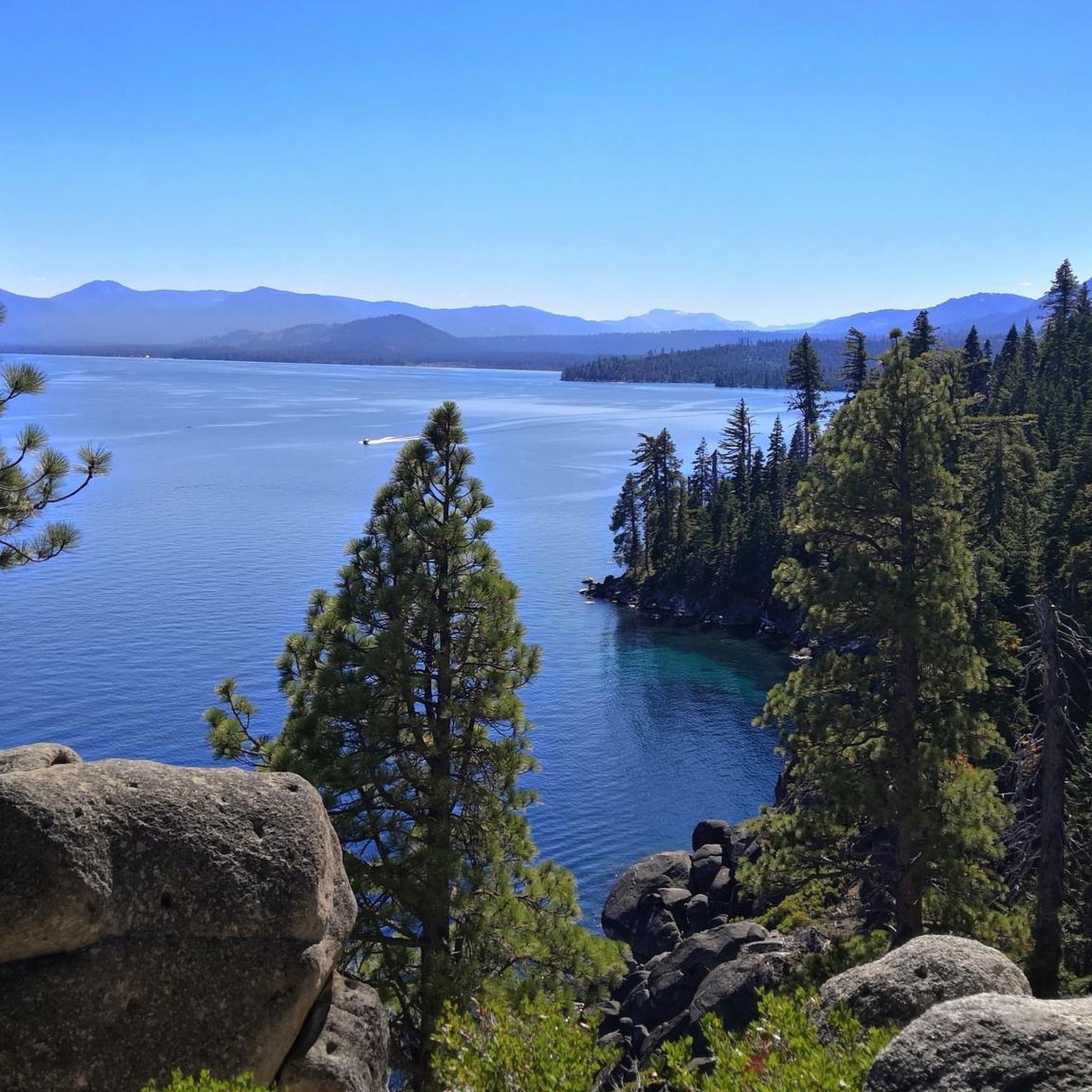
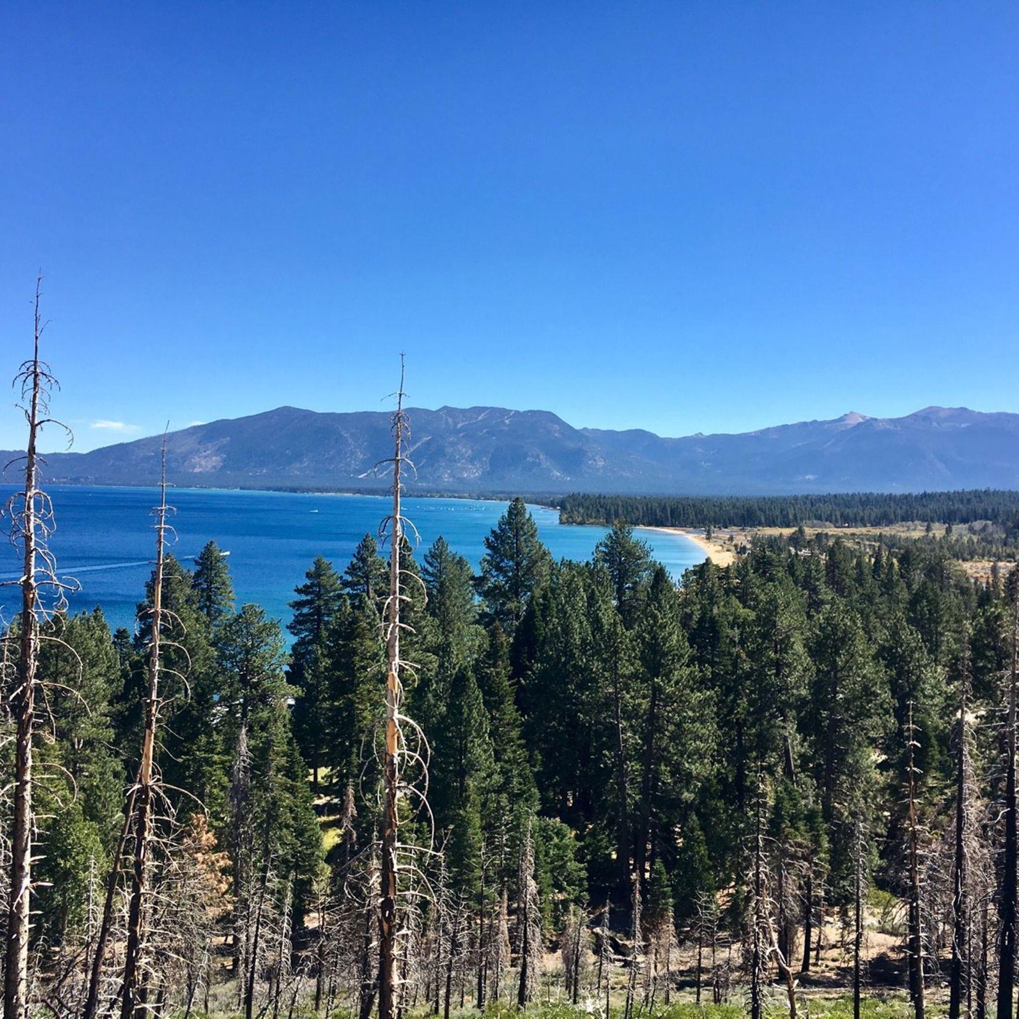
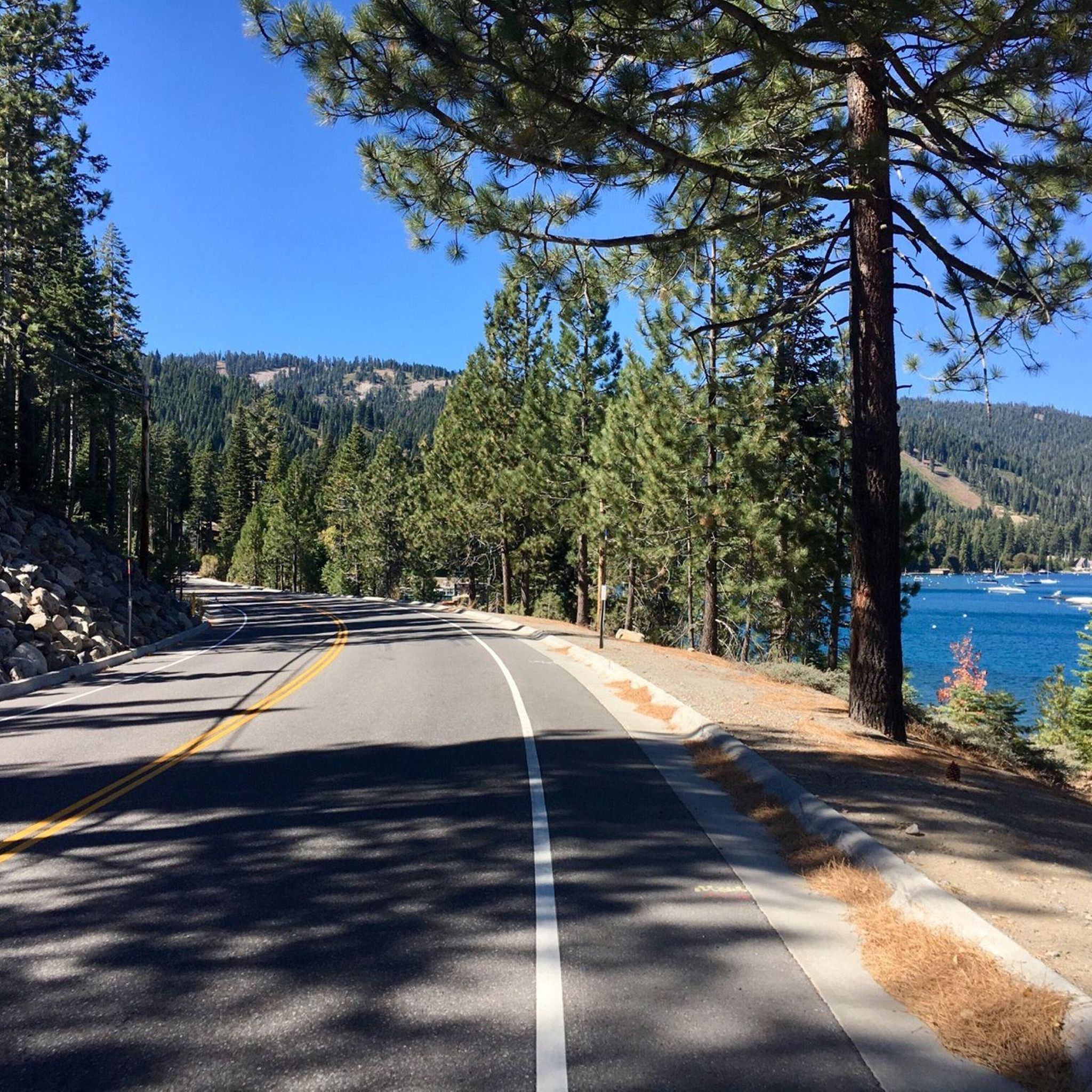
Tips from the Community

Lake Tahoe is a large freshwater lake that straddles the border of California and Nevada. Sitting at 6,225 feet in elevation makes it the largest alpine lake in North America. It is a major tourist draw with its stunning beauty and world-class ski resorts.
0
0

The trail from Incline Village to Sand Harbor is a must for anyone visiting North Lake Tahoe. There is one hill as you leave/enter Incline Village, but the rest of the trail is flat and follows along Tahoe's east shore, with incredible views around every corner. Eventually you'll end up at the fantastic Sand Harbor State Park, where you can enjoy the sun, sand, and water before heading back to Incline Village.
1
0

Lake Tahoe Commons Beach is just a one-minute walk from the main street of Tahoe City. A nice beachfront area and a fantastic swimming spot.
0
0

The West Shore Trail is a popular multi-use trail from Tahoe City to Meeks Bay. It gives you great views of Lake Tahoe and is mostly off-road.
0
0
Lake Tahoe Commons Beach is just a one minute walk from the main street of Tahoe City. A nice beachfront area and a fantastic swimming spot.
0
0
Sunnyside Restaurant & Lodge is an upscale dining establishment right on the water of Lake Tahoe. It is also a getaway lodge with 23 guest rooms. It is a pretty place to visit year-round, as it is open in the summer and the winter.
0
0
Sherwood Express is the only lift on Alpine Meadows Ski Resort's "backside" or south side. It is usually the last to open and the first to close during the season due to it being the sunniest spot on the mountain. This is the backside entrance to the resort, with only a few parking spots; only the lucky ones will nab them in the morning.
0
0
Barker Pass is the junction for Baker Pass Road, Baker Meadow, FR 15N38 and the Pacific Crest Trail. Barker Pass is up FR 15N38 just 50 feet north of this junction. Barker Pass Road continues on, but this spot is pretty close to Barker Peak and is a great rest spot with benches to sit on and a pit toilet.
0
0
Frequently Asked Questions
What kind of terrain can I expect on touring cycling routes in Tahoma?
Tahoma offers diverse terrain for touring cyclists. You'll find routes with significant elevation changes, incorporating both paved and unpaved segments. Many paths feature scenic lake views, dense forests, and historical sights, especially around the Lake Tahoe area. For example, the Kaspian Campground to Barker Pass via Barker Pass Road route includes challenging climbs with stunning views of Lake Tahoe.
Are there any easy touring cycling routes suitable for beginners in Tahoma?
Yes, Tahoma offers several easier options. There are 5 easy touring cycling routes available. A good starting point is the Ed Z'berg Sugar Pine Point State Park loop, which is 8.8 miles (14.1 km) long and offers moderate touring opportunities with lake views and historical sights.
What are some challenging touring cycling routes in Tahoma for experienced riders?
For experienced touring cyclists seeking a challenge, Tahoma has 6 difficult routes. The Kaspian Campground to Barker Pass via Barker Pass Road is a popular choice, covering 14.7 miles (23.7 km) with significant climbs and rewarding views of Lake Tahoe. Another demanding option is the Hidden Beach, Lake Tahoe – Lake Tahoe loop from Idlewild, which is over 75 km long with substantial elevation gain.
Can I find circular touring cycling routes in Tahoma?
Yes, Tahoma features several circular routes. The Ed Z'berg Sugar Pine Point State Park loop is a well-known 8.8-mile (14.1 km) option that provides lake views and historical sights. Another longer loop is the Lake Tahoe Commons Beach – West Shore Trail loop from Ed Z'berg Sugar Pine Point State Park, offering a more extensive ride.
What natural features and landmarks can I see along the touring cycling routes in Tahoma?
Many touring cycling routes in Tahoma offer access to stunning natural features and landmarks. You can explore areas with lake views, dense forests, and historical sights. Specific highlights include the Rubicon Point Light, the scenic Rubicon Trail (D.L. Bliss State Park), and various viewpoints offering panoramic Lake Tahoe vistas. The Sunnyside Restaurant & Lodge to Sherwood Express route, for instance, provides views of Lake Tahoe and the Truckee River.
Are there any family-friendly touring cycling routes in Tahoma?
While specific routes are not explicitly labeled 'family-friendly' in the guide data, the easier and moderate routes are generally more suitable. The Ed Z'berg Sugar Pine Point State Park loop, being a moderate 8.8-mile (14.1 km) path with lake views and historical sights, could be a good option for families with some cycling experience.
What is the best time of year for touring cycling in Tahoma?
The best time for touring cycling in Tahoma, particularly around Lake Tahoe, is typically from late spring through early fall (May to October). During these months, the weather is generally mild, and trails are clear of snow. Some routes, especially those at higher elevations, may have seasonal closures or conditions that make them unsuitable for winter cycling.
What do other touring cyclists say about the routes in Tahoma?
The touring cycling routes in Tahoma are highly rated by the komoot community, with an average score of 4.25 stars from over 10 reviews. Cyclists often praise the diverse landscapes, significant elevation changes, and scenic lake views. Many appreciate the variety of options available for different ability levels, from moderate loops to more challenging climbs.
Are there any specific trails that offer views of the Truckee River?
Yes, the Sunnyside Restaurant & Lodge to Sherwood Express route is a moderate 9.1-mile (14.7 km) path that offers scenic views of both Lake Tahoe and the Truckee River, making it a popular choice for those looking to enjoy riverside scenery.
Where can I find information about parking for touring cycling routes in Tahoma?
Parking availability varies by trailhead and specific location. For routes like the Kaspian Campground to Barker Pass via Barker Pass Road, you would typically look for parking at or near Kaspian Campground. For the Ed Z'berg Sugar Pine Point State Park loop, parking is available within the state park. It's always advisable to check local park websites or specific trailhead information for the most current parking details and any potential fees.
Are there any specific areas in Tahoma known for old-growth forests that I can cycle near?
While the touring cycling routes primarily focus on the Lake Tahoe area, the broader Tahoma region (referring to Mount Rainier) includes the Tahoma Forest Natural Resources Conservation Area. This 230-acre area protects mature, old-growth forests with Douglas fir and western hemlock. While not directly on the listed cycling routes, it represents the rich forest ecosystems found in the wider region. For more information on this conservation area, you can visit wa.gov.
How many touring cycling routes are available in Tahoma?
There are 17 touring cycling routes available in Tahoma, offering a wide range of experiences for cyclists of all levels. These include 5 easy, 6 moderate, and 6 difficult routes.
Most popular routes around Tahoma
Most popular attractions around Tahoma

Get inspired with the komoot mobile app


Explore more
Browse the best Cycling routes in other regions.
