The best cycling routes around Avocado Heights
4.6
(23)
474
riders
40
rides
Touring cycling around Avocado Heights offers a unique blend of semi-rural charm and accessible terrain. The area features a relatively flat topography, which is ideal for comfortable cycling. It is bordered by the San Gabriel River, providing access to the extensive San Gabriel River Trail, a key feature for long-distance routes. Distant views of the San Gabriel Mountains add a scenic backdrop to many of the local trails.
Best touring cycling routes around Avocado Heights
- The most popular touring cycling…
Last updated: June 29, 2026
13
riders
49.2km
02:58
170m
170m
Moderate bike ride. Good fitness required. Mostly paved surfaces. Suitable for all skill levels.
5.0
(1)
45
riders
55.8km
03:24
230m
230m
Moderate bike ride. Good fitness required. Mostly paved surfaces. Suitable for all skill levels.

Sign up for free
4.0
(2)
54
riders
Moderate bike ride. Good fitness required. Mostly paved surfaces. Suitable for all skill levels.
4.3
(3)
27
riders
Easy bike ride. Great for any fitness level. Mostly paved surfaces. Suitable for all skill levels.
10
riders
Easy bike ride. Great for any fitness level. Mostly paved surfaces. Suitable for all skill levels.
Get access to more routes and recommendations from other explorers.
Sign up for free
Already have an account?
Our route recommendations are based on thousands of hikes, rides, and runs completed by other people on komoot.
Start today with a free account
Your next adventure awaits.
Login or Signup


Tips from the Community

The Rio Hondo Greenway is a beautiful bike lane that follows the river that gives the trail its name. It is fully paved and flat, so it is not a challenging trail.
0
0
The San Gabriel Dam is a rock‑fill structure completed in 1939 on the San Gabriel River and is used for flood control.
0
0

Nice bike path. not much roads to cross. some are hilly but doable for newbies. It's our first time and we had a good time. just some areas are with a lot of homeless people, esp. the tunnels.
0
0
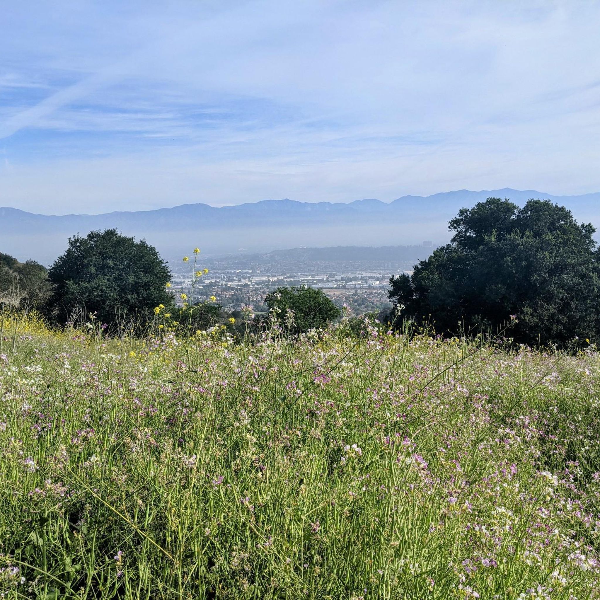
Great view from the cycle path of the San Gabriel Mountains in the distance.
0
0

Limited cars use the roads so it is nice to get away from traffic
0
0

One of the best dedicated bike trails in the LA area, leading from the San Gabriel mountains north of Azuza along a car free paved river route all the way to Seal beach
1
0

The trail is part paved concrete and part packed dirt, and takes you through a series of parks along the San Gabriel River. The trail runs for a mile and a half and is interrupted by only two road crossings.
0
0
There is a parking lot and restroom here at the trailhead, which provides access to a large network of paved and packed dirt trails along the beautiful Rio Hondo. The trailhead closes at sunset.
0
0
Frequently Asked Questions
How many touring cycling routes are available in Avocado Heights?
Avocado Heights offers a good selection of touring cycling routes, with over 40 options available. These routes cater to various skill levels, including easy, moderate, and difficult trails.
What is the best time of year for touring cycling in Avocado Heights?
The relatively flat topography and generally mild climate of Avocado Heights make it suitable for touring cycling year-round. However, spring and fall often provide the most comfortable temperatures for longer rides, avoiding the peak heat of summer.
What are the general difficulty levels of touring cycling routes in Avocado Heights?
The routes around Avocado Heights offer a mix of difficulties. You'll find 13 easy routes, 19 moderate routes, and 11 more challenging options, ensuring there's something for every touring cyclist, from beginners to experienced riders.
Are there family-friendly touring cycling routes in Avocado Heights?
Yes, the area is well-suited for family cycling, especially due to its largely flat topography and extensive paved sections. Routes like the Bosque del Rio Hondo – Rio Hondo Greenway loop from North El Monte are considered easy and provide a pleasant experience for all ages.
Can I find circular touring cycling routes around Avocado Heights?
Many of the touring cycling routes in Avocado Heights are designed as loops, allowing you to start and end at the same point. Examples include the popular Rio Hondo Greenway Loop and the San Gabriel River Greenway – View of San Gabriel Mountains loop from El Monte.
What kind of terrain can I expect on touring cycling routes in Avocado Heights?
You can expect a variety of terrain, predominantly flat. The major trails, such as the San Gabriel River Trail, are largely paved, offering smooth riding. Within Avocado Heights itself, the Avocado Heights Trail features a decomposed granite surface. This mix provides accessible and comfortable cycling for touring bikes.
Where can I park when visiting touring cycling trails in Avocado Heights?
Parking is generally available at various access points along the major trail systems. For instance, Avocado Heights Park offers amenities including parking, and many trailheads along the San Gabriel River Trail and Rio Hondo Greenway have designated parking areas. It's advisable to check specific route details for the most convenient parking options.
Is public transport accessible for reaching touring cycling routes?
Avocado Heights is part of Los Angeles County, which has a public transportation network. While direct access to every trailhead via public transport might vary, major routes like the San Gabriel River Trail often have access points near bus stops or transit hubs. Planning your route with local transit maps is recommended.
What scenic views or landmarks can I expect along the touring cycling routes?
Touring cyclists can enjoy diverse scenery, from the semi-rural environment of Avocado Heights to the natural beauty of the San Gabriel River. Distant views of the majestic San Gabriel Mountains provide a picturesque backdrop. You might also pass by areas like Bosque del Rio Hondo or the Santa Fe Flood Control Basin, offering varied landscapes.
Are there places to eat or stay near the touring cycling routes?
As an unincorporated community within Los Angeles County, Avocado Heights and its surrounding areas offer various amenities. You'll find local eateries and cafes in nearby towns. For accommodation, there are hotels and motels in the broader San Gabriel Valley region, easily accessible from the main cycling corridors.
What do other touring cyclists enjoy the most about touring cycling in Avocado Heights?
The area is highly rated by the komoot community, with an average score of 4.6 stars from over 30 reviews. Reviewers often praise the extensive and well-maintained trail network, the accessible flat terrain, and the scenic views of the San Gabriel River and distant mountains, making it ideal for comfortable touring.
Are there any long-distance touring cycling routes in the area?
Yes, Avocado Heights provides excellent access to long-distance touring opportunities. The San Gabriel River Trail – San Gabriel River Trail loop from South El Monte, for example, is a moderate 48.6-mile (78.2 km) path that utilizes the extensive San Gabriel River Trail, which stretches approximately 39 miles from the San Gabriel Mountains to the Pacific Ocean.
Most popular attractions around Avocado Heights

Get inspired with the komoot mobile app


Explore more
Browse the best Cycling routes in other regions.
