The best road cycling routes around Alum Rock
4.1
(94)
3,757
riders
99
rides
Road cycling routes around Alum Rock are situated within a canyon in the Diablo Range foothills, characterized by rugged ridges and the year-round flow of Penitencia Creek. The park's varied topography includes north-facing canyon walls with ferns and large trees, contrasting with sunnier, south-facing slopes of chaparral and scrub. Cyclists encounter diverse terrain, from lush riparian corridors along the creek to climbs with switchbacks leading to panoramic viewpoints. This 720-acre municipal park offers routes with significant elevation gains into the Diablo Range foothills.
Best road cycling routes around Alum Rock
- The most popular road cycling route is Penitencia Creek Trail – Piedmont Ponds loop from McKee, a 16.3 miles (26.3 km) trail that takes 1 hour 6 minutes to complete. This easy route offers a gentle paved climb along the creek.
- Another top favourite among local road cyclists is Mount Hamilton Road – Piedmont Ponds loop from McKee, a difficult 60.3 miles (97.1 km) path. This challenging route features substantial elevation gain through the region's varied landscape.
- Local road cyclists also love the JD Grant Park – Lake Cunningham loop from McKee, a 25.1 miles (40.4 km) trail leading through the foothills, often completed in about 2 hours 28 minutes.
- Road cycling around Alum Rock is defined by canyon paths, creek-side routes, and climbs into the Diablo Range foothills. The network offers options for different ability levels, from gentle rides to strenuous ascents.
- The routes in Alum Rock are highly rated by the komoot community with an average score of 4.4 stars from over 60 reviews. More than 3000 road cyclists have used komoot to explore Alum Rock's varied terrain.
Last updated: August 25, 2026
5.0
(1)
149
riders
96.4km
05:30
2,230m
2,230m
Hard road ride. Very good fitness required. Mostly well-paved surfaces and easy to ride.
3.0
(1)
62
riders
33.9km
01:57
700m
700m
Moderate road ride. Good fitness required. Some segments of this route may be unpaved and difficult to ride.

Sign up for free
5.0
(5)
38
riders
17.2km
01:57
180m
180m
Moderate road ride. Great for any fitness level. Some segments of this route may be unpaved and difficult to ride.
5.0
(1)
30
riders
32.8km
01:25
180m
180m
Easy road ride. Great for any fitness level. Mostly well-paved surfaces and easy to ride.
16
riders
27.4km
01:10
130m
130m
Easy road ride. Great for any fitness level. Mostly well-paved surfaces and easy to ride.
Get access to more routes and recommendations from other explorers.
Sign up for free
Already have an account?
Our route recommendations are based on thousands of hikes, rides, and runs completed by other people on komoot.
Start today with a free account
Your next adventure awaits.
Login or Signup
Tips from the Community

Biggest peak in the area. If you go when it's open (weekends as of today), you can do the tour of what was once the largest telescope in the world (still one of the biggest refraction telescopes). The observatory is still active
0
0

This pedestrian bridge was completed in 2002 and offers pedestrians and cyclists away to travel away from traffic.
0
0
When in season you will see a lot of beautiful oleander lining the road along this stretch.
0
0

Lick Observatory is a must-visit destination for cyclists, featuring historic and modern telescopes, including the world’s largest glass lens observatory. Free tours provide fascinating insights into astronomy and the observatory’s history. At 4,209 feet, temperatures can drop significantly compared to Silicon Valley, especially in winter—bring warm layers.
0
0

Alum Rock Park, established in 1872, is one of California's oldest municipal parks, spanning 720 acres. Visitors can enjoy hiking, biking, horseback riding, and family picnicking with amenities like picnic tables, barbecue pits, restrooms, and a playground in the mid-canyon area. The park is wheelchair accessible and open daily from 8 a.m. to half an hour after sunset, a great spot to explore year-round.
0
0

It's really amazing that this stone bridge is still here. I understand it was originally built to easily get pack horses across the creek — and of course the people with them, too.
0
0
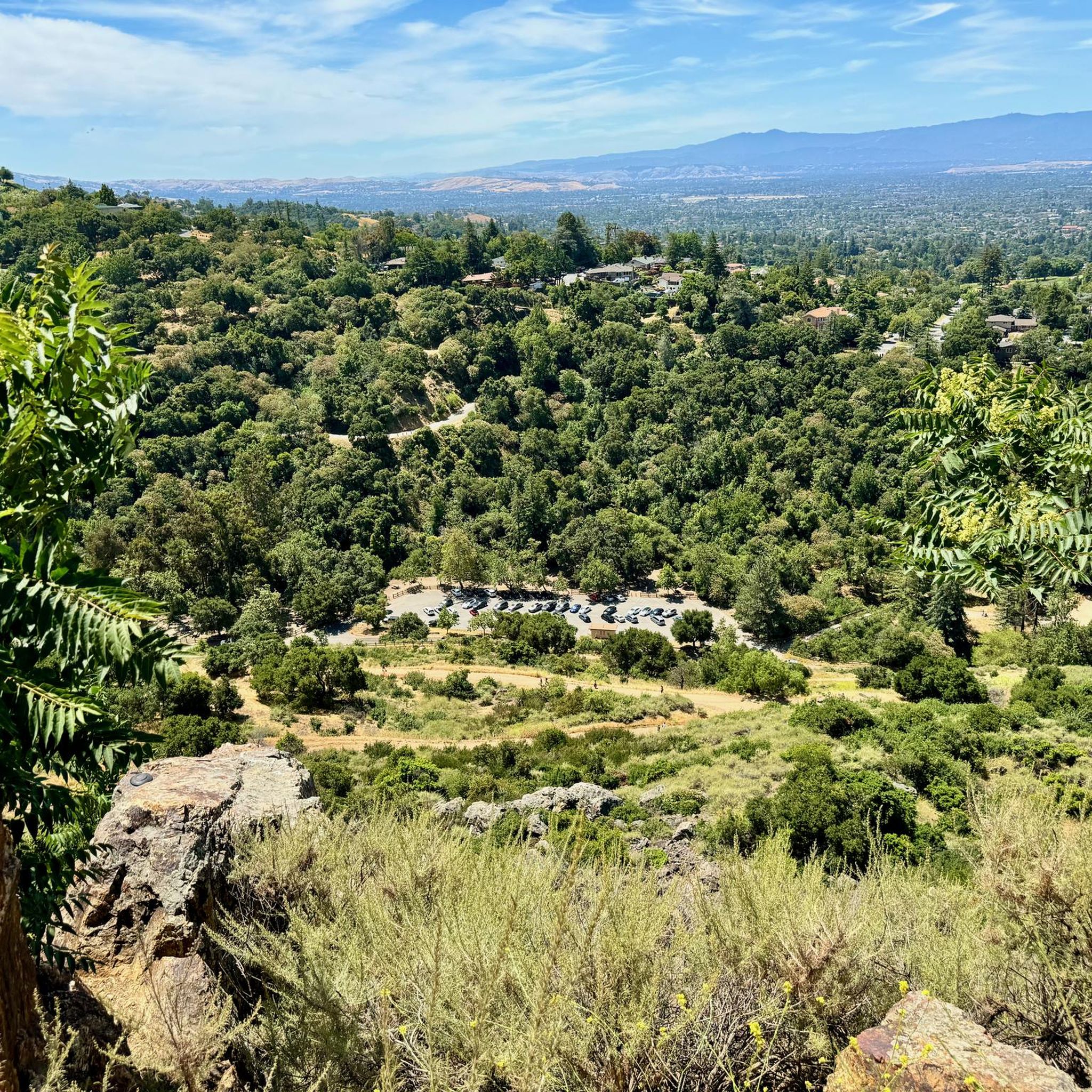
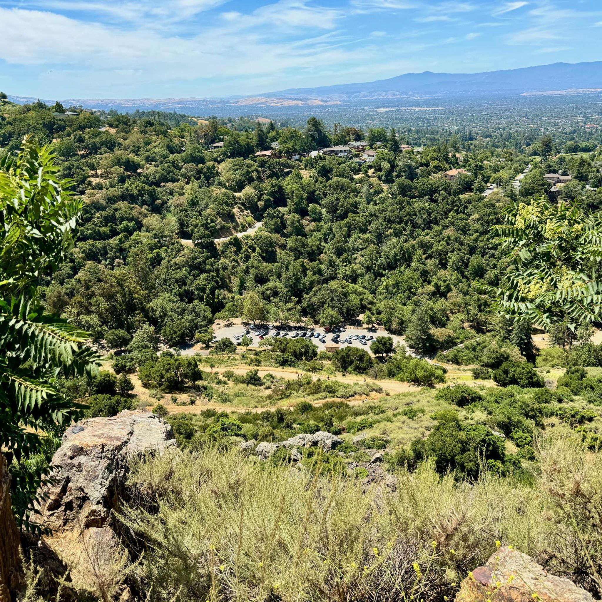
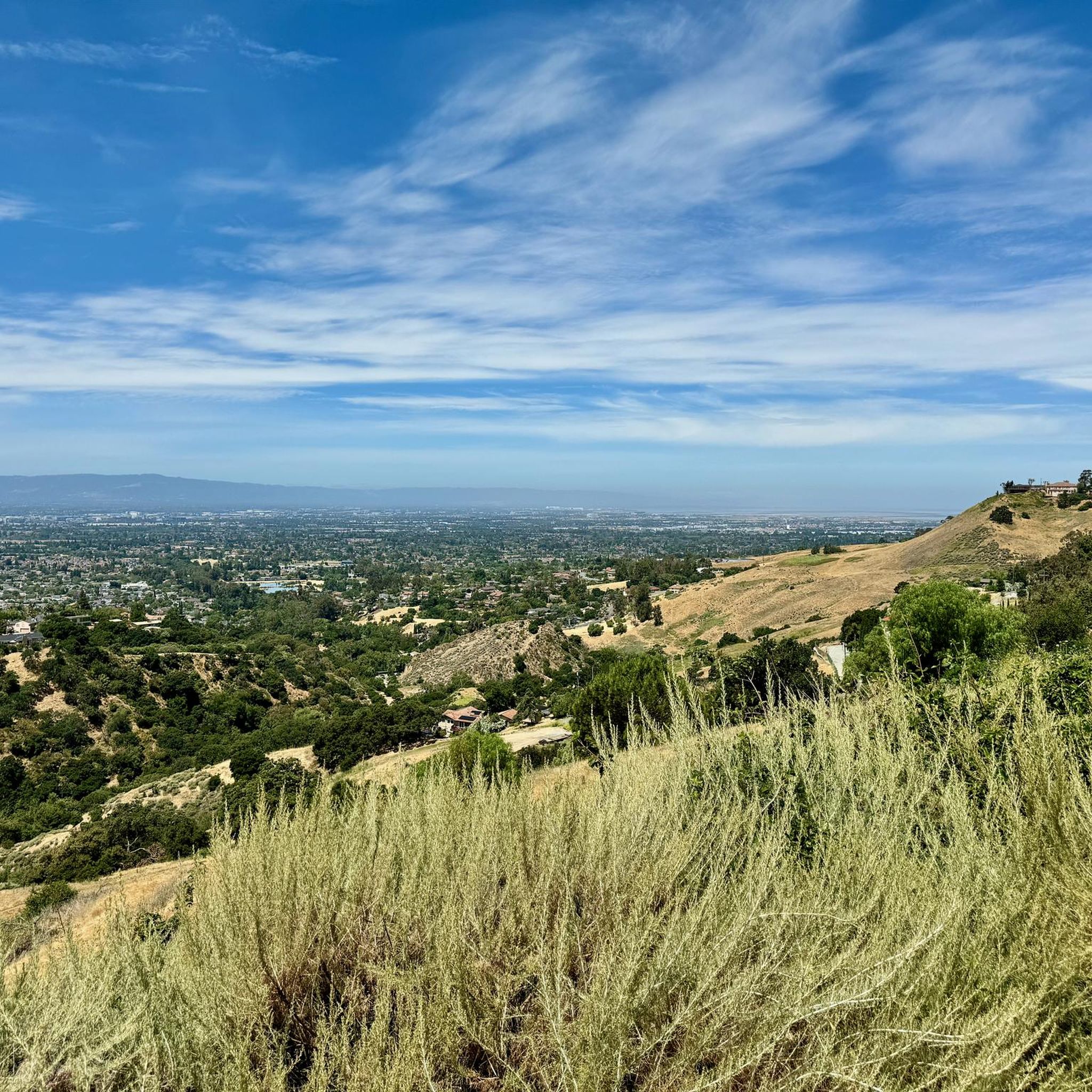
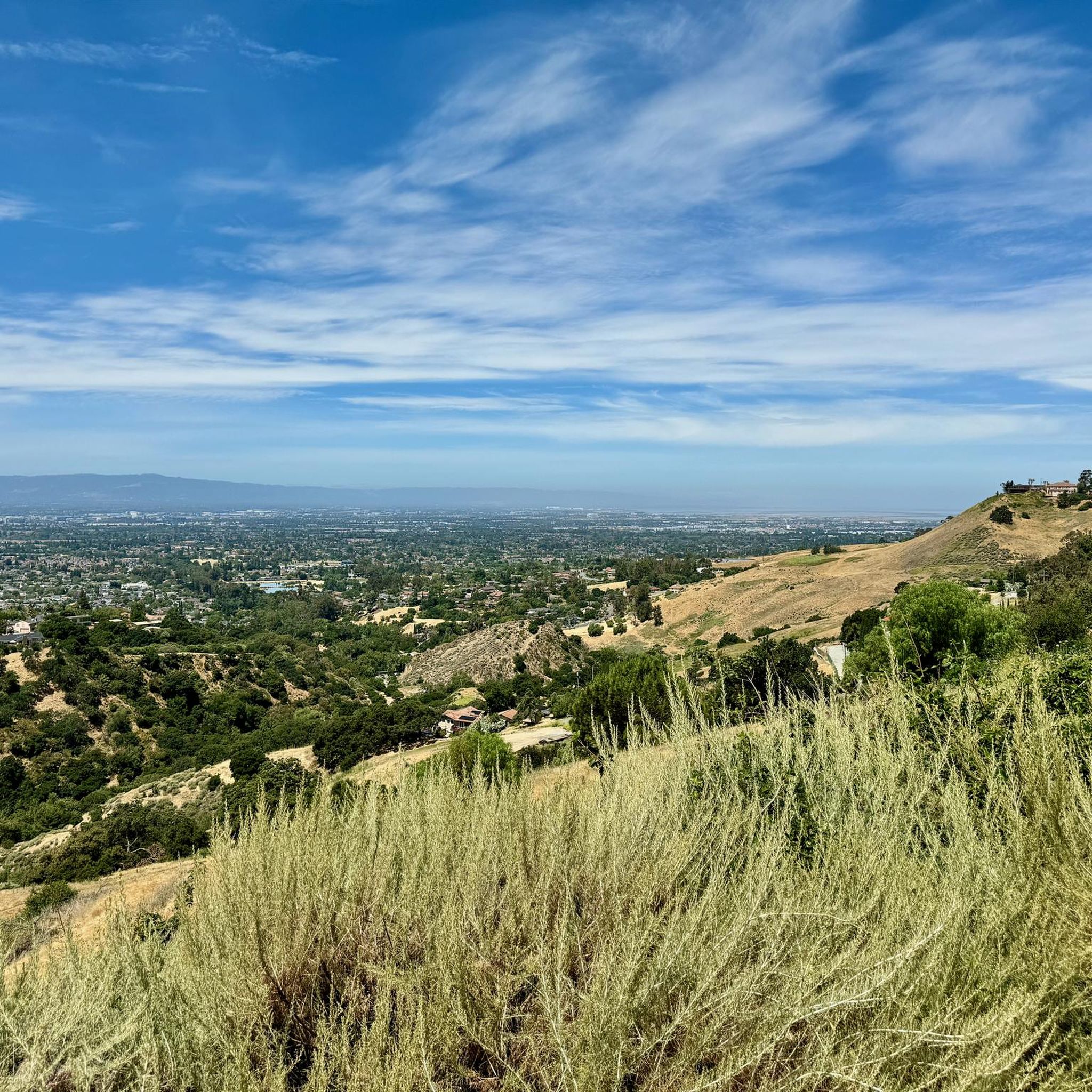
Inspiration Point in Alum Rock Park offers stunning views of San Jose and the Bay and is surrounded by mature native trees and shrubs. Since 2011, volunteers have been working to restore the area by removing invasive species through the "Weed & Walk" group. Shade can be found up here amongst the trees, and there is a wooden fence and wooden benches indicating the arrival of the Inspiration Point viewpoint.
0
0

You can find free parking and restrooms by the side of the creek. From here you have the option of many different hilly but nontechnical trails up to Eagle Rock, Inspiration Point, Boccardo, or along the creek side.
0
0
Frequently Asked Questions
What kind of terrain and elevation can I expect on road cycling routes in Alum Rock?
Road cycling routes in Alum Rock offer diverse terrain, ranging from relatively flat paths along Penitencia Creek to steep climbs with sharp switchbacks leading to the ridges of the Diablo Range foothills. You can find routes with significant elevation gains, such as the challenging Mount Hamilton Road – Piedmont Ponds loop from McKee, which features over 2,200 meters of ascent.
Are there road cycling routes suitable for beginners in Alum Rock?
Yes, Alum Rock offers options for beginners. The Penitencia Creek Trail – Piedmont Ponds loop from McKee is an easy 16.3-mile route that provides a gentle paved climb along the creek, making it ideal for those new to road cycling or looking for a more relaxed ride.
What options are available for experienced road cyclists seeking a challenge?
Experienced road cyclists will find several challenging routes. The Mount Hamilton Road – Piedmont Ponds loop from McKee is a difficult 60.3-mile path with substantial elevation gain, offering extensive Bay Area views. Another option is the McCreery Lake – JD Grant Park loop from McKee, a 21.3-mile route through the foothills.
What scenic viewpoints can I find along the road cycling routes in Alum Rock?
While cycling in Alum Rock, you can enjoy panoramic views of the Santa Clara Valley, Silicon Valley, and the East Bay hills from various vantage points. Notable spots include the South Rim Trail, Eagle Rock summit, and Inspiration Point. The View of San Jose from Sierra Vista Open Space Preserve is also a highly rated viewpoint accessible from connecting trails.
Are there any historical or natural landmarks to see while cycling in Alum Rock?
Alum Rock Park is rich in history and natural features. You can explore remnants of its past as a health spa, including the Historic Mineral Springs Grotto. Natural landmarks include Eagle Rock and the Penitencia Creek flowing through the canyon. The park also features historic bridges and a log cabin built between 1914-1916.
Is parking available for cyclists at Alum Rock Park?
Yes, parking is available at Alum Rock Park. Many road cycling routes, such as those starting 'from McKee,' often originate from areas with accessible parking, allowing cyclists to easily begin their rides within or near the park.
What is the best time of year for road cycling in Alum Rock?
Alum Rock offers good cycling conditions for much of the year. Many trails, particularly those on north-facing slopes and along Penitencia Creek, provide natural shade, which can be beneficial during warmer months. The diverse ecosystem means vegetation changes with seasons, offering different scenic experiences.
Are there family-friendly road cycling routes in Alum Rock?
Yes, Alum Rock offers family-friendly options. The Penitencia Creek Trail, which is part of routes like the Penitencia Creek Trail – Piedmont Ponds loop from McKee, is a gentle, paved path suitable for families and those looking for an easier ride.
Are the road cycling routes in Alum Rock primarily paved?
Many of the road cycling routes in Alum Rock are primarily paved, especially those along Penitencia Creek and the main park roads. While some segments within the broader park system may be unpaved, the designated road bike trails are generally suitable for road bikes.
What do other road cyclists enjoy the most about road cycling in Alum Rock?
The area is highly rated by the komoot community, with an average score of 4.3 stars from over 80 reviews. Reviewers often praise the diverse terrain, from gentle creek-side paths to challenging climbs, and the scenic views of the Santa Clara Valley. The variety of routes caters to different ability levels, making it a popular destination.
Can I connect to other trail systems from Alum Rock Park?
Yes, Alum Rock Park trails serve as a gateway to other trail systems. For instance, the Todd Quick trail links to the 1,600-acre Sierra Vista Open Space Preserve, offering further exploration opportunities for cyclists.
Are there restrooms and water fountains available along the routes?
Yes, restrooms and water fountains are available throughout Alum Rock Park, enhancing the cycling experience by providing essential facilities for riders.
Most popular attractions around Alum Rock

Get inspired with the komoot mobile app


Explore more
Browse the best Road cycling routes in other regions.
