The best walks and hikes around Rancho Santa Margarita
4.3
(50)
465
hikers
16
hikes
Hiking around Rancho Santa Margarita traverses a landscape characterized by diverse natural features, nestled against the foothills of the Santa Ana Mountains. The region features native chaparral, oak woodlands, and seasonal wildflowers, with rolling hills providing varied terrain. Arroyo Trabuco Creek offers a natural wilderness setting, while Rancho Santa Margarita Lake serves as a central feature with perimeter pathways.
Best hiking trails around Rancho Santa Margarita
- The most popular hiking route is Santa Margarita Lake Loop, an easy 1.2 miles (1.9 km) trail that takes 28 minutes to complete. This path offers views of the lake and is suitable for leisurely strolls.
- Another top favourite among local hikers is Tijeras Creek and Westridge Trail Loop, a moderate 5.5 miles (8.9 km) path. This route features varied terrain with some elevation gain.
- Local hikers also love the Bell View Trail Loop, a 2.3 miles (3.7 km) trail leading through rolling hills, often completed in about 1 hour 10 minutes.
- Hiking around Rancho Santa Margarita is defined by rolling hills, chaparral, and oak woodlands. The network offers options for different ability levels, from easy lakeside walks to more strenuous climbs in wilderness parks.
- The routes in Rancho Santa Margarita are highly rated by the komoot community with an average score of 4.6 stars from over 40 reviews. More than 390 hikers have used komoot to explore Rancho Santa Margarita's varied terrain.
Last updated: August 18, 2026
23
hikers
1.89km
00:29
0m
10m
Take a refreshing walk on the Santa Margarita Lake Loop, an easy hiking trail that circles the serene waters. As you follow the path, you'll enjoy consistent vistas across the lake, making for a peaceful outing. The route is mostly flat, gaining only 12 feet (4 metres) in elevation over its 1.2 miles (1.9 km) distance. You can comfortably complete this loop in about 28 minutes, offering a quick escape into nature.
Accessing the Santa Margarita Lake Loop is straightforward, as it is conveniently located within a community park in Lago Santa Margarita, Orange County. You will typically find parking available close to the trailhead, making your visit hassle-free. There are no specific permits or fees mentioned for enjoying this particular loop, so you can simply arrive and start your hike.
This loop is ideal for anyone seeking a brief, easy outdoor activity, perfect for all ages and fitness levels. The trail's gentle terrain and constant lake views provide a relaxing backdrop for your walk. It stands out as a readily accessible option for a quick nature break in the area, offering a pleasant experience without demanding much time or effort.
3
hikers
3.70km
01:10
160m
130m
Embark on the Bell View Trail Loop, an easy hike that winds through coastal sage scrub and chaparral, characteristic of the Santa Ana Mountains. This 2.3-mile (3.7 km) route offers panoramic views of the surrounding valleys, with a total elevation gain of 532 feet (162 metres). You can complete this loop in about 1 hour and 9 minutes, making it a great option for a quick outdoor escape. Look for Bell Peak, which provides extensive vistas, and on clear days, you might even spot the Pacific Ocean in the distance.
The Bell View Trail Loop is a dog-friendly route, so feel free to bring your canine companion along. While the trail is rated easy, be aware that some sections can be steep and dusty. Sturdy footwear is recommended to navigate the varying terrain comfortably. Plan your visit during cooler parts of the day for the most enjoyable experience.
This trail is notable for its historical significance, as you can keep an eye out for the old Bell View Mine along the way. The natural environment here showcases the typical flora of the Santa Ana Mountains, providing a glimpse into the local ecosystem. It's a popular choice for those seeking a straightforward outdoor activity near Rancho Santa Margarita.

Sign up for free
1
hikers
7.95km
02:11
140m
120m
The Tijeras Creek Trail and Westridge Loop offers a dynamic hiking experience, transitioning from the gentle, shaded paths alongside the free-flowing Tijeras Creek to the open, panoramic vistas of the Westridge ridgeline. You'll navigate single-track dirt, some rocky sections, and potentially wet creek crossings, especially in spring when wildflowers burst into color. The ridgeline views provide a striking contrast to the creek-side tranquility, showcasing the surrounding canyons and suburban landscape.
This moderate 4.9-mile (8.0 km) loop involves 446 feet (136 metres) of elevation gain and typically takes around 2 hours and 11 minutes to complete. Parking is conveniently available at Canada Vista Park, making trailhead access simple. Remember to bring sun protection and water, as shade is limited on much of the route, and check local regulations regarding dogs, as they are often not permitted on the Tijeras Creek section.
This trail is a popular choice for those seeking a balanced outdoor activity in Orange County, blending natural beauty with accessible paths. It's a great option for a quick escape, offering both the soothing sounds of the creek and expansive views, making it a rewarding hike for those looking to experience varied terrain and scenery without committing to an all-day trek.
1
hikers
8.92km
02:25
120m
130m
Embark on the Tijeras Creek and Westridge Trail Loop for a moderate hike spanning 5.5 miles (8.9 km). This route offers a pleasant mix of natural beauty and open views, taking about 2 hours and 25 minutes to complete. You will gain 401 feet (122 metres) of elevation as you follow mostly single-track dirt paths. Enjoy picturesque creek views along Tijeras Creek, finding shaded areas under tree cover. From the ridgeline, you can look out over the town, and in spring, the path often comes alive with wildflowers.
Accessing the Tijeras Creek and Westridge Trail Loop is straightforward, with convenient parking available at Canada Vista Park. This makes starting your hike simple and hassle-free. Before you head out, it is wise to check local signage or official park websites regarding dog access. Information on whether dogs are permitted can sometimes be conflicting, so confirming current regulations will help you plan your visit smoothly.
This trail provides a balanced outdoor experience for hikers seeking both a moderate challenge and scenic variety within O'Neill Regional Park. You will find yourself immersed in natural surroundings while also catching glimpses of suburban life from higher points. The combination of creek-side paths and ridgeline vistas makes this loop a notable option for exploring the area's diverse landscape.
847m
00:16
50m
0m
The Live Oak and Vista Trail Loop offers a surprisingly diverse and scenic experience for its short length. You'll navigate an immediate climb with switchbacks, leading to a plateau and then a steep ascent towards a radio tower. From Vista Point, you're rewarded with expansive views of Portola Hills, Upper Oso Reservoir, and Santiago Peak, making this easy 0.5-mile (0.8 km) hike with 177 feet (54 metres) of elevation gain a high-payoff option that takes only about 15 minutes.
Planning your visit is straightforward, as parking is available at O'Neill Regional Park, though a fee might be required. It's important to note that dogs are typically not allowed on the dirt trails here. Also, keep an eye on the weather, as trails can close for up to three days after rain, so check conditions before heading out.
This loop is a fantastic way to experience the natural beauty of O'Neill Regional Park, showcasing diverse ecosystems from shaded oak and sycamore groves to open, shrubby hillsides. While short, the trail's varied terrain and panoramic viewpoints make it a notable option for a quick outdoor escape in Orange County.
Get access to more routes and recommendations from other explorers.
Sign up for free
Already have an account?
Our route recommendations are based on thousands of hikes, rides, and runs completed by other people on komoot.
Start today with a free account
Your next adventure awaits.
Login or Signup

Tips from the Community

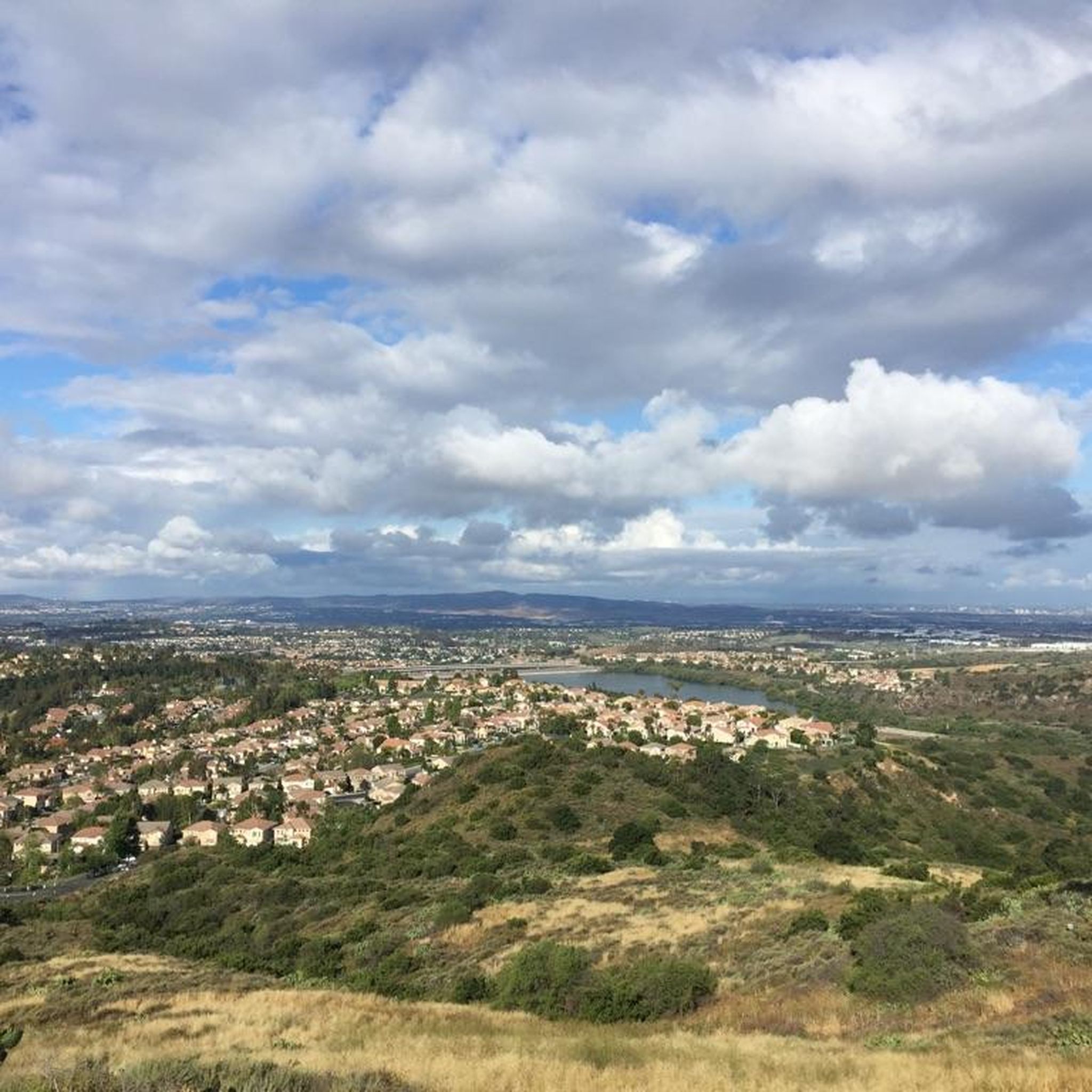
From here you get beautiful sweeping panoramic views out toward Portola Hills, Upper Oso Reservoir, and Santiago Peak. There are picnic tables and benches and the trail is quite accessible.
0
0
From here you get beautiful sweeping panoramic views out toward Portola Hills, Upper Oso Reservoir, and Santiago Peak. There are picnic tables and benches and the trail is quite accessible.
0
0

Easy 90 minutes trail from parking to Vista Peak Point.
0
0
Frequently Asked Questions
How many hiking trails are available around Rancho Santa Margarita?
There are nearly 50 hiking trails around Rancho Santa Margarita, offering a wide range of options for different skill levels and preferences. You'll find everything from easy strolls to more challenging climbs.
Are there easy hiking trails suitable for beginners or families in Rancho Santa Margarita?
Yes, Rancho Santa Margarita offers many easy hiking trails perfect for beginners and families. There are 16 easy routes, including paths around the Rancho Santa Margarita Lake and gentle trails through regional parks. A good option is the Wagon Wheel Canyon and Oak Canyon Trail loop — Thomas F Riley Wilderness Park, which is an easy 2.8-mile path winding through scenic canyon and oak woodland.
Are there any challenging or longer hikes for experienced hikers in the area?
For experienced hikers seeking a challenge, Rancho Santa Margarita and its surrounding areas offer several difficult routes. One notable option is the Los Pinos Peak — Cleveland National Forest, a demanding 14.5-mile trail with over 3,700 feet of elevation gain.
Are there any loop hikes available in Rancho Santa Margarita?
Yes, many of the trails in Rancho Santa Margarita are designed as loops, providing varied scenery without retracing your steps. For example, the Vista Point loop — O'Neill Regional Park is an easy 3.4-mile loop offering great views within the park.
Can I bring my dog on the hiking trails in Rancho Santa Margarita?
Many of the open spaces and regional parks around Rancho Santa Margarita are dog-friendly, typically requiring dogs to be on a leash. However, specific rules can vary by park or trail, so it's always best to check the regulations for the particular area you plan to visit beforehand.
What kind of natural features can I expect to see while hiking?
Hiking around Rancho Santa Margarita offers diverse natural features. You'll encounter the scenic Arroyo Trabuco Creek, the tranquil Rancho Santa Margarita Lake, and expansive open spaces characterized by rolling hills, native chaparral, and oak woodlands. Depending on the season, you might also see beautiful wildflowers.
Are there any hiking trails that feature waterfalls?
Yes, the region around Rancho Santa Margarita is home to a few beautiful waterfalls. You can find trails leading to Chiquito Falls and Holy Jim Falls, offering refreshing sights during your hike.
What are some interesting landmarks or points of interest to explore near the trails?
Beyond the trails themselves, you can explore several interesting landmarks. The Red Rock Trail — Whiting Ranch Wilderness Park is a notable natural monument. For panoramic views, consider visiting Santiago Peak. You might also find facilities like Reynolds Bench along some routes.
What do other hikers enjoy most about hiking in Rancho Santa Margarita?
The komoot community highly rates the hiking experience in Rancho Santa Margarita, with an average score of 4.7 stars from over 50 reviews. Hikers often praise the varied terrain, from easy lakeside walks to more strenuous climbs, and the immersive natural environment of chaparral and oak woodlands.
Is there good parking available at the trailheads?
Most regional parks and popular trailheads around Rancho Santa Margarita offer designated parking areas. However, during peak times, especially on weekends, these can fill up quickly. It's advisable to arrive early to secure a spot.
What is the best time of year to hike in Rancho Santa Margarita?
The best time to hike in Rancho Santa Margarita is typically during the cooler months, from fall through spring, when temperatures are more moderate. Spring is particularly beautiful for experiencing seasonal wildflowers. Summers can be hot, so early morning or late afternoon hikes are recommended during that season.
Can I spot wildlife on the trails?
Yes, the diverse natural landscapes, including the Arroyo Trabuco Creek and oak woodlands, provide opportunities for wildlife viewing. Hikers may encounter various bird species, rabbits, and other small mammals. Early mornings or late afternoons are often the best times for spotting wildlife.
Most popular routes around Rancho Santa Margarita
Most popular attractions around Rancho Santa Margarita

Get inspired with the komoot mobile app


Explore more
Browse the best Hikes in other regions.
