The best MTB trails around Picture Rocks
4.9
(23)
371
riders
5
rides
Mountain biking around Picture Rocks offers a diverse landscape characterized by rolling hills and varied terrain. The region features open grasslands in the foothills, transitioning to more rocky and technical sections. Riders can expect scenic overlooks and views across the landscape, with routes often incorporating natural features that require skill to navigate. The area provides a mix of challenging and accessible paths for mountain bikers.
Best mountain bike trails around Picture Rocks
- The most popular mountain bike trail is Brown…
Last updated: May 20, 2026
4.7
(7)
65
riders
12.2km
01:04
130m
120m
Embark on an easy mountain biking adventure through the Sonoran Desert on the Saguaro Vista, Black Rock, Homestead and Oxbow Trail. This route spans 7.6 miles (12.2 km) and features…
2
riders
7.73km
00:46
150m
150m
Easy 4.8-mile mountain biking loop in Tucson Mountain Park, offering desert views and technical sections for a quick ride.

Sign up for free
5.0
(1)
43
riders
15.2km
01:20
150m
150m
Hard mountain bike ride. Great for any fitness level. Advanced riding skills necessary. Some portions of the route may require you to push your bike.
5.0
(2)
34
riders
12.6km
01:06
120m
120m
Moderate mountain bike ride. Great for any fitness level. Advanced riding skills necessary.
5.0
(1)
25
riders
6.65km
00:35
70m
70m
Moderate mountain bike ride. Great for any fitness level. Advanced riding skills necessary.
Our route recommendations are based on thousands of hikes, rides, and runs completed by other people on komoot.
Start today with a free account
Your next adventure awaits.
Login or Signup
Tips from the Community

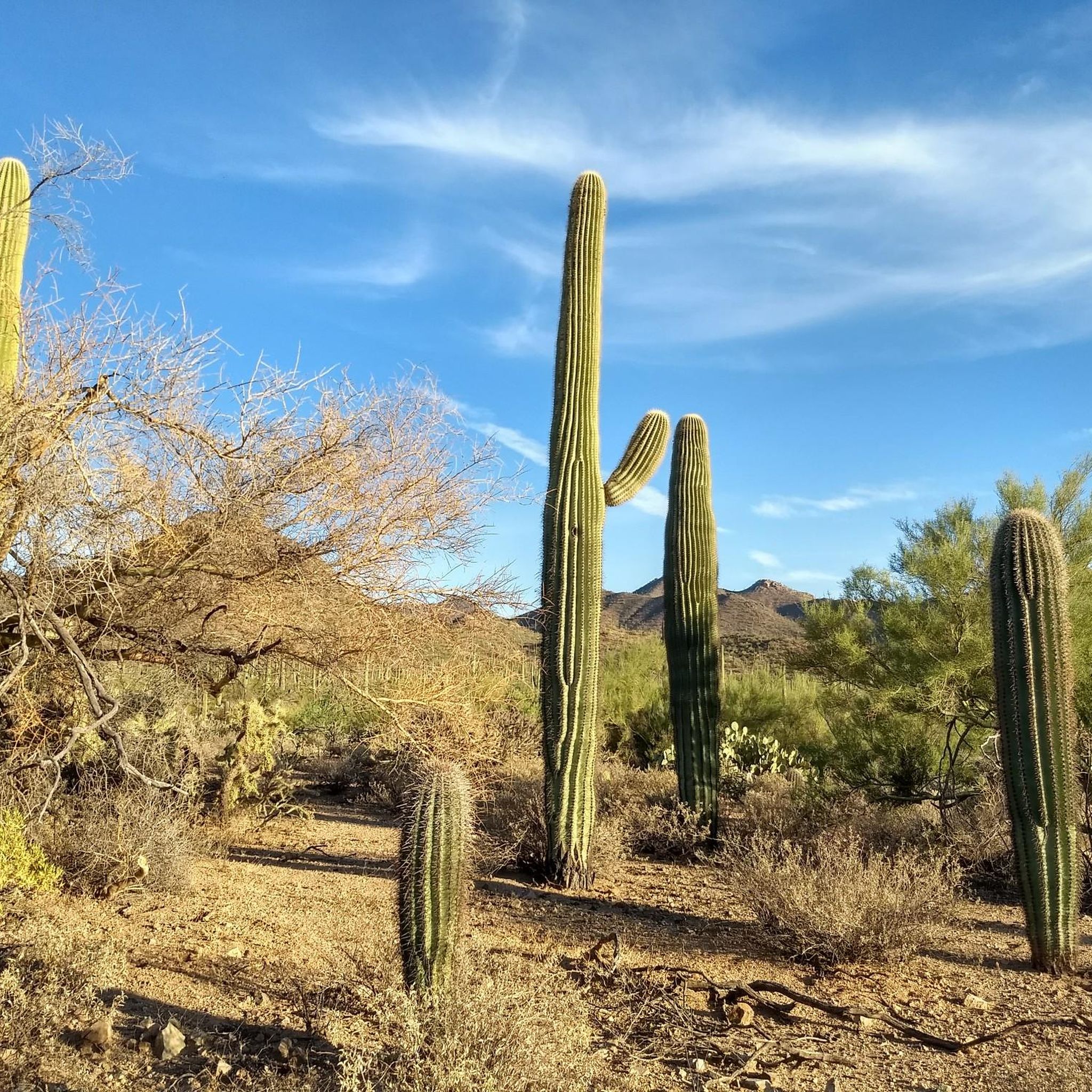
Sweetwater Preserve is nearly 900 acres of mountainous desert landscape with miles of trails winding around hills of cacti.
0
0

Endless fun and beautiful views. Suitable for less and more experienced riders. Love all the types of cactuses there.
0
0

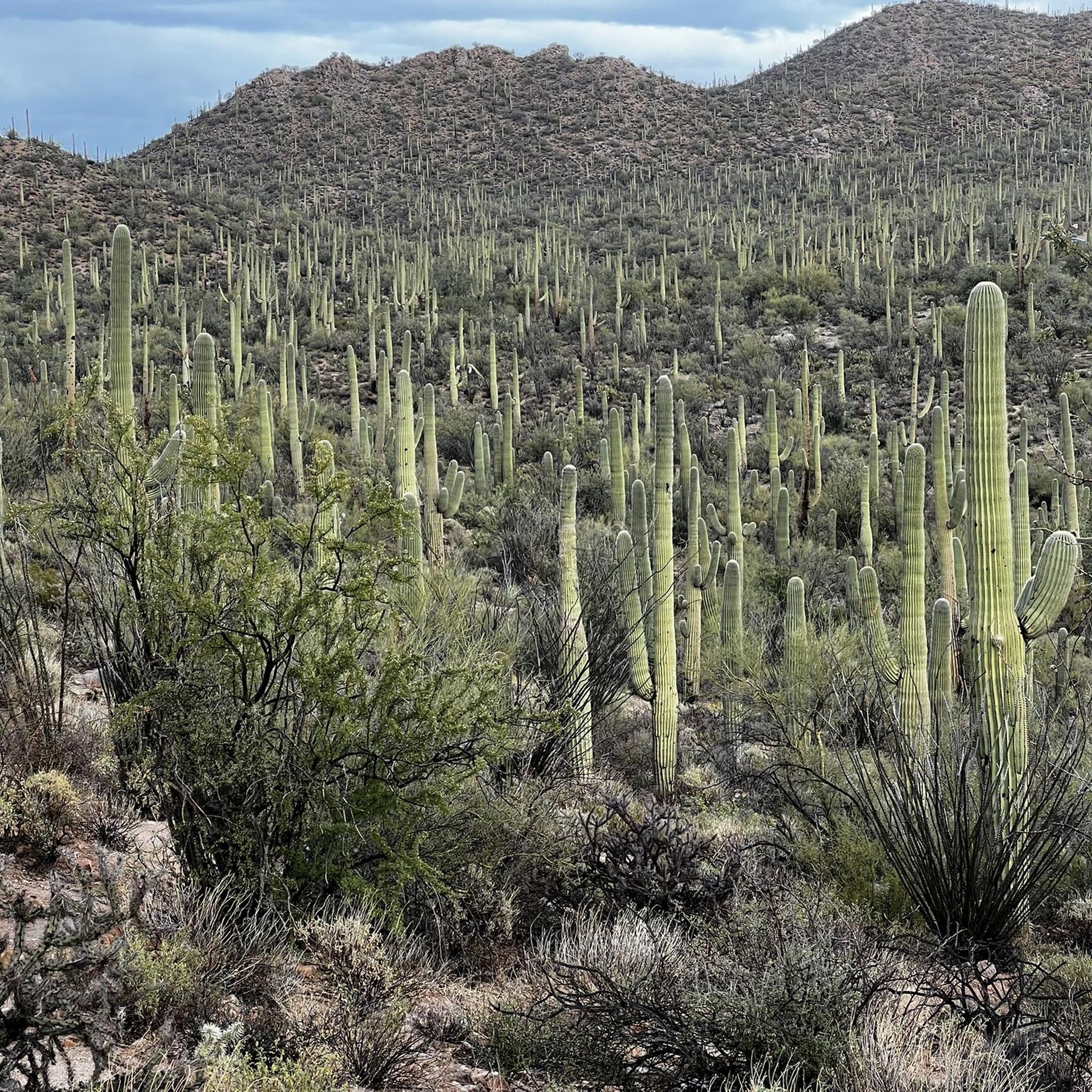
Sweetwater Preserve is over 880 acres of land in the foothills. This area has tons of unique Saguaro cactus and mountain vistas to enjoy along your ride.
0
0

This is the entrance to the Sweetwater Preserve trail system. You can find good views of saguaros here! The trails are open from dawn to dusk and are great for hiking, biking, and trail running. Dogs are welcome for hiking but need to be on a leash.
0
0

Brown Mountain Trails is short loop with a fun technical descent. It also offers great views from the top of the ridge.
0
0
Saguaro Vista trails shows off some of Tucson's amazing desert scenery. You will be surrounded by tall Saguaro cacti the entire trail.
1
0
Sweetwater Preserve offers 13 miles of singletrack built by mountain bikers. Set in a beautiful desert landscape, it contains one of the densest collections of saguaro cactus in the Tucson area.
0
0
Frequently Asked Questions
What kind of terrain can I expect on mountain bike trails around Picture Rocks?
Mountain biking around Picture Rocks offers a diverse landscape with rolling hills and varied terrain. You'll encounter open grasslands in the foothills, transitioning to more rocky and technical sections. The routes often incorporate natural features that require skill to navigate, providing a blend of challenging and flowy sections.
Are there mountain bike trails suitable for beginners in Picture Rocks?
Yes, there are trails suitable for beginners. For an accessible ride through the local foothills, consider the Brown Mountain Loop Trail, which is rated as easy and covers 4.8 miles (7.7 km).
Are there challenging mountain bike trails for experienced riders?
Absolutely. For experienced riders seeking a challenge, trails like the Mountainbike loop from Tortolita Preserve Trailhead offer a difficult 9.4 miles (15.2 km) path with varied terrain and sustained effort. Another demanding option is the Start of Coatamundi trail – Tucson Mountain Park loop from Old Tucson, an 11.5 miles (18.5 km) trail through Tucson Mountain Park.
What are the typical lengths of mountain bike trails in Picture Rocks?
Trail lengths vary, catering to different preferences. You can find shorter loops like the Brown Mountain Loop Trail at 4.8 miles (7.7 km), moderate routes around 9-11 miles, and longer options such as the Cañada del Oro River Trail – Cañada del Oro River Park loop from Bus or RV Parking which extends to 30.6 miles (49.3 km).
Are there any loop mountain bike trails in the Picture Rocks area?
Yes, many of the trails in Picture Rocks are designed as loops, offering a continuous riding experience. Examples include the easy Brown Mountain Loop Trail and the more challenging Mountainbike loop from Tortolita Preserve Trailhead.
What natural features or landmarks can I see along the mountain bike trails?
The area offers scenic overlooks and views across the landscape. While riding, you might encounter significant natural landmarks such as Wasson Peak or explore areas like Sweetwater Preserve. The region is characterized by its desert flora and unique geological formations.
Are there any historical sites or points of interest near the mountain bike trails?
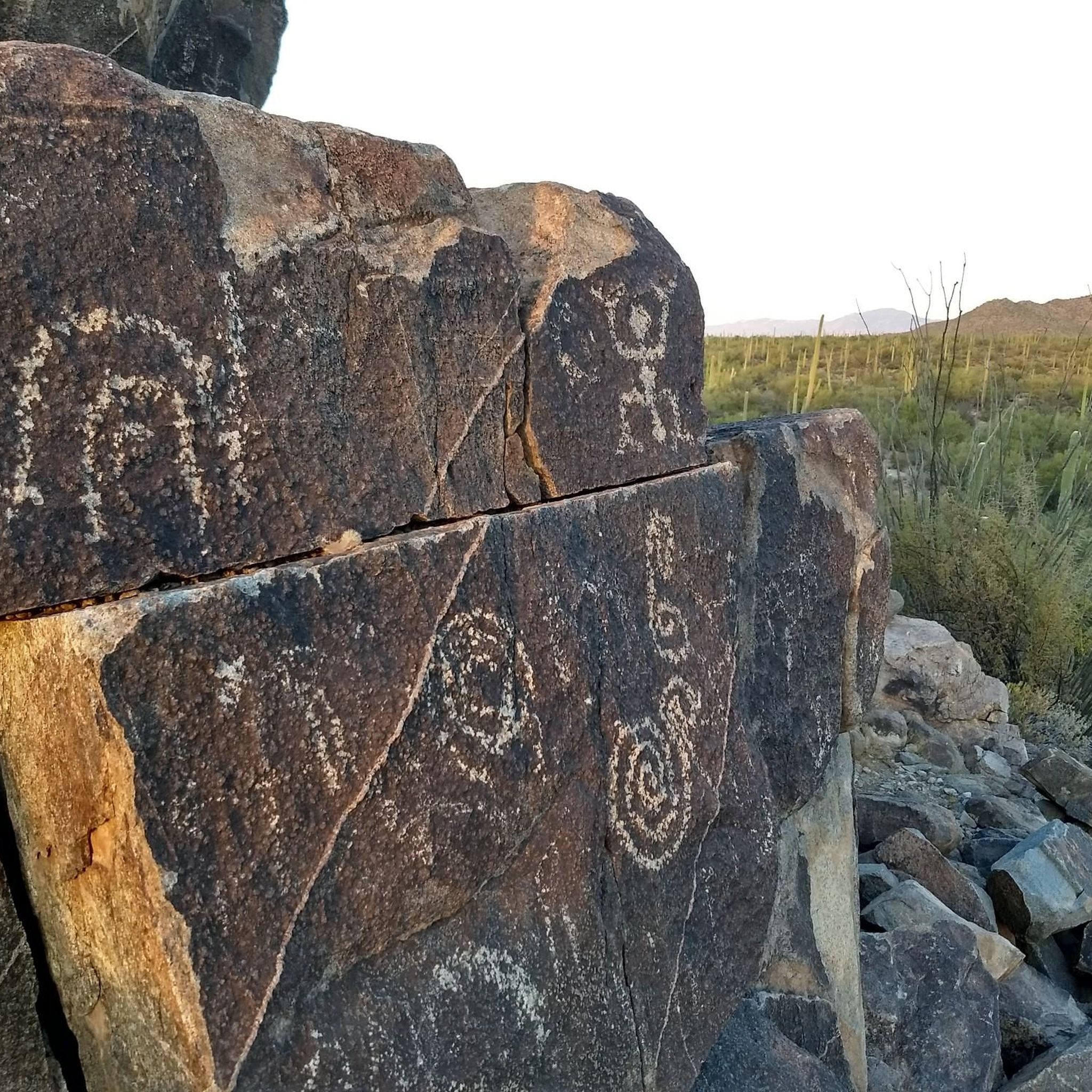
Yes, the Picture Rocks area is rich in history. You can find ancient petroglyphs at sites like King Canyon Wash Petroglyphs and Signal Hill Petroglyphs, offering a glimpse into the region's past.
What do other mountain bikers enjoy most about mountain biking in Picture Rocks?
The area is highly rated by the komoot community, with an average score of 4.9 stars from over 20 reviews. Riders often praise the diverse terrain, from open grasslands to technical rocky sections, and the scenic views. The variety of trails, catering to different skill levels, is also a frequently highlighted positive aspect.
When is the best time of year to go mountain biking in Picture Rocks?
Given the desert climate, the cooler months from late fall through early spring (roughly October to April) are generally the most pleasant for mountain biking in Picture Rocks. Summers can be very hot, making early morning or late afternoon rides essential if visiting during that season.
Are there any family-friendly mountain bike trails in Picture Rocks?
Yes, there are options suitable for families. The Brown Mountain Loop Trail is an easy-rated trail that provides an accessible and enjoyable experience for riders of varying skill levels, making it a good choice for families.
Is parking available at the trailheads in Picture Rocks?
Parking is generally available at various trailheads serving the Picture Rocks area. For example, routes like the Mountainbike loop from Tortolita Preserve Trailhead indicate specific starting points where parking facilities are typically provided. It's always advisable to check specific trailhead information for details.
Are there any cafes or amenities near the mountain bike trails in Picture Rocks?
While the trails themselves are often in natural settings, the Picture Rocks area is close to communities like Tucson, where you can find a range of cafes, restaurants, and other amenities for pre- or post-ride refreshments and supplies.
Most popular attractions around Picture Rocks

Get inspired with the komoot mobile app


Explore more
Browse the best MTB trails in other regions.
