The best walks and hikes around Pitt Lake
4.6
(97)
2,274
hikers
61
hikes
Hiking around Pitt Lake provides access to a unique fjord-like valley, characterized by steep mountain slopes and deep waters. The area features extensive wetlands and marshes, notably within the Pitt-Addington Marsh Wildlife Management Area, which supports diverse ecosystems. Dense forests of Cedar, Fir, and Maple trees are common along many trails, offering varied terrain for outdoor activities. A network of dykes along the Pitt River also provides flat and accessible paths for leisurely walks.
Best hiking trails around Pitt Lake
…Last updated: October 8, 2026
22.2km
05:37
40m
40m
Hard hike. Very good fitness required. Easily-accessible paths. Suitable for all skill levels.
5.0
(4)
57
hikers
6.57km
01:40
10m
10m
Easy hike. Great for any fitness level. Easily-accessible paths. Suitable for all skill levels.

5.0
(1)
7
hikers
10.2km
02:34
10m
10m
Moderate hike. Good fitness required. Easily-accessible paths. Suitable for all skill levels.
2
hikers
2.90km
01:02
80m
80m
Moderate hike. Great for any fitness level. Mostly accessible paths. Sure-footedness required.
5
hikers
14.7km
03:41
10m
10m
Moderate hike. Good fitness required. Easily-accessible paths. Suitable for all skill levels.
Get access to more routes and recommendations from other explorers.
Already have an account?
Our route recommendations are based on thousands of hikes, rides, and runs completed by other people on komoot.
Start today with a free account
Your next adventure awaits.

Tips from the Community

Pitt Meadows Regional Airport sits right along the Pitt River Regional Greenway and the Fraser River, serving general aviation, flight training, and small aircraft operations in the Lower Mainland. The low-lying airfield is surrounded by farmland and dike trails, making aircraft activity a constant backdrop for nearby walks and rides. As you pass by, you'll likely see planes taking off and landing at close range against the open valley setting.
0
0
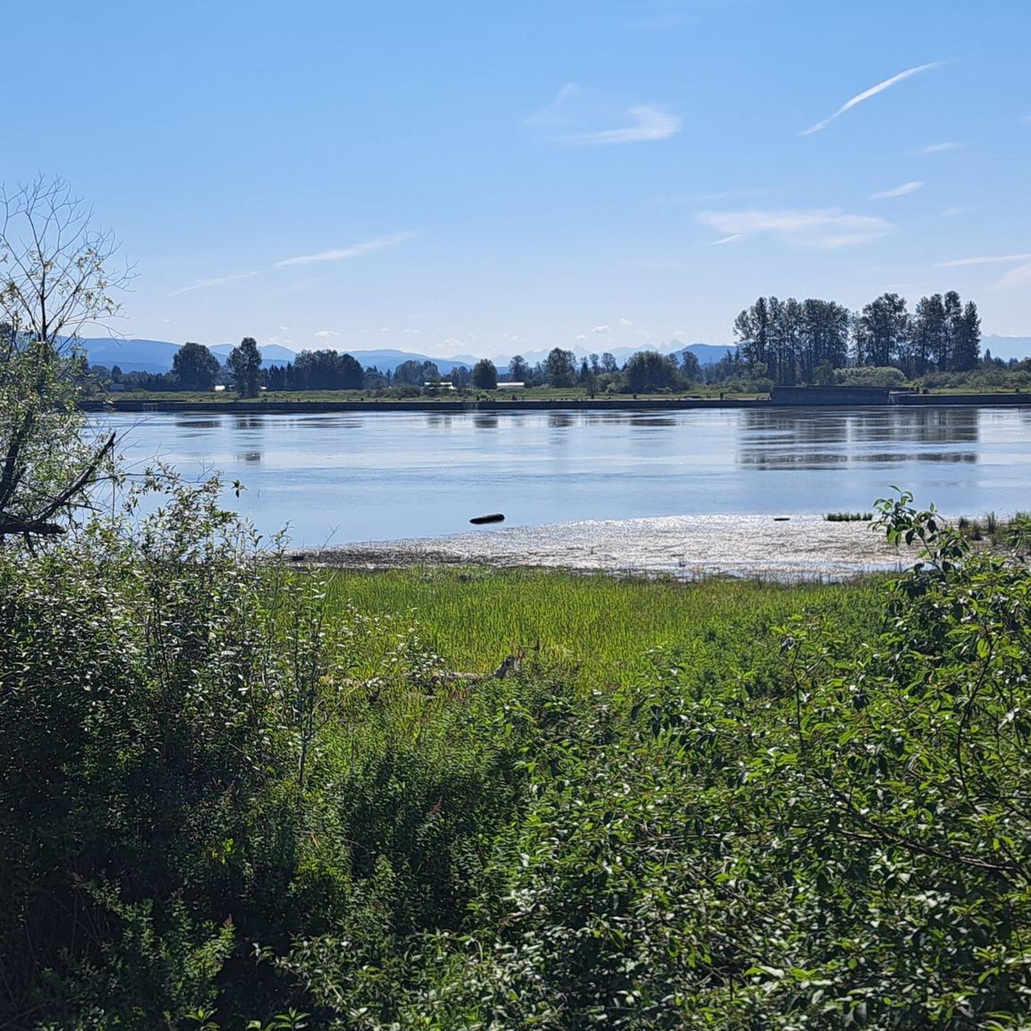
Waterfront Commons sits directly along the Fraser River, and though small, it is one of the main access points on the Pitt River Regional Greenway. The space is simple and open, with a wide gravel path, grassy edges, and unobstructed views out across the Fraser River. With little development and constant exposure to the river and sky, it feels more like a pause along the greenway than a traditional park, with several picnic tables, making it an ideal place for a scenic lunch along the water.
0
0
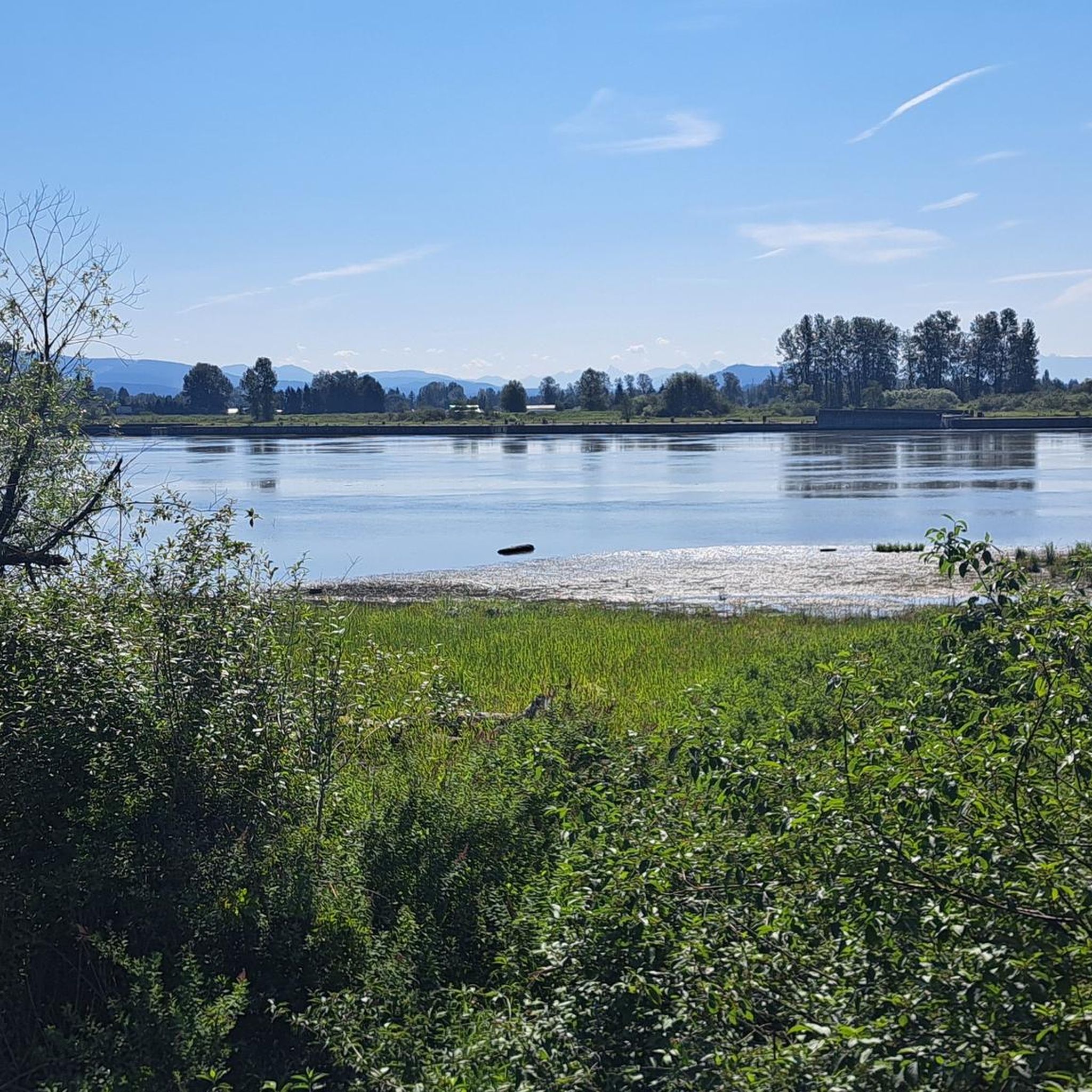
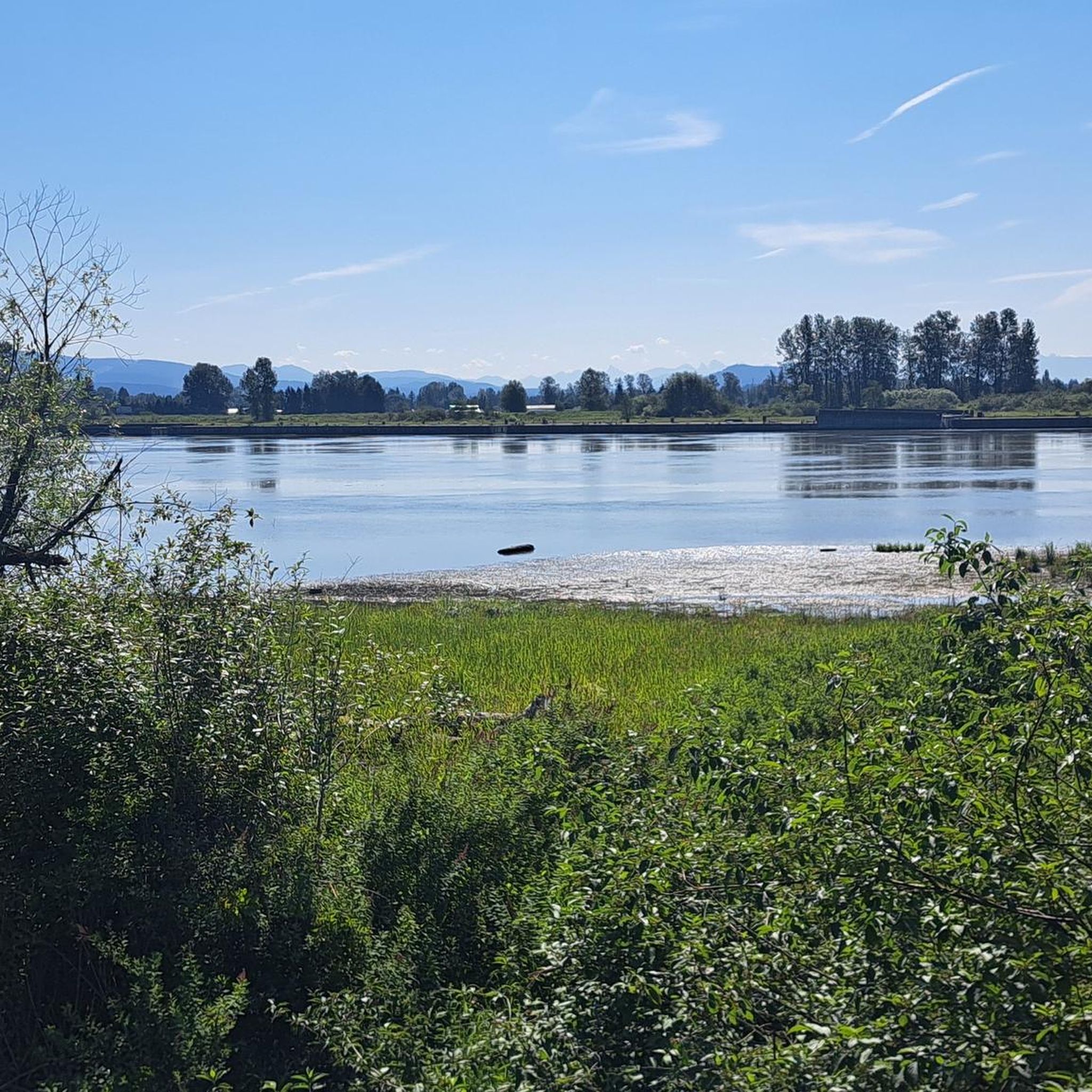
The Pitt River Regional Greenway follows the Fraser and Pitt Rivers and is a flat, easy route that is part of a wider network of cycling and walking paths through Pitt Meadows. The trail runs through open farmland, with long, uninterrupted views of the river and the surrounding mountains. With minimal tree cover and expansive scenery, it feels exposed and spacious, shaped more by the river and sky than by forest. There are plenty of access points and parking at both ends, making it perfect for a short or extended hike along the riverfront.
0
0
The Fern Trail at Minnekhada Regional Park is a lovely shaded path through second-growth forest, linking the Lodge Trail to the Quarry Trail and High Knoll. It’s relatively steep in sections but well-marked, with dense ferns, mossy trunks, and a quiet, enclosed feel. It’s a fantastic connector trail, with options to access higher viewpoints or complete longer loops to explore more across the park’s eastern ridge.
0
0
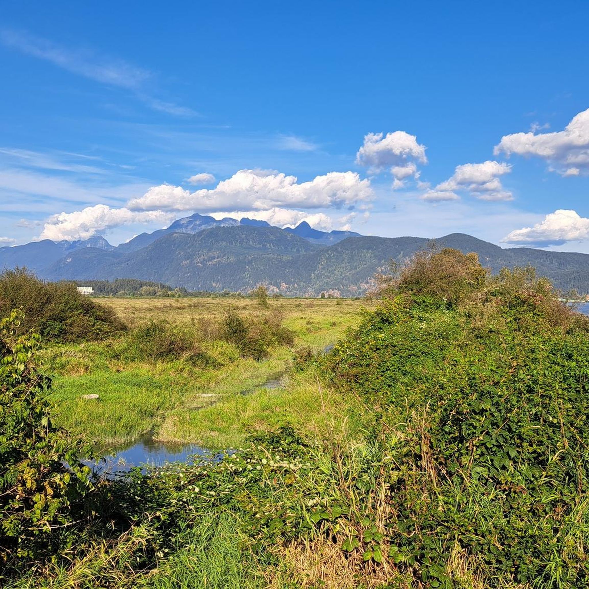
This viewpoint is an excellent place for expansive, unobstructed views across the wetland. It’s an easy walk from the main parking area and a reliable spot for birdwatching, especially in spring and summer. Visitors often see herons, ducks, and other wetland birds feeding or nesting in the open marsh. There are several picnic tables and restrooms nearby, making it a great spot for a scenic lunch before or after exploring the trails in this beautiful area.
0
0

Addington Lookout is a viewpoint from the top of a knoll in the 200-plus hectare Minnekhada Regional Park. It's a great view from Metro Vancouver, and if you get there for sunrise you are more likely to see deer and moose.
0
0

buy berries along the road, delicious
0
0
Frequently Asked Questions
What types of hiking trails can I find around Pitt Lake?
Pitt Lake offers a diverse range of hiking experiences, from easy, flat dyke trails perfect for leisurely walks and birdwatching to more challenging routes through forested areas and along the water. The region is characterized by its unique fjord-like valley, extensive wetlands, and dense forests of Cedar, Fir, and Maple trees.
Are there any easy, family-friendly hiking options near Pitt Lake?
Yes, Pitt Lake has numerous easy trails suitable for families. Many of the dyke trails within the Pitt-Addington Marsh Wildlife Management Area offer flat, accessible routes. For example, the Heron Cove loop from Burke Mountain is an easy 7.1 km trail leading through forested areas and along the water, often completed in about 1 hour 46 minutes.
Can I bring my dog on the hiking trails around Pitt Lake?
Many trails around Pitt Lake are dog-friendly, particularly the dyke trails and those within regional parks. However, it's always recommended to check specific park regulations or trail signage for leash requirements and any restricted areas, especially within wildlife management zones like the Pitt-Addington Marsh, to protect the diverse ecosystems.
Are there any circular hiking routes available?
Yes, Pitt Lake features several circular routes. A popular option is the Pitt River Bank Walk loop from Widgeon Marsh Regional Park, an easy 6.5 km trail offering views along the Pitt River. Another is the Osprey Basin – Munmunta Basin loop from Burke Mountain, a moderate 13.0 km path traversing varied terrain.
What kind of wildlife can I expect to see while hiking in the area?
The Pitt Lake area is a haven for wildlife, especially within the Pitt-Addington Marsh Wildlife Management Area. You can expect to see over 200 bird species, including various waterfowl, making it excellent for birdwatching. Other wildlife sightings may include deer, bears, beavers, and swans, particularly along the dyke trails and near wetland areas.
Are there any waterfalls accessible by hiking around Pitt Lake?
Yes, Widgeon Falls is a notable scenic spot accessible by combining canoeing and hiking. The trail to the falls winds through lush forests, offering picturesque views. Visitors can explore both the lower and upper falls, with the upper falls providing a serene picnic area. A further hike from the Widgeon Creek campsite leads to the tranquil Widgeon Lake.
What are some interesting landmarks or viewpoints along the trails?
The region offers several points of interest. You can find scenic views of the Pitt River and surrounding landscapes from trails like the Pitt River Bank Walk loop from Burke Mountain. For specific landmarks, consider exploring the Pitt River Viewpoint or the Pitt River Bridge. The Addington Lookout via Fern Trail in Minnekhada Regional Park also offers elevated perspectives.
How many hiking routes are available in the Pitt Lake region?
There are over 50 hiking routes documented around Pitt Lake, catering to various skill levels. Approximately half of these are rated as easy, while a significant number are moderate, and a few are more difficult, ensuring options for every hiker.
Is there public transport available to reach the Pitt Lake hiking areas?
While public transport options directly to all trailheads around Pitt Lake may be limited, some routes are more accessible. It's advisable to check local transit schedules for connections to Pitt Meadows or specific regional parks like Grant Narrows, which serves as a primary access point to the lake and its surrounding trails.
Where can I park when visiting Pitt Lake for hiking?
Grant Narrows Regional Park is a primary access point to Pitt Lake and offers parking facilities. Many trailheads within regional parks or along the dykes will have designated parking areas. It's recommended to check specific park websites or trail information for detailed parking instructions and any potential fees before your visit.
What do other hikers enjoy most about the trails around Pitt Lake?
The trails around Pitt Lake are highly rated by the komoot community, with an average score of 4.8 stars from over 80 reviews. Hikers frequently praise the stunning natural beauty, the peaceful atmosphere of the wetlands, the diverse wildlife viewing opportunities, and the well-maintained paths, especially the scenic dyke trails.
What is the best time of year to hike around Pitt Lake?
The Pitt Lake area offers hiking opportunities year-round, but the best time often depends on your preferences. Spring and fall provide pleasant temperatures and vibrant scenery, with fewer crowds. Summer is ideal for longer days and combining hiking with water activities, while winter can offer unique, serene experiences, though some trails might be muddy or require appropriate gear.
Most popular routes around Pitt Lake
Most popular attractions around Pitt Lake

Get inspired with the komoot mobile app


Explore more
Browse the best Hikes in other regions.
