The best MTB trails around Area F (McConnell Creek/Hatzic Prairie)
25
riders
3
rides
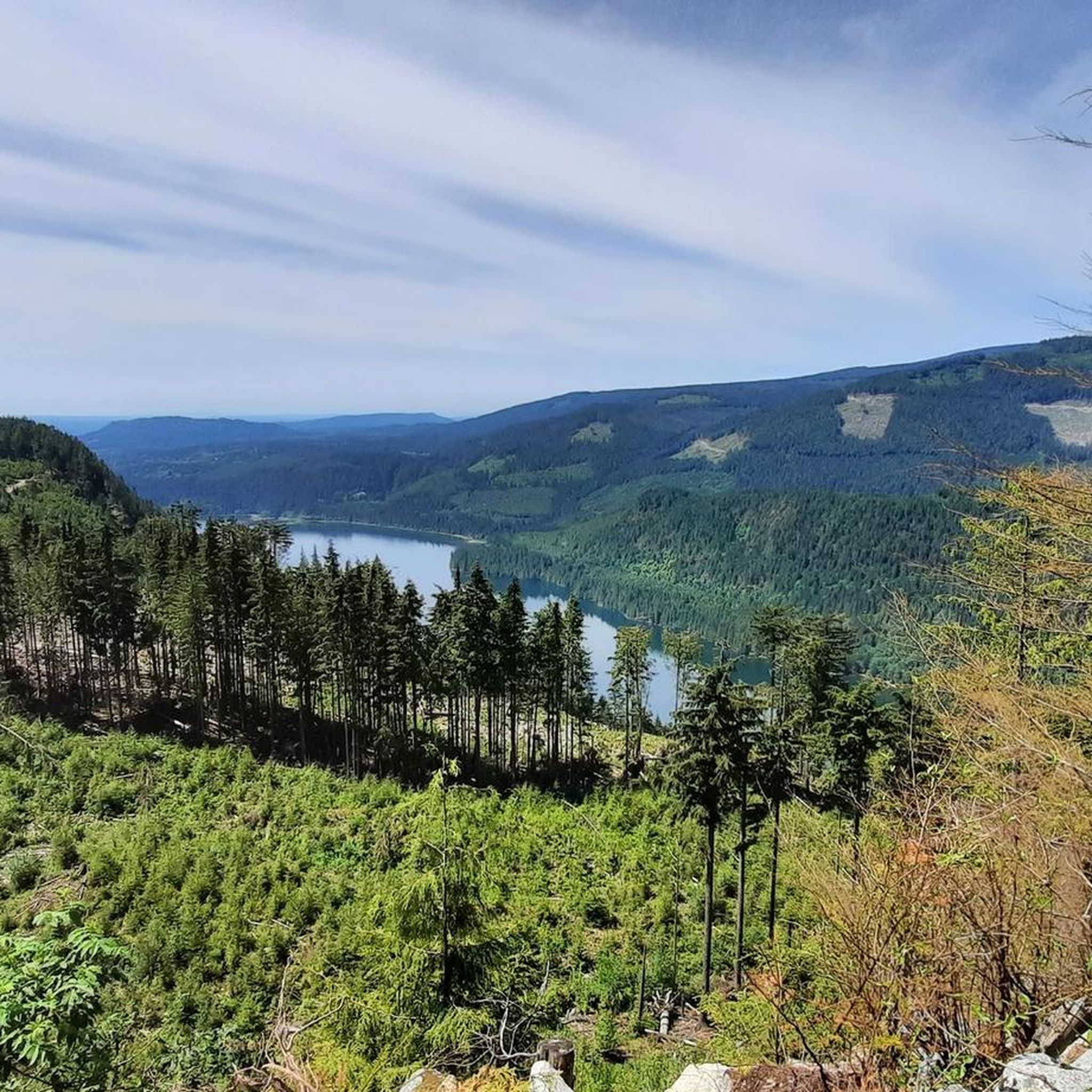
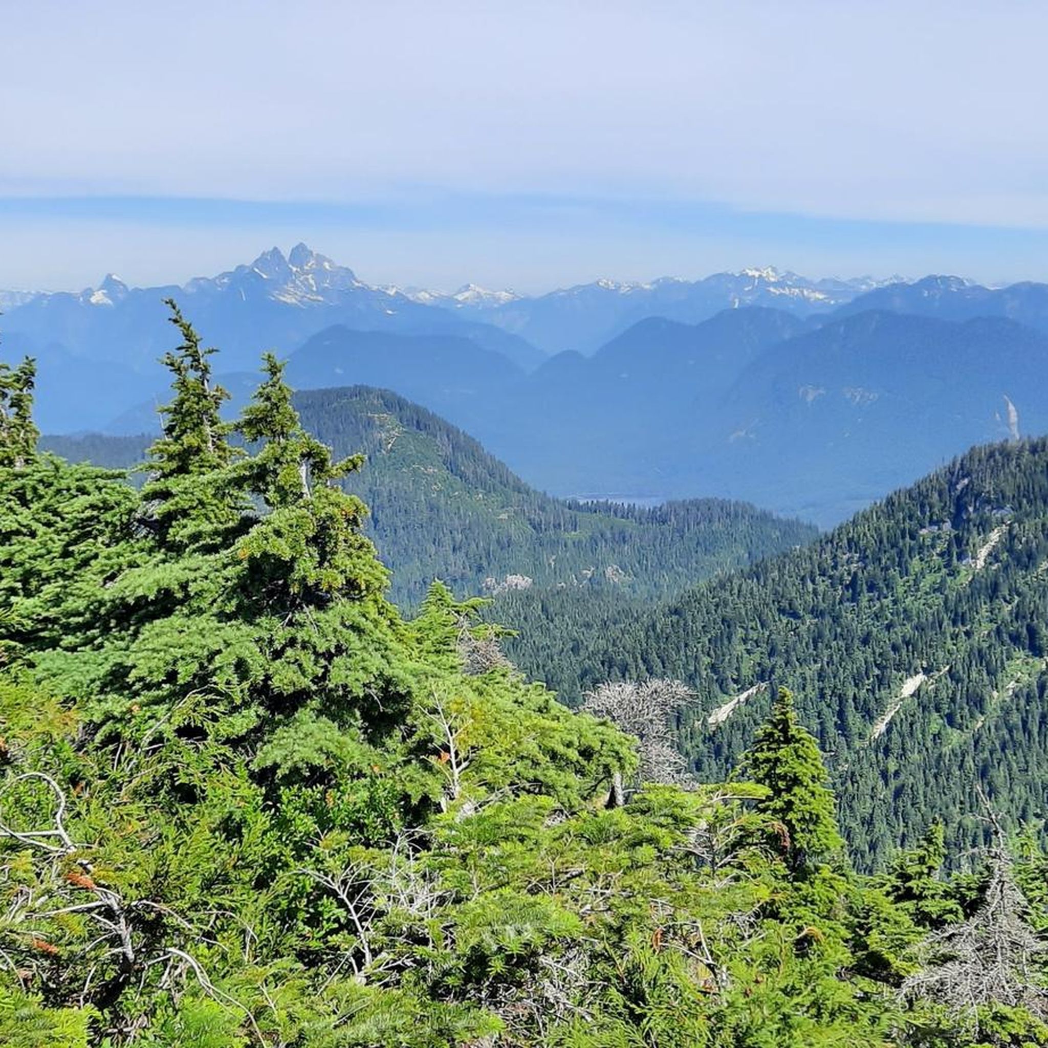
Mountain biking around Area F (McConnell Creek/Hatzic Prairie) offers diverse terrain, transitioning from the lowland farmlands of Hatzic Prairie to the wilder, forested areas of McConnell Creek. This region features former logging roads and forested singletracks, providing varied riding conditions. Riders can explore areas with small lakes like Allan Lake and Davies Lake, as well as trails offering panoramic views of Stave Lake and surrounding mountains. The landscape includes established networks with both technical challenges and beginner-friendly options.
Best mountain…
Last updated: July 10, 2026
9
riders
12.5km
01:42
470m
470m
Moderate mountain bike ride. Good fitness required. Advanced riding skills necessary.
10
riders
8.46km
01:04
360m
360m
Moderate mountain bike ride. Good fitness required. Advanced riding skills necessary.

Sign up for free
6
riders
35.5km
03:59
1,140m
1,140m
Hard mountain bike ride. Very good fitness required. Advanced riding skills necessary. Some portions of the route may require you to push your bike.
Our route recommendations are based on thousands of hikes, rides, and runs completed by other people on komoot.
Start today with a free account
Your next adventure awaits.
Login or Signup
Tips from the Community

As the high point of McKee Park, McKee Peak offers great views over Abbotsford, the Fraser Valley, and surrounding mountains such as Mt. Robie & Mt. Judge Howay. There's a large communication tower to use as a landmark since the many trails around the summit can be confusing.
0
0
Frequently Asked Questions
What kind of terrain can I expect when mountain biking in Area F (McConnell Creek/Hatzic Prairie)?
The region offers diverse terrain, transitioning from the lowland farmlands of Hatzic Prairie to the wilder, forested areas of McConnell Creek. You'll find a mix of former logging roads and forested singletracks, with trails that include moderate climbs and more technical descents. The area also features scenic views of lakes and mountains.
Are there mountain bike trails suitable for beginners or families in Area F?
Yes, the trail network in Area F (McConnell Creek/Hatzic Prairie) includes options for various ability levels. While some routes offer technical challenges, there are also beginner-friendly options, particularly in areas like the Hatzic to Heritage / East Greenway and parts of the Stave Lake area, which feature old rail beds suitable for family-friendly rides.
What are some of the natural attractions or viewpoints I can see while mountain biking in the area?
Mountain biking in Area F offers access to several natural attractions and viewpoints. You can find trails with panoramic views of Stave Lake and the surrounding mountains. The region is also home to small lakes like Allan Lake and Davies Lake. Additionally, nearby attractions include Lower Falls, Golden Ears Provincial Park, and various viewpoints such as Panoramic View of Garibaldi Lake and Battleship Islands and View of Black Tusk.
What is the best time of year to go mountain biking in Area F (McConnell Creek/Hatzic Prairie)?
The Fraser Valley, which includes Area F, benefits from a temperate climate, making it a viable choice for mountain biking year-round. However, for the most comfortable conditions and best trail access, spring through fall is generally ideal. Winter riding may be possible but could involve wet or muddy conditions, especially on forested trails.
Are there any long or challenging mountain bike routes in the region?
Yes, for those seeking a challenge, Area F offers several difficult routes. For example, the Bear Mountain loop from Ruskin is a difficult 10.7-mile (17.1 km) path with significant elevation gain. Another challenging option is the Sumas Mountain Viewpoint loop from McKinley Drive at Sandy Hill (NB), which spans 34.1 miles (34.1 km) and features over 1000 meters of elevation gain.
How many mountain bike trails are available in Area F (McConnell Creek/Hatzic Prairie)?
There are at least 5 highly-rated mountain bike tours available in Area F (McConnell Creek/Hatzic Prairie) on komoot, ranging in difficulty from moderate to difficult. These routes showcase the best of the region's diverse landscape.
Are there any circular mountain bike routes in Area F?
Yes, many of the mountain bike routes in Area F are designed as loops. Examples include the Bear Mountain loop from Mill Pond, the Bear Mountain loop from Ruskin, and the McKee Peak loop from Auguston, all of which offer circular paths through the region's varied terrain.
What is the typical duration for mountain bike rides in this area?
The duration of mountain bike rides in Area F varies depending on the route and your pace. For instance, a moderate route like the Bear Mountain loop from Mill Pond typically takes about 1 hour 25 minutes to complete, while a longer, more difficult route such as the Sumas Mountain Viewpoint loop from McKinley Drive at Sandy Hill (NB) can take over 3 hours 50 minutes.
Where can I find parking for mountain biking trails in Area F?
While specific parking locations for each trail are best checked on individual route pages, the region's history as a logging area means many trails, especially those on former logging roads, often have accessible entry points. For routes starting from specific locations like Mill Pond, Ruskin, or Auguston, parking is typically available nearby. Always consult the detailed route information on komoot for precise starting points and parking suggestions.
What makes Area F (McConnell Creek/Hatzic Prairie) a good mountain biking destination?
Area F stands out as a mountain biking destination due to its combination of accessible lowland trails in Hatzic Prairie, linking to more challenging and scenic routes in the forested McConnell Creek area. The natural beauty of Cascade Falls, the presence of various lakes, and panoramic mountain views, coupled with a diverse and well-developed trail network catering to all skill levels, make it an attractive location for mountain biking.
Are there any specific trails that offer great views of Stave Lake?
Yes, trails in the wider Mission area, which includes Area F, offer panoramic views of Stave Lake and the surrounding mountains. The Hunter Logging Road, for example, is known for providing such vistas. You can often find these scenic viewpoints incorporated into longer routes in the region.
Can I find trails that were specifically built for mountain biking in this region?
Yes, Hatzic Prairie connects to established mountain biking networks like the Hatzic to Heritage / East Greenway and the broader Heritage Trails in Mission. Many of these trails were built by and for mountain bikers over several decades, offering a mix of technical challenges and easier, flowy options with features like bermed corners.
Most popular routes around Area F (McConnell Creek/Hatzic Prairie)
Most popular attractions around Area F (McConnell Creek/Hatzic Prairie)

Get inspired with the komoot mobile app


Explore more
Browse the best MTB trails in other regions.
