The best cycling routes around Maple Ridge
4.2
(226)
1,253
riders
36
rides
Touring cycling around Maple Ridge offers diverse natural landscapes, extensive trail networks, and scenic attractions. The region features numerous flat dyke trails along the Alouette, Fraser, and Pitt Rivers, providing views of mountains and farm fields. Cyclists can also experience undulating road rides through forested areas and low-lying floodplains, with some routes offering views of Alouette Lake. The varied geography includes both easy, flat paths and more challenging sections.
Best touring cycling routes around Maple Ridge
- The most popular touring cycling route is Pitt River Bridge – Pitt River Dike Trail loop from Maple Meadows, a 27.2 miles (43.8 km) trail that takes 3 hours 28 minutes to complete. This route follows scenic dyke trails along the Pitt River, offering views of mountains and waterways.
- Another top favourite among local touring cyclists is Edge Farm Trail – Fort-to-Fort Trail loop from Maple Ridge, an easy 7.6 miles (12.3 km) path. This trail provides a flat and accessible ride through local landscapes, suitable for various skill levels.
- Local touring cyclists also love the North Alouette River – Alouette River loop from Research Area, a 17.1 miles (27.5 km) trail leading through riverfront areas and forested sections, often completed in about 2 hours 13 minutes.
- Touring cycling around Maple Ridge is defined by dyke trails along major rivers, views of snow-capped mountains, and routes through forested areas. The network offers options for different ability levels, from easy, flat paths to more challenging rides with varied elevation.
- The routes in Maple Ridge are highly rated by the komoot community with an average score of 4.6 stars from over 100 reviews. More than 700 touring cyclists have used komoot to explore Maple Ridge's varied terrain.
Last updated: October 8, 2026
4.2
(98)
313
riders
45.3km
03:24
160m
160m
Moderate bike ride. Good fitness required. Mostly paved surfaces. Suitable for all skill levels.
4.7
(26)
86
riders
46.6km
03:25
90m
90m
Moderate bike ride. Good fitness required. Mostly paved surfaces. Suitable for all skill levels.

4.3
(3)
37
riders
Easy bike ride. Great for any fitness level. Mostly paved surfaces. Suitable for all skill levels.
4.1
(24)
25
riders
Moderate bike ride. Good fitness required. Mostly paved surfaces. Suitable for all skill levels.
5.0
(1)
21
riders
Easy bike ride. Great for any fitness level. Mostly paved surfaces. Suitable for all skill levels.
Get access to more routes and recommendations from other explorers.
Already have an account?
Our route recommendations are based on thousands of hikes, rides, and runs completed by other people on komoot.
Start today with a free account
Your next adventure awaits.

Tips from the Community

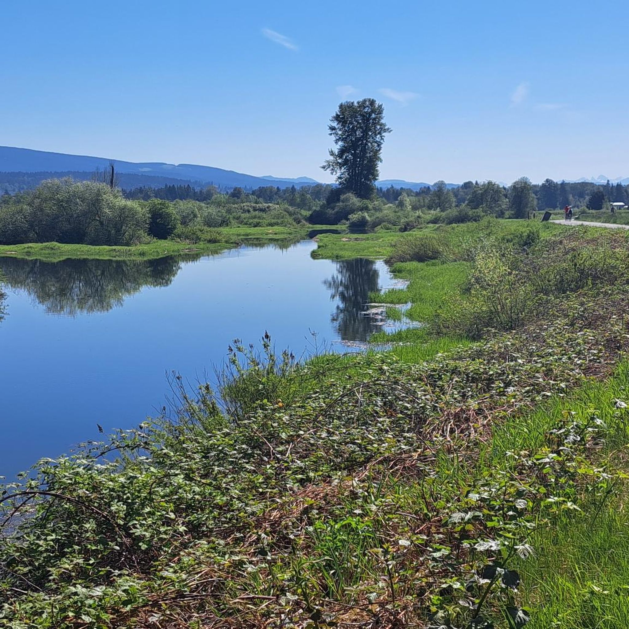
The Alouette River was formerly known as the Lillooet River, but the name was changed since there is a larger, more well known river that had the same name. The name Alouette was chosen for the simple reason that it sounds similar to Lillooet, but French speakers will recognize that it means lark.
0
0

The Hyde Creek Salmon Hatchery is a small powerhouse of local conservation, run entirely by volunteers who raise thousands of coho and chum salmon each year. Its story began in the 1980s with a homemade backyard hatchery, complete with an old bathtub! Drop by on a Saturday morning when volunteers are usually around, and you may get a glimpse behind the scenes before heading back out to watch for salmon in Hyde Creek itself.
1
0

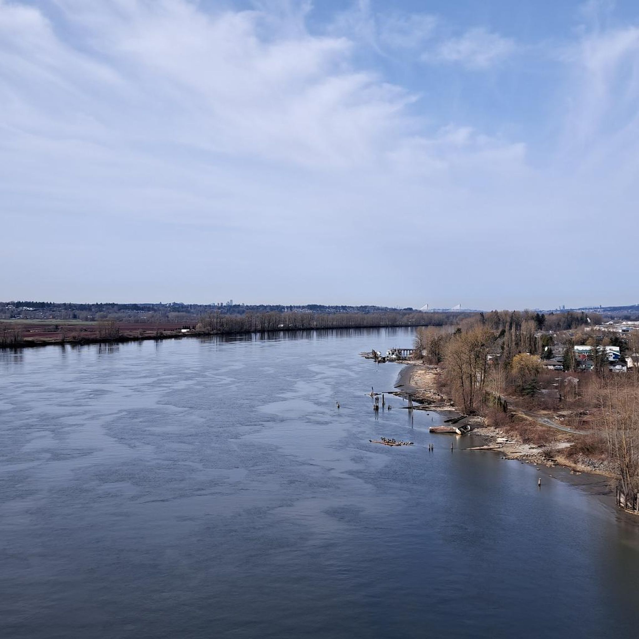
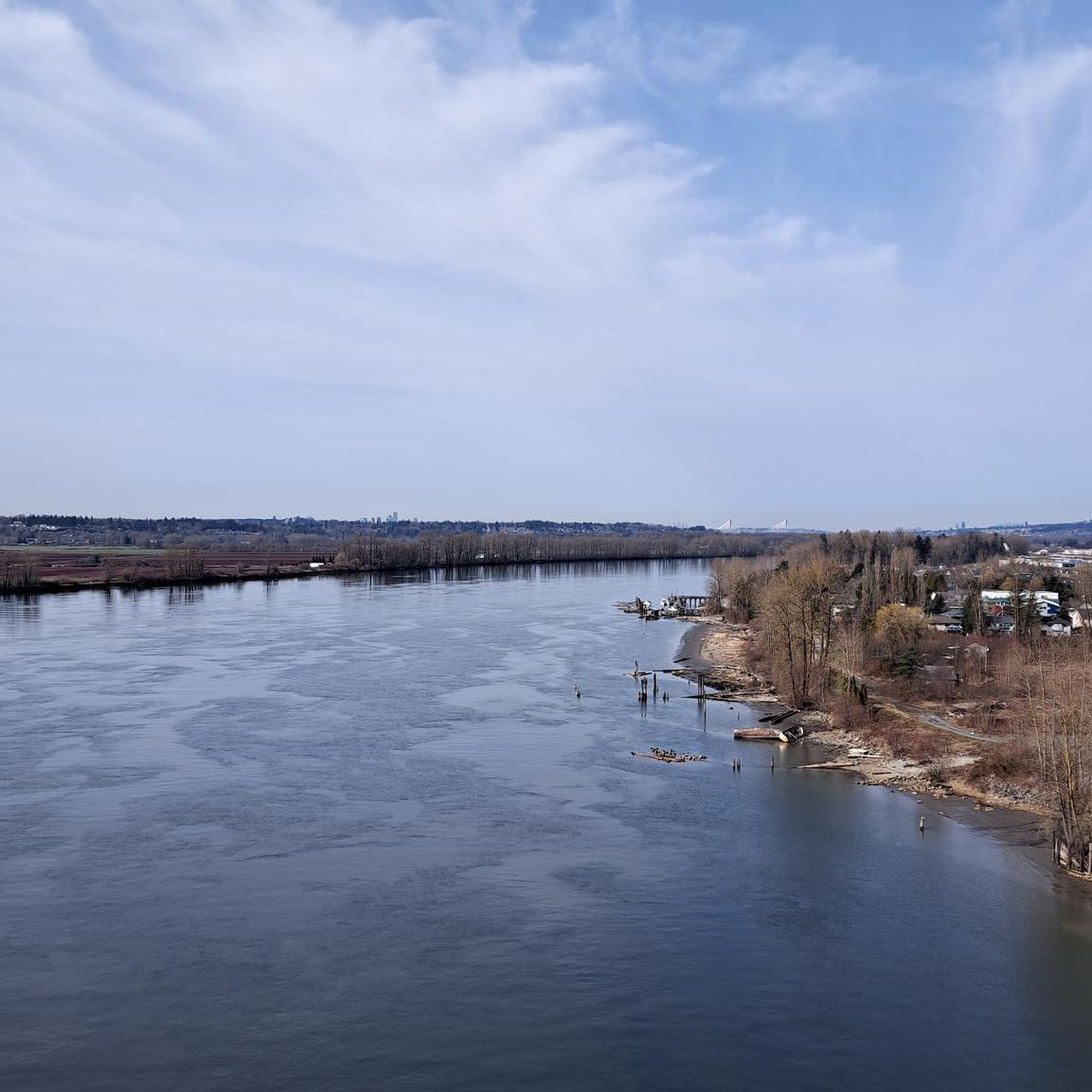
The view opens onto a slow, meandering river cutting through wide-open farmland — a mix of grassy fields, wetland patches, and hedgerows rather than dense forest crowding the banks.
0
0
This brigde was built through community fundraising efforts led by the Colony Farm Park Association, working in partnership with Metro Vancouver, to give walkers and cyclists a direct river crossing within the park's trail network. It serves as a key junction point: crossing it lets visitors extend a walk into a longer loop, linking the western side of the park near the Community Gardens to the eastern Wilson Farm area, rather than backtracking the way they came.
0
0
At this southern spot near Pitt River Road, the Coquitlam River opens up and slows down. The water here is wider and calmer than the fast-moving sections further upstream.
0
0
Derby Reach stretches along a calm bend of the Fraser River, where open fields, quiet forests, and wide riverside trails make for easy wandering. You'll find a mix of flat shoreline paths and the hillier Houston Trail loop with some multi-use trails open to hikers, joggers, cyclists, and even horseback riders. A large campground sits right at the water’s edge, with picnic shelters, washrooms, drinking water, and plenty of space to settle in for the night. Dogs are welcome on‑leash throughout most of the park, with a large off‑leash zone near Edgewater Bar. In short, you'll find that Derby Reach delivers a peaceful break with all the essentials close at hand.
0
0
The Canyon to Coast trail runs for 550 kilometers between Hope and the Salish Sea. This particular section follows the Fraser River through parkland, nature reserve and historic sites as it nears its end at the sea.
0
0

Pitt River Regional Greenway is a multi-use trail that follows the east bank of the Pitt and Fraser rivers through Pitt Meadows. The route runs along dikes and through riparian areas, with wide views of the river, surrounding farmland, and nearby mountains. Its flat, open alignment and proximity to the water give it a calm, spacious feel, with plenty of opportunities to see birds and other wildlife.
0
0
Frequently Asked Questions
What types of terrain can I expect on touring cycling routes in Maple Ridge?
Maple Ridge offers a diverse range of terrain for touring cyclists. You'll find many flat and scenic dyke trails along the Alouette, Fraser, and Pitt Rivers, providing easy cycling with picturesque views. There are also undulating road rides and some more challenging sections through forested areas and low-lying floodplains, catering to various skill levels.
Are there any easy touring cycling routes suitable for beginners or families in Maple Ridge?
Yes, Maple Ridge has several easy touring cycling routes perfect for beginners or families. For instance, the Edge Farm Trail – Fort-to-Fort Trail loop from Maple Ridge is an easy 12.3 km path that offers a flat and accessible ride. Another great option is the Alouette River – Pitt River Dike Trail loop from Yennadon, which is 17.7 km and also rated easy.
What scenic natural features can I see along the cycling routes in Maple Ridge?
Cyclists in Maple Ridge can enjoy stunning natural features. Many routes offer views of snow-capped mountains, the serene Alouette Lake, and extensive cranberry fields, especially during harvest season in mid to late October. The dyke trails provide opportunities for wildlife spotting, including eagles and herons, along the Alouette, Fraser, and Pitt Rivers.
Are there any waterfalls accessible or visible from touring cycling routes in Maple Ridge?
While some waterfalls might require a short detour or hike, you can find beautiful natural attractions in the area. For example, Kanaka Creek Regional Park features the cascades of Kanaka Cliff Falls and offers scenic trails. Other notable waterfalls in the region include Lower Falls in Golden Ears Provincial Park, Rolley Falls, and Steelhead Falls.
What do other touring cyclists say about the routes in Maple Ridge?
The touring cycling routes in Maple Ridge are highly regarded by the komoot community, holding an average rating of 4.6 stars from over 120 reviews. Cyclists often praise the scenic dyke trails, the diverse landscapes, and the well-maintained paths that cater to various skill levels.
Are there any longer or more challenging touring cycling routes in the area?
For those seeking a longer or more challenging ride, the Pitt River Bridge – Pitt River Dike Trail loop from Maple Meadows is a moderate 43.8 km route that follows scenic dyke trails. Another option is the North Alouette River – Alouette River loop from Research Area, a difficult 27.5 km trail leading through riverfront and forested sections with more elevation.
What is the best time of year to go touring cycling in Maple Ridge?
The most popular times for touring cycling in Maple Ridge are typically May and July. The region's natural beauty, including cranberry fields, is particularly scenic during the harvest season in mid to late October. Generally, spring through fall offers pleasant conditions for exploring the trails.
Are there any circular touring cycling routes available in Maple Ridge?
Yes, many of the touring cycling routes in Maple Ridge are designed as loops, allowing you to start and end at the same point. Examples include the Pitt River Bridge – Pitt River Dike Trail loop from Maple Meadows and the Alouette River – North Alouette River loop from Maple Ridge. These circular routes make planning your ride convenient.
What kind of landmarks or points of interest can I explore along the routes?
Beyond natural beauty, you can encounter interesting landmarks. The region features several bridges, such as the Tynehead Pedestrian Overpass and the Golden Ears Bridge. Trails like the Fort-to-Fort Trail and the Rolley Lake Boardwalk also offer unique points of interest.
How many touring cycling routes are available in Maple Ridge on komoot?
Komoot features over 40 touring cycling routes in Maple Ridge, offering a wide variety of options for different skill levels and preferences. This includes 23 easy routes, 13 moderate routes, and 4 difficult routes, ensuring there's something for every cyclist.
Are there opportunities for wildlife viewing while cycling in Maple Ridge?
Absolutely. The dyke trails along the Alouette, Fraser, and Pitt Rivers are excellent for wildlife spotting. Cyclists often report seeing eagles and herons, especially in the more natural and less developed sections of these routes. Kanaka Creek Regional Park also offers observation towers for wildlife viewing.
Most popular routes around Maple Ridge
Most popular attractions around Maple Ridge

Get inspired with the komoot mobile app


Explore more
Browse the best Cycling routes in other regions.
