The best running trails around Cowichan Valley G
5.0
(1)
31
runners
6
runs
Jogging around Cowichan Valley G offers diverse landscapes, from extensive river paths to trails through ancient forests and along rugged coastlines. The region's terrain includes gentle valleys, significant hills, and varied elevations, shaped by glacial activity. Runners can explore a mix of dedicated pedestrian trails, forest loops, and routes with scenic viewpoints. This area provides a range of running experiences suitable for different fitness levels.
Best jogging routes around Cowichan Valley G
- The most popular jogging route is Stocking Lake…
Last updated: November 4, 2026
6
runners
9.28km
01:15
340m
340m
Hard run. Very good fitness required. Mostly paved surfaces.
3
runners
10.5km
01:07
110m
110m
Moderate run. Good fitness required. Mostly paved surfaces.

4
runners
8.56km
00:55
90m
90m
Moderate run. Good fitness required. Mostly paved surfaces.
5.0
(1)
7
runners
6.57km
00:42
90m
90m
Moderate run. Good fitness required. Mostly paved surfaces.
4
runners
Hard run. Very good fitness required. Mostly paved surfaces.
Our route recommendations are based on thousands of hikes, rides, and runs completed by other people on komoot.
Start today with a free account
Your next adventure awaits.

Tips from the Community

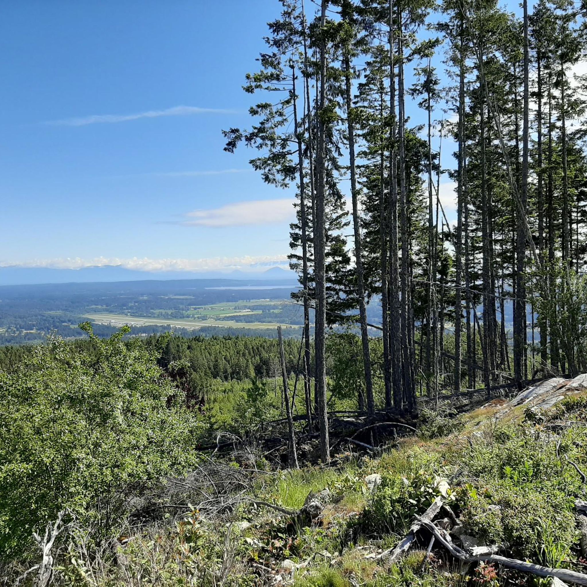
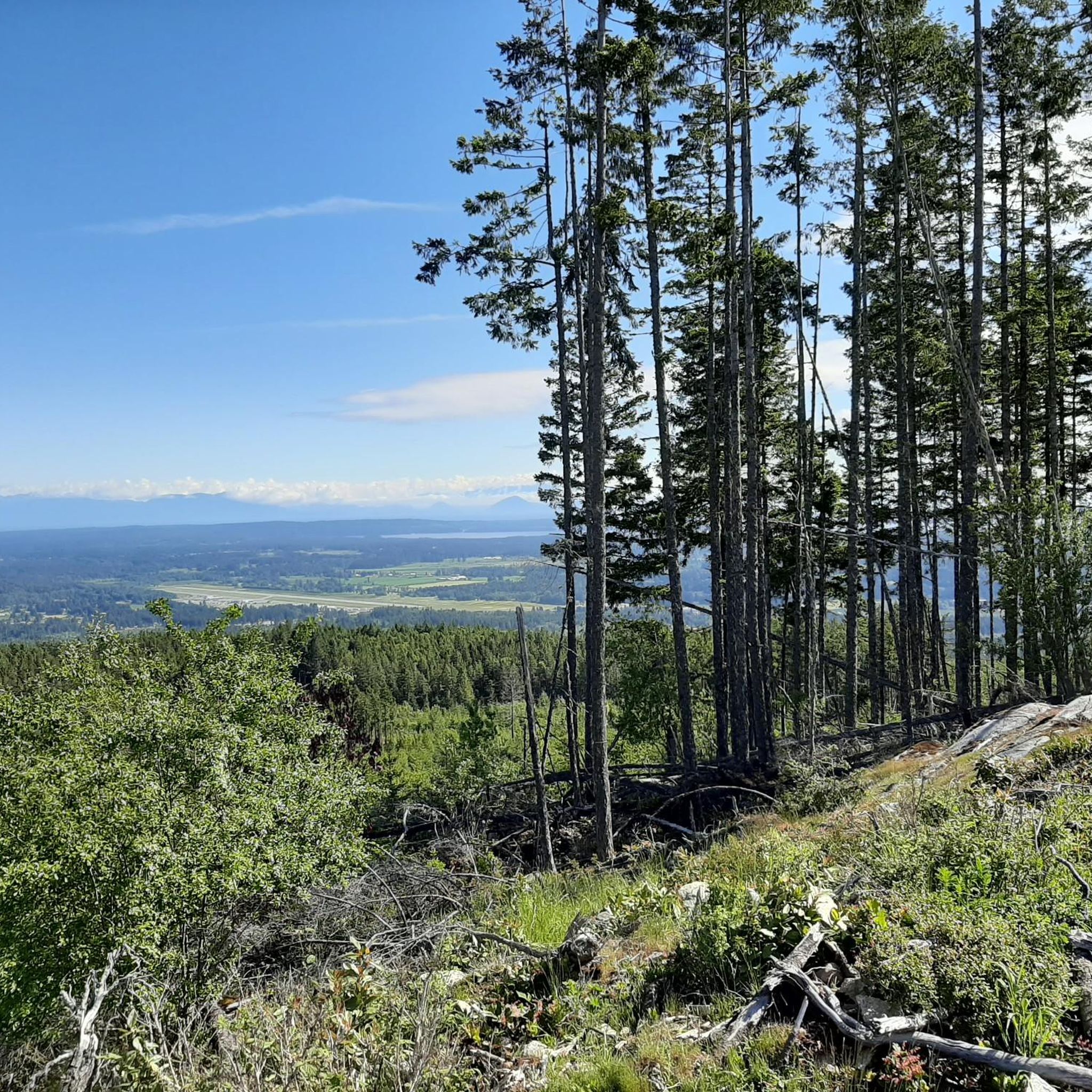
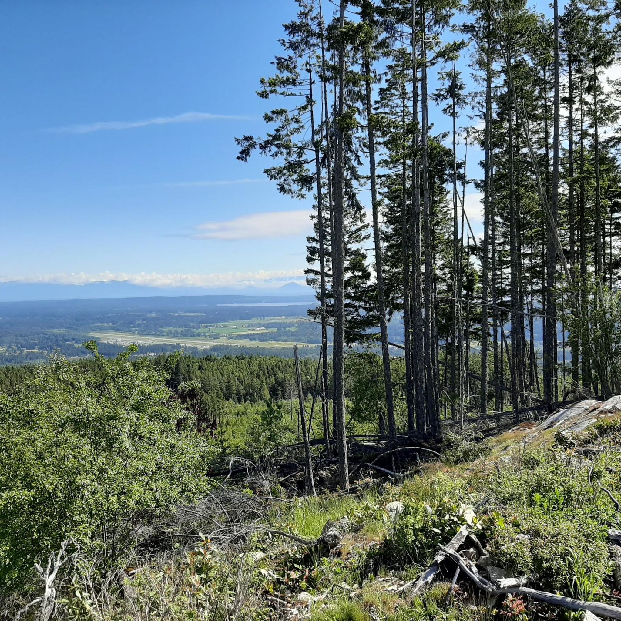
A short spur trail takes you to a clearing where the mossy bedrock rises out of the trees and gives you a view northward across Ladysmith. If the weather is clear, you can see the looming white-capped mountains in the direction of Whistler across the Strait of Georgia.
0
0
Stocking Lake was dammed in the 1960s to provide clean drinking water to Ladysmith and nearby towns. From here you can look along the length of the lake, and there are trails you can explore that circumnavigate the water's edge.
0
0
This is an old logging road and makes for a fairly easy walk through the woods toward Stocking Lake and Banon Creek Falls. It's a pleasant walk. You can drive up and intersect the trail closer to the falls if you wish to skip some of the hike along the logging road.
0
0

Take a few steps for a super view. On a clear day you can see Vancouver from here.
0
0

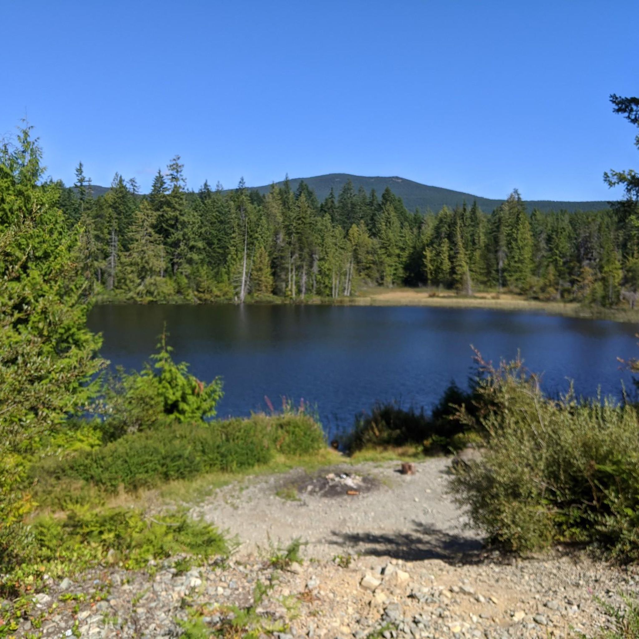
Heart Lake is a secluded lake nestled in a surrounding forest setting. There's a large rock outcrop along the banks that makes for a great spot to rest and take in the views.
0
0
The Heart Lake Trail climbs through forested terrain along Holland Creek to the banks of Heart Lake. There are plenty of spots to take in some incredible views of the lake along the trail, as well as a few spots to cool off with a dip.
0
0
Frequently Asked Questions
What types of running routes are available in the Cowichan Valley?
The Cowichan Valley offers a diverse range of running routes, from extensive river paths and trails through ancient forests to routes along rugged coastlines. You'll find options ranging from gentle valley runs to more challenging trails with significant elevation gains, suitable for various fitness levels.
Are there any challenging running trails for experienced runners?
Yes, for experienced runners seeking a challenge, the Cowichan Valley has several demanding routes. For instance, the Stocking Lake loop from Davis at Battie (SB) is a difficult 9.2 km trail with over 340 meters of elevation gain through forested areas. Another difficult option is the 17.2 km St. Mary Lake Beach loop from Quarry Drive - Baker Road Linear Park Reserve, featuring over 220 meters of ascent.
Can I find any moderate running paths in the region?
Absolutely. The Cowichan Valley features several moderate running paths. A popular choice is the St. Mary Lake Beach loop from Fernwood Rd at Walkers Hook Rd (NB), a 10.6 km route offering scenic views of St. Mary Lake with varied terrain. Another moderate option is the Running loop from Fernwood Rd at Walkers Hook Rd (NB), an 8.6 km trail through local parkland.
Are there any circular running routes in the Cowichan Valley?
Many of the running routes in the Cowichan Valley are designed as loops, providing a convenient way to start and finish at the same point. Examples include the Stocking Lake loop from Davis at Battie (SB), the St. Mary Lake Beach loop from Fernwood Rd at Walkers Hook Rd (NB), and the Running loop from Wildwood Crescent Park Reserve.
What natural features or landmarks can I see while running in the Cowichan Valley?
The Cowichan Valley is rich in natural beauty and interesting landmarks. You might encounter features like the iconic Kinsol Trestle on the Cowichan Valley Trail, or explore the 'Rainforest Section' of the same trail. Along various routes, you could discover Heart Lake, the beautiful Crystal Falls, or the impressive Haslam Suspension Bridge. The region also offers stunning viewpoints of the ocean and mountains, particularly from areas like Cobble Hill Mountain Recreation Area and Mount Tzouhalem.
Is the Cowichan Valley suitable for year-round running?
Yes, the Cowichan Valley benefits from a Mediterranean-like climate, making it pleasant for outdoor activities, including running, throughout the year. While conditions can vary, the mild climate generally allows for enjoyable runs in all seasons.
Are there any trails with waterfalls in the Cowichan Valley?
Yes, if you enjoy running near waterfalls, Stocking Creek Park offers beautiful trails through the forest that feature waterfalls. Additionally, Crystal Falls is a notable highlight in the region that can be incorporated into or viewed from certain routes.
What is the general difficulty level of running trails in the Cowichan Valley?
The Cowichan Valley offers a mix of difficulty levels. While there are no routes classified as 'easy' in our guide, you'll find a good selection of moderate trails, such as the Running loop from Wildwood Crescent Park Reserve (6.5 km), and more challenging options like the Stocking Lake loop from Davis at Battie (SB). This variety ensures there's something for most fitness levels.
What do other runners say about the Cowichan Valley trails?
The Cowichan Valley is a popular destination for runners, with over 20 komoot users having explored its varied terrain. Runners often praise the diverse landscapes, from serene river paths to ancient forests and coastal views, and appreciate the options available for different ability levels.
Are there any historical sites or unique structures to see while running?
Yes, the Cowichan Valley Trail incorporates the iconic Kinsol Trestle, one of the world's tallest and longest wooden trestle systems, offering a unique and historically rich experience for runners. You might also encounter the Haslam Suspension Bridge on some routes.
How long are the running routes typically in this area?
The running routes in the Cowichan Valley vary in length. You can find shorter loops, such as the Running loop from Wildwood Crescent Park Reserve at 6.5 km, or longer, more challenging runs like the St. Mary Lake Beach loop from Quarry Drive - Baker Road Linear Park Reserve, which spans 17.2 km.
Most popular routes around Cowichan Valley G
Most popular attractions around Cowichan Valley G

Get inspired with the komoot mobile app


Explore more
Browse the best Running Trails & Routes in other regions.
