The best running trails in McCreary County
12
runners
9
runs
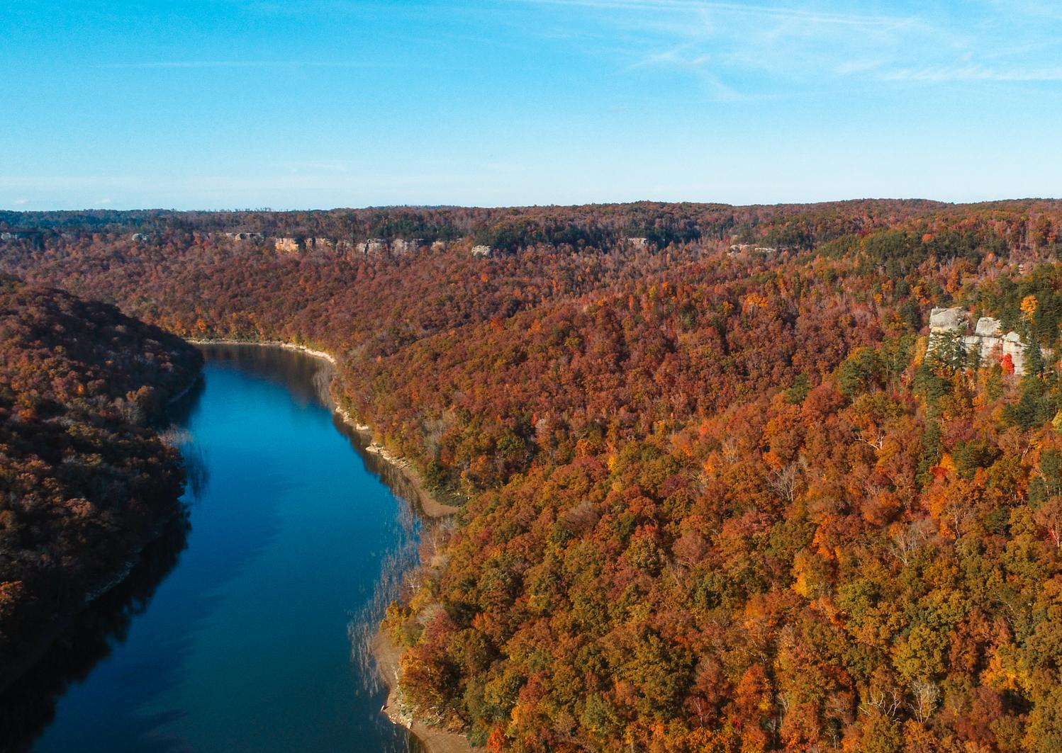
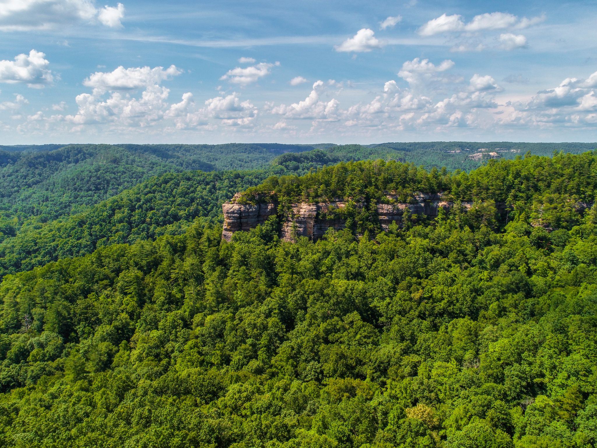
Jogging routes in McCreary County traverse the rugged landscapes of the Cumberland Plateau, offering diverse terrain for runners. The region is characterized by dense forests, towering sandstone cliffs, and deep gorges, particularly within the Daniel Boone National Forest and the Big South Fork National River and Recreation Area. Meandering rivers and numerous waterfalls add to the scenic beauty, providing varied backdrops for running. Natural arches and unique rock formations are also prominent features across the county's extensive trail systems.
Best jogging routes in McCreary County
- The most popular jogging route is Blue Heron Loop Trail, a 6.6 miles (10.7 km) trail that takes 1 hour 22 minutes to complete. This moderate route offers views of river gorges and historical sites.
- Another top favourite among local runners is Twin Arches Loop Trail, a moderate 4.9 miles (7.9 km) path. This trail leads through impressive geological formations, including the twin arches.
- Local runners also love the Dog Slaughter Falls on the Sheltowee Trace Trail, a 5.8 miles (9.3 km) trail leading through dense forests to a picturesque waterfall, often completed in about 1 hour 16 minutes.
- Jogging in McCreary County is defined by dense forests, rugged terrain, and scenic waterfalls. The network offers options for various ability levels, from easy paths to more challenging routes.
- The guide includes highly-rated routes that showcase the best of the region's landscape. More than 12 runners have used komoot to explore McCreary County's varied terrain.
Last updated: May 10, 2026
4
runners
10.7km
01:22
250m
250m
The Blue Heron Loop Trail offers a rewarding jogging experience through the Big South Fork National River & Recreation Area. This moderate route covers 6.6 miles (10.7 km) and involves an elevation gain of 813 feet (248 metres), typically taking about 1 hour and 22 minutes to complete. As you jog, you will traverse both the plateau top and the river gorge, encountering varied terrain and scenic river views alongside dramatic rock bluffs.
When planning your visit, be aware that sections of the trail can be soft and muddy, particularly where it is shared with horses. You should also watch out for slippery wooden steps, especially during wet conditions. For a more manageable ascent from the river, many joggers find it easier to tackle the loop in a counter-clockwise direction.
This trail is notable for its impressive geological features, including the unique "Cracks in the Rock," which are giant fissures in the sandstone. You will also pass by the powerful Devils Jump rapids, adding to the natural beauty and historical context of the area. The route combines natural beauty with historical sites, making it a diverse outing.
3
runners
7.86km
01:02
170m
170m
Imagine jogging the Twin Arches Loop Trail, a moderate route that takes you through a landscape of impressive rock formations and lush forests. This 4.9-mile (7.9 km) journey involves a total elevation gain of 572 feet (174 metres), typically completed in about 1 hour and 1 minute. As you move along, you'll encounter the monumental North and South Arches, which are among the largest natural rock arches in the eastern United States. The terrain varies, featuring sandstone paths, fire roads, and sections with roots and rocks, offering a dynamic experience for joggers. You'll navigate scenic gorges and sandstone bluffs, with some parts requiring steep steps and switchbacks.
When planning your visit to the Twin Arches Loop Trail, you should know that parking is generally available right at the trailhead, making access straightforward. Be prepared for the varied surfaces and the physical demands of the route. The trail includes numerous steep steps and switchbacks, particularly when you descend into the valley and then climb back out. While parts are suitable for jogging, the challenging terrain might make sustained running difficult in certain sections.
This trail is a highlight within the Big South Fork National River & Recreation Area, known for its unique geological features. The Twin Arches themselves are a testament to millions of years of natural erosion, forming a dramatic backdrop to your outdoor activity. Exploring this area gives you a sense of the vast, rugged beauty of the eastern United States, with its deep gorges and ancient forests. It's a prime example of the natural wonders hidden within this region.

Sign up for free
3
runners
9.35km
01:16
120m
120m
Embark on a moderate jogging adventure along the Dog Slaughter Falls on the Sheltowee Trace Trail, a 5.8 miles (9.3 km) route that will take you about 1 hour and 15 minutes to complete. You will gain 383 feet (117 metres) in elevation as you navigate through a rugged, natural environment. The trail follows Dog Slaughter Creek, immersing you in dense rhododendron tunnels and guiding you past towering cliffs, offering scenic views of the rocks and water. The highlight is Dog Slaughter Falls itself, a picturesque 15 to 20-foot waterfall featuring a unique "key hole" opening and a beautiful blue plunge pool at its base.
Before you head out, be prepared for challenging terrain, which includes burly tree roots, steep inclines, and even a moderate scramble as you approach the falls. If you plan your visit after rain, expect the trail to be muddy and slippery, so it is wise to check the trail conditions and weather beforehand. A hiking stick can provide better footing on this route, especially on the more difficult sections.
This trail truly showcases the natural features of the Daniel Boone National Forest, offering a deep dive into its unique ecosystem. The area is known for its diverse plant life and geological formations, making it a prime example of the region's wild beauty. The Sheltowee Trace Trail, which this route is part of, is a long-distance trail that winds through Kentucky, connecting various natural attractions and offering a glimpse into the state's rich outdoor heritage.
2
runners
23.3km
02:55
290m
290m
Embark on a challenging jogging adventure along the Sheltowee Trace and Negro Creek Trail Loop, a difficult route spanning 14.5 miles (23.3 km) with an elevation gain of 958 feet (292 metres). This scenic loop, which you can complete in about 2 hours and 54 minutes, offers a diverse experience through varied terrain. You will encounter everything from runnable gravel roads to technical singletrack with uneven footing and stream crossings, all while enjoying views of numerous waterfalls, natural arches, and dramatic sandstone cliffs, including the impressive 110-foot Yahoo Falls.
When you plan your visit, be aware that the trail conditions can change, with muddy or wet sections common, especially near stream crossings. It is wise to carry plenty of water and be ready for shifts in weather. Also, stay vigilant for wildlife, as black bears and poisonous snakes are known to live in this area. Starting early in the day can help you avoid warmer temperatures and enjoy a more peaceful experience on the trail.
This route takes you through the beautiful Daniel Boone National Forest and the Big South Fork National River and Recreation Area, showcasing the region's natural beauty. As you jog, you might discover the intriguing
3.04km
00:23
90m
90m
Embark on an easy jogging route along the Eagle Falls Trail, where you can immerse yourself in the natural beauty of cascading water features. This 1.9-mile (3.0 km) path offers a quick and refreshing experience, with a gentle elevation gain of 295 feet (90 metres) that takes approximately 22 minutes to complete. You will encounter the stunning Cumberland Falls, often referred to as the 'Niagara of the South', and the picturesque Eagle Falls, which lends its name to the route. The trail also guides you past Eagle Creek Waterfall, providing multiple viewpoints of the area's aquatic splendor.
Accessing the Eagle Falls Trail is straightforward, with parking generally available within Cumberland Falls State Resort Park. You can typically visit without needing special permits or worrying about specific warnings regarding snow conditions or road closures. This makes the route a convenient option for a spontaneous jog. Consider starting your outing in the morning for cooler temperatures and fewer crowds, allowing you to fully enjoy the serene environment.
This trail stands out for its focus on the region's impressive water features, offering a unique opportunity to experience three distinct waterfalls on a single, accessible route. The presence of Cumberland Falls, a significant natural landmark, adds to the trail's appeal, making it a notable destination within the state park. It is an excellent choice if you are looking for a short, scenic outing that highlights the power and beauty of water in a natural setting.
12.0km
01:28
160m
160m
Embark on the Hidden Passage Trail Loop for a moderate jogging experience through diverse terrain. This 7.5-mile (12.0 km) route will challenge you with 514 feet (157 metres) of elevation gain, typically taking about 1 hour and 28 minutes to complete. As you jog, you'll encounter rocky sections, impressive sandstone bluffs, and even a small stone arch. The trail winds along creek beds and stone ledges, offering spectacular ridgetop views, especially from Thompson Overlook, where you can see across the Pickett State Forest. Keep an eye out for unique rock formations throughout your journey.
The Hidden Passage Trail Loop is situated within Pickett CCC Memorial State Park, making it easily accessible for your jogging adventure. Parking is generally available within the state park, so you should find a spot without much trouble. While there are no specific warnings about snow or road closures, be aware that some parts of the trail run close to bluff edges with significant drop-offs. Always exercise caution in these areas to ensure a safe and enjoyable outing. Plan your visit during daylight hours to fully appreciate the scenery and navigate the varied terrain.
What truly sets this route apart is the
12.4km
01:41
410m
410m
Prepare for a difficult jogging challenge on the Kentucky Trail, a 7.7 miles (12.4 km) route that winds through the rugged landscapes of the Big South Fork National River & Recreation Area. You will gain 1345 feet (410 metres) of elevation, making for a strenuous workout that typically takes around 1 hours and 41 minutes to complete. Along the way, you can expect to encounter impressive sights like the Blue Heron Railroad Bridge and the beautiful Big Spring Falls, offering scenic breaks from the demanding terrain.
To begin your adventure, head to the trailhead near Blue Heron, where you can usually find parking for your vehicle. Before you set out, always remember to check the local conditions, especially if there has been recent heavy rain. Certain sections of the trail can become muddy or more technically challenging due to the terrain after wet weather, so it is wise to be prepared.
This route offers a true test for experienced trail runners, featuring wooded singletrack with legitimate climbs and descents that are reminiscent of trails found in the Red River Gorge. The diverse and engaging experience provides a significant workout within a stunning natural setting. If you are seeking a demanding jogging route that pushes your limits, this trail delivers a rewarding challenge.
8.63km
01:04
100m
100m
Embark on a moderate jogging route through the lush Daniel Boone National Forest on the Lick Creek and Princess Falls Trail. This 5.4-mile (8.6 km) journey will have you gaining 320 feet (98 metres) in elevation, typically taking about 1 hour and 4 minutes to complete. You will discover impressive natural beauty, including the towering 64-foot Lick Creek Falls and the more accessible 13-foot Princess Falls, all while jogging past stunning rock shelters and overhangs.
As you plan your visit, be aware that the trail involves numerous water crossings over Lick Creek, which can become slippery or high after rain; quick-draining trail shoes are highly recommended. Sections of the route also feature metal stairs and steep descents, which might make continuous jogging challenging for some. Prepare for varied terrain to fully enjoy your experience.
This trail offers a unique opportunity to follow Lick Creek, experiencing its rapids and calm pools as you move through the forest. The combination of two distinct waterfalls and ancient rock formations sets this route apart, providing a memorable outdoor experience within the rich natural landscape of the Daniel Boone National Forest.
3.69km
00:27
60m
60m
Embark on an easy jogging route through a beautiful hardwood forest on the Hazard Cave and Natural Bridge Trail Loop. This 2.3-mile (3.7 km) path offers a gentle ascent of 186 feet (57 metres), making it a quick and enjoyable experience you can complete in about 27 minutes. You will encounter impressive rock formations, serene creeks, and scenic canyons as you move through the landscape, with a highlight being the striking Natural Bridge sandstone arch.
To begin your journey, head to Pickett CCC Memorial State Park, where the trail is primarily located. The route features a mix of dirt paths and some rocky sections, so be sure to wear appropriate footwear for comfort and safety. You will also find man-made wooden walkways designed to protect the delicate plant life, guiding you through some of the more sensitive areas of the park.
This loop combines two distinct trails, leading you past unique geological features like the large rock shelter known as Hazard Cave, which is home to the rare Cumberland Sandwort and seasonal glow worms. Further along, you can admire the Natural Bridge, an impressive sandstone arch stretching 86 feet in length and standing 35 feet high, offering fantastic viewpoints both from above and below.
Our route recommendations are based on thousands of hikes, rides, and runs completed by other people on komoot.
Start today with a free account
Your next adventure awaits.
Login or Signup


Tips from the Community

The Blue Heron Bridge once carried cars to and from a coal mine. It was decommissioned in 1962 but refurbished in 1989 for non-motorized traffic.
0
0

The bridge is a truly remarkable formation that closely resembles the slender and graceful arch of a man-made bridge. This is right next to the parking area and easily accessible both from the trail and as a quick stop off the highway.
0
0
Hazard Cave is an epic open cavern with plenty of space to walk around inside and feel like you are in an underground amphitheater. There are some benches just under near the entrance. The trail is well marked, well maintained, and fairly easy.
0
0
Up on the ridgeline you get a view of the creek network and Pickett State Forest. This is one of the most exciting parts of the trail, and as you continue on the loop you will be treated to cliffs, caves, waterfalls, and the intricate network of creeks crisscrossing the park.
0
0
The lodge is a rustic getaway experience which is only accessible via the Big South Fork trail system. You can learn more about room prices, meals, and the experience on the CCL website here: https://www.ccl-bsf.com.
0
0
The arch is gigantic and towers majestically over the forest floor. There are a ton of trail to explore from the base of the arch, so bring a map to make sure you are on track!
0
0
You can take the trail up on top of the arch to get sweeping views across Big South Fork. You can also explore the base of the arch. Both are great spots for photo ops!
0
0
As you follow the trial along the base off the bluff there are a number of carved-out cliffs. There are large rocks below the cliff pockets that you can scramble on and the views are a delight.
0
0
Frequently Asked Questions
How many running routes are available in McCreary County?
McCreary County offers a diverse selection of 9 running routes, catering to various preferences and fitness levels. These trails traverse the rugged landscapes of the Cumberland Plateau, providing scenic backdrops for your run.
What kind of terrain can I expect on the running trails in McCreary County?
You can expect a mix of rugged and varied terrain. The routes often feature dense forests, the dramatic topography of the Cumberland Plateau, towering sandstone cliffs, and deep gorges. Many trails also meander alongside rivers and lead to picturesque waterfalls, offering a dynamic and scenic running experience.
Are there running routes suitable for beginners or families with children?
Yes, McCreary County has routes suitable for all skill levels, including easier options perfect for beginners or families. For instance, the Eagle Falls Trail is an easy 1.9-mile (3 km) path offering views of Cumberland Falls. Another great choice is the Hazard Cave and Natural Bridge Trail Loop, which is also easy and just over 2 miles (3.7 km) long, providing an accessible way to explore unique geological features.
Can I find running routes that pass by waterfalls?
Absolutely! McCreary County is known for its beautiful waterfalls. You can run the Dog Slaughter Falls on the Sheltowee Trace Trail, which leads to a picturesque waterfall. The Lick Creek and Princess Falls Trail also takes you to the lovely Princess Falls. Additionally, the Eagle Falls Trail provides stunning views of Cumberland Falls, often called the 'Niagara of the South'.
Are there any circular running routes in McCreary County?
Yes, several routes in McCreary County are circular, allowing you to start and end at the same point. Popular options include the Blue Heron Loop Trail, the Twin Arches Loop Trail, and the Hidden Passage Trail Loop. These loops offer diverse scenery and are great for exploring the region without retracing your steps.
What unique geological features can I see while running in McCreary County?
McCreary County is rich in unique geological formations. Many trails lead through impressive sandstone cliffs, deep gorges, and natural arches. The Twin Arches Loop Trail, for example, showcases magnificent twin arches. You can also explore the Hazard Cave and Natural Bridge Trail Loop to experience more of these natural wonders.
Are dogs allowed on the running trails in McCreary County?
Generally, dogs are welcome on trails within the Daniel Boone National Forest and Big South Fork National River and Recreation Area, provided they are kept on a leash. It's always a good idea to check specific park regulations or trail signage before heading out, but most trails are dog-friendly for responsible owners.
Are there any longer or more challenging running routes for experienced runners?
Yes, for experienced runners seeking a challenge, McCreary County offers more difficult routes. The Sheltowee Trace and Negro Creek Trail Loop is a demanding 14.5-mile (23.3 km) route, and the Kentucky Trail is a difficult 7.7-mile (12.4 km) path with significant elevation changes, perfect for pushing your limits.
What are some notable attractions or points of interest near the running routes?
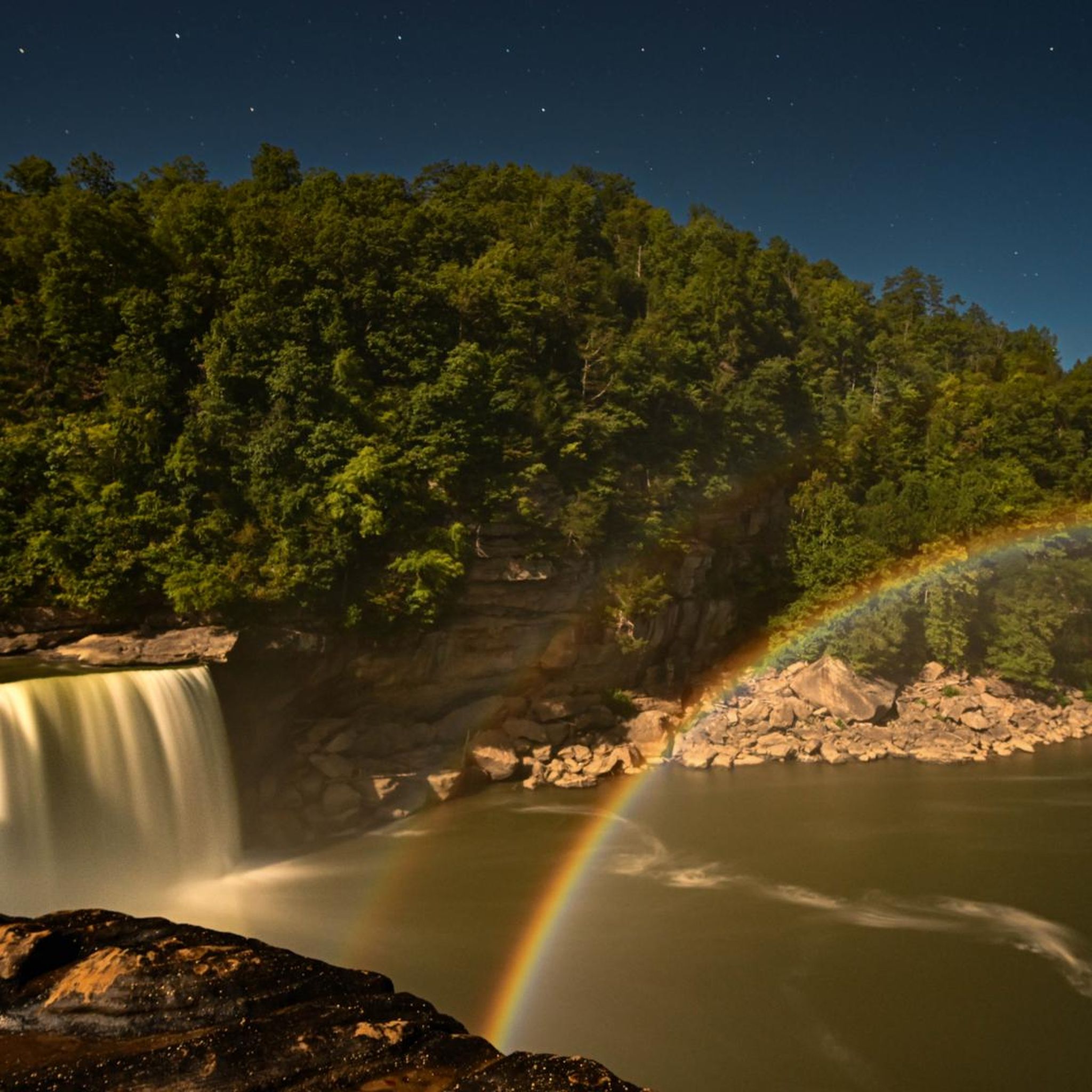
Beyond the trails themselves, McCreary County offers several attractions. You can visit Cumberland Falls, famous for its 'moonbow,' or explore the Devils Jump river overlook. The Blue Heron Railroad Bridge is another interesting historical site within the Big South Fork National River and Recreation Area.
Is there public transportation available to reach the trailheads in McCreary County?
Public transportation options directly to trailheads in McCreary County are generally limited. Most visitors find it easiest to access the running routes by car, as many trailheads are located within the Daniel Boone National Forest or the Big South Fork National River and Recreation Area, which are best reached by personal vehicle.
What is the best time of year for running in McCreary County?
The spring and fall seasons are generally considered the best times for running in McCreary County. Spring brings lush greenery and blooming wildflowers, while fall offers vibrant foliage. Both seasons typically have milder temperatures, making for more comfortable conditions compared to the heat and humidity of summer or the colder, potentially icy conditions of winter.
Most popular routes in McCreary County
Most popular attractions in McCreary County

Get inspired with the komoot mobile app


Explore more
Browse the best Running Trails & Routes in other regions.
