The best cycling routes in Pottawattamie County
4.5
(62)
510
riders
15
rides
Touring cycling in Pottawattamie County offers diverse landscapes, characterized by the unique Loess Hills, extensive riverfront paths along the Missouri River, and a robust network of trails. The region features a mix of prairies, wetlands, and woodlands, providing varied environments for cyclists. Many routes utilize converted railroad beds and connect to regional trail systems, making it a prominent cycling destination in Iowa.
Best touring cycling routes in Pottawattamie County
- The most popular touring cycling route is Bob Kerrey Pedestrian Bridge – Bob Kerrey Pedestrian Bridge loop from Vincent Bluff Preserve, a 27.9 miles (44.9 km) trail that takes 2 hours 41 minutes to complete, offering views of the Missouri River and connecting to Omaha.
- Another top favourite among local touring cyclists is Wabash Trace Trail – Tobey Jack's Steakhouse loop from Saint Paul Evangelical Country Church Cemetery, a moderate 17.5 miles (28.2 km) path that follows a converted railroad right-of-way through rural landscapes.
- Local touring cyclists also love the Tom Hanafan River's Edge Park – Bob Kerrey Pedestrian Bridge loop from Lewis Township, a 17.9 miles (28.9 km) trail leading through riverfront parks and across the pedestrian bridge, often completed in about 1 hour 51 minutes.
- Touring cycling in Pottawattamie County is defined by the Loess Hills, Missouri River Valley, and extensive trail networks, with options for easy rides along riverfronts and more moderate routes through varied terrain.
- The routes in Pottawattamie County are highly rated by the komoot community with an average score of 4.7 stars from over 29 reviews. More than 400 touring cyclists have used komoot to explore Pottawattamie County's varied terrain.
Last updated: June 28, 2026
5.0
(3)
60
riders
Moderate bike ride. Good fitness required. Mostly paved surfaces. Suitable for all skill levels.
5.0
(3)
52
riders
34.8km
03:10
200m
200m
Moderate bike ride. Good fitness required. Mostly paved surfaces. Suitable for all skill levels.

Sign up for free
4.8
(6)
28
riders
Moderate bike ride. Good fitness required. Mostly paved surfaces. Suitable for all skill levels.
5.0
(3)
22
riders
27.2km
02:11
130m
130m
Moderate bike ride. Good fitness required. Mostly paved surfaces. Suitable for all skill levels.
5.0
(2)
12
riders
Easy bike ride. Great for any fitness level. Mostly paved surfaces. Suitable for all skill levels.
5.0
(2)
11
riders
31.5km
02:26
120m
120m
Moderate bike ride. Good fitness required. Mostly paved surfaces. Suitable for all skill levels.
8
riders
13.9km
01:14
70m
70m
Easy bike ride. Great for any fitness level. Mostly paved surfaces. Suitable for all skill levels.
5.0
(2)
8
riders
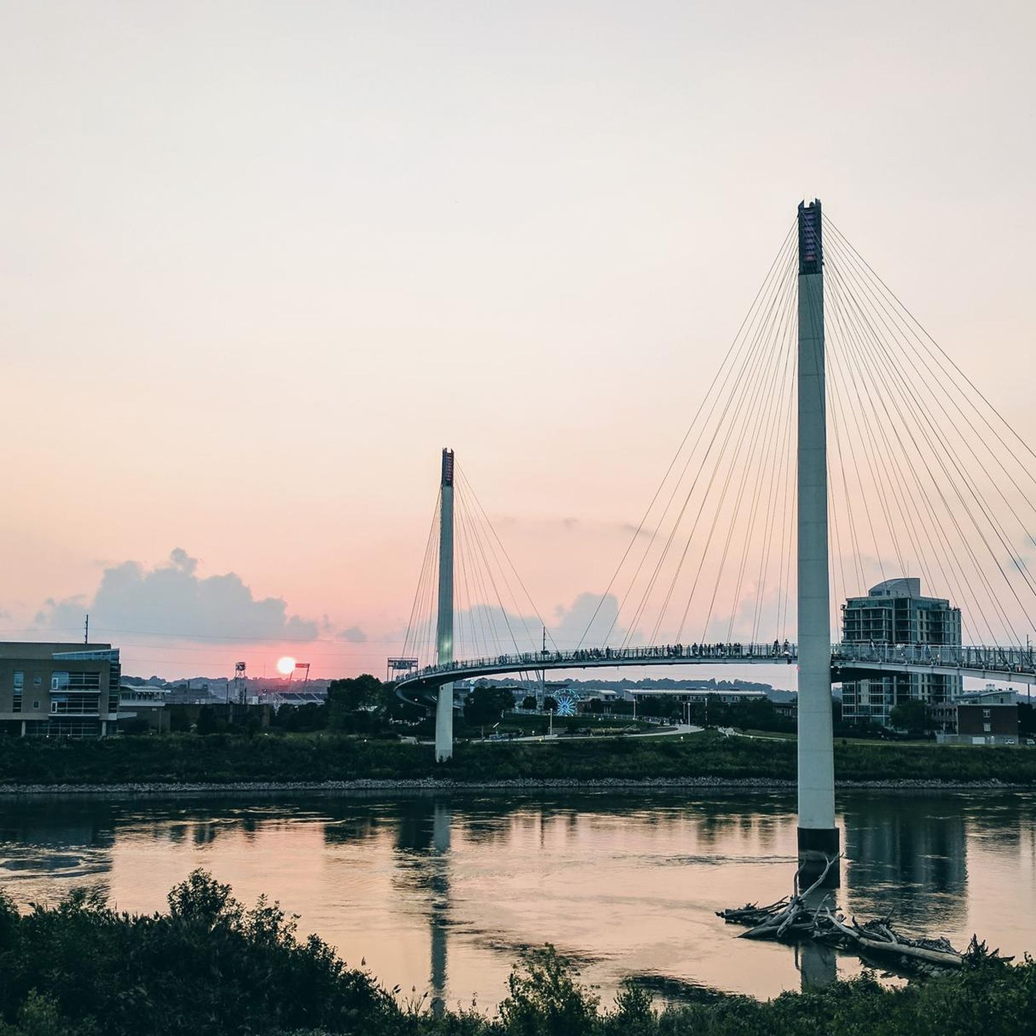
This easy 10.4-mile (16.8 km) touring bicycle loop around the Bob Kerrey Pedestrian Bridge offers a fantastic blend of urban views and riverside tranquility. You'll glide across smooth, paved surfaces, taking in panoramic vistas of the Missouri River and the Omaha skyline, including notable landmarks like the Qwest Center. The distinctive S-curve of the bridge itself is a visual highlight, leading you directly into Tom Hanafan River's Edge Park on the Iowa side, where you can enjoy more riverside scenery.
Starting from The Marketplace Council Bluffs, this route is incredibly accessible and requires no special permits or fees. It's an easy ride with only 116 feet (35 metres) of elevation gain, making it suitable for cyclists of all skill levels, including families. The entire loop can be comfortably completed in about 58 minutes, making it a perfect option for a quick, scenic outing.
The Bob Kerrey Pedestrian Bridge is more than just a crossing; it's a landmark that connects two states, offering a unique photo opportunity to stand with one foot in Iowa and the other in Nebraska. It also serves as a vital link to over 150 miles of interconnected trails in the Omaha and Council Bluffs metropolitan area, forming a key component of the Great American Rail-Trail. The bridge's architectural design and its role in riverfront redevelopment make it a significant regional feature.
4
riders
Easy bike ride. Great for any fitness level. Mostly paved surfaces. Suitable for all skill levels.
5
riders
Easy bike ride. Great for any fitness level. Mostly paved surfaces. Suitable for all skill levels.
Get access to more routes and recommendations from other explorers.
Sign up for free
Already have an account?
Our route recommendations are based on thousands of hikes, rides, and runs completed by other people on komoot.
Start today with a free account
Your next adventure awaits.
Login or Signup
Popular around Pottawattamie County



Other adventures in Pottawattamie County

Tips from the Community

You get a nice view of the river here, and could even park your bike and hop on a river cruise if you like. But the best thing about River Road (just south of you) is that it connects cycle-friendly paths on the north and south sides of I-80.
0
0

From here you gain an awesome view of the bendy Bob Kerrey Pedestrian Bridge. A real feat of engineering and an interesting perspective to view it from.
1
0

The Bob Kerrey Pedestrian Bridge is a 3,000-foot-long pedestrian bridge over the Missouri River between Council Bluffs, Iowa, and Omaha, Nebraska. It is a popular way for cyclist, runners and walkers to move between the two cities.
1
0
Tom Hanafan River's Edge Park is a 90-acre public park on the banks of the Missouri River. There is large lawn, several walking and running trails, picnic areas and restrooms.
1
0
The Bob Kerrey Pedestrian Bridge 3,000-foot-long pedestrian bridge over the Missouri River between Council Bluffs, Iowa, and Omaha, Nebraska. It is a popular way for cyclist, runners and walkers to move between the two cities.
2
0

OMAR is a troll that traveled Omaha and wants to share its experiences, especially with kids, in an interactive way. You can find him 'in person' under the Bob Kerrey Pedestrian Bridge.
2
0
The Lewis and Clark National Historic Trail Headquarters and Visitor Center provides visitors with a comprehensive experience related to the Lewis and Clark expedition of 1804–1806. Inside you can find informative exhibits, artifacts, and multimedia presentation about the journey.
2
0

The Bob Kerrey Pedestrian Bridge is a 3,000-foot-long pedestrian bridge over the Missouri River between Council Bluffs, Iowa, and Omaha, Nebraska. It opened on September 28, 2008.
1
0
Frequently Asked Questions
How many touring cycling routes are available in Pottawattamie County?
Pottawattamie County offers a diverse selection of touring cycling routes. You can find over 15 routes on komoot, catering to various preferences and skill levels.
What do other touring cyclists say about the routes in Pottawattamie County?
The touring cycling routes in Pottawattamie County are highly regarded by the komoot community, with an average rating of 4.7 stars from over 29 reviews. Cyclists often praise the varied landscapes, from the unique Loess Hills to scenic riverfront paths, and the extensive network of well-maintained trails.
Are there easy touring cycling routes suitable for beginners in Pottawattamie County?
Yes, Pottawattamie County has numerous easy touring cycling routes perfect for beginners. For example, the Tom Hanafan River's Edge Park – Bob Kerrey Pedestrian Bridge loop from Lewis Township is an easy 17.9-mile ride that takes you through riverfront parks and across the pedestrian bridge. Another accessible option is the Wabash Trace Trail loop from Lewis Township, offering a gentle 8.6-mile experience.
What are some options for longer touring cycling routes in the area?
For longer rides, consider the Bob Kerrey Pedestrian Bridge – Bob Kerrey Pedestrian Bridge loop from Vincent Bluff Preserve, which spans 27.9 miles and offers views of the Missouri River. Another great choice is the Tobey Jack's Steakhouse – Wabash Trace Nature Trail loop from Lewis Township, a moderate 21.6-mile route that explores rural landscapes.
Are there family-friendly touring cycling routes in Pottawattamie County?
Many of the trails in Pottawattamie County are suitable for families, especially those on converted railroad beds like sections of the Wabash Trace Nature Trail. These paths are generally flat and well-maintained, offering a safe and enjoyable experience for all ages. The paved trails within the City of Council Bluffs and around Lake Manawa State Park are also excellent family options.
Can I bring my dog on touring cycling routes in Pottawattamie County?
While many trails in Pottawattamie County are popular for outdoor activities, specific regulations regarding dogs on cycling routes can vary by park or trail section. It's always best to check the local rules for the specific trail you plan to ride. Generally, dogs on leashes are welcome in many public outdoor spaces, but always ensure they are under control and clean up after them.
Are there circular touring cycling routes in Pottawattamie County?
Yes, Pottawattamie County features several excellent circular touring cycling routes. Popular options include the Bob Kerrey Pedestrian Bridge – Bob Kerrey Pedestrian Bridge loop from Vincent Bluff Preserve and the Wabash Trace Trail – Tobey Jack's Steakhouse loop from Saint Paul Evangelical Country Church Cemetery. These loops allow you to start and end at the same point, making logistics easier.
What kind of landscapes can I expect to see while touring cycling in Pottawattamie County?
Pottawattamie County offers a diverse range of landscapes. You'll encounter the unique, wind-formed Loess Hills with their steep ridges and prairie remnants, scenic paths along the Missouri River Valley, and extensive networks through prairies, wetlands, and woodlands. The region's geological formations provide breathtaking views, especially from elevated points like the HawkWatch Tower at Hitchcock Nature Center.
Are there any notable attractions or points of interest along the touring cycling routes?
Absolutely. Many routes offer access to significant attractions. You can cycle across the iconic Bob Kerrey Pedestrian Bridge connecting Iowa and Nebraska, explore the natural beauty of Hitchcock Nature Center in the Loess Hills, or enjoy the recreational facilities at Lake Manawa State Park. Botna Bend Park also offers a unique opportunity to observe bison and elk near cycling trails.
What is the best time of year for touring cycling in Pottawattamie County?
Spring and fall generally offer the most pleasant conditions for touring cycling in Pottawattamie County, with milder temperatures and beautiful scenery. Spring brings blooming wildflowers, while fall showcases vibrant foliage in the Loess Hills. Summer can be enjoyable, but be prepared for warmer temperatures and ensure you stay hydrated. Winter cycling is possible, but trail conditions may vary due to snow and ice.
Where can I find parking for touring cycling routes in Pottawattamie County?
Parking is generally available at various trailheads and parks throughout Pottawattamie County. For routes utilizing the Wabash Trace Nature Trail, you can often find parking in towns along the trail. For routes near Council Bluffs, parks like Tom Hanafan River's Edge Park or areas near the Bob Kerrey Pedestrian Bridge typically offer parking facilities. Always check specific park or trailhead information for designated parking areas.
Are there any challenging touring cycling routes in Pottawattamie County?
While many routes are easy to moderate, the unique topography of the Loess Hills can introduce more challenging sections with steeper climbs. For instance, while the main touring routes are generally not classified as 'difficult' on komoot, exploring some of the trails within areas like Hitchcock Nature Center, though not strictly touring routes, can offer more strenuous climbs and descents for those seeking a challenge.
Most popular routes in Pottawattamie County

Get inspired with the komoot mobile app


Didn’t find what you were looking for?
Check out more Cycling routes throughout Pottawattamie County below and find the perfect route in your destination.
Explore more
Browse the best Cycling routes in other regions.
