The best walks and hikes in Unicoi County
4.3
(12)
186
hikers
22
hikes
Hiking in Unicoi County offers diverse landscapes within the Blue Ridge Mountains, largely encompassed by the Cherokee National Forest. The terrain features elevations ranging from under 1,700 feet to over 5,500 feet, providing varied scenic vistas. Hikers can explore old-growth forests, follow the Nolichucky River, and discover numerous mountain streams and waterfalls. This region provides a comprehensive outdoor experience for various skill levels.
Best hiking trails in Unicoi County
- The most popular hiking route is Appalachian Trail: Nolichucky River to…
Last updated: July 8, 2026
5
hikers
4.46km
01:23
220m
70m
This section of the Appalachian Trail from Sam's Gap to Hogback Ridge Shelter offers a taste of the iconic long-distance path without committing to an all-day trek. You'll navigate the…
5
hikers
12.5km
03:54
640m
130m
Hike the moderate 7.8-mile Appalachian Trail from Nolichucky River to Indian Grave Gap, featuring river views and 360-degree panoramas from

Sign up for free
3
hikers
4.54km
01:19
180m
40m
This section of the Appalachian Trail from Devil's Fork Gap to Flint Mountain Shelter offers a delightful forest experience, perfect for a relaxed outing. You'll wander through luscious woods on…
2
hikers
8.00km
02:24
310m
190m
Hike the moderate 5.0-mile Snakeden Ridge Loop in Rocky Fork State Park for mountain vistas, wildflowers, and cascades.
2
hikers
14.8km
04:34
600m
490m
Hike the moderate 9.2-mile Appalachian Trail section from Iron Mountain Gap to Hughes Gap, featuring forests, wildflowers, and views from Li
2
hikers
18.1km
05:26
590m
570m
Prepare for a demanding hike on the Appalachian Trail from Devil Fork Gap to Coldspring Mountain. This difficult 11.2-mile (18.1 km) section will challenge you with 1931 feet (589 metres)…
2
hikers
15.9km
04:36
420m
370m
Hike the moderate to strenuous 9.9-mile Blockstand Creek and Flint Creek Loop in Rocky Fork State Park, featuring diverse terrain and histor
1.50km
00:29
110m
0m
The Martin's Creek Falls trail in Erwin, Tennessee, offers a delightful, easy hike through the serene Cherokee National Forest, culminating in a beautiful 20-foot cascading waterfall. You'll start on a…
1.73km
00:39
200m
0m
Step into a unique high-elevation ecosystem on the Unaka Mountain via Appalachian Trail. This easy 1.1-mile (1.7 km) hike takes you through changing forest types, culminating in the dense, mysterious…
4.99km
01:38
320m
100m
Hike the 3.1-mile Dick Creek Falls Trail in Cherokee National Forest to a 60-foot waterfall and stunning views of the Chattooga River.
Get access to more routes and recommendations from other explorers.
Sign up for free
Already have an account?
Our route recommendations are based on thousands of hikes, rides, and runs completed by other people on komoot.
Start today with a free account
Your next adventure awaits.
Login or Signup





Tips from the Community

I found a recommendation for this special surface in a newsletter for residents in Traun. I was frustrated after a series of bad bets and actually wanted to stop playing. But Gates of Olympus 1000 https://gatesolympus1000-site.org/ offered me a fresh start with card games. I made a profit on the machines that immediately lifted my mood and covered my losses. I am very satisfied with the result today.
0
0
Safety and transparency are the most important criteria for many users when choosing a new portal today. With https://slotozen.com.de, you gain access to a licensed environment where fair gaming conditions and fast support are paramount. It is the ideal place for anyone who values quality and a reputable handling of their transactions.
0
0

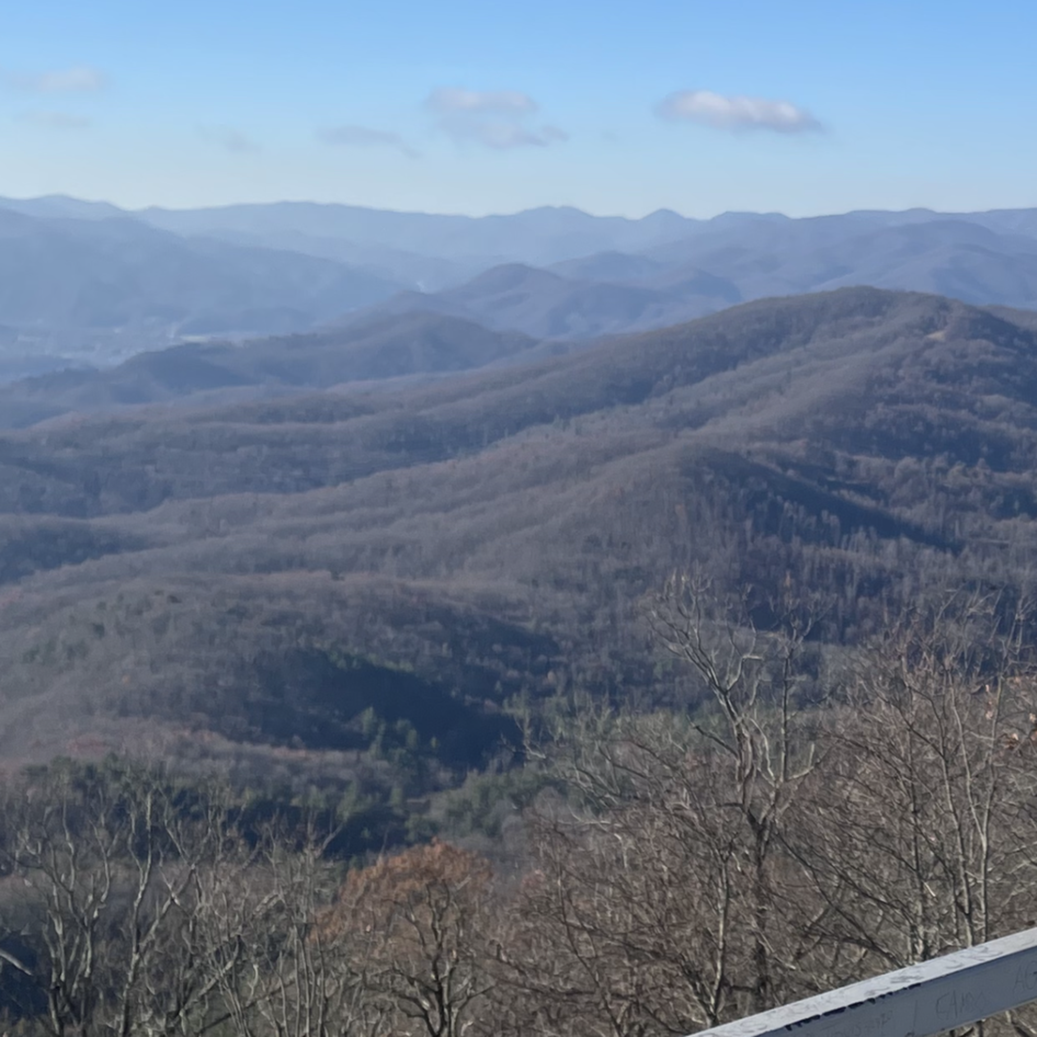
Little Rock Knob is a high point and scenic summit between Iron Mountain Gap and Hughes Gap along the Appalachian Trail. This small peak reaches up to 4,930 feet and views out in the Tennessee direction from the Tennessee/North Carolina state border.
0
0
Little Rock Knob is a high point and scenic summit between Iron Mountain Gap and Hughes Gap along the Appalachian Trail. This small peak reaches up to 4,930 feet and views out in the Tennessee direction from the Tennessee/North Carolina state border.
0
0
The Flint Mountain Shelter is conveniently located next to several water sources. There is also a picnic area and bear cables at this shelter area.
0
0
Sam's Gap is a popular parking area on the Appalachian Trail just outside of the town of Flag Pond, Tennessee. The parking area is situated below an interstate bridge so this area can get a bit noisy at times, but the Appalachian Trail stretches two different directions out of the parking lot and offers a quick escape from the interstate noise.
0
0
There is a natural viewing 'window' between the trees from a rock jutting out from the mountain. You can access this viewing area by following a short spur trail (marked with blue blazes) from the main Appalachian Trail for a few hundred feet. The view from High Rock is most expansive in the winter and late fall when the leaves on the trees have mostly fallen.
0
0
The Hogback Ridge Shelter is one of the many maintained sleeping shelters on the Appalachian Trail. There is a privy near the shelter and a water source only a few hundred feet away. This is an excellent picnic site or overnight camping spot. Please follow LNT practices, and don't attract animals to the shelter area by leaving food and trash behind.
0
0
Frequently Asked Questions
How many hiking trails are available in Unicoi County?
Unicoi County offers a wide variety of hiking experiences, with over 20 routes documented on komoot. These trails range from easy strolls to challenging multi-day treks, catering to all skill levels.
Are there any family-friendly hiking trails in Unicoi County?
Yes, Unicoi County has several options suitable for families. For an easy and picturesque walk, consider the Martin’s Creek Falls trail, which is just under a mile long and leads to a beautiful waterfall. The Erwin Linear Trail, a 4-mile paved path along the Nolichucky River, also offers a gentle option for all ages.
Which trails feature waterfalls in Unicoi County?
Unicoi County is known for its beautiful waterfalls. Besides the easy Martin’s Creek Falls, you can explore the Dick Creek Falls Trail, a moderate 3-mile hike. Other notable waterfalls in the region include Buckeye Falls, Pine Ridge Falls, Rock Creek Falls, and Rocky Fork Falls, offering refreshing stops along various routes.
What are some scenic viewpoints or landmarks to look for on Unicoi County hikes?
Hikers in Unicoi County can enjoy stunning panoramic views from several locations. The Beauty Spot bald and the Pinnacle Mountain Fire Tower on Buffalo Mountain offer 360-degree overlooks of the surrounding Blue Ridge Mountains. Many trails also wind through the enchanting Emerald Forest and along the Nolichucky River.
Are there any loop trails for hiking in Unicoi County?
Yes, for those who prefer not to retrace their steps, Unicoi County offers loop options. The Snakeden Ridge Loop is a moderate 5-mile trail that provides a varied experience. Another option is the longer Blockstand Creek and Flint Creek Loop, which covers nearly 10 miles through the forest.
What is the best time of year to go hiking in Unicoi County?
The best time to hike in Unicoi County largely depends on your preferences. Spring brings lush greenery and blooming wildflowers, while autumn offers spectacular fall foliage. Summer is popular for enjoying the cool mountain streams and waterfalls, though some trails can be more crowded. Winter hiking is possible, but requires appropriate gear for colder temperatures and potential snow at higher elevations.
Are there challenging trails for experienced hikers in Unicoi County?
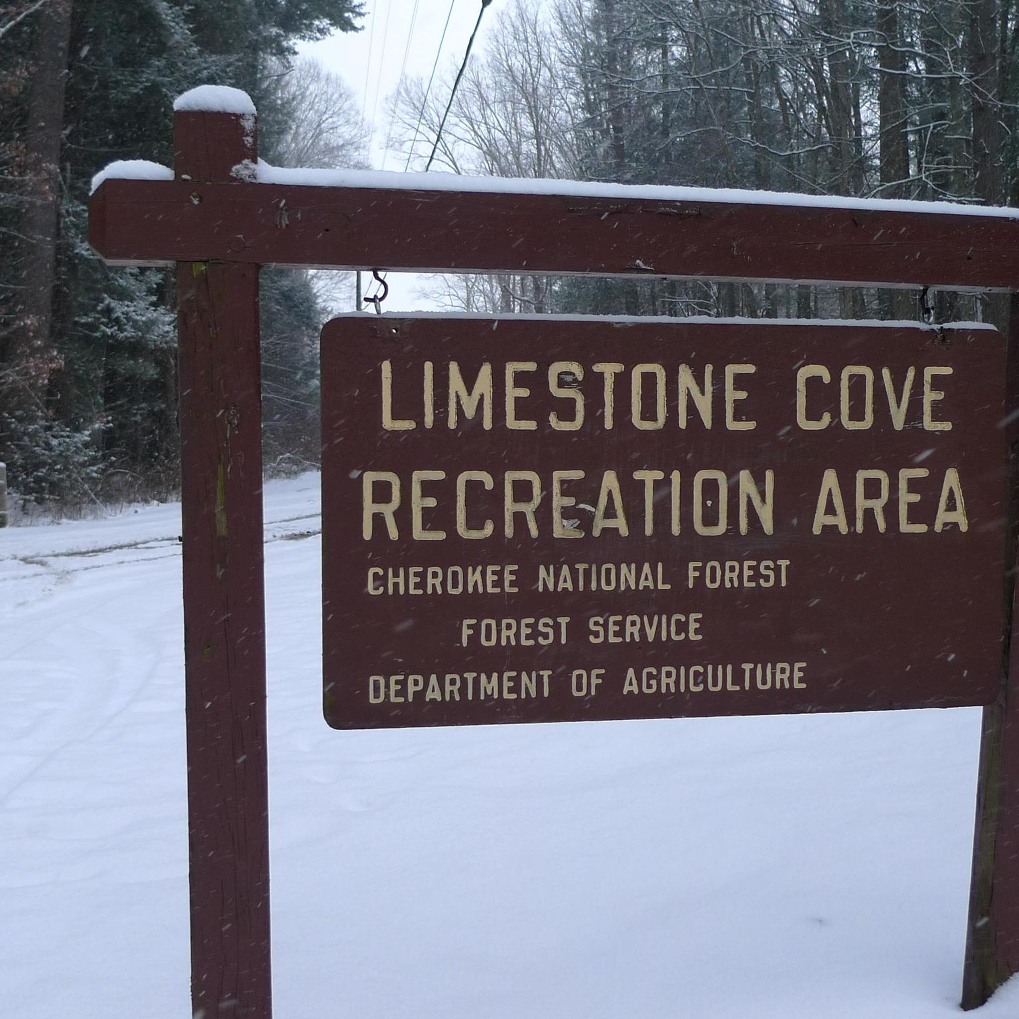
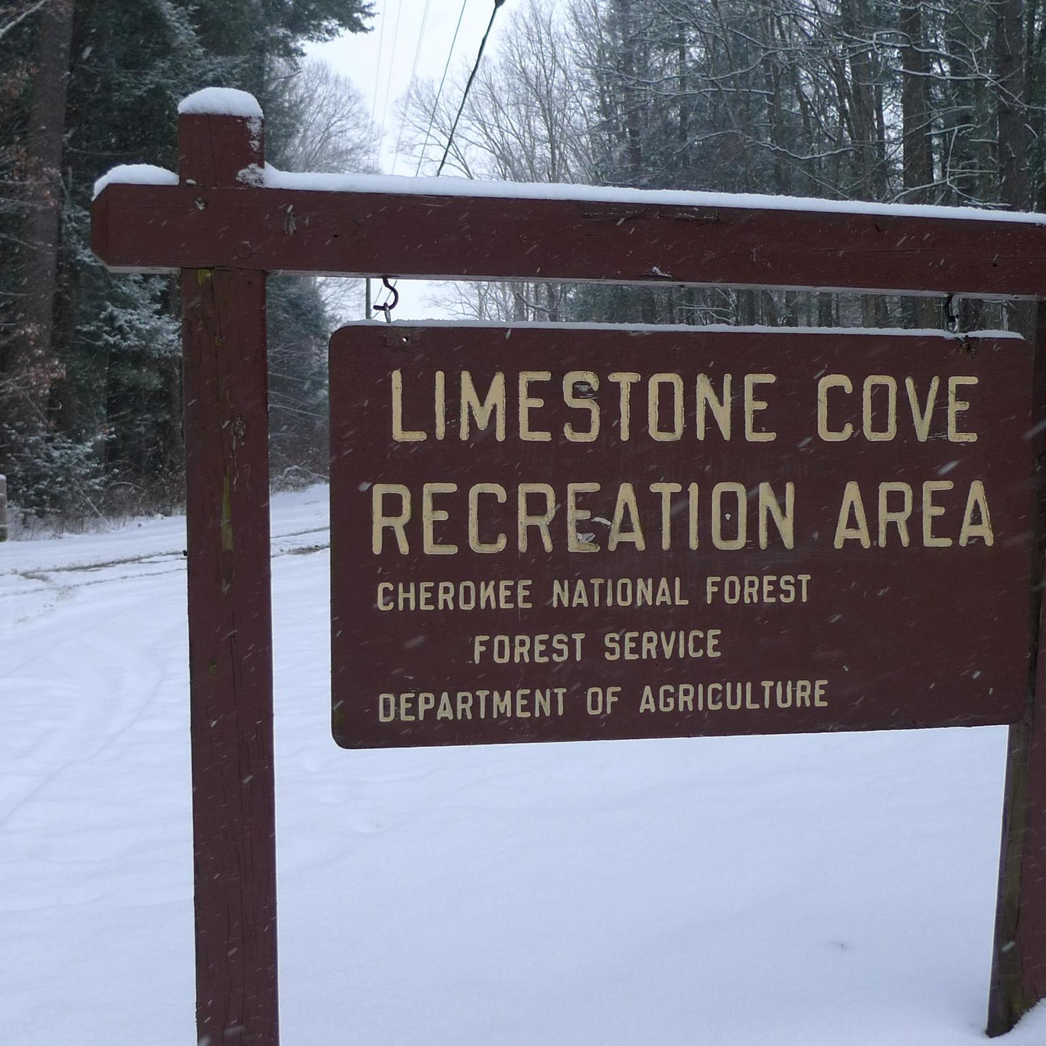
Absolutely. For experienced hikers seeking a challenge, the Appalachian Trail: Devil Fork Gap to Coldspring Mountain is a difficult 11.2-mile section. The Limestone Cove Trail also offers a challenging and secluded experience through thick foliage and creeks, ideal for those seeking solitude.
What are the parking options for Appalachian Trail access points in Unicoi County?
Unicoi County is recognized as an Appalachian Trail Community, providing several convenient trailheads. Parking availability varies by trailhead, but many popular access points, such as those near the Nolichucky River or Sam's Gap, offer designated parking areas. It's advisable to check specific trailhead information for detailed parking instructions before your hike.
What do other hikers enjoy most about hiking in Unicoi County?
The hiking routes in Unicoi County are highly rated by the komoot community, with an average score of 4.6 stars. Reviewers often praise the diverse landscapes, from dense old-growth forests to stunning mountain vistas, and the abundance of natural features like waterfalls and river valleys. The variety of trails, catering to all ability levels, is also frequently highlighted.
Are there any easy, shorter hikes for beginners in Unicoi County?
Yes, beginners have several easy options. Besides the Martin’s Creek Falls trail, you can try shorter sections of the Appalachian Trail like Appalachian Trail: Devil's Fork Gap to Flint Mountain Shelter (2.8 miles) or Appalachian Trail: Sam's Gap to Hogback Ridge Shelter (2.7 miles). The Unaka Mountain via Appalachian Trail is also an easy 1.1-mile hike.
Can I find information about public transport to trailheads in Unicoi County?
Public transport options directly to trailheads in Unicoi County are generally limited due to the rural and mountainous nature of the region. Most visitors rely on personal vehicles to access hiking routes. For more detailed information on local transportation, you might find resources on the official Unicoi County tourism website: visitunicoicounty.com.
What kind of terrain can I expect on Unicoi County hiking trails?
Unicoi County's terrain is rugged and diverse, with elevations ranging from under 1,700 feet to over 5,500 feet at Big Bald. You can expect trails to wind through dense old-growth forests, along the banks of the Nolichucky River, and beside numerous cool mountain streams. Many routes feature sustained climbs and descents, offering varied challenges and scenic rewards.
Most popular routes in Unicoi County

Get inspired with the komoot mobile app


Didn’t find what you were looking for?
Check out more Hikes throughout Unicoi County below and find the perfect route in your destination.
Explore more
Browse the best Hikes in other regions.
