The best walks and hikes in Chisago County
4.3
(14)
442
hikers
19
hikes
Hiking trails in Chisago County, Minnesota, traverse a landscape characterized by rolling hills, extensive wetlands, and significant waterways including the St. Croix River and numerous lakes. The region features diverse habitats and geological formations, notably glacial potholes and river bluffs. These natural elements contribute to varied hiking experiences across state parks and regional trails.
Best hiking trails in Chisago County
- The most popular hiking route is Lake of the Dalles, Eagle Peak, Skyline and Ice Age Loop, an easy 4.2 miles (6.8 km) trail that takes 1 hour 53 minutes to complete. This route offers views of unique glacial formations and river scenery.
- Another top favourite among local hikers is Old Military Road, Deer Creek, and Pioneer Trail Loop, a moderate 7.2 miles (11.6 km) path. This trail winds through diverse habitats, including sections near Deer Creek, providing opportunities for wildlife observation.
- Local hikers also love the Allemansrätt Wilderness Loop, a 1.1 miles (1.8 km) trail leading through woodlands and wetlands, often completed in about 27 minutes.
- Hiking in Chisago County is defined by river valleys, glacial features, and lake views. The network offers options for different ability levels, from easy loops to more challenging moderate paths.
- The routes in Chisago County are highly rated by the komoot community with an average score of 4.7 stars from over 10 reviews. More than 300 hikers have used komoot to explore Chisago County's varied terrain.
Last updated: September 27, 2026
5.0
(1)
11
hikers
6.75km
01:53
130m
110m
The Lake of the Dalles, Eagle Peak, Skyline and Ice Age Loop offers a delightful blend of natural beauty and geological wonder within Interstate State Park. You'll wander past the serene Lake O' The Dalles, climb to viewpoints on Eagle Peak, and find moments of quiet solitude on the Skyline Trail, often surrounded by vibrant green foliage. The trail also guides you through sections of the renowned Ice Age National Scenic Trail, where you can witness unique glacial features like potholes and eskers, making for a truly engaging experience.
This easy 4.2-mile (6.8 km) hike, with a modest 436 feet (133 metres) of elevation gain, typically takes around 1 hour and 52 minutes to complete. It's an ideal choice for families or anyone seeking a rewarding outdoor experience without a strenuous climb. Parking is available within Interstate State Park; arriving earlier in the day is often best to secure a spot, especially on weekends.
What makes this loop particularly special is its connection to the Ice Age National Scenic Trail, showcasing the dramatic impact of ancient glaciers on the Wisconsin landscape. This trail is a fantastic way to explore diverse ecosystems, from forested valleys to unique geological formations, offering a comprehensive overview of the park's natural heritage and making it one of the popular trails in the area.
4
hikers
11.6km
03:03
100m
100m
Hike the moderate 7.2-mile Old Military Road, Deer Creek, and Pioneer Trail Loop in Wild River State Park, gaining 340 feet.

2
hikers
1.78km
00:28
10m
10m
The Allemansrätt Wilderness Loop offers a delightful, easy hike through 125 acres of diverse wilderness, perfect for a quick nature immersion. As you follow the mostly unpaved path, you'll encounter unique glacial eskers, tranquil ephemeral wetlands, and a vibrant oak forest. Keep an eye out for the scenic views of Bull Lake, the North Lindstrom Lake channel, and North Center Lake, which provide a serene backdrop to this accessible route.
Located within Allemansrätt Park in Lindstrom, Minnesota, the trailhead is easy to find, and parking is readily available. This 1.1-mile (1.8 km) loop has a minimal 37 feet (11 metres) of elevation gain, making it an easy hike suitable for all skill levels, and you can comfortably complete it in about 27 minutes. It's a great option for a spontaneous outdoor adventure.
What truly sets this trail apart is its connection to the Swedish principle of Allemansrätten, or "every man's right" to nature, which the park actively promotes through its accessible design. Beyond the loop, the park offers additional attractions like the Anderson Historical House and a pavilion on Bull Lake, and it's a haven for birdwatchers, with over 100 species migrating through seasonally.
1
hikers
5.57km
01:28
50m
50m
The Old Logging Trail in Wild River State Park offers a wonderfully accessible and easy outdoor experience, perfect for a relaxed outing. This paved path winds through a landscape of tall pines and mixed hardwoods, often paralleling the scenic St. Croix River, providing pleasant views of the water and forested valley. It's a gentle 3.5-mile (5.6 km) route with only 163 feet (50 metres) of elevation gain, making it an easy hike that takes about 1 hour and 28 minutes.
This multi-use trail is incredibly versatile, accommodating hikers, bikers, runners, and even snowshoers or Nordic skiers in winter. Dogs are welcome, so you can bring your canine companion along for the adventure. As it's located within Wild River State Park, you'll find it well-integrated into the park's network, offering a straightforward and enjoyable way to explore the natural surroundings.
What makes this trail stand out is its commitment to accessibility and varied use, a stark contrast to more rugged logging paths. It provides a wide, scenic corridor along the St. Croix River, allowing for expansive views without demanding strenuous effort. It's an excellent option if you're looking for a family-friendly route or a gentle way to enjoy the park's natural beauty throughout the year.
5.0
(2)
61
hikers
4.53km
01:12
50m
40m
The Railroad and Walter F. Mondale River Trail Loop offers a delightful escape into nature, winding along the scenic St. Croix River. You'll experience a mix of natural and gravel paths, with some stone and wooden stairs, as you pass dramatic sandstone bluffs and get up close to the fascinating glacial potholes. It's an easy 2.8-mile (4.5 km) hike with 149 feet (46 metres) of elevation gain, typically taking about 1 hour and 12 minutes to complete.
To plan your visit, head to Interstate State Park. There's parking available, but it's wise to arrive early, especially during peak times, to ensure you find a spot. Remember that park entrance fees usually apply. This trail is a great option for a casual outing, offering beautiful river views and geological wonders without requiring a full day's commitment.
This loop is particularly notable for its unique geological features, including over 400 glacial potholes, some of the deepest in the world, formed by ancient glaciers. The route also follows parts of the historic Railroad Trail, tracing the path of the old Northern Pacific Railroad and offering glimpses into the region's logging past. It's a fantastic way to experience the natural beauty and history of the St. Croix River Valley.
4.3
(3)
20
hikers
6.65km
01:51
120m
120m
The Lake O' The Dalles and Potholes Loop offers a captivating blend of natural beauty and geological wonders, making it a standout among Lake O' The Dalles Potholes Loop routes. You'll traverse diverse terrain, from serene lake shores around Lake O' The Dalles to dramatic rock formations on the Pothole Trail, where ancient glacial meltwaters carved unique, deep potholes. The trail winds through wooded areas, providing glimpses of the St. Croix River gorge and culminating in breathtaking panoramic views from viewpoints like Summit Rock. This 4.1-mile (6.6 km) hike, with 401 feet (122 metres) of elevation gain, is rated easy and typically takes about 1 hour and 50 minutes, offering a rewarding experience without being overly strenuous.
To plan your visit, head to Interstate State Park in St. Croix Falls, Wisconsin. While the overall route is easy, be aware that certain segments, particularly on the Pothole Trail and the ascent to Summit Rock, feature steep, rocky paths and stone stairs that can be tricky, especially when wet or covered with leaves. Parking is available at the park, but arriving early is recommended during peak times. Always check the park's official website for any current conditions or advisories before you go.
This trail is a geological marvel, showcasing a significant concentration of glacial potholes, which are a primary highlight and a testament to the powerful forces that shaped this landscape. It also serves as the western terminus of the extensive 1,200-mile Ice Age National Scenic Trail, adding a layer of historical significance to your hike. The stunning St. Croix River Gorge, often called "The Dalles," provides a dramatic backdrop, carved by the river that forms the natural border between Wisconsin and Minnesota.
1
hikers
13.9km
03:36
90m
90m
The Wild River State Park Loop offers a delightful journey through Minnesota's diverse ecosystems, blending restored prairies with serene oak woods and bottomland forests. You'll enjoy long stretches alongside the federally designated Wild and Scenic St. Croix River, where bald eagles and otters are common sights, creating a peaceful and immersive natural experience. The trail's varied terrain, including some rolling hills, keeps things interesting without being overly strenuous.
This moderate hiking route covers 8.6 miles (13.9 km) with 284 feet (86 metres) of elevation gain, typically taking around 3 hours and 36 minutes. The park is about an hour from the Twin Cities, making it an easy day trip. While beautiful in spring and summer with wildflowers, the fall foliage is particularly stunning, and winter offers groomed trails for skiing and snowshoeing.
Beyond its natural beauty, the park holds historical significance, with sections of the Old Military Road dating back to 1853. Its designation as a National Wild and Scenic River ensures a pristine environment, perfect for wildlife observation and a quiet escape. The interconnected loop system allows for custom adventures, making it a versatile choice for many hikers.
1
hikers
20.1km
05:08
60m
60m
Embark on the Swedish Immigrant Regional Trail for a unique journey through Chisago County, Minnesota, often called "America's Little Sweden." This 12.5-mile (20.1 km) route, while rated difficult due to its length, offers a relatively gentle 213 feet (65 metres) of elevation gain, making it a long but accessible hike. You'll wander through diverse scenery, from lush forests and serene lakes to rolling pastoral lands, reminiscent of Småland, Sweden, the homeland of many early immigrants. The trail's historical significance is palpable, with interpretive signage telling the stories immortalized in Vilhelm Moberg's "Emigrant novels." Expect a rewarding 5 hours and 7 minutes on this immersive path.
Accessing the Swedish Immigrant Regional Trail is convenient, with the Swedish Immigrant Trailhead serving as a primary starting point. The trail is multi-use and open year-round, welcoming hikers, cyclists, and even snowshoers in winter, so you can plan your visit according to your preferred activity and season. While the path is generally flat, following a former rail corridor with a hard surface, be aware that some sections, like parts of Government Street, can feature steep grades of 14-16%. This trail is an excellent option if you're looking for a long, engaging day out without extreme vertical challenges.
Beyond its natural beauty, the Swedish Immigrant Regional Trail is a crucial historical and community connector. It links several cities, including Chisago City, Lindström, and Taylors Falls, providing a safe path for recreation and alternative transportation. The trail's development aims to meet 21st-century standards, ensuring a pleasant experience while honoring the region's past. You can also connect to other regional trails and local attractions like Eichten's Cheese & Bison Farm, making it a central hub for exploration in Chisago County.
23
hikers
5.49km
01:25
30m
30m
Easy hike. Great for any fitness level. Easily-accessible paths. Suitable for all skill levels.
17
hikers
Easy hike. Great for any fitness level. Easily-accessible paths. Suitable for all skill levels.
Get access to more routes and recommendations from other explorers.
Already have an account?
Our route recommendations are based on thousands of hikes, rides, and runs completed by other people on komoot.
Start today with a free account
Your next adventure awaits.

Other adventures in Chisago County

Tips from the Community

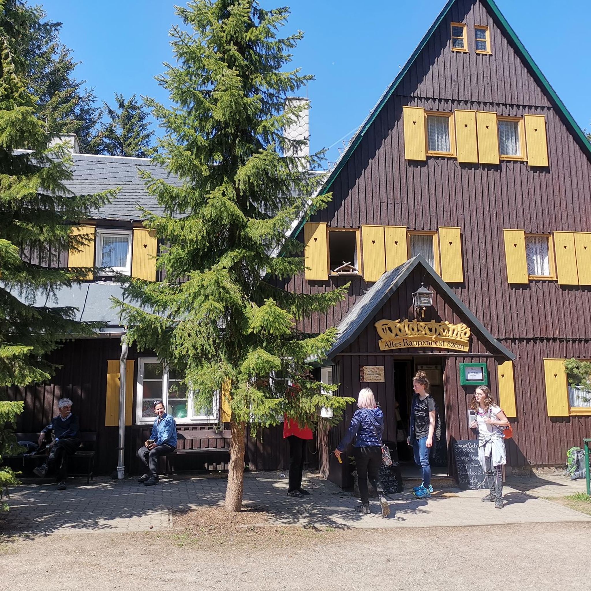
Not sure I have ever seen inside this building, as I'm usually here in the late fall or winter
1
0
Beach changing building plus beach. On a day like today it looked nice to jump in.
3
0
I have not been in this building, but it's a neat building for sure.
0
0
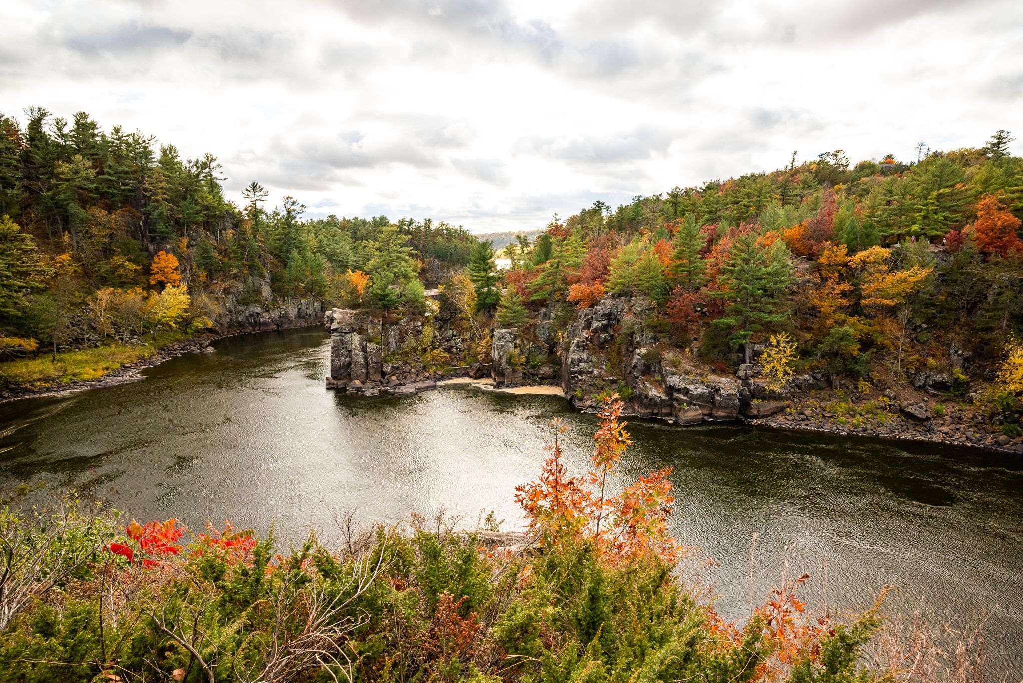
Probably one of the most highly trafficked of the Minnesota's State Parks. Worth at least the short walk around the potholes, and check out more of the park or the Wisconsin side which is much bigger.
1
0

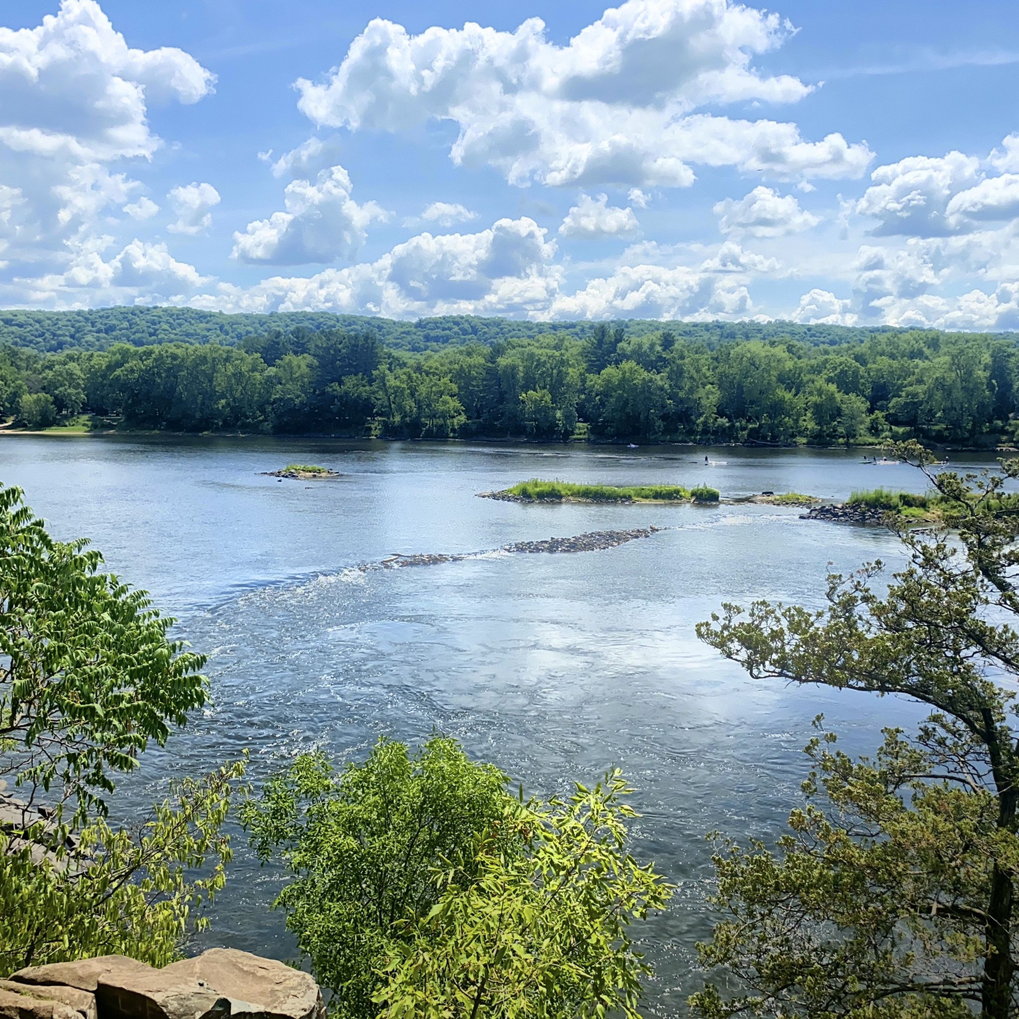
This section of the Walter Mondale Trail is fairly easy. If you continue downstream, you will reach a trail that heads inland and hugs, then ascends, a sandstone bluff that is significantly more challenging.
0
0

The Swedish Immigrant Trailhead is a parking area and a starting point for the Swedish Immigrant Regional Trail, a 20-mile, multi-use trail that celebrates the history and culture of the Swedish immigrants who settled in Chisago County in the late 1800s.
0
1
Great spot along the Swedish Immigrant Trail to take a rest and have a picnic.
0
0
Frequently Asked Questions
How many hiking trails are available in Chisago County?
Chisago County offers a wide range of hiking experiences, with over 20 routes documented on komoot. These trails cater to various skill levels, from easy strolls to more challenging paths.
Are there easy or beginner-friendly hiking trails in Chisago County?
Yes, Chisago County has numerous easy trails perfect for beginners or those seeking a relaxed walk. For example, the Allemansrätt Wilderness Loop in Lindström is an easy 1.1-mile path through woodlands and wetlands. Another accessible option is the Old Logging Trail in Wild River State Park, which is about 3.5 miles long.
What are some family-friendly hiking options in Chisago County?
Many trails in Chisago County are suitable for families. The Lake of the Dalles, Eagle Peak, Skyline and Ice Age Loop in Interstate State Park is an easy 4.2-mile trail offering unique glacial formations and river views. Additionally, the paved sections of the Swedish Immigrant Regional Trail are great for strollers and wheelchairs, providing an accessible outdoor experience.
Are dogs allowed on hiking trails in Chisago County?
Generally, dogs are welcome on trails in Chisago County parks and state parks, provided they are kept on a leash. It's always a good idea to check specific park regulations before you go, but many trails, including those in Wild River State Park and Interstate State Park, are dog-friendly.
Where can I find trails with scenic viewpoints or natural features?
For stunning views and unique natural features, head to Interstate State Park. The Lake O' The Dalles and Potholes Loop offers dramatic cliff-top views of the St. Croix River and allows you to explore the famous glacial potholes (Glacial Potholes, Interstate State Park). Wild River State Park also provides excellent river views along its extensive trail system.
Are there any loop hikes available in Chisago County?
Yes, several trails in Chisago County are designed as loops, offering varied scenery without retracing your steps. Beyond the Allemansrätt Wilderness Loop, you can explore the Railroad and Walter F. Mondale River Trail Loop in Interstate State Park, an easy 2.8-mile option. The Wild River State Park Loop is a longer, moderate 8.6-mile option for those seeking a more extensive circular route.
What is the best time of year to go hiking in Chisago County?
Chisago County offers beautiful hiking experiences year-round. Spring brings wildflowers, while summer is ideal for enjoying the lakes and rivers. Fall is particularly popular for its vibrant foliage along the St. Croix River Valley. Even winter offers opportunities for snowshoeing and cross-country skiing on many trails.
Are there any long-distance or challenging hikes in the area?
For a longer, moderate hike, consider the Old Military Road, Deer Creek, and Pioneer Trail Loop, which spans 7.2 miles through diverse habitats. The Swedish Immigrant Regional Trail, while paved, offers a challenging distance of over 12 miles for a long day hike or bike ride.
What kind of natural landmarks can I expect to see while hiking?
Chisago County is rich in natural landmarks shaped by glacial activity. You'll encounter unique glacial potholes at Interstate State Park, dramatic river bluffs along the St. Croix River, and diverse wetlands and forests. Many trails also offer views of the county's numerous lakes, such as Green Lake and Chisago Lake.
Is parking available at the trailheads?
Most state parks and regional trails in Chisago County, such as Wild River State Park and Interstate State Park, provide designated parking areas. For specific information on parking facilities, you can often find details on the respective park websites or by checking the komoot tour details. Some state parks may require a vehicle permit.
What do other hikers enjoy most about hiking in Chisago County?
The hiking experiences in Chisago County are highly rated by the komoot community, with an average score of 4.7 stars. Reviewers often praise the diverse landscapes, including river views and glacial features, as well as the well-maintained trails that cater to various skill levels. The tranquility and opportunities for wildlife observation are also frequently highlighted.
Are there any trails that feature waterfalls?
While Chisago County is not known for large, permanent waterfalls, Interstate State Park's Sandstone Bluffs Trail (0.9-mile loop) can feature intermittent waterfalls, especially after significant rainfall. The dramatic bluffs and river views are a constant draw regardless.
Most popular routes in Chisago County
Most popular attractions in Chisago County

Get inspired with the komoot mobile app


Didn’t find what you were looking for?
Check out more Hikes throughout Chisago County below and find the perfect route in your destination.
Explore more
Browse the best Hikes in other regions.
