The best running trails around Lake Luzzone
5.0
(1)
47
runners
14
runs
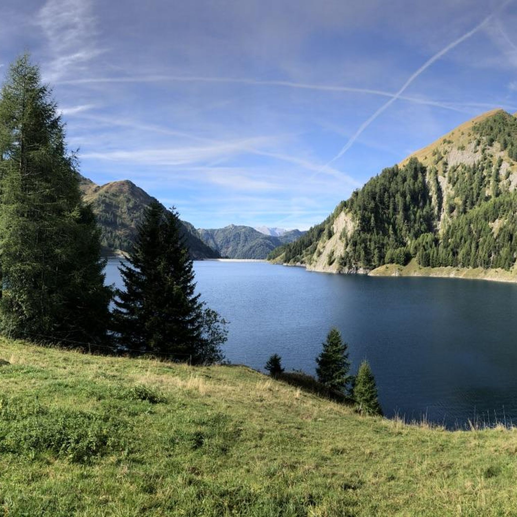
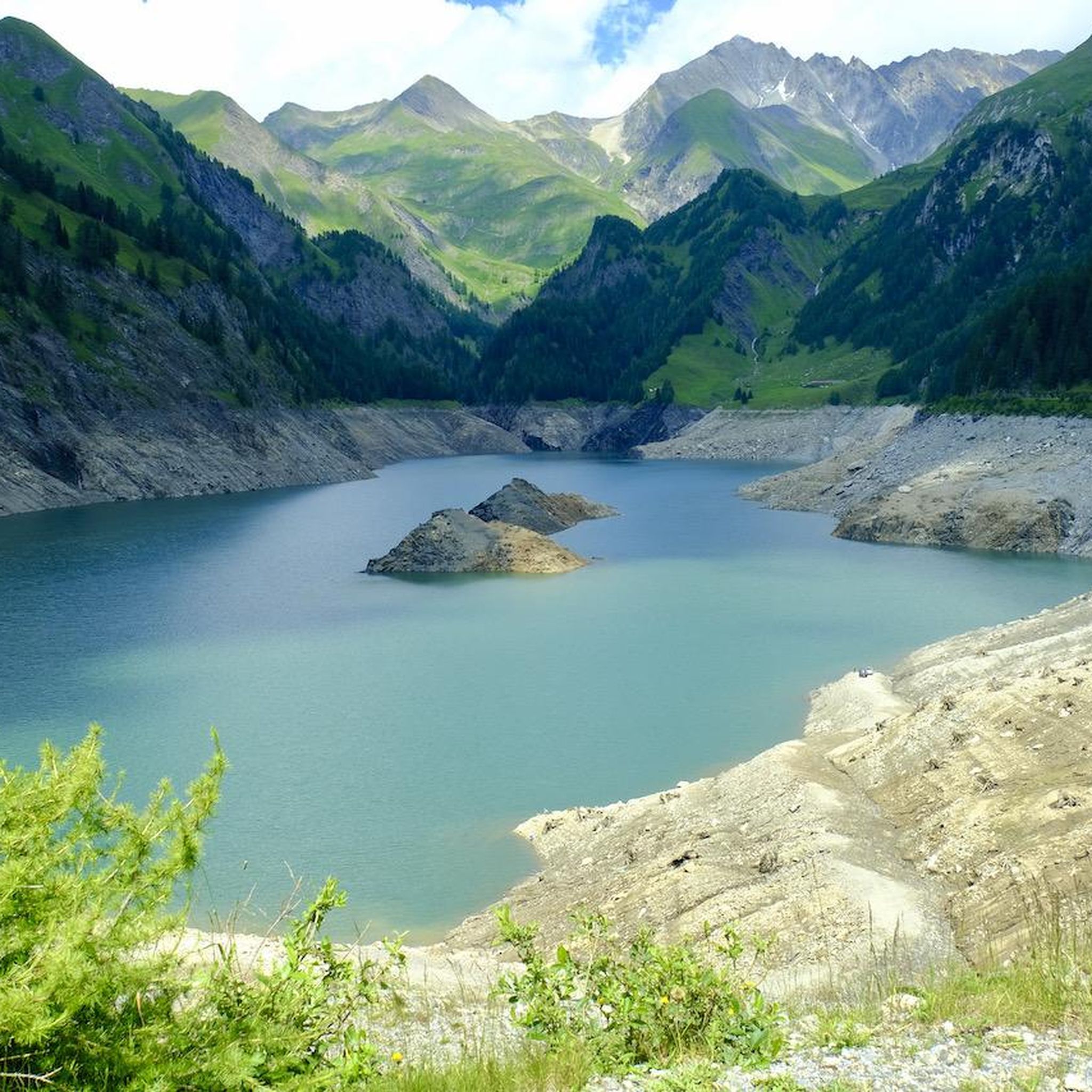
Jogging routes around Lake Luzzone are set within the upper Blenio Valley of Ticino, Switzerland, at an elevation of approximately 1,606 meters. The region is characterized by the majestic peaks of the Adula Alps, with several rising over 3,000 meters, providing an alpine panorama. The landscape also features the serene lake itself, the impressive Luzzone Dam, and the Ri di Mutarasc Gorge with its suspension bridge. These elements combine to create a diverse environment for running.
Best jogging routes around…
Last updated: August 9, 2026
5
runners
19.9km
02:51
990m
990m
Hard run. Very good fitness required. Mostly paved surfaces. Suitable for all skill levels.
11.7km
03:51
1,370m
1,370m
Hard run. Very good fitness required. Sure-footedness, sturdy shoes and alpine experience required.

Sign up for free
5.0
(1)
11
runners
8.04km
00:59
200m
190m
Hard run. Good fitness required. Sure-footedness, sturdy shoes and alpine experience required.
7
runners
Hard run. Good fitness required. Sure-footedness, sturdy shoes and alpine experience required.
3
runners
20.8km
03:25
1,150m
1,150m
Hard run. Very good fitness required. Sure-footedness, sturdy shoes and alpine experience required.
Get access to more routes and recommendations from other explorers.
Sign up for free
Already have an account?
Our route recommendations are based on thousands of hikes, rides, and runs completed by other people on komoot.
Start today with a free account
Your next adventure awaits.
Login or Signup

Tips from the Community

Pizzo Cassinello exceeds 3100 m above sea level and is one of the most accessible peaks above 3,000 m in all of Ticino.
1
0
From the crest of the Soreda pass you can admire the majesty of the Alpine reliefs. Located at over 2700 meters, the pass can have modest snow accumulations even in summer.
1
0
The Scardara valley is enclosed between suggestive rock walls (particularly loved by boulders), comfortable green meadows and the fresh stream.
1
0
The Gorda hut is an alpine refuge at almost 1800 m above sea level. It's a perfect place for a regenerating break during a run.
1
0

This Tibetan bridge was recently built between the two towns of Aquila and Olivone, allowing cyclists and walkers to cross the Riasc watercourse. Always be careful when crossing as the surface can be slippery.
0
0
The path is a semi-flat double track where you can run or cycle with serenity, immersing yourself in nature.
1
0
Here, to cross the Riasc stream, run onto a Tibetan bridge where it is good to be careful and a splendid panorama opens up.
1
0
Lake Luzzone is located in the upper Blenio valley at 1590 meters above sea level. It is an artificial basin originating from a 225 meter high dam and completed in 1963.
2
0
Frequently Asked Questions
What types of running routes can I find around Lake Luzzone?
The Lake Luzzone area offers a diverse network of running paths, ranging from easy strolls to more challenging mountain routes. You'll find options suitable for various ability levels, with a mix of alpine scenery, lake views, and forest trails. There are 15 routes listed in total, with 1 easy, 2 moderate, and 12 difficult options.
Are there any easy or beginner-friendly jogging routes in the Lake Luzzone region?
Yes, while many routes are challenging, there is at least one easy running route available. The area also features 'easy hikes and walks' with mostly accessible paths, which can be suitable for beginner joggers or those looking for a more relaxed run. These often include paths around the lake itself or through less steep terrain.
What are some notable natural attractions or scenic viewpoints along the running trails?
Runners can enjoy breathtaking alpine panoramas of the Adula Alps, including peaks like Piz Terri and Plattenberg. Key natural attractions include the impressive Val Scaradra Waterfall and the scenic Ri di Mutarasc Gorge, which features a suspension bridge. The tranquil lake itself, surrounded by lush greenery, also provides serene views.
Are there any interesting landmarks or engineering marvels to see while running?
Absolutely. The most prominent landmark is the impressive Luzzone Dam, a 225-meter-high structure that offers unique perspectives of the lake and mountains. You can also experience the Lago di Luzzone Tunnel, an 800-meter-long, well-lit footpath that adds an interesting element to some routes.
What is the best time of year to go running around Lake Luzzone?
The region is best enjoyed for running during the warmer months, typically from late spring to early autumn, when trails are clear of snow and the alpine scenery is at its most vibrant. During these seasons, the weather is generally more favorable, and all routes are accessible. Winter running might be possible on lower elevation paths, but higher alpine routes could be closed due to snow.
Are there any circular running routes available near Lake Luzzone?
Yes, the area offers several loop tours. For example, the difficult From Lago di Luzzone to Pizzo Cassinello – loop tour is a popular choice, providing extensive mountain views. Another option is the Campo Blenio loop from Sosto, which takes you through varied terrain.
How long are the running trails in this area?
The running trails around Lake Luzzone vary significantly in length. You can find shorter routes, such as the difficult Tibetan Bridge over the Risciao – Lower Trail loop from Distretto di Blenio at approximately 5.2 km (3.2 miles). Longer, more challenging options include the Carassino Valley High Route, which spans nearly 20 km (12.4 miles).
Is Lake Luzzone a good destination for family-friendly running or walks?
While many routes are rated as difficult, the region does offer 'easy hikes and walks' with mostly accessible paths, which can be suitable for families looking for a less strenuous activity. These paths often feature manageable elevation gains and scenic views, making them enjoyable for all ages.
What are the parking options for accessing the running routes?
Specific parking details for each route are usually available on the individual komoot tour pages. However, given the area's popularity for outdoor activities, there are generally designated parking areas near key access points, such as the Lago di Luzzone Tunnel and Bus Stop, which serves as a common starting point for many trails.
How can I reach Lake Luzzone using public transport?
Public transport access to Lake Luzzone is available, with a bus stop located near the Lago di Luzzone Tunnel. This allows runners to reach the starting points of various trails without needing a car. It's advisable to check local bus schedules for the most up-to-date information on routes and timings.
Are there any cafes or restaurants near Lake Luzzone for a post-run refreshment?
While the immediate vicinity of Lake Luzzone is quite alpine and remote, the broader Blenio Valley, where the lake is situated, offers amenities. You might find cafes or restaurants in nearby villages such as Olivone or Campo Blenio, which are accessible from some of the running routes or a short drive away.
What do other runners say about the trails around Lake Luzzone?
The running routes around Lake Luzzone are highly regarded by the komoot community, with an average rating of 5.0 stars from a single review. Over 50 runners have used komoot to explore this varied terrain, often praising the stunning alpine views, the unique combination of natural beauty and engineering marvels like the Luzzone Dam, and the diverse range of trails available.
Can I bring my dog on the running trails around Lake Luzzone?
Generally, many outdoor trails in Switzerland are dog-friendly, provided dogs are kept on a leash, especially in areas with livestock or wildlife. While specific restrictions for Lake Luzzone trails are not detailed, it's usually safe to assume well-behaved dogs are welcome. Always ensure you carry water for your dog and clean up after them.
Most popular routes around Lake Luzzone
Most popular attractions around Lake Luzzone

Get inspired with the komoot mobile app


Explore more
Browse the best Running Trails & Routes in other regions.
