The best road cycling routes around Lake del Narèt
4.5
(205)
10,998
riders
18
rides
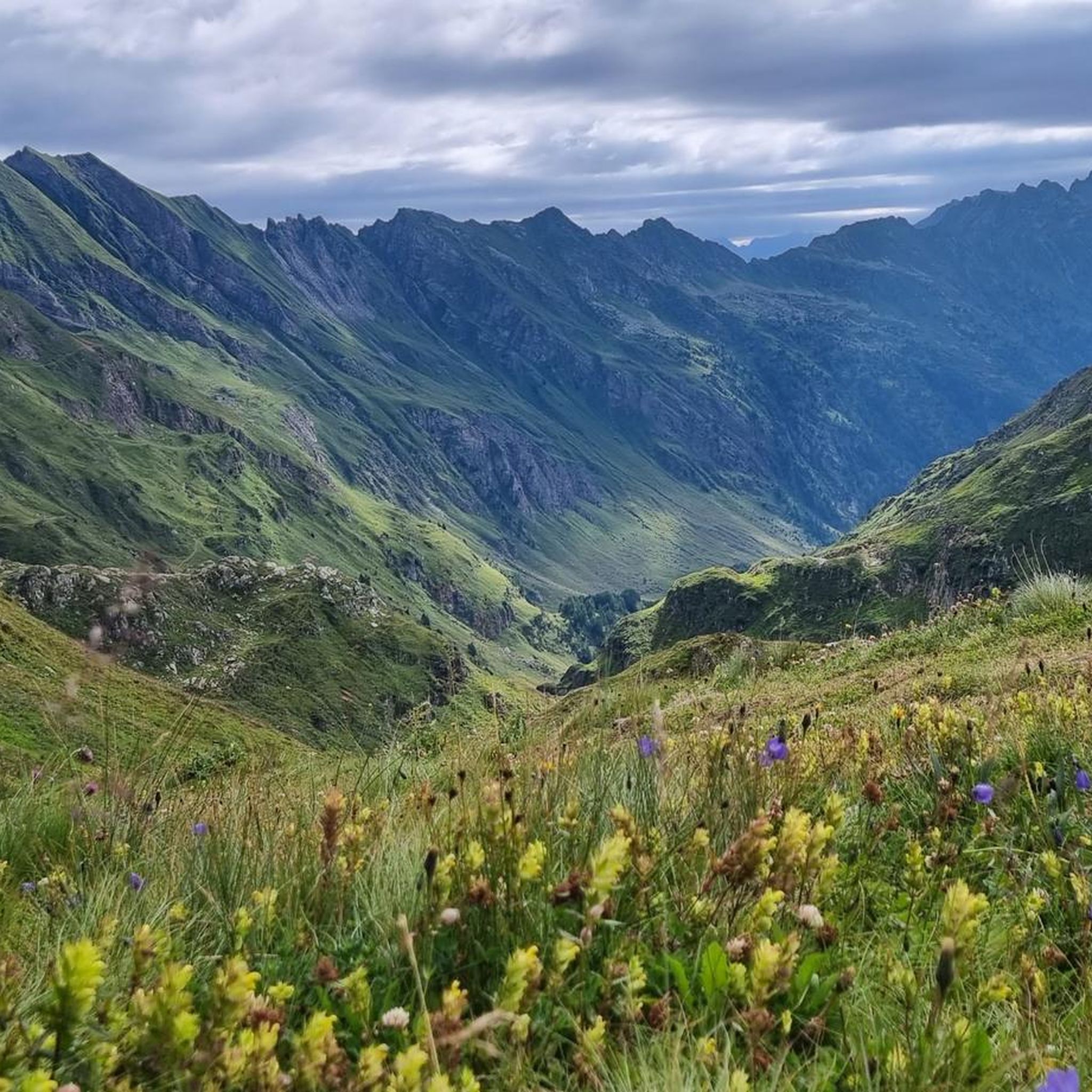
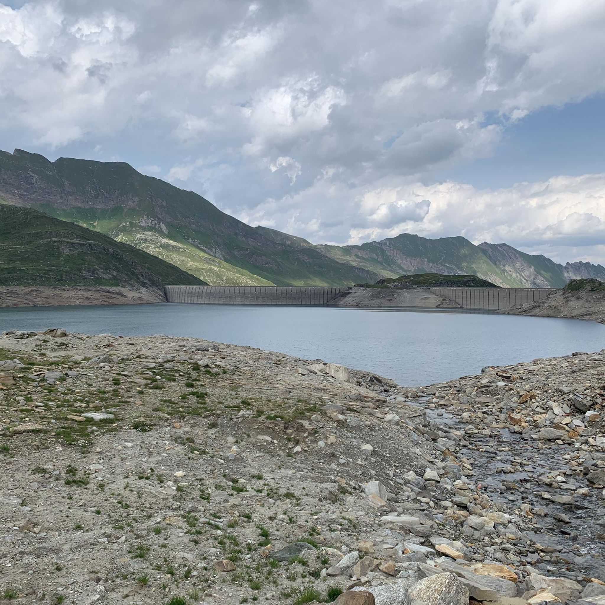
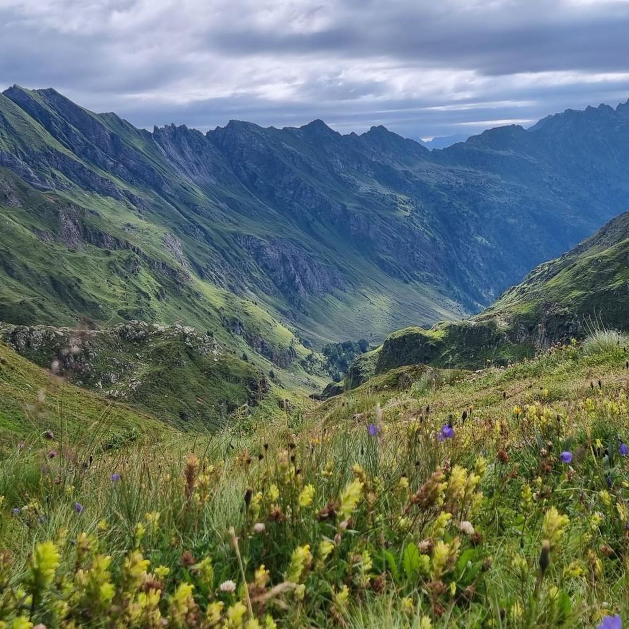
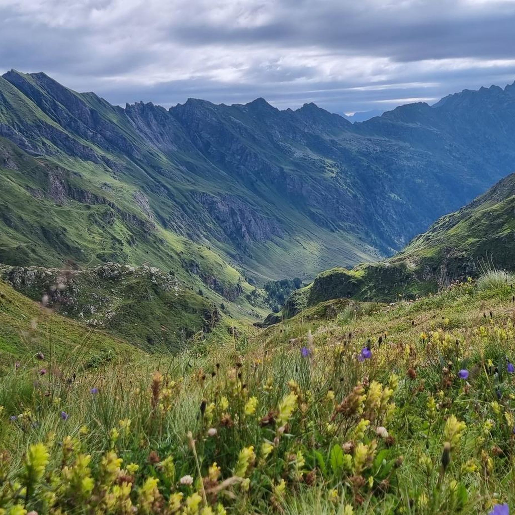
Road cycling around Lake del Narèt, situated at 2,310 meters in the Ticino canton of Switzerland, is characterized by challenging alpine climbs and significant elevation gains. The routes traverse diverse landscapes, transitioning from lush valleys and deciduous forests to rugged, high-alpine environments. The area features numerous artificial reservoirs and natural alpine lakes, surrounded by grey rock formations and majestic mountains. Roads are generally well-paved, though some segments can be unpaved, and routes are typically accessible during summer months.
Best road…
Last updated: October 7, 2026
5.0
(3)
227
riders
37.7km
02:31
1,230m
1,230m
Hard road ride. Very good fitness required. Mostly well-paved surfaces and easy to ride.
5.0
(2)
275
riders
44.8km
02:53
1,380m
1,380m
Hard road ride. Very good fitness required. Mostly well-paved surfaces and easy to ride.

4.9
(159)
8,592
riders
99.1km
06:46
3,050m
3,050m
Hard road ride. Very good fitness required. Mostly well-paved surfaces and easy to ride.
4.3
(14)
608
riders
156km
08:46
3,440m
3,440m
Hard road ride. Very good fitness required. Some segments of this route may be unpaved and difficult to ride.
4.7
(14)
563
riders
26.1km
02:29
940m
940m
Cycle the difficult 16.2-mile San Gottardo Pass from Airolo, climbing 3087 feet on the historic Tremola Road with stunning views.
Get access to more routes and recommendations from other explorers.
Already have an account?
Our route recommendations are based on thousands of hikes, rides, and runs completed by other people on komoot.
Start today with a free account
Your next adventure awaits.

Tips from the Community

At 2,478 meters above sea level, the Nufenen Pass (Nufenenpass in German) connects the Goms Valley in the upper Valais with the Bedretto Valley in the upper Ticino. From Airolo, the climb is approximately 22 kilometers (average gradient 5.6%), while from Ulrichen it is shorter but more challenging: 14 kilometers at an average gradient of approximately 7.9%.
0
0

The Furka Pass is a 2,429 m high Swiss road pass in the Alps. It connects the Urseren Valley (the upper valley of the Reuss River) in the canton of Uri with the Goms district in the canton of Valais. It straddles the European watershed between the Mediterranean Sea and the North Sea. Source: Furka Pass – Wikipedia https://share.google/zJGI3KsPRtARfpYje
6
0


St. Gotthard Pass The Gotthard Pass divides waterways and connects various cultural and linguistic areas. Its significance as an "Alpine transversal" began at the beginning of the 13th century with the construction of the legendary Devil's Bridge in the Schöllenen Gorge. For many centuries, trade caravans (trading cattle and cheese for grain, wine, rice, and salt), mercenaries, messengers, and even entire armies crossed the pass. Between 1818 and 1836, the canton of Uri, with the help of other cantons, expanded the pass road, thus achieving its predominance among Swiss Alpine passes. The Gotthard Pass has significantly shaped the economy and culture of Central Switzerland for centuries. Until the opening of the Gotthard Railway in 1882, the Gotthard Pass was also used in winter. Dozens of roadmen and shovel workers were employed for this purpose. In 1922, the post bus replaced the stagecoach, and with the introduction of gasoline duties in 1923, the expansion of the pass roads began, continuing to this day. The old pass road on the south side, the Tremola between the top of the pass and Airolo, is still preserved and passable. This stretch of road recalls more tranquil journeys over the Gotthard that occurred not so long ago. In the 19th and 20th centuries, the Gotthard Pass was "condensed" into a myth, a symbol of Switzerland's independence, unity, and identity. Text / Source: Interest Group for Alpine Passes IAP, PO Box 11, 6491 Realp https://alpen-paesse.ch/de/alpenpaesse/gotthardpass
15
1

Shopping opportunities
0
0

A great starting point for hikes from Airolo. The trains are reliably punctual, and there are many departures in both directions.
0
0
Great train station for hiking. Many trains run here, and they're generally punctual.
0
0

Swiss
0
0
Frequently Asked Questions
How many road cycling routes are available around Lake del Narèt?
There are nearly 20 road cycling routes around Lake del Narèt, offering a range of experiences from moderate to difficult. The majority, 12 routes, are classified as difficult, providing significant challenges for experienced cyclists.
What is the best time of year for road cycling to Lake del Narèt?
The road to Lake del Narèt is typically open only during the summer months due to its high elevation (2,310 to 2,316 meters). This is the best time to experience the challenging climbs and breathtaking alpine scenery, as snow can block access at other times of the year.
Are there any circular road cycling routes in the Lake del Narèt area?
Yes, there are circular routes available. For example, the View of Nufenen Pass – Bedretto Valley loop from Circolo di Airolo is a difficult 37.7 km route that offers a substantial elevation gain through the alpine landscape.
What kind of landscapes can I expect to see while cycling around Lake del Narèt?
The routes offer a dramatic transition in landscapes. You'll start in areas with a southern climate and palms, moving through deciduous forests, and eventually reaching rugged high-alpine environments with majestic mountains, grey rock formations, and crystal-clear lakes. The area around Lake del Narèt itself features a stony alluvial plain near the summit.
What are some notable natural features or attractions along the road cycling routes?
Beyond Lake del Narèt itself, the region is rich with natural beauty. You can encounter other picturesque alpine lakes such as Lago del Sambuco, Lago di Sassilo, Lago Superiore, Lago Scuro, and Lago del Corbo. The Gotthard, Furka and Nufenen passes route, for instance, takes you through multiple high alpine passes, offering spectacular panoramic views.
Are there any particularly challenging multi-pass routes for experienced cyclists?
Absolutely. For experienced cyclists seeking a significant challenge, the Lukmanier, Oberalp and Gotthard passes route is a demanding 155.8 km journey with over 3,400 meters of ascent, traversing multiple iconic alpine passes.
What do other road cyclists enjoy most about cycling in Lake del Narèt?
The area is highly rated by the komoot community, with an average score of 4.7 stars from over 130 reviews. Reviewers often praise the challenging climbs, the quiet roads with minimal traffic, and the impressive, often 'awesome,' panoramic views that make the demanding ascents incredibly rewarding.
Where can I find parking for road cycling routes near Lake del Narèt?
Many routes, such as those starting from Airolo or Bignasco, offer parking options in the valley towns before you begin your ascent. It's advisable to check specific route details for recommended starting points and parking availability.
Are there any easier road cycling options for beginners or families?
While the region is known for its challenging climbs, there is one route classified as easy among the nearly 20 available. However, the overall character of road cycling around Lake del Narèt is geared towards more experienced cyclists due to significant elevation gains and steep gradients.
What is the typical gradient for climbs to Lake del Narèt?
The climb to Lake del Narèt is renowned for its difficulty, featuring significant elevation gain with some sections reaching gradients of 9% to 20%. The route from Bignasco, for example, becomes significantly steeper with numerous hairpin bends, especially around Peccia.
Can I find accommodation or places to eat near the cycling routes?
Yes, towns like Bignasco, Fusio, and Airolo, which serve as common starting points for routes, offer various options for accommodation, restaurants, and cafes. These can provide a refreshing stop before or after your ride.
Is public transport available for cyclists in the Vallemaggia region?
Public transport options, including bus services that can accommodate bikes, are available in the Vallemaggia region, particularly from towns like Bignasco. This can be useful for reaching starting points or for returning after a long ride.
Most popular routes around Lake del Narèt

Get inspired with the komoot mobile app


Explore more
Browse the best Road cycling routes in other regions.
