The best walks and hikes around Narrow Water
4.5
(281)
1,984
hikers
103
hikes
Hiking around Narrow Water offers a diverse range of trails, primarily exploring the landscapes of the Ring of Gullion and the shores of Carlingford Lough. The region features a mix of rolling hills, forested areas, and coastal paths. Hikers can expect varied terrain, from gentle greenways to more challenging ascents within the Ring of Gullion. This area provides opportunities for exploring both natural and historical features.
Best hiking trails around Narrow Water
- The most popular hiking route is Clermont &…
Last updated: August 20, 2026
4.3
(4)
5
hikers
13.9km
03:25
470m
480m
Moderate hike. Good fitness required. Easily-accessible paths. Suitable for all skill levels.
3.0
(2)
3
hikers
7.74km
01:48
210m
210m
Easy hike. Great for any fitness level. Easily-accessible paths. Suitable for all skill levels.

Sign up for free
1
hikers
18.1km
04:53
240m
240m
Hike the moderate 11.2-mile Ring of Gullion and Carlingford Lough Greenway Loop, combining coastal paths with rugged mountain trails.
1
hikers
8.51km
02:23
160m
170m
Moderate hike. Good fitness required. Easily-accessible paths. Suitable for all skill levels.
4.7
(10)
64
hikers
15.3km
03:54
50m
50m
Moderate hike. Good fitness required. Easily-accessible paths. Suitable for all skill levels.
Get access to more routes and recommendations from other explorers.
Sign up for free
Already have an account?
Our route recommendations are based on thousands of hikes, rides, and runs completed by other people on komoot.
Start today with a free account
Your next adventure awaits.
Login or Signup


Tips from the Community

Above the medieval street pattern, which dominates the silhouette of Carlingford, stands the imposing ruin of Carlingford Castle, also known as King John’s Castle. This castle was built around 1190 by the Norman knight Hugh de Lacy and was for centuries the strategic key to the entrance of Carlingford Lough.
5
2
De An Bealach Glas (The Greenway) is a stunning, traffic-free greenway that connects Newry to the monumental Victoria Lock. This 6-kilometre-long 'green route' takes you along the tidal river Clanrye and the sea canal, with the impressive peaks of the Mourne Mountains to your left and Cooley Mountains to your right.
6
0
Saint Patrick and Saint Colman's Cathedral is the architectural jewel of Newry and one of Ireland's most impressive Neo-Gothic structures. Construction began in 1825, and upon its completion in 1829, the cathedral made history as the first Catholic cathedral to open in Ireland following the repeal of the penal laws (Catholic Emancipation). Built from local granite from the nearby Mourne Mountains, this edifice exudes a robust yet elegant power. The cathedral is world-renowned for its fabulous interior: the walls and ceiling are adorned with colourful mosaics, meticulously applied by hand by Italian master craftsmen in the early 20th century. For the cyclist, this is not only a visual highlight along the route but also a place of serene tranquility. Its detailed stained-glass windows and monumental tower make it one of the city's most photographed locations and a worthy endpoint (or starting point) for your tour along the Newry Canal Towpath.
6
0

A super stop off on the greenway. 4.2km from the start of the greenway in Carlingford. delicious food, cooffee, scones etc and free fruit flavoured water.
1
0

Clontygora Court Tomb is a truly special experience on the Ring of Gullion. While travelling along the quiet roads of County Armagh, I discovered this ancient megalithic tomb, also known as 'The King's Ring'. The imposing, upright stones of the U-shaped exedra are a striking sight and provide a fascinating insight into times long past. Although some parts have been damaged over the centuries, the tomb exudes a remarkable atmosphere - as if you are looking back in time. The site, nestled in the rolling hills at the foot of Slieve Gullion, makes the visit a worthwhile break for any cyclist. It is amazing how quiet it is here, with only the gentle breeze whistling through the stones. Those interested in prehistoric sites will also find the nearby monuments such as Ballymacdermot and Ballykeel fascinating. This area clearly has a rich history, which becomes apparent when you take a closer look at the megalithic chambers. I was particularly taken with the two massive portal stones that mark the entrance to the gallery - they seem like silent sentinels that have stood here for thousands of years. The view of the valley and the Newry River completes the experience. It is definitely worth a short detour, especially if you love nature and also have a bit of an interest in archaeology.
1
1
The "Ring of the King", the Clontygora Court Tomb, awaits you on a hill in Slieve Gullion, surrounded by the rugged beauty of the Ring of Gullion. This megalithic site with its distinctive Y-shape and central tomb gallery immerses you in the early history of Northern Ireland. The stones, which rise over 2.7 metres into the air, form an impressive exedra that encloses the deep, U-shaped courtyard - it is more than just a collection of rocks, it is a silent witness to times gone by. As you step between the portal stones that mark the entrance to the three-part burial chamber, you can easily imagine how the early inhabitants performed their rituals here over 5000 years ago. Flint artefacts and ceramic finds tell of long-gone cultures that already cultivated this land. From here you have a view not only of history but also of the landscape - a place where you can look out over the green hills and valleys. Close by you will find other megalithic monuments such as the Ballymacdermot Court Tomb or the Ballykeel Dolmen, all of which help to complete the mosaic of the past.
1
1
From the Flagstaff Viewpoint you can enjoy a stunning view of the expansive landscape where the Newry River gently curves its way to Carlingford Lough. The view stretches down to the fjord where the land meets the water and the hills in the distance form a picturesque backdrop. The valley opens up between the lush green conifers and you can watch the landscape unfold below you. From up here, the roads and fields look like little veins and patches that tie the whole picture together. It is a place to linger and enjoy the silence - a haven of calm that makes you feel above it all.
0
0
Frequently Asked Questions
How many hiking trails are available around Narrow Water?
There are over 100 hiking routes available around Narrow Water, offering a diverse range of experiences. These trails primarily explore the landscapes of the Ring of Gullion and the shores of Carlingford Lough.
Are there any easy hikes suitable for beginners or families in the Narrow Water area?
Yes, there are many easy options. For a tranquil experience, consider the Fathom Wood loop — Ring of Gullion, an easy 4.8-mile (7.7 km) path that winds through Fathom Wood. Overall, more than 50 easy trails are available in the region.
What kind of terrain can I expect on hikes around Narrow Water?
The terrain around Narrow Water is quite varied, featuring rolling hills, dense forested areas, and scenic coastal paths along Carlingford Lough. You'll find everything from gentle greenways to more challenging ascents within the Ring of Gullion.
Are there any circular walks available in the Narrow Water region?
Yes, many trails are designed as circular routes. A popular option is the Ring of Gullion and Carlingford Lough Greenway Loop, an 11.2-mile (18.1 km) trail that combines varied terrain with sections of the Carlingford Lough Greenway.
What historical sites or landmarks can I explore while hiking near Narrow Water?
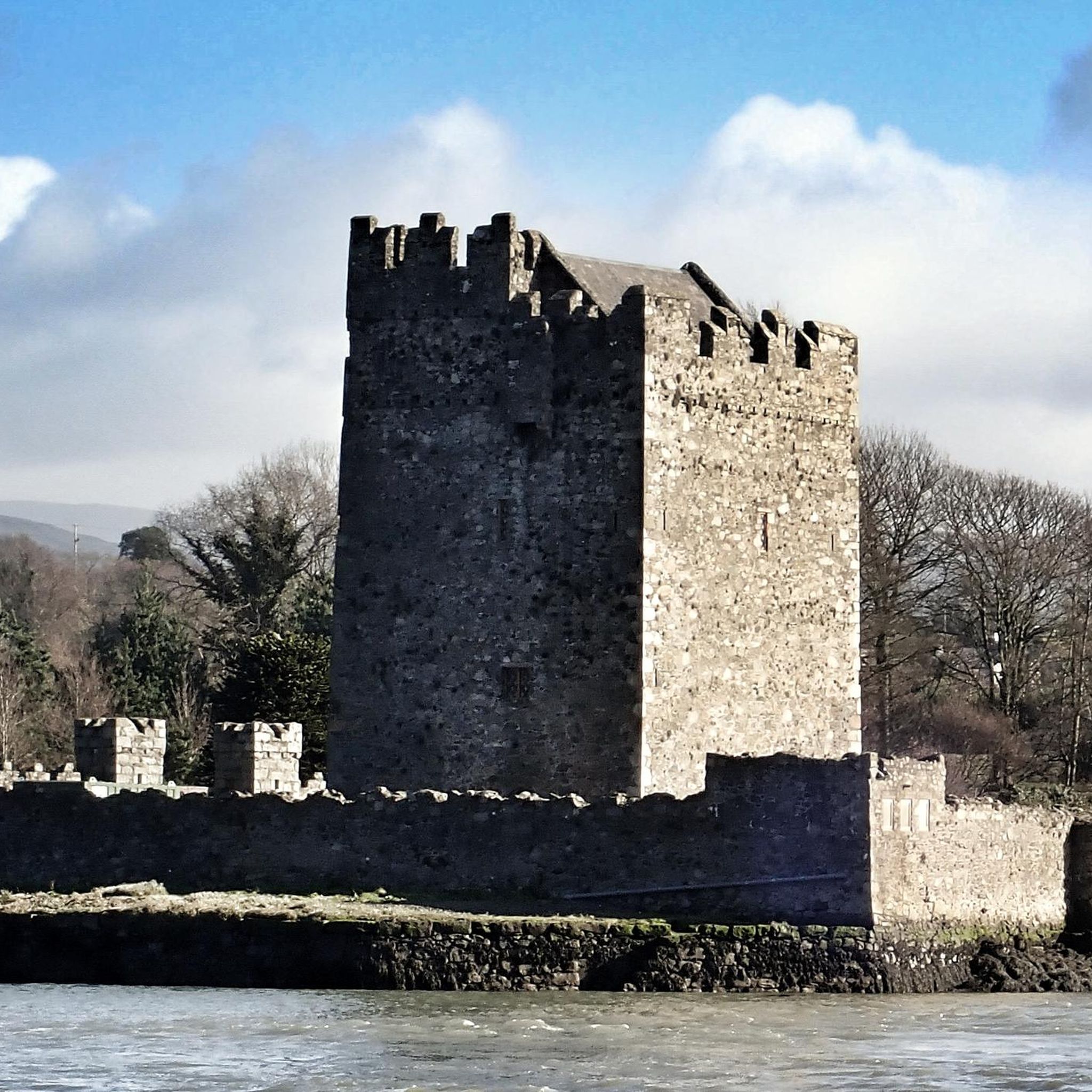
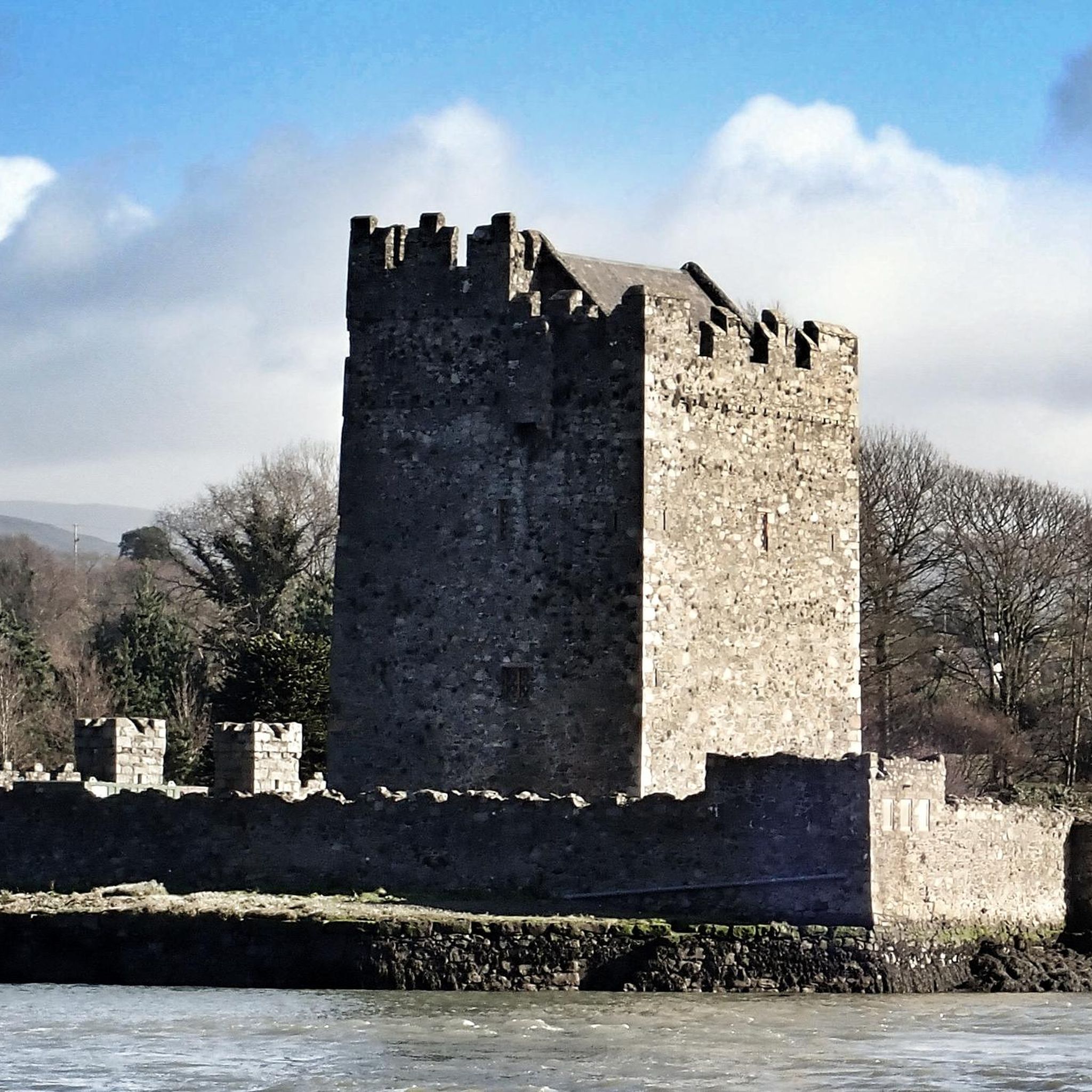
The area is rich in history and natural beauty. You can visit impressive structures like Narrow Water Castle or Carlingford Castle. For natural monuments, don't miss the unique Cloughmore Stone or the panoramic views from Slieve Gullion Summit.
What do other hikers enjoy most about the trails in Narrow Water?
The trails in Narrow Water are highly rated by the komoot community, with an average score of 4.6 stars from over 250 reviews. Hikers often praise the diverse landscapes, from tranquil woodlands to coastal views, and the well-maintained paths that cater to various skill levels.
How long do hikes near Narrow Water typically take?
Hike durations vary significantly depending on the route and your pace. For example, the moderate Clermont & Clontygora loop from Flagstaff — Ring of Gullion takes approximately 3 hours 25 minutes to complete its 8.6 miles (13.9 km). Shorter, easy trails can be completed in under 2 hours, while longer routes might take 5 hours or more.
Is there parking available for hiking trails around Narrow Water?
While specific parking details vary by trailhead, many popular starting points for hikes in the Ring of Gullion and along Carlingford Lough offer designated parking areas. It's advisable to check the route details on komoot for specific parking information for your chosen trail.
Are there any trails that offer views of Carlingford Lough?
Absolutely. Many trails provide stunning views of Carlingford Lough. The Cloughmore Stone – View of Carlingford Lough loop from Rostrevor is a moderate 9.3-kilometer (5.8-mile) hike specifically known for its panoramic vistas over the lough.
What is the best time of year to go hiking in Narrow Water?
The region offers enjoyable hiking experiences throughout much of the year. Spring and autumn provide pleasant temperatures and beautiful scenery with blooming wildflowers or vibrant foliage. Summer is also popular, though trails can be busier. Winter hikes are possible, but conditions may be cooler and wetter, requiring appropriate gear.
Are there any trails that pass by ancient tombs or historical churches?
Yes, the area is rich in ancient history. The St Michael's Church & Clontygora Tomb loop — Ring of Gullion is a moderate 8.5-kilometer (5.3-mile) route that allows you to explore both St. Michael's Church and the ancient Clontygora Tomb.
Most popular attractions around Narrow Water

Get inspired with the komoot mobile app


Explore more
Browse the best Hikes in other regions.
