The best walks and hikes around Embalse del Quiebrajano
4.7
(22)
159
hikers
19
hikes
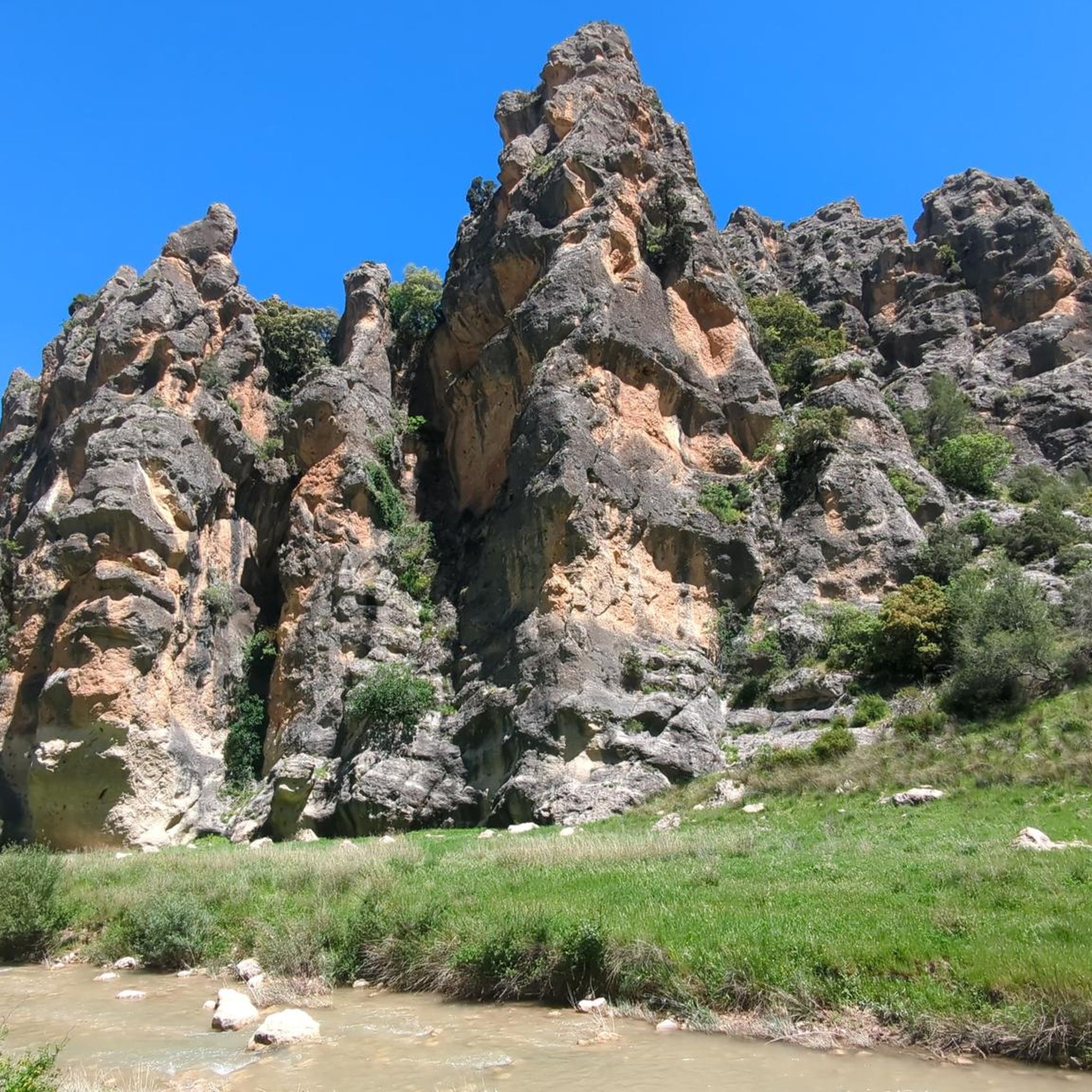
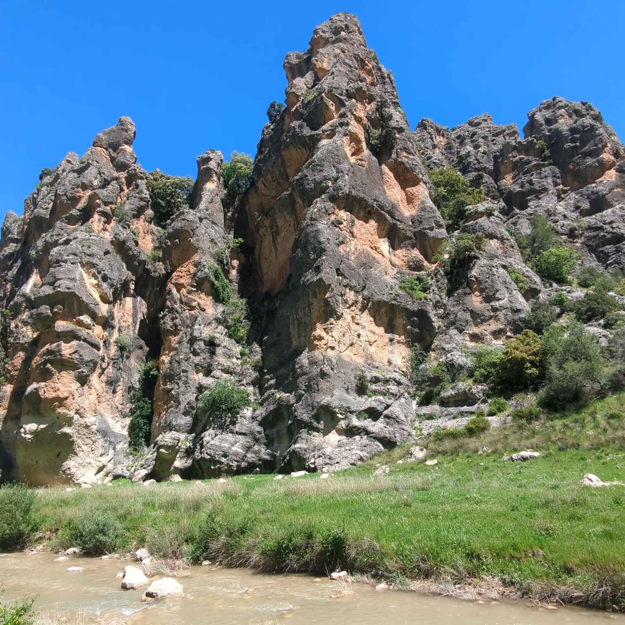
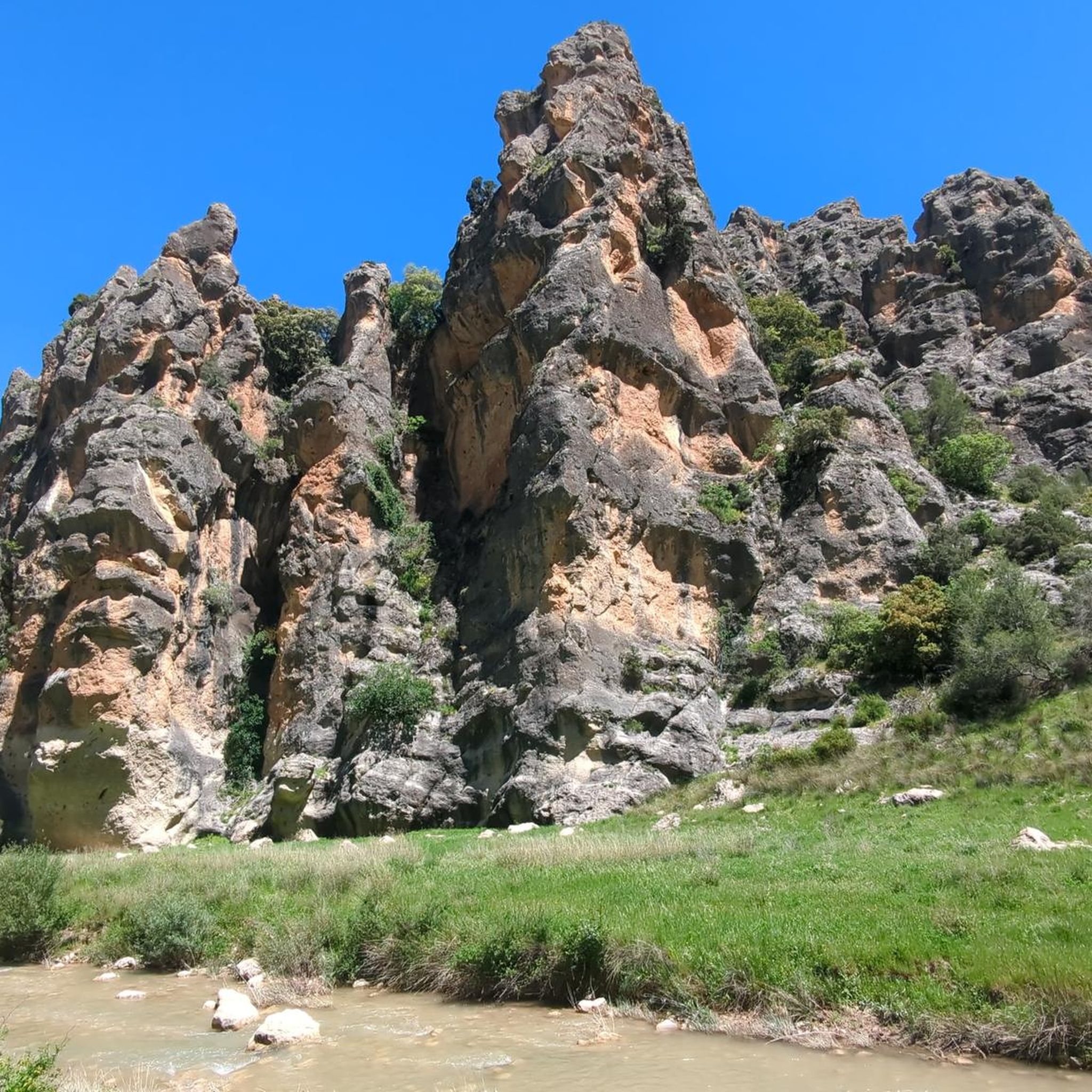
Hiking around Embalse del Quiebrajano offers diverse trails through a landscape characterized by picturesque valleys, unique rock formations, and mountain views. The region features the Valdearazo River, which feeds the reservoir and creates distinct stone formations along its course. Hikers can explore varied terrain, from riverbeds to higher elevations offering panoramic vistas of the Quiebrajano valley and distant cities.
Best hiking trails around Embalse del Quiebrajano
- The most popular hiking route is Cueva del Yedrón loop from Cerro Montesas, a 5.0 miles (8.0 km) trail that takes 2 hours 35 minutes to complete. This moderate route features a steady ascent of approximately 320 meters.
- Another top favourite among local hikers is Collado del Pico la Llana – Cruz de la Calamba Refuge loop from Cerro Montesas, a moderate 7.6 miles (12.2 km) path. This longer trail includes a significant elevation gain of about 680 meters, leading to a refuge with expansive views.
- Local hikers also love the Valdearazo Bridge loop from Puerto Pitillos, a 5.2 miles (8.4 km) trail leading through riverbeds and past unique rock formations, often completed in about 2 hours 28 minutes.
- Hiking around Embalse del Quiebrajano is defined by picturesque valleys, unique rock formations, and mountain views. The network offers options for easy strolls, moderate paths, and more challenging routes.
- The routes in Embalse del Quiebrajano are highly rated by the komoot community with an average score of 4.8 stars from over 15 reviews. More than 140 hikers have used komoot to explore Embalse del Quiebrajano's varied terrain.
Last updated: June 25, 2026
7
hikers
8.04km
02:35
320m
320m
Moderate hike. Good fitness required. Easily-accessible paths. Suitable for all skill levels.
4
hikers
Moderate hike. Good fitness required. Easily-accessible paths. Suitable for all skill levels.

Sign up for free
5.0
(1)
2
hikers
8.37km
02:29
250m
250m
Moderate hike. Good fitness required. Easily-accessible paths. Suitable for all skill levels.
10
hikers
12.3km
03:57
510m
510m
Moderate hike. Good fitness required. Easily-accessible paths. Suitable for all skill levels.
4.8
(4)
15
hikers
10.1km
03:14
440m
430m
Hike the moderate 6.3-mile Cruz de la Chimba Trail, featuring coffee plantations, artistic sculptures, and views near Santa Ana.
Get access to more routes and recommendations from other explorers.
Sign up for free
Already have an account?
Our route recommendations are based on thousands of hikes, rides, and runs completed by other people on komoot.
Start today with a free account
Your next adventure awaits.
Login or Signup

Tips from the Community

From this viewpoint, you can contemplate the impressive views of the Quiebrajano valley, the Otiñar, and the horizon can be seen: the Jabalcuz mountain range, Jaén, and the majestic La Pandera mountain range.
1
0

Small footbridge at the lowest point of the Cañada del Sabinar.
4
0


Small refuge at 1154 meters altitude, near the famous Cañada de las Hazadillas. Easily accessible and in a setting of singular beauty, it has become one of the most frequented routes in the Sierra Sur.
1
0
Viewpoint with panoramic views of the Quiebrajano reservoir and its surrounding mountains.
3
0
It is a small refuge at 1154 meters altitude, near the famous Cañada de las Hazadillas site. It is easily accessible and in a setting of singular beauty, it has become one of the most frequented routes in the Sierra Sur.
0
0
Viewpoint with wonderful views of the Quiebrajano valley, Otiñar and in the distance Jabalcuz and Jaén. In front of us, the majestic La Pandera is shown, with its 1872 meters of altitude.
1
1

Frequently Asked Questions
What types of hiking trails can I expect around Embalse del Quiebrajano?
The Embalse del Quiebrajano area offers a diverse range of trails, catering to various fitness levels. You'll find everything from easy strolls along riverbeds to more challenging routes with significant elevation gains, providing panoramic views of the Quiebrajano valley and distant cities like Jaén. The landscape is characterized by picturesque valleys, unique rock formations, and mountain vistas.
Are there any easy hiking routes suitable for beginners or families?
Yes, there are several easier routes around Embalse del Quiebrajano. Out of the 16 available trails, 3 are classified as easy, making them suitable for beginners or families looking for a more relaxed experience. These trails often feature gentler inclines and shorter distances, allowing you to enjoy the natural beauty without strenuous effort.
What kind of unique natural features or landmarks can I see while hiking here?
Hikers in Embalse del Quiebrajano can discover remarkable natural features. The Valdearazo River, which feeds the reservoir, has carved out marvelous stone formations along its course. You'll also encounter unique geological formations, including 'capricious shapes in the stone' and 'chess piece' like rock formations such as 'Piedra del Palo'. The Cañón de Pitillos is another area known for its distinctive rock structures and pinnacles.
Are there any circular hiking routes in Embalse del Quiebrajano?
Yes, many of the trails around Embalse del Quiebrajano are designed as circular routes, allowing you to start and end at the same point. For example, the Valdearazo Bridge loop from Puerto Pitillos is a popular moderate circular trail that takes you through riverbeds and past unique rock formations.
What do other hikers say about the trails in Embalse del Quiebrajano?
The trails in Embalse del Quiebrajano are highly regarded by the komoot community, boasting an impressive average rating of 4.8 stars from over 15 reviews. Hikers often praise the varied terrain, the stunning views of the valley and distant cities, and the unique geological formations found along the routes.
Can I bring my dog on the hiking trails around Embalse del Quiebrajano?
While the region is generally welcoming to outdoor enthusiasts, specific regulations regarding dogs on trails can vary. It's always recommended to keep your dog on a leash, especially in areas with wildlife or near livestock, and to clean up after them. Check local signage for any specific restrictions in certain areas or protected zones.
Are there any challenging hikes for experienced hikers?
Yes, for experienced hikers seeking a challenge, Embalse del Quiebrajano offers several routes with significant elevation gains. There are 2 trails classified as difficult, and 11 as moderate, many of which require good physical condition and sure-footedness. An example is the Collado del Pico la Llana – Cruz de la Calamba Refuge loop from Cerro Montesas, which features a substantial ascent of about 680 meters.
Where can I find parking for the hiking trails?
Parking availability varies depending on the specific trailhead. Popular starting points like Puerto Pitillos or Cerro Montesas often have designated areas where you can leave your vehicle. It's advisable to check the route details on komoot for specific parking information related to your chosen trail.
What is the best time of year to go hiking in Embalse del Quiebrajano?
The Embalse del Quiebrajano region is enjoyable for hiking during much of the year. Spring and autumn generally offer the most pleasant temperatures for hiking, with lush greenery in spring and beautiful colors in autumn. Summer can be hot, so early morning or late afternoon hikes are recommended, while winter can bring cooler temperatures and occasional rain, but also a unique tranquility.
Are there any refuges or rest points along the trails?
Yes, the region includes points of interest like refuges that can serve as rest stops. For instance, a small refuge located at 1,154 meters above sea level near Cañada de las Hazadillas is a popular and easily accessible spot, nestled in a beautiful environment. The Collado del Pico la Llana – Cruz de la Calamba Refuge loop specifically leads to a refuge with expansive views.
How long do hikes typically take in Embalse del Quiebrajano?
The duration of hikes varies significantly based on the trail's length and difficulty. Shorter, easier routes might take around 2 hours, while longer, more challenging loops can extend to 4-5 hours or more. For example, the Cueva del Yedrón loop from Cerro Montesas typically takes about 2 hours 35 minutes, while the Collado del Pico la Llana – Cruz de la Calamba Refuge loop can take over 4 hours.
Are there any trails that offer views of the reservoir itself?
Many trails in the area provide excellent views of the Embalse del Quiebrajano and its surroundings. The 'Colas del Quiebrajano' route, for example, is known for its unique landscapes where the river converges into the reservoir, offering picturesque perspectives of the water and its winding end sections.
Most popular routes around Embalse del Quiebrajano

Get inspired with the komoot mobile app


Explore more
Browse the best Hikes in other regions.
