The best road cycling routes around Lake Rims
4.8
(106)
8,531
riders
15
rides
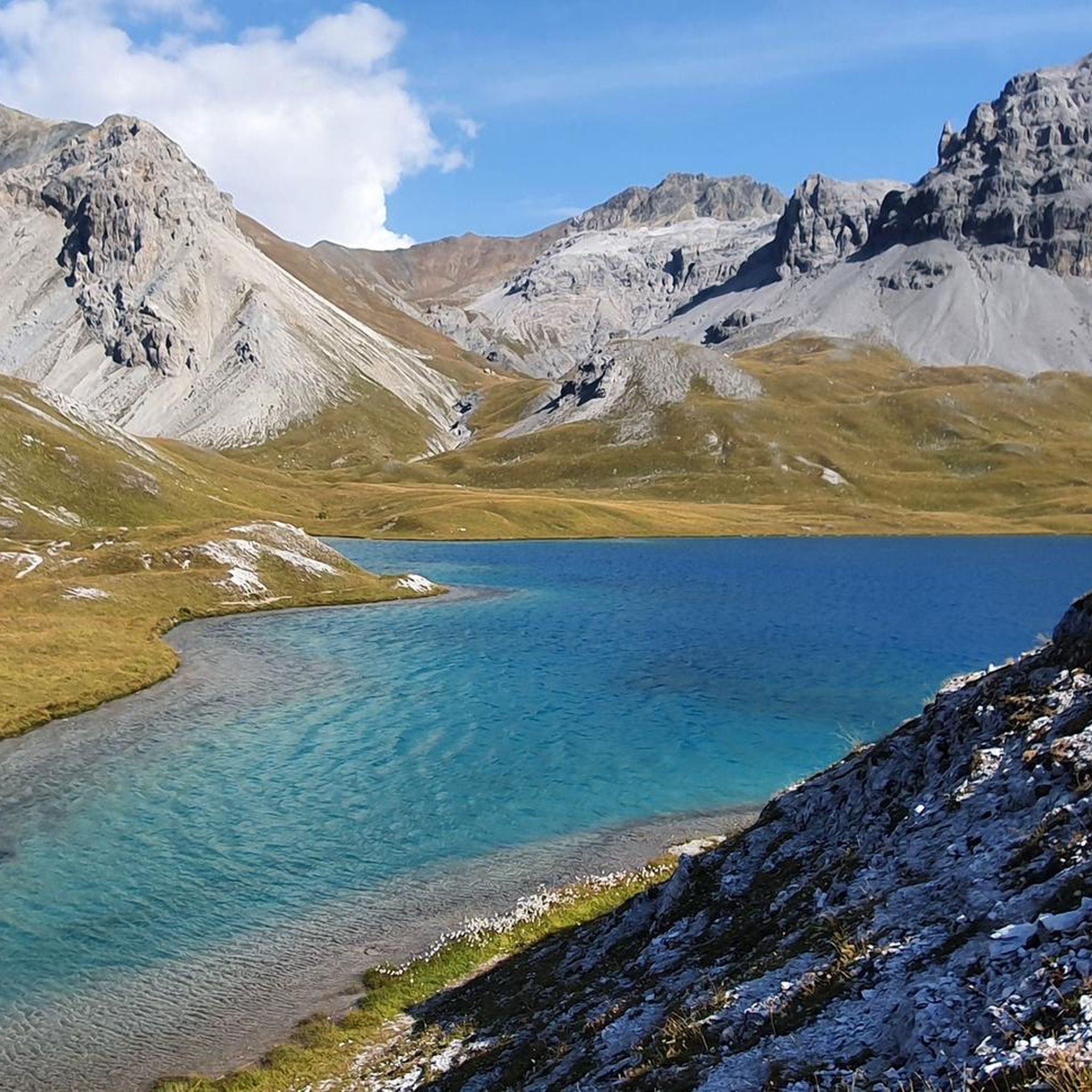
Road cycling routes around Lake Rims are characterized by high mountain passes and deep valleys within an Alpine setting, often featuring significant elevation changes. The region's terrain includes challenging ascents and descents, with routes winding through mountainous landscapes. Many routes offer views of the Inn river valley and surrounding peaks. This area provides a diverse range of road cycling experiences for those seeking mountain challenges.
Best road cycling routes around Lake Rims
- The most popular road cycling route is Fountain Near the Umbrail Pass – Santa Maria Val Müstair loop from Val Müstair, a 16.5 miles (26.6 km) trail that takes 1 hour 24 minutes to complete. This moderate route features a steady climb towards Umbrail Pass.
- Another top favourite among local road cyclists is Santa Maria Val Müstair – Lü Village loop from Val Müstair, a moderate 12.6 miles (20.3 km) path. This route offers a substantial climb through the Val Müstair, leading to Lü Village.
- Local road cyclists also love the Passo del Forno – Bernina Pass loop from Sta. Maria Val Müstair, a 107.5 miles (172.9 km) trail leading through high mountain passes, often completed in about 10 hours 4 minutes.
- Road cycling around Lake Rims is defined by high mountain passes, deep valleys, and significant elevation changes. The network offers options for different ability levels, from moderate valley rides to difficult multi-pass loops.
- The routes in Lake Rims are highly rated by the komoot community with an average score of 4.8 stars from over 40 reviews. More than 2,000 road cyclists have used komoot to explore Lake Rims's varied terrain.
Last updated: June 27, 2026
20
riders
Moderate road ride. Good fitness required. Mostly well-paved surfaces and easy to ride.
12
riders
20.2km
01:30
810m
810m
Moderate road ride. Good fitness required. Mostly well-paved surfaces and easy to ride.

Sign up for free
4.9
(39)
4,742
riders
105km
06:56
3,330m
3,330m
Hard road ride. Very good fitness required. Mostly well-paved surfaces and easy to ride.
4.7
(3)
109
riders
173km
10:04
4,180m
4,180m
Hard road ride. Very good fitness required. Mostly well-paved surfaces and easy to ride.
5.0
(2)
108
riders
Hard road ride. Very good fitness required. Mostly well-paved surfaces and easy to ride.
Get access to more routes and recommendations from other explorers.
Sign up for free
Already have an account?
Our route recommendations are based on thousands of hikes, rides, and runs completed by other people on komoot.
Start today with a free account
Your next adventure awaits.
Login or Signup
Tips from the Community

Both from the Morteratsch valley and from Montebello, you can enjoy a magnificent view of glaciers and the Bernina massif.
0
0

Breathtaking climb to the 2nd highest pass in Europe. 24 km and 48 hairpin bends on this fairly steep but even climb will make you suffer. You are constantly rewarded with beautiful views.
0
0

The first documented evidence dates back to the new building by Andreas Bühler in pre-Reformation times in 1492. It replaced a Romanesque predecessor church, parts of which were preserved. A special feature was that after the village majority adopted the Reformation, the church was used simultaneously by both denominations until 1838, when the building was transferred entirely to the Reformed.
0
0

The new cycle path from Prad to the Stilfser Bridge is an important contribution to safety – for cyclists as well as for other road users. On the narrow state road, dangerous situations and accidents repeatedly occurred in the past. It is important to note that the cycle path may only be used in the valley direction. In the direction out of the valley, cyclists must continue to use the state road.
0
0

Morteratsch Glacier Trail 16 information points provide insights into the glacier's retreat and the mysterious life in its foreland. Where else can you admire, touch, and even walk on eternal ice after such a short hike? Just under 50 minutes from Morteratsch train station, you'll reach your destination: the milky glacial lake and the gigantic ice tongue. A literary treat awaits you on the LiteraTOUR. The captivating audio texts can be accessed individually via QR code at the 16 information points along the Morteratsch Glacier Trail. The stories include anecdotes, poems, and tour reports from various eras. Text / Source: Engadin Tourism AG, Via Maistra 1, 7500 St. Moritz https://www.engadin.ch/de/aktivitaeten/gletscherweg-morteratsch/
14
0
Morteratsch Glacier The Morteratsch Glacier is a historically significant glacier that has been systematically monitored since 1878. Over the last 150 years, the glacier has retreated by almost three kilometers, and its ice volume has decreased by two-thirds. The Bernina Railway, which began operating in 1908, was then located just a stone's throw from the glacier's terminus. Since then, the glacier has retreated considerably, and the movement of its surroundings is no longer visible. Text / Source: wikipedia.org https://de.wikipedia.org/wiki/Morteratschgletscher
14
0

Simply an impressive climb; coming from Prad, 24km with 48 hairpin bends await you. Stunning views constantly unfold, and the closer you get to the summit, the farther you can see down. Of course, this pass is extremely touristy, but it still has its charm, and you can even get a summit espresso for €1.50.
1
0

Beautiful descent to Prad
0
0
Frequently Asked Questions
What kind of terrain can I expect when road cycling around Lake Rims?
Road cycling routes around Lake Rims are characterized by an Alpine setting with high mountain passes and deep valleys. You can expect significant elevation changes, challenging ascents, and descents as routes wind through mountainous landscapes, often providing views of the Inn river valley and surrounding peaks.
How many road cycling routes are available in the Lake Rims region?
There are over 18 road cycling routes available in the Lake Rims region, catering to various skill levels from moderate valley rides to difficult multi-pass loops.
What is the general difficulty level of road cycling routes in Lake Rims?
The routes in Lake Rims offer a diverse range of experiences. You'll find 2 easy routes, 10 moderate routes, and 6 difficult routes, ensuring options for different ability levels, from steady climbs to substantial multi-pass challenges.
Are there any challenging road cycling routes for experienced riders in Lake Rims?
Yes, Lake Rims offers several challenging routes. For instance, the Passo del Forno – Bernina Pass loop from Sta. Maria Val Müstair is a difficult 107.5-mile trail leading through high mountain passes. Another demanding option is the Umbrail Pass – Stelvio–Umbrail Pass Junction loop from Sta. Maria Val M., Blockhütte, which features significant elevation gain over 22.2 miles.
What do other road cyclists enjoy most about road cycling in Lake Rims?
The Lake Rims area is highly rated by the komoot community, with an average score of 4.8 stars from over 40 reviews. Road cyclists often praise the varied terrain, the challenge of the mountain passes, and the scenic views of the Alpine landscape.
Are there any circular road cycling routes in Lake Rims?
Yes, many routes in Lake Rims are designed as loops. Examples include the moderate Fountain Near the Umbrail Pass – Santa Maria Val Müstair loop from Val Müstair and the more challenging Passo del Forno – Bernina Pass loop from Sta. Maria Val Müstair.
What is a good moderate road cycling route in Lake Rims?
A popular moderate route is the Santa Maria Val Müstair – Lü Village loop from Val Müstair. This 12.6-mile path offers a substantial climb through the Val Müstair, leading to Lü Village, and is a favorite among local road cyclists.
What is the best season for road biking in Lake Rims?
Given the Alpine setting with high mountain passes, the best season for road biking in Lake Rims is typically from late spring through early autumn. During these months, the passes are generally clear of snow, and the weather is more favorable for cycling. Autumn offers particularly scenic rides with colorful foliage.
Are there any specific attractions or scenic stops along the road cycling routes in Lake Rims?
While specific attractions are not detailed, the routes in Lake Rims are known for their stunning natural beauty. You can expect panoramic views of the Inn river valley, surrounding peaks, and the dramatic landscapes characteristic of an Alpine region. The passes themselves, like Umbrail Pass and Bernina Pass, are significant landmarks.
What is the typical duration for road cycling routes in Lake Rims?
Route durations vary significantly based on distance and elevation. Shorter, moderate loops like the Fountain Near the Umbrail Pass – Santa Maria Val Müstair loop from Val Müstair can take around 1 hour 24 minutes, while longer, difficult multi-pass routes such as the Passo del Forno – Bernina Pass loop from Sta. Maria Val Müstair may require about 10 hours 4 minutes to complete.
Is Lake Rims suitable for family road cycling?
While many routes feature significant elevation changes and mountain passes, there are easier options available. The region offers a network of routes with varying difficulty levels, so families can look for the 2 easy routes or select moderate valley rides that suit their experience and fitness levels.
Most popular routes around Lake Rims

Get inspired with the komoot mobile app


Explore more
Browse the best Road cycling routes in other regions.
