The best running trails around Lake del Brugneto
5.0
(2)
99
runners
16
runs
Jogging around Lake del Brugneto offers diverse landscapes within the Antola Regional Natural Park, situated in the Upper Trebbia Valley. The region features well-maintained trails that traverse dense forests, cultivated fields, and the shores of Liguria's largest artificial lake, which sits at an elevation of 776 meters. Joggers can experience varied terrain, from lakeside paths to routes with significant elevation gains leading to mountain viewpoints.
Best jogging routes around Lake del Brugneto
- The most popular jogging route is Race tour around Lake Brugneto, an 8.3 miles (13.4 km) trail that takes 1 hour 44 minutes to complete. This moderate route offers panoramic views of the emerald waters and shaded forests.
- Another top favourite among local runners is Mount Antola Loop from Bavastrelli, a difficult 6.2 miles (10.0 km) path. This route provides significant elevation gain and panoramic views within the Monte Antola Regional Park.
- Local runners also love the Monte Antola from the village of Caprile – Parco Regionale Naturale dell'Antola, a 4.4 miles (7.0 km) trail leading through varied mountain terrain, often completed in about 1 hour 19 minutes.
- Jogging around Lake del Brugneto is defined by lakeside scenery, dense woodlands, and mountain views. The network offers options for different ability levels, from moderate loops to more challenging mountain ascents.
- The guide includes highly-rated routes that showcase the best of the region's landscape. More than 100 runners have used komoot to explore Lake del Brugneto's varied terrain.
Last updated: May 18, 2026
17
runners
13.4km
01:44
300m
300m
The Race tour around Lake Brugneto offers a moderate jogging experience through varied terrain, combining natural paths with some asphalt stretches. You will encounter several ups and downs, including a few steep climbs, as the path winds along the emerald waters of Lake Brugneto and recedes into shaded forests. This 8.3-mile (13.4 km) loop, with 972 feet (296 metres) of elevation gain, typically takes about 1 hour and 43 minutes to complete, providing panoramic views and a peaceful atmosphere.
Planning your visit is straightforward, as the loop can be accessed from various points around the lake, including the dam. The trail is generally well-maintained and clearly marked, often with yellow barred circle signposts. You will find numerous picnic areas along the route, perfect for a short break. The trail is recommended in all seasons due to extensive tree cover, though spring and autumn are particularly pleasant, and summer is enjoyable on non-excessively hot days.
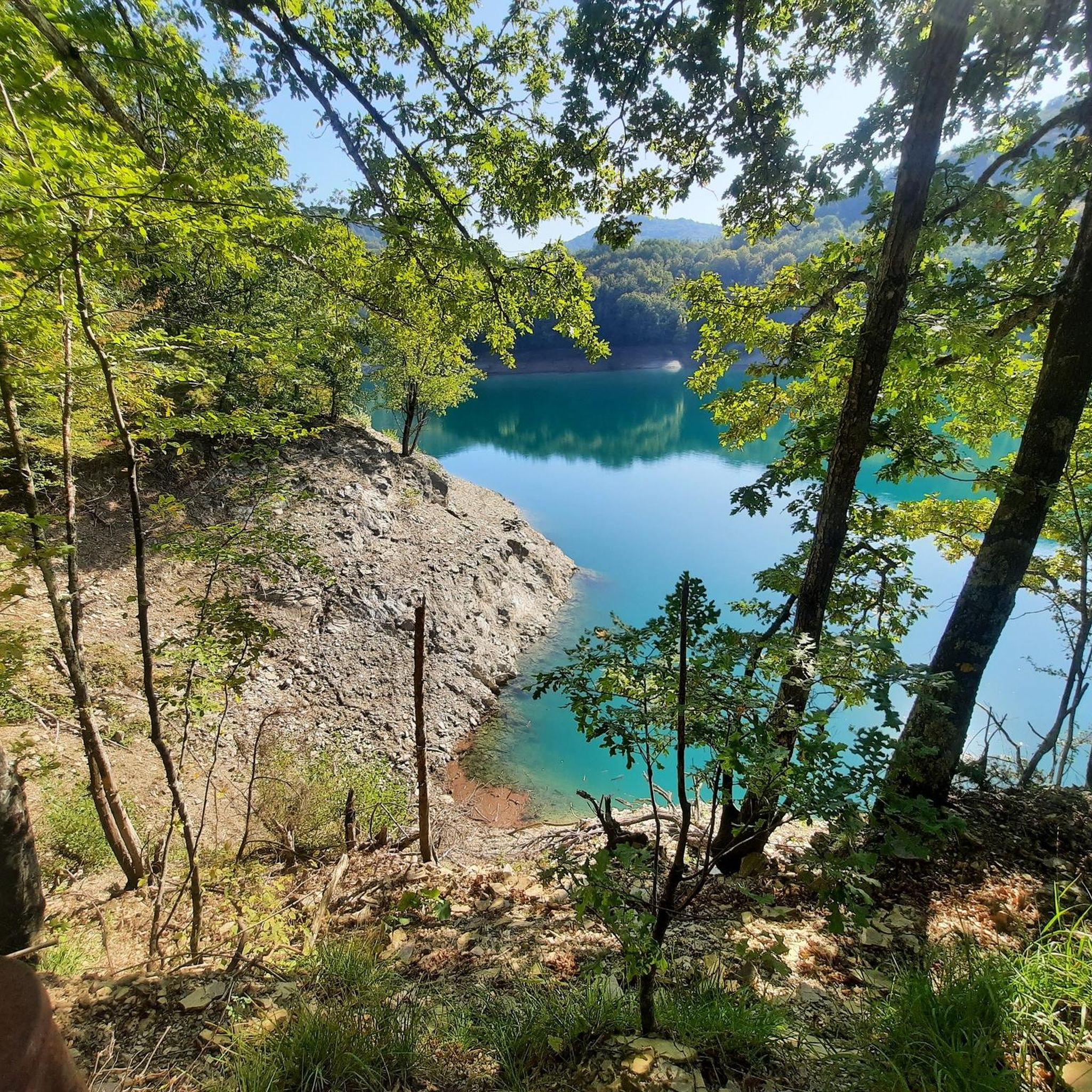
This route circles Lake Brugneto, Liguria's largest artificial lake, which was built between 1955 and 1960 to serve as Genoa's primary water reservoir. Located within the Antola Regional Natural Park, the area is rich in flora and fauna; you might spot aquatic birds like cormorants and herons, or even fallow deer in the surrounding woods. The path also features interesting historical elements, such as ancient stone bridges and views of an old mill with a waterfall.
1
runners
10.0km
01:55
650m
650m
Jogging the difficult 6.2-mile Monte Antola da Bavastrelli trail offers panoramic views and a 2133-foot elevation gain.

Sign up for free
Hard run. Very good fitness required. Sure-footedness, sturdy shoes and alpine experience required.
4.64km
01:05
460m
460m
This difficult 2.9-mile jogging trail from Caprile to Passo delle Tre Croci offers a challenging ascent through varied terrain in Parco dell
11
runners
16.8km
02:59
940m
940m
Embark on a challenging jogging route from Torriglia to Monte Antola, a difficult 10.5-mile (16.8 km) journey with a significant 3088 feet (941 metres) of elevation gain. You will start on cobbled mule tracks alongside a stream, transitioning to dirt roads and forest paths through dense woodlands of chestnut, oak, and beech. As you ascend, the terrain opens up to grassy ridges, leading to the summit of Monte Antola, where a distinctive large white cross marks the peak. This route typically takes around 2 hours and 59 minutes to complete, offering varied scenery and a rewarding workout.
Planning your visit requires good to very good fitness and sure-footedness due to the steep ramps and undulating sections. The trail is also used by horses and cows, so expect potentially muddy sections, especially in damp conditions. While the research doesn't specify trailhead access or parking details, be prepared for a substantial ascent to the 1597-meter peak. Near the summit, at 1460 meters, you will find the Rifugio Parco Antola, a mountain hut managed by the Club Alpino Italiano, which offers accommodation if you plan an overnight stay.
This trail is a segment of the ancient Via del Sale, or Salt Road, a historic route once used for transporting goods between the coast and inland regions. As you gain elevation, you will be treated to panoramic views across the Apennine mountains, including the artificial Lago del Brugneto. On clear days from Monte Antola's summit, you can see the Ligurian coast, the Mediterranean Sea, and even snow-capped peaks of the north-western Alps like Monviso and Monte Bianco. The Antola Natural Regional Park is rich in biodiversity, offering a chance to spot wild boar, roe deer, fallow deer, and wolves.
Get access to more routes and recommendations from other explorers.
Sign up for free
Already have an account?
Our route recommendations are based on thousands of hikes, rides, and runs completed by other people on komoot.
Start today with a free account
Your next adventure awaits.
Login or Signup
Tips from the Community

Ecclesiastical building kept in excellent condition.
18
0


Unfortunately this place is infested with ticks. Be very careful!
0
0

Is it swimmable?
0
0

Monte loved by the Genoese in summer and winter
0
0

beautiful and fun, definitely an experience to try at least once...
0
0
Beautiful peak to reach in all seasons. Path from the Roman's house with approximately 400 meters of altitude difference and suitable for everyone
0
1
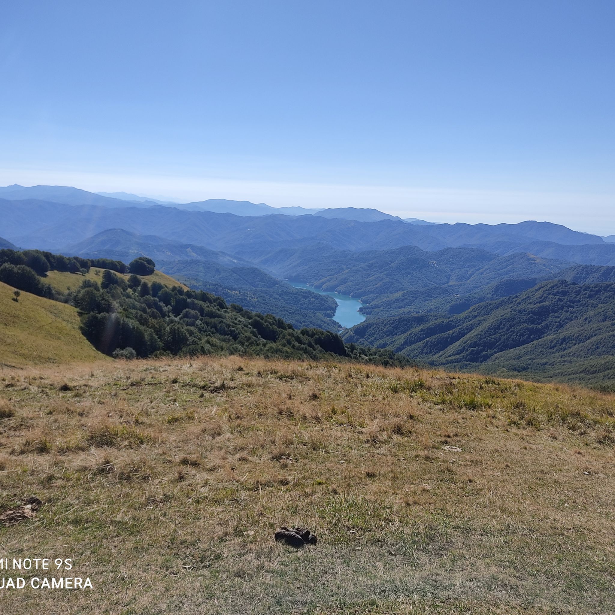
From the top of Mount Antola you can enjoy a beautiful view of the lake and up to the sea, in perfect conditions you can even see Corsica
0
0
Frequently Asked Questions
How many running trails are available around Lake del Brugneto?
There are 15 running routes around Lake del Brugneto, offering a variety of experiences for different fitness levels. While there are no routes specifically classified as 'easy', you'll find several moderate options and more challenging trails with significant elevation gains.
Are there any moderate running routes suitable for those new to the area?
Yes, for those looking for a moderate challenge, the Race tour around Lake Brugneto is an excellent choice. This 8.3-mile (13.4 km) trail offers panoramic views of the emerald waters and shaded forests, taking approximately 1 hour 44 minutes to complete.
What kind of landscapes can I expect to see while jogging around Lake del Brugneto?
Jogging around Lake del Brugneto offers a diverse range of landscapes. You'll experience tranquil lakeside scenery, dense woodlands, and cultivated fields. Many routes also provide stunning mountain views, as the lake is nestled within the Monte Antola Regional Park.
Are there any routes that offer significant elevation gain for a more challenging run?
Absolutely. For a more demanding run with substantial elevation gain, consider the Mount Antola Loop from Bavastrelli. This difficult 6.2-mile (10.0 km) path provides panoramic views within the Monte Antola Regional Park.
Can I bring my dog on the running trails around Lake del Brugneto?
Yes, the trails around Lake del Brugneto are generally dog-friendly, allowing you to enjoy your run with your canine companion. However, it's always advisable to keep your dog on a leash, especially in areas where wildlife might be present or near cultivated fields, and to respect local regulations within the Antola Regional Natural Park.
Are there any family-friendly activities or amenities near the jogging routes?
Beyond jogging, the area is great for families. There are four designated picnic areas along the lake path, some equipped with tables and stone barbecue stations. The varied terrain and natural beauty also make it suitable for leisurely walks or exploring the surrounding woodlands.
What are some notable points of interest or landmarks to look out for on the trails?
The lake itself is a beautiful centerpiece. During periods of low water, you might even spot the ruins of two submerged villages, Frinti and Mulino del Brugneto, which add a unique historical element. The surrounding Monte Antola Regional Park offers numerous viewpoints, and you might encounter local wildlife like deer, foxes, and various bird species.
What is the best time of year to go running around Lake del Brugneto?
The spring and autumn months are generally ideal for running around Lake del Brugneto, offering pleasant temperatures and vibrant natural scenery. Summer can also be enjoyable, especially in the shaded forest sections, but be prepared for warmer weather. Winter runs are possible but require appropriate gear due to colder temperatures and potential snow at higher elevations.
Are there any circular running routes available?
Yes, many of the routes around Lake del Brugneto are circular, allowing you to start and finish at the same point. The most prominent circular route is the Race tour around Lake Brugneto, which loops around the lake itself.
Where can I park when visiting the running trails at Lake del Brugneto?
Parking is generally available at various access points around Lake del Brugneto. Specific parking areas can be found near the dam and other popular trailheads, providing convenient access to the running routes. It's advisable to check local signage upon arrival for designated parking spots.
Are there any cafes or places to get refreshments near the running paths?
While direct amenities on the immediate lakeside paths might be limited, you can find cafes, pubs, and restaurants in nearby charming inland villages such as Torriglia, Propata, and Rondanina. These villages are a short drive from the lake and offer options for refreshments after your run.
What kind of wildlife might I encounter while running in the area?
Lake del Brugneto is a splendid nature reserve. While running, you might spot various aquatic birds like cormorants and herons near the water. In the surrounding woods, there's a chance to see deer, wild boars, foxes, and birds of prey. The presence of 'free horses' and 'deer herds' is also noted, adding to the wild appeal of the region.
What do other runners say about the trails around Lake del Brugneto?
The running routes around Lake del Brugneto are highly regarded by the komoot community, with an average rating of 5.0 stars. Runners often praise the diverse terrain, the stunning lakeside views, and the immersive experience of running through dense forests and open fields within the Antola Regional Natural Park.
Most popular routes around Lake del Brugneto

Get inspired with the komoot mobile app


Explore more
Browse the best Running Trails & Routes in other regions.
