The best cycling routes around Sanchorreja
5.0
(1)
27
riders
6
rides
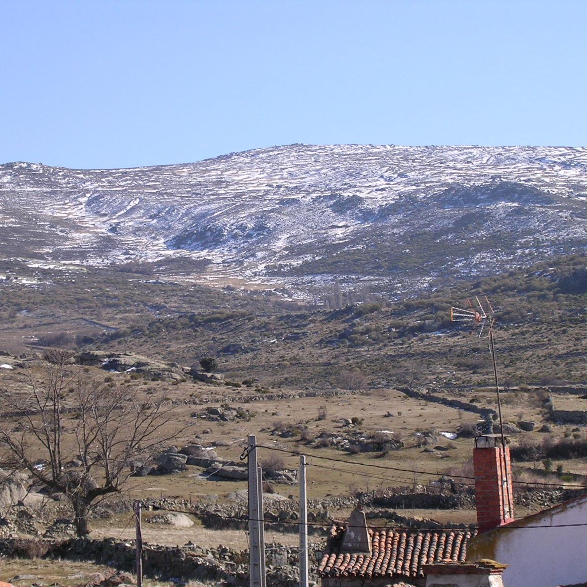
Touring cycling around Sanchorreja offers an elevated landscape within the Sierra de Ávila, providing a serene setting for outdoor activities. The region is characterized by hills, granite outcrops, pastureland, and oak groves, creating varied topography for cyclists. Quiet country roads allow for an immersive experience of the natural environment and local culture. This area provides a tranquil base to explore the natural beauty and historical richness of the surrounding province of Ávila.
Best touring cycling routes around Sanchorreja
- The most…
Last updated: August 25, 2026
9
riders
45.1km
04:12
500m
500m
Hard bike ride. Very good fitness required. Mostly paved surfaces. Suitable for all skill levels.
4
riders
27.8km
02:06
340m
340m
Moderate bike ride. Good fitness required. Mostly paved surfaces. Suitable for all skill levels.

Sign up for free
5.0
(1)
2
riders
23.5km
01:50
130m
130m
Easy bike ride. Great for any fitness level. Mostly paved surfaces. Suitable for all skill levels.
5
riders
55.0km
04:49
800m
800m
Hard bike ride. Very good fitness required. Mostly paved surfaces. Suitable for all skill levels.
2
riders
27.6km
02:23
300m
300m
Moderate bike ride. Good fitness required. Mostly paved surfaces. Suitable for all skill levels.
Our route recommendations are based on thousands of hikes, rides, and runs completed by other people on komoot.
Start today with a free account
Your next adventure awaits.
Login or Signup
Popular around Sanchorreja


Tips from the Community

The Church of Our Lady of the Assumption in El Fresno is a religious building that occupies one of the sides of the town's Plaza Mayor. Built in the 19th century, it was consecrated in 1803 under the dedication of Our Lady of the Assumption. This church replaced a previous parish temple, dedicated to Our Lady of Galindos, which was located away from the urban center. Although its exterior appearance is simple, with ashlars and a brick belfry, its interior offers a reconstructed space with a flat plastered ceiling. On the west side, the belfry stands out with three openings for bells. The temple houses free-standing images, such as a wooden Crucified from the 17th-18th centuries and a Virgin and Child from 1867. The latter, the work of drawing professor Ramón Álvarez, is appreciated for the joyful expression of the Child. If you have the opportunity, I invite you to visit this church full of history and devotion. 🙏🌟
2
0
Aldea del Rey Niño is a Spanish district that belongs to the municipality of Ávila, capital of the homonymous province, in the autonomous community of Castilla y León. Although its full history is not yet fully documented, archaeological remains have been found indicating the existence of Roman settlements in the area. The town is located inside the municipality of Ávila, in the foothills of the Sierra de Yemas. If you ever get the chance, I highly recommend exploring this charming area. 🏞️🌿
2
0
Aveinte, a name with historical roots, has a fascinating legend dating back to ancient times. Many centuries ago, at the dawn of the Middle Ages, there was a small town in what we know today as Aveinte. The inhabitants of this place were simple people, dedicated mainly to agriculture and livestock. They lived in harmony with nature and worshiped the gods of the earth and sky. One day, during a time of drought and scarcity, the locals gathered in the town square to pray for rain and good harvests. The wise old man of the place, known as Adventius, led the ceremony. With his wrinkled hands and deep voice, he spoke words of supplication to heaven. Legend has it that, at that crucial moment, a mysterious figure appeared among the clouds. He was a luminous being, dressed in white robes and silver hair. The villagers were amazed and knelt before this heavenly presence. The being addressed Adventius and spoke to him in an ancient language that only he understood. “For your devotion and the faith of your people, I will grant a blessing,” he said. “From now on, every twenty years, the waters of the river that runs through Aveinte will overflow, fertilizing the land and ensuring abundant harvests.” Thus the name Aveinte was born, which means “advent” or “arrival” in honor of the heavenly visit. Since then, every twenty years, the river overflows and renews the earth, fulfilling the promise of the luminous being. The inhabitants of Aveinte keep this tradition alive and celebrate “Aveinte” with joy and gratitude. The legend has been passed down from generation to generation, and the town's name remains a reminder of its connection to the divine and renewed hope. So, when you walk through the cobblestone streets of Aveinte, remember this story and the magic that surrounds its name. 🌟🏡
2
0

A charming small town with a heritage dating back to Roman times. The town church can be your starting point for an adventure in the area and a trailhead to the Sierra de Yemas.
2
0
Leaving the river landscape you reach the center of the town and you can rest in the church of Nuestra Señora de la Asunción, from the 19th century.
1
1

It is the parish church of Gotarrendura and its construction dates from the s. XVII. Regarding its artistic style, it connects very well with the Mudejar style typical of its area, although its baroque part stands out more.
1
0
Mural at the entrance to the town of Gotarrendura that claims the birth of Santa Teresa in this town in Avila.
1
0

Cardeñosa is the ideal place to stop along the way and have a drink to continue the route. Here is the Castro Interpretation Center
1
0
Frequently Asked Questions
How many touring cycling routes are available around Sanchorreja?
There are currently 4 touring cycling routes around Sanchorreja listed on komoot. These routes offer a variety of experiences, from moderate to difficult, exploring the elevated landscapes of the Sierra de Ávila.
What kind of terrain can I expect on touring cycling routes in Sanchorreja?
Touring cyclists in Sanchorreja can expect varied terrain characterized by hills, granite outcrops, pastureland, and oak groves. The routes often follow quiet country roads, providing scenic ascents and descents with panoramic views. While some segments are paved, you might encounter unpaved sections as well.
Are there any circular touring cycling routes in the Sanchorreja area?
Yes, several touring cycling routes around Sanchorreja are circular. For example, you can try the Sotalbo loop from La Colilla, a challenging 51.3 km ride, or the moderate Views of Ávila loop from La Colilla, which is 35.8 km and offers great vistas.
What are some notable landmarks or attractions I can see while cycling near Sanchorreja?
While cycling near Sanchorreja, you can explore charming settlements and natural features. Highlights include the village of Cardeñosa, the historic Muñogalindo, and the scenic Las Fuentes Pass. The region also features traditional architecture and the important archaeological site of Los Castillejos within Sanchorreja's municipal area.
Are there any moderate touring cycling routes suitable for intermediate cyclists?
Yes, there are moderate touring cycling routes available. The Views of Ávila loop from La Colilla is a moderate 35.8 km path offering panoramic views. Another good option is the Muñogalindo – Oco Village Water Pond loop from Muñogalindo, which is 27.8 km long and also rated moderate.
What is the best season for touring cycling in Sanchorreja?
Given Sanchorreja's elevated position at 1310 meters in the Sierra de Ávila, spring and autumn generally offer the most pleasant conditions for touring cycling. Temperatures are milder, and the natural landscapes are vibrant. Summers can be warm, while winters might bring colder temperatures and potentially snow at higher elevations, making them more challenging.
What do other touring cyclists say about the routes in Sanchorreja?
The touring cycling routes around Sanchorreja are highly regarded by the komoot community, with an average score of 5.0 stars from reviews. Cyclists often praise the serene setting, the varied topography, and the opportunity to ride along quiet country roads, away from heavy traffic, allowing for an immersive experience of the natural environment.
Are there any challenging touring cycling routes for experienced riders?
Absolutely. For experienced touring cyclists seeking a challenge, routes like the Sotalbo loop from La Colilla stand out. This route covers 51.3 km and features significant elevation changes. Another demanding option is the Puerto de Villatoro – Las Fuentes Pass loop from La Torre, a 56.3 km trail leading through mountainous passes.
Can I find routes that offer views of Ávila city?
Yes, some routes provide excellent views of the historic city of Ávila. The Views of Ávila loop from La Colilla is specifically designed to offer panoramic vistas of the surrounding landscape and the city, which is a UNESCO World Heritage site.
What kind of natural features will I encounter on a touring bike ride in this region?
The region around Sanchorreja, nestled in the Sierra de Ávila, is rich in natural beauty. You'll encounter diverse landscapes including rolling hills, distinctive granite outcrops known as 'berrocales', expansive pastureland, and beautiful oak groves ('encinares de dehesa'). These features provide a constantly changing and picturesque backdrop for your ride.
Is Sanchorreja a good base for exploring the wider Ávila province by touring bike?
Sanchorreja serves as a tranquil and elevated base for exploring the broader Ávila province. Its location allows access to a network of quiet country roads that connect to other areas known for diverse cycling opportunities, including parts of the Sierra de Gredos Regional Park, which offers stunning natural scenery.
Most popular routes around Sanchorreja
Most popular attractions around Sanchorreja

Get inspired with the komoot mobile app


Explore more
Browse the best Cycling routes in other regions.
