The best walks and hikes around Griovių geomorfologinis draustinis
4.7
(724)
11,024
hikers
442
hikes
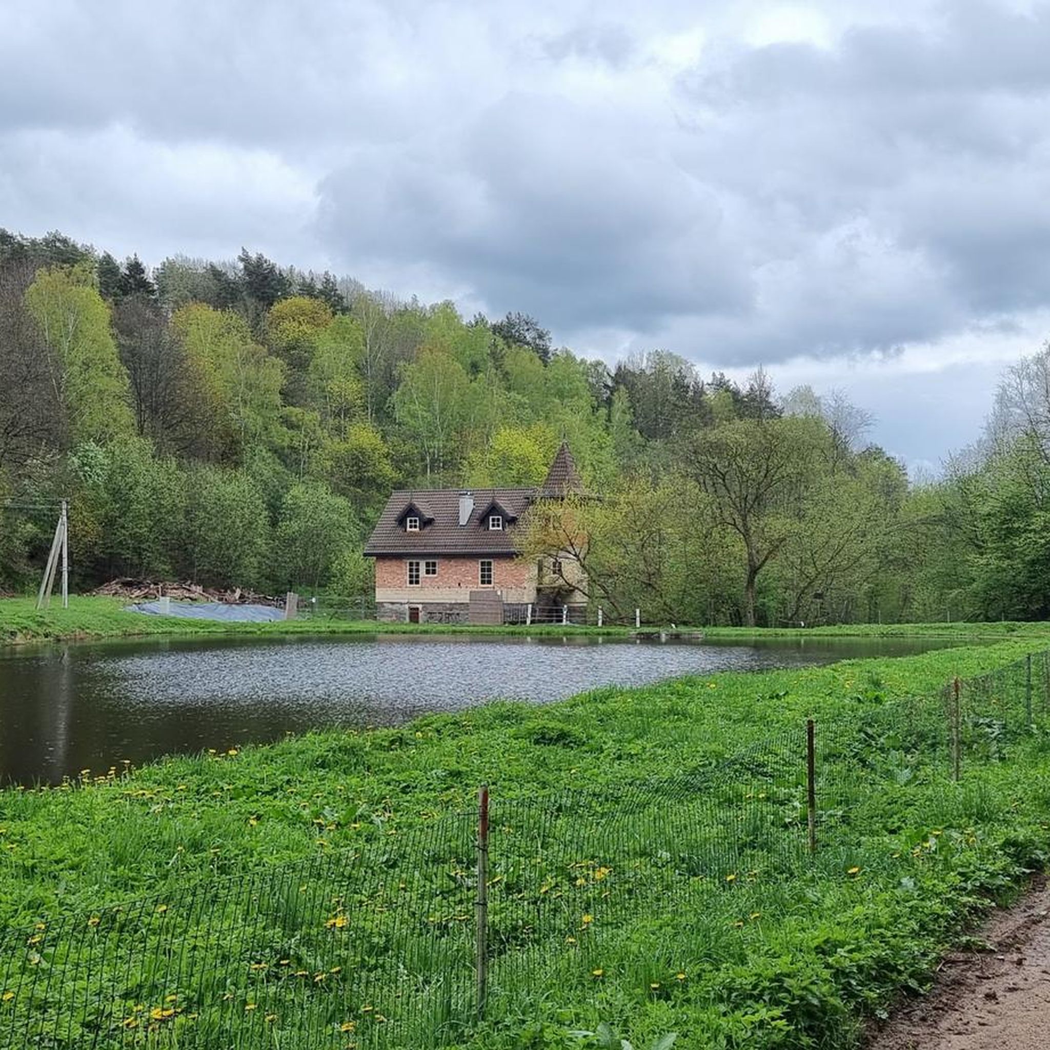
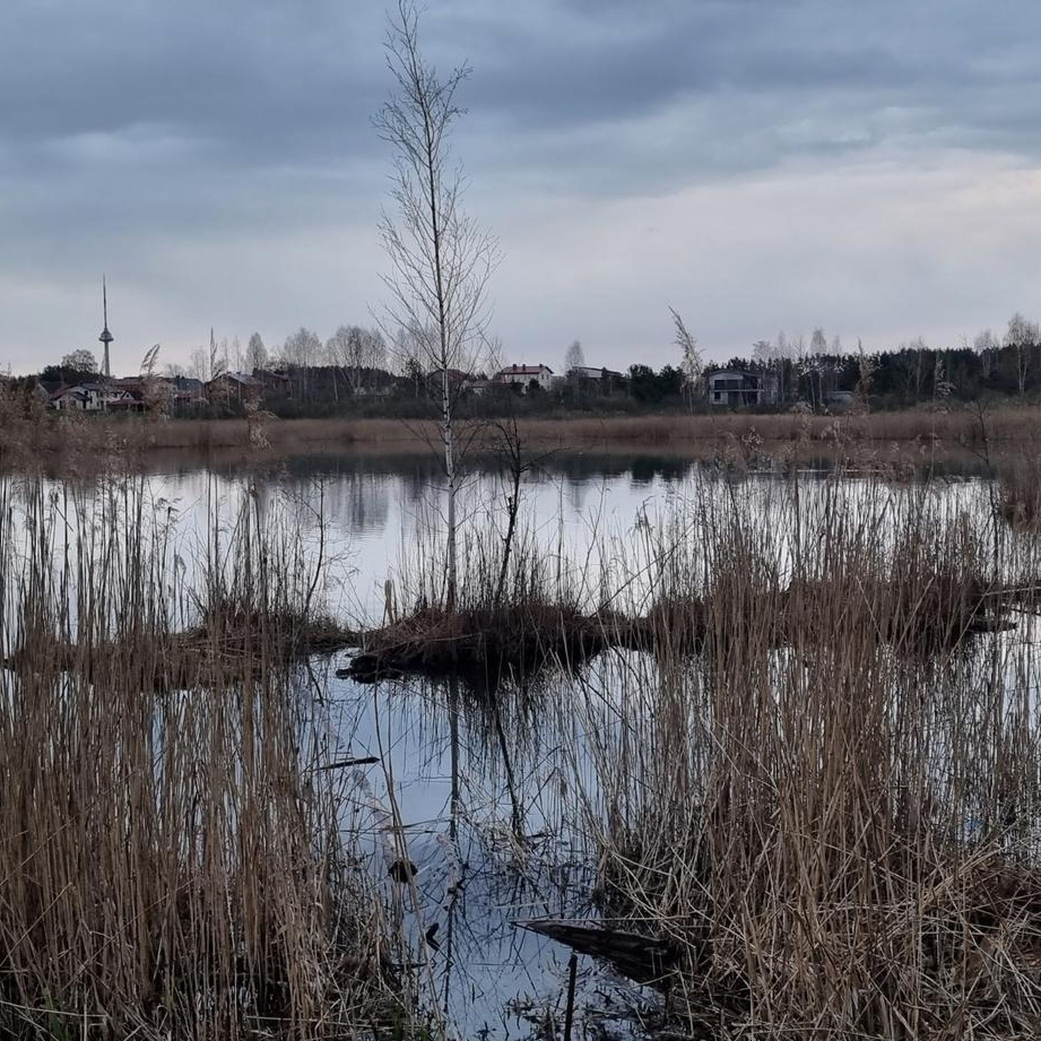
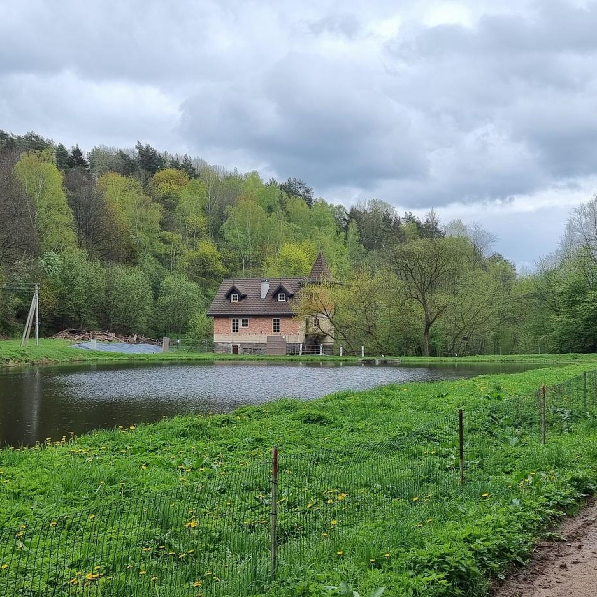
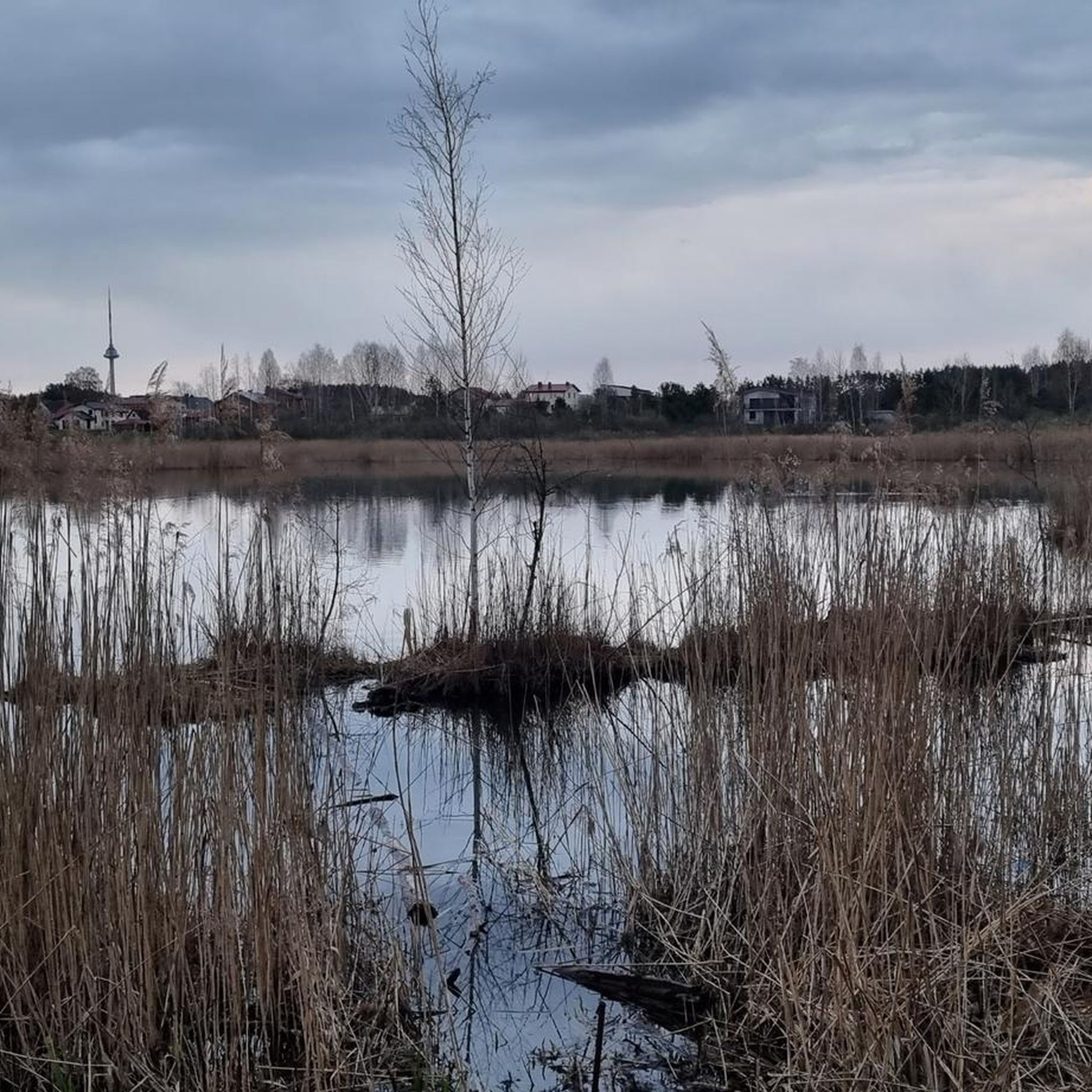
Hiking around Griovių geomorfologinis draustinis offers exploration through a complex natural landscape. The region is characterized by erosional hilly terrain, featuring distinct ravine-type formations and significant elevation changes. Extensive and diverse forests, including spruce, pine, and oak stands, cover much of the area. Numerous springs feed small streams that meander through valleys, and higher points provide views of the deep Neris valley.
Best hiking trails around Griovių geomorfologinis draustinis
- The most popular hiking route is Bieliūnai Oak – View of the Snowy Forest loop from Grioviai geomorphological reserve, a 9.5 miles (15.3 km) trail that takes 4 hours 15 minutes to complete. This moderate route winds through diverse forest types and hilly terrain.
- Another top favourite among local hikers is View of the Neris River – Mniszek Memorial Site loop from Zujūnai Eldership, a moderate 11.0 miles (17.7 km) path. This route offers views of the Neris River and passes a memorial site.
- Local hikers also love the Grigiškių tv. loop from Grigiškės, a 2.1 miles (3.3 km) trail leading through forested areas, often completed in about 52 minutes.
- Hiking around Griovių geomorfologinis draustinis is defined by erosional hilly terrain, diverse forests, and views of the Neris valley. The network offers options for easy, moderate, and more challenging ability levels.
- The routes in Griovių geomorfologinis draustinis are highly rated by the komoot community with an average score of 4.6 stars from over 600 reviews. More than 9000 hikers have used komoot to explore Griovių geomorfologinis draustinis's varied terrain.
Last updated: September 3, 2026
4.4
(7)
34
hikers
Moderate hike. Good fitness required. Easily-accessible paths. Suitable for all skill levels.
5
hikers
3.35km
00:52
20m
20m
Easy hike. Great for any fitness level. Easily-accessible paths. Suitable for all skill levels.

Sign up for free
4.7
(7)
32
hikers
Moderate hike. Good fitness required. Easily-accessible paths. Suitable for all skill levels.
4.7
(6)
15
hikers
9.88km
02:38
100m
100m
Moderate hike. Good fitness required. Easily-accessible paths. Suitable for all skill levels.
4.0
(1)
21
hikers
Hard hike. Very good fitness required. Easily-accessible paths. Suitable for all skill levels.
Get access to more routes and recommendations from other explorers.
Sign up for free
Already have an account?
Our route recommendations are based on thousands of hikes, rides, and runs completed by other people on komoot.
Start today with a free account
Your next adventure awaits.
Login or Signup
Popular around Griovių geomorfologinis draustinis
Tips from the Community

A must when you are there
0
0

Vilnius Cathedral was built in 1779.
3
1

Vinkas Kudirka was editor of the newspaper Varpas ("The Bell") and founder of the Varpininkai ("The Hunchback") movement. He is considered one of the leading thinkers of the Lithuanian popular movements in the 19th century. However, it should be noted that he made derogatory comments about the Jewish population. In 1898, Vincas Kudirka wrote the text and composed the music of the national anthem Tautiška giesmė. Source and further information: https://de.m.wikipedia.org/wiki/Vincas_Kudirka
0
0


Šilenai St. The Church of the Virgin Mary is a church located in the village of Šilėnai, 16 km west of Vilnius. Forms of folk architecture. Services are held only in Polish. The church has folk architectural forms, a rectangular plan, with 2 turrets, a narrow three-walled apse, and a low sacristy. The church is single-nave, has 3 altars. There is a cemetery and a lourdes grotto in the churchyard. Its fence is stone masonry.
0
0

The Cathedral Basilica of St Stanislaus and St Ladislaus of Vilnius (EN) Cathedral of Vilnius (IT) Vilnius Archcathedral (LT) La cattedra metropolitana dei Santi Stanislao e Ladislao (in Lithuanian Vilnius St. Stanislaus and St. Vladislaus Archcathedral Basilica) is the principal place of culto cattolico di Vilnius, in Lithuania, and cattedrale dell'archidiocesi di Vilnius. taken from Wikipedia
1
1


Gediminas (also Gedimin; * around 1275; † December 1341) was Grand Duke of Lithuania from 1316. Along with Mindaugas and Vytautas, he is one of the great rulers in Lithuanian history. Under him, Lithuania finally rose to become a major Eastern European power and Gediminas considered himself the “King of the Lithuanians and Ruthenians”. Source: Wikipedia
2
0
Frequently Asked Questions
How many hiking trails are available in Griovių geomorfologinis draustinis?
Griovių geomorfologinis draustinis offers a wide variety of hiking experiences with over 400 routes. This includes more than 260 easy trails, 120 moderate options, and a selection of more challenging paths for experienced hikers.
What kind of landscape and terrain will I encounter while hiking here?
The reserve is characterized by its complex and picturesque natural landscape, featuring erosional hilly terrain with distinct ravine-type formations. You'll hike through extensive and diverse forests, including dark spruce, bright pine, and oak groves. Several natural springs feed small streams that meander through the valleys, adding to the scenic beauty. From higher points, you can enjoy excellent views of the deep Neris valley.
Are there any easy or family-friendly hiking routes?
Yes, Griovių geomorfologinis draustinis is well-suited for families and those seeking easier walks. There are over 260 easy routes available. A popular choice is the Grigiškių tv. loop from Grigiškės, an easy 2.1-mile (3.3 km) trail through forested areas, typically completed in under an hour.
Are dogs allowed on the hiking trails?
While specific regulations for dogs can vary, generally, dogs are welcome on trails in natural reserves like Griovių geomorfologinis draustinis, provided they are kept on a leash and owners clean up after them. It's always a good idea to check local signage upon arrival for any specific restrictions.
Are there any circular hiking routes in the area?
Yes, many of the trails in Griovių geomorfologinis draustinis are designed as circular routes, allowing you to start and end at the same point. Examples include the Bieliūnai Oak – View of the Snowy Forest loop from Grioviai geomorphological reserve, a moderate 9.5-mile (15.3 km) trail, and the Bieliūnai Oak – View of the Snowy Forest loop from Grigiškės Eldership, a moderate 5.4-mile (8.7 km) option.
What are some notable natural features or viewpoints along the trails?
The reserve is rich in natural features. You'll find numerous springs and small streams winding through valleys. From the higher points and hills, hikers can enjoy excellent views of the deep Neris valley. The diverse forests themselves, with dark spruce, bright pine, and oak groves, are a significant natural highlight.
What do other hikers enjoy most about Griovių geomorfologinis draustinis?
The area is highly rated by the komoot community, with an average score of 4.6 stars from over 600 reviews. Hikers often praise the diverse and picturesque landscape, the engaging hilly terrain, and the tranquility of the extensive forests. The variety of routes, from easy walks to more challenging hikes, is also frequently highlighted.
Is there parking available for hikers?
While specific designated parking areas are not detailed, natural reserves in Lithuania typically have informal or small official parking spots near popular trailheads or access points. Given the proximity to Vilnius, it's advisable to look for parking near the starting points of routes like those originating from Grigiškės or Zujūnai Eldership.
Can I reach Griovių geomorfologinis draustinis using public transport?
As the reserve is located near Vilnius, public transport options, such as local buses, likely serve the surrounding towns and villages like Grigiškės or Pilaitė, which are common starting points for hikes. It's recommended to check local bus schedules from Vilnius to these areas for the most up-to-date information.
What is the best time of year to visit Griovių geomorfologinis draustinis for hiking?
Griovių geomorfologinis draustinis offers beautiful hiking opportunities throughout the year. Spring brings lush greenery and blooming flora, while autumn showcases vibrant fall colors in the diverse forests. Summer is ideal for longer hikes, and even winter can be picturesque with snow-covered landscapes, though some trails might be more challenging.
Are there any longer, more challenging routes for experienced hikers?
Yes, for those seeking a longer and more challenging experience, routes like the View of the Neris River – Mniszek Memorial Site loop from Zujūnai Eldership offer a moderate 11-mile (17.7 km) journey with significant elevation gain, providing a rewarding adventure through varied terrain and scenic views.
Most popular routes around Griovių geomorfologinis draustinis

Get inspired with the komoot mobile app


Explore more
Browse the best Hikes in other regions.
