The best running trails around Parco dei Monti Aurunci
4.2
(31)
2,062
runners
117
runs
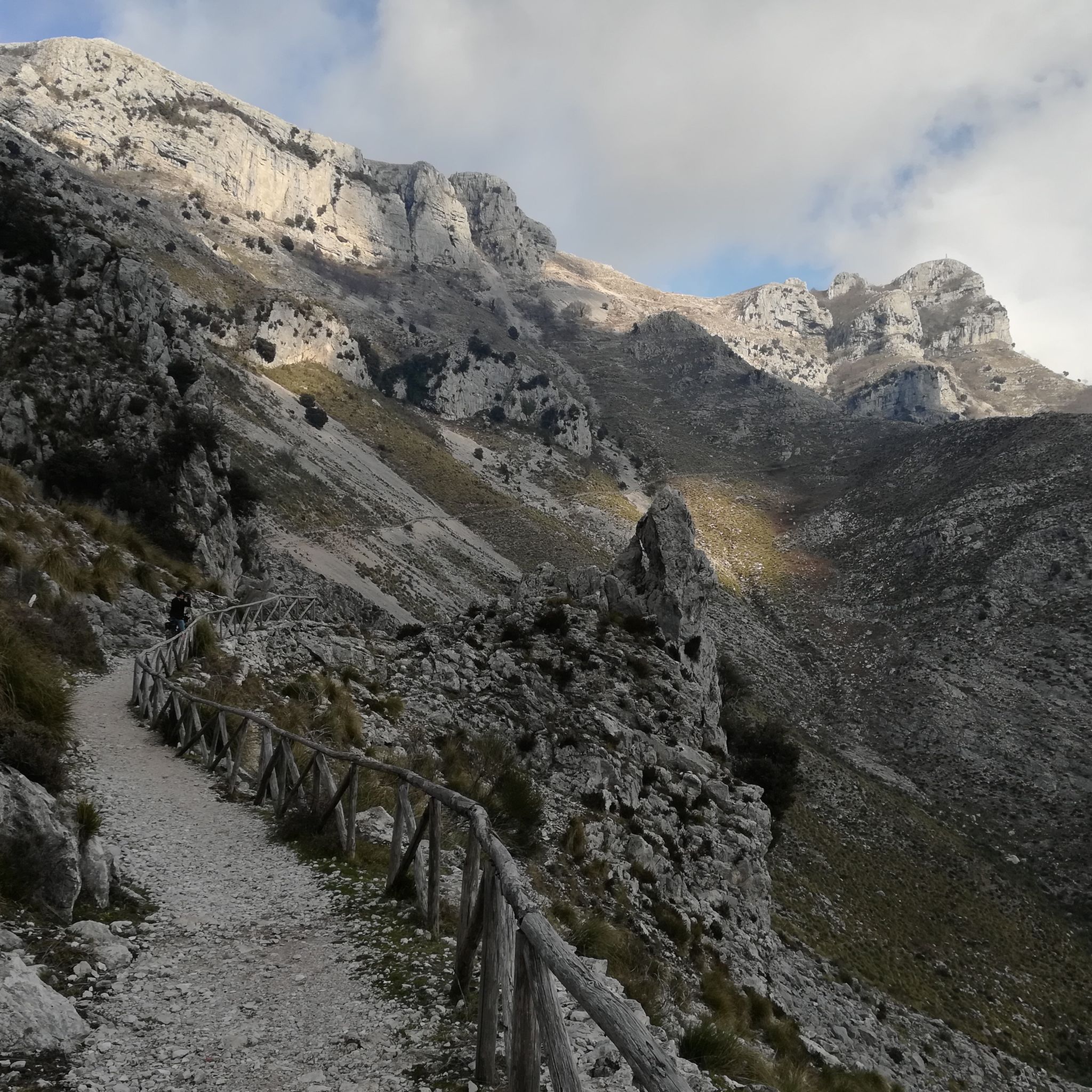
Jogging around Parco dei Monti Aurunci offers diverse terrain, ranging from lowland areas to high peaks, with significant elevation changes. The region is characterized by its mountainous landscape, including prominent peaks like Monte Petrella, which provides panoramic views. Joggers can explore routes through dense beech forests and mixed forests of oaks and maples, offering varied scenery. The park's proximity to the Tyrrhenian Sea also allows for routes with coastal vistas.
Best jogging routes around Parco dei Monti Aurunci
- The most…
Last updated: July 8, 2026
6.62km
00:58
290m
290m
Moderate run. Good fitness required. Mostly accessible paths. Some sure footedness required.
66
runners
Hard run. Very good fitness required. Mostly paved surfaces. Suitable for all skill levels.

Sign up for free
62
runners
Hard run. Very good fitness required. Mostly paved surfaces. Suitable for all skill levels.
7
runners
Hard run. Very good fitness required. Mostly paved surfaces. Suitable for all skill levels.
6
runners
12.4km
01:21
220m
220m
Moderate run. Good fitness required. Mostly paved surfaces. Suitable for all skill levels.
Get access to more routes and recommendations from other explorers.
Sign up for free
Already have an account?
Our route recommendations are based on thousands of hikes, rides, and runs completed by other people on komoot.
Start today with a free account
Your next adventure awaits.
Login or Signup
Tips from the Community

Beautiful trail, also suitable for cycling, naturally downhill, at times very stony and loose with very large rocks, steps, and rocky parts. The gradients in some sections are double-digit but for short stretches. Excellent riding skills or carrying the bike are required. The panorama repays the difficulties.
0
0
Once at the top of the climb, a wonderful panorama opens up over the valley with a view of Christ the Redeemer.
0
0

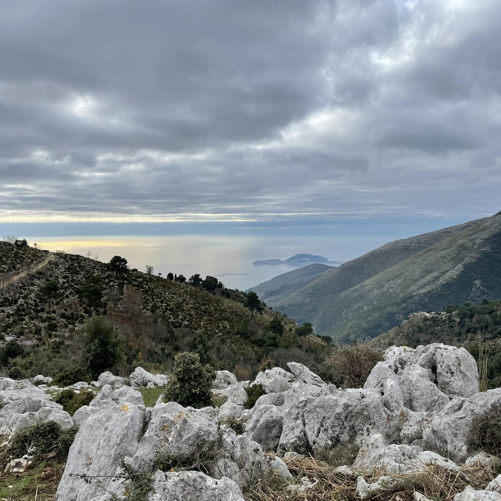
The climb to the Redentore rewards with a breathtaking panorama of the Gulf of Gaeta
0
0

This saddle is fast and allows you to catch your breath before the last ramps that give access to the monument.
0
0
It's the real reward for all the climbing. The ramps that lead up to the monument are technically challenging. Lower the saddle, put a hard gear and push all the way to the top.
2
0
Challenging until the end where roots and rocks increase the difficulty level but also the technical fun
0
0

In my opinion one of the most worthwhile views of the Aurunci
0
0
Breathtaking view on a beautiful day
0
0
Frequently Asked Questions
How many running routes are available in Parco dei Monti Aurunci?
Parco dei Monti Aurunci offers over 100 diverse running routes, catering to various fitness levels. You'll find everything from moderate paths to more challenging mountain trails, with a total of 105 routes documented on komoot.
What kind of terrain can I expect on the running trails in Parco dei Monti Aurunci?
The terrain in Parco dei Monti Aurunci is highly varied, ranging from lowland areas to high peaks. You can expect significant elevation changes, mountainous landscapes, and diverse forests including dense beech forests and mixed oak and maple woods. Some routes also offer breathtaking views of the Tyrrhenian Sea coast.
Are there any running routes with panoramic views in the park?
Absolutely! Many routes in Parco dei Monti Aurunci offer spectacular panoramic views. For instance, the route From Fonte Canale to Monte Petrella ascends towards Monte Petrella, providing excellent vistas. Another challenging option is the Monte Sant'Angelo Summit – Fontana di Canale loop, which includes a substantial climb to Monte Sant'Angelo Summit for expansive views of the coast and islands.
What are some interesting landmarks or natural features to see while jogging?
While jogging in Parco dei Monti Aurunci, you can encounter several notable landmarks and natural features. The historic Hermitage of St. Michael the Archangel is a significant cultural attraction. You might also pass by impressive summits like Cima del Redentore (Monte Altino) or Monte Petrella, which offer stunning views. The park's diverse forests, including ancient beech woods, are also a beautiful natural highlight.
Are there any easy or beginner-friendly running routes in Parco dei Monti Aurunci?
Yes, while many routes involve significant elevation, there are options suitable for beginners. The park features 7 routes classified as easy. These trails typically have less elevation gain and are shorter in distance, providing a gentler introduction to running in the Aurunci Mountains.
Can I find circular running routes in the area?
Yes, many of the running paths in Parco dei Monti Aurunci are designed as loops, allowing you to start and finish at the same point. Examples include the challenging Monte Sant'Angelo Summit – Fontana di Canale loop and the Cima del Redentore – Monte Moleta loop, both starting from Area del Pellegrino Fossa Massaraccio.
What do other runners say about the trails in Parco dei Monti Aurunci?
The running routes in Parco dei Monti Aurunci are highly regarded by the komoot community, with an average rating of 4.0 stars from over 30 reviews. More than 1800 runners have explored the varied terrain, often praising the challenging climbs, rewarding views, and the natural beauty of the diverse forests.
Are there any running routes near the coast or with sea views?
Yes, the unique geography of the Aurunci Mountains means they directly overlook the Tyrrhenian Sea. This allows for routes that combine mountainous terrain with coastal vistas. While many routes are inland, some offer glimpses of the sea, especially from higher elevations like Monte Petrella. For a more direct coastal experience, consider the Old Gaeta Seafront – Strada Massimo Running Route loop from Formia, which offers a different perspective near the water.
What is the best time of year for running in Parco dei Monti Aurunci?
Spring and autumn are generally ideal for running in Parco dei Monti Aurunci. In spring, the forests are vibrant with blooming wildflowers, including over 50 species of orchids. Autumn offers cooler temperatures and beautiful foliage. Summer can be hot, especially at lower elevations, so early morning or late afternoon runs are recommended. Winter running is possible, but higher mountain trails may be subject to snow or ice.
Are there any family-friendly running options in the park?
While many routes involve significant elevation, families looking for a run can find suitable options among the easier trails. These routes are typically shorter and less strenuous, allowing for a more relaxed experience. It's always advisable to check the route details and difficulty grade on komoot to ensure it matches your family's fitness level.
Is it possible to access running trails by public transport?
Access to some areas of Parco dei Monti Aurunci is possible via public transport, particularly to towns and villages on the periphery. However, direct public transport links to specific trailheads within the more remote mountainous areas can be limited. It's recommended to research local bus services to the nearest towns and plan your route accordingly, or consider driving to designated parking areas.
Where can I park my car when visiting the running routes?
Many popular trailheads and access points within Parco dei Monti Aurunci have designated parking areas. For example, routes like the Monte Sant'Angelo Summit loop often start from areas like Area del Pellegrino Fossa Massaraccio, which typically offers parking facilities. Always check the specific route details on komoot for information on parking availability at the starting point.
Most popular routes around Parco dei Monti Aurunci
Most popular attractions around Parco dei Monti Aurunci

Get inspired with the komoot mobile app


Explore more
Browse the best Running Trails & Routes in other regions.
