The best running trails around Galindo Y Perahuy
4.0
(21)
1,996
runners
73
runs
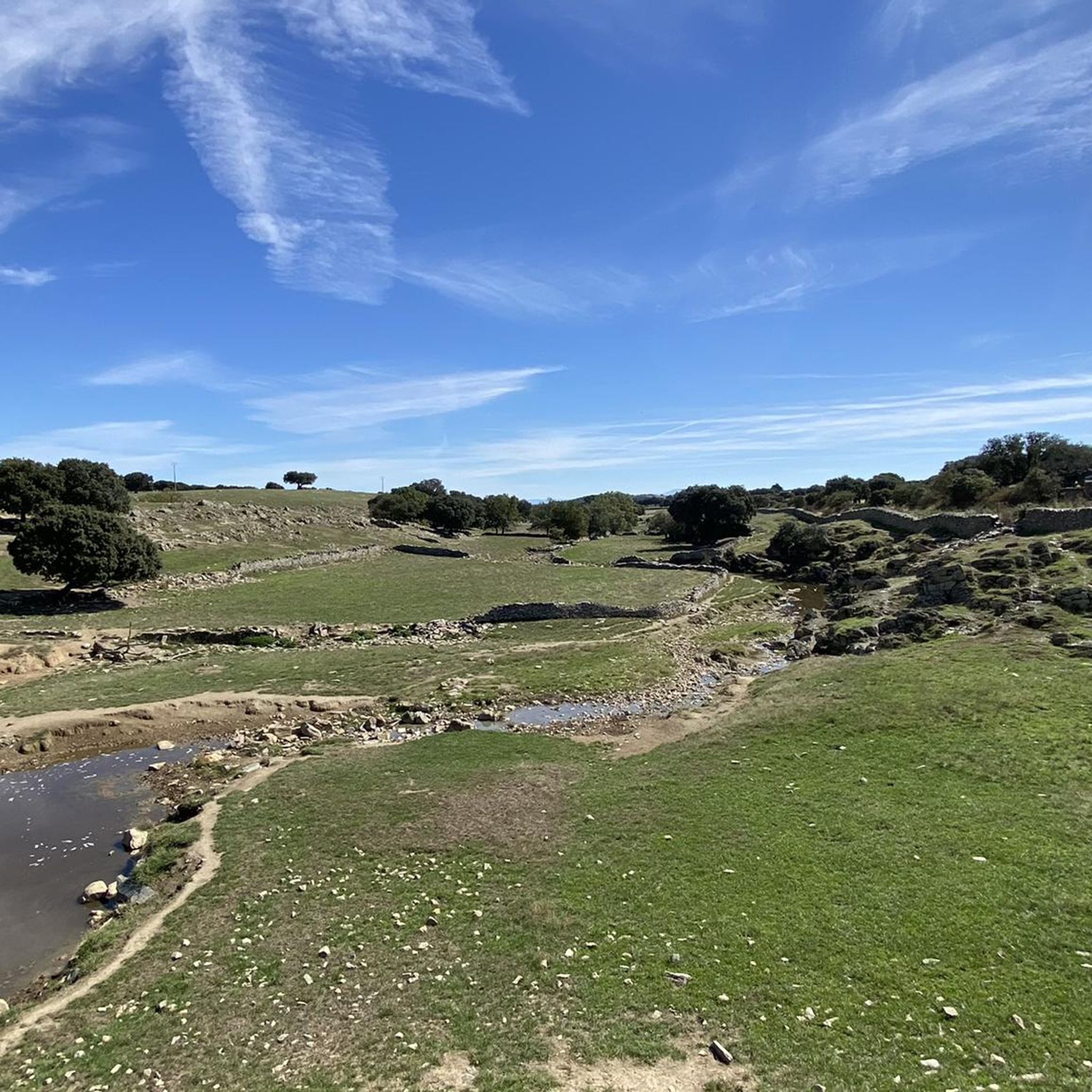
Jogging around Galindo Y Perahuy offers access to the distinctive dehesa ecosystem of the Campo Charro region. This landscape features open woodlands of holm oaks and cork oaks, interspersed with expansive pastures and meadows. The terrain is characterized by gently rolling hills and extensive plains, providing varied backdrops for running. A network of accessible rural paths and municipal roads makes the area suitable for outdoor activities.
Best jogging routes around Galindo Y Perahuy
- The most popular jogging route is River…
Last updated: May 16, 2026
3
runners
4.99km
00:28
10m
10m
Easy run. Great for any fitness level. Mostly paved surfaces. Suitable for all skill levels.
5.0
(2)
20
runners
7.62km
00:49
20m
20m
Moderate run. Good fitness required. Mostly paved surfaces. Suitable for all skill levels.

Sign up for free
16
runners
Moderate run. Good fitness required. Mostly paved surfaces. Suitable for all skill levels.
13
runners
8.62km
01:01
150m
150m
Moderate run. Good fitness required. Mostly paved surfaces. Suitable for all skill levels.
10
runners
13.5km
01:28
160m
160m
Moderate run. Good fitness required. Mostly paved surfaces. Suitable for all skill levels.
Get access to more routes and recommendations from other explorers.
Sign up for free
Already have an account?
Our route recommendations are based on thousands of hikes, rides, and runs completed by other people on komoot.
Start today with a free account
Your next adventure awaits.
Login or Signup
Tips from the Community

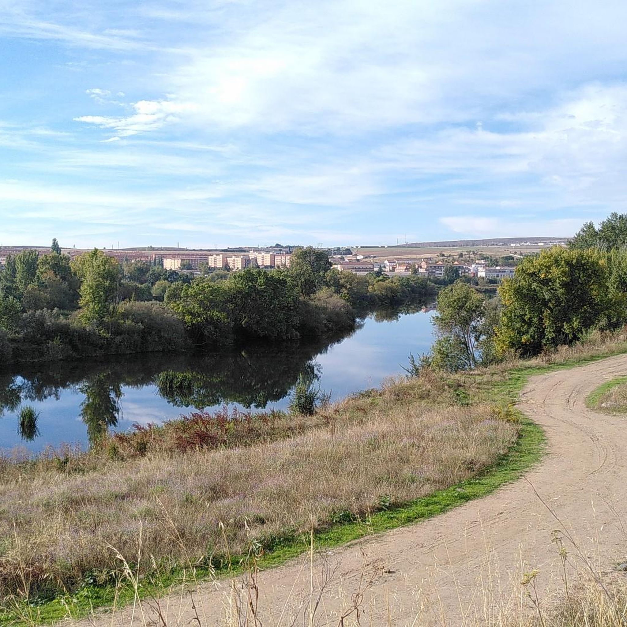
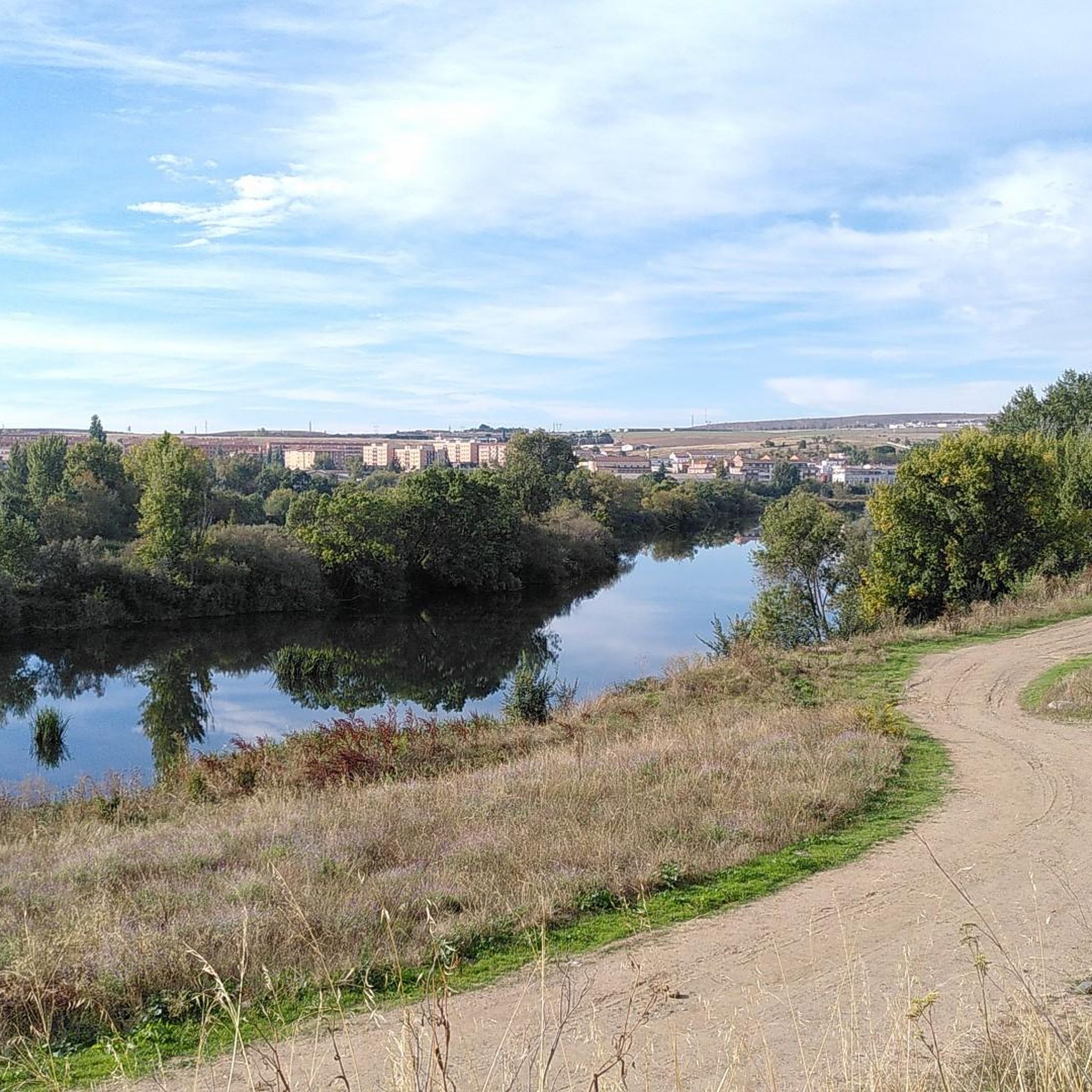
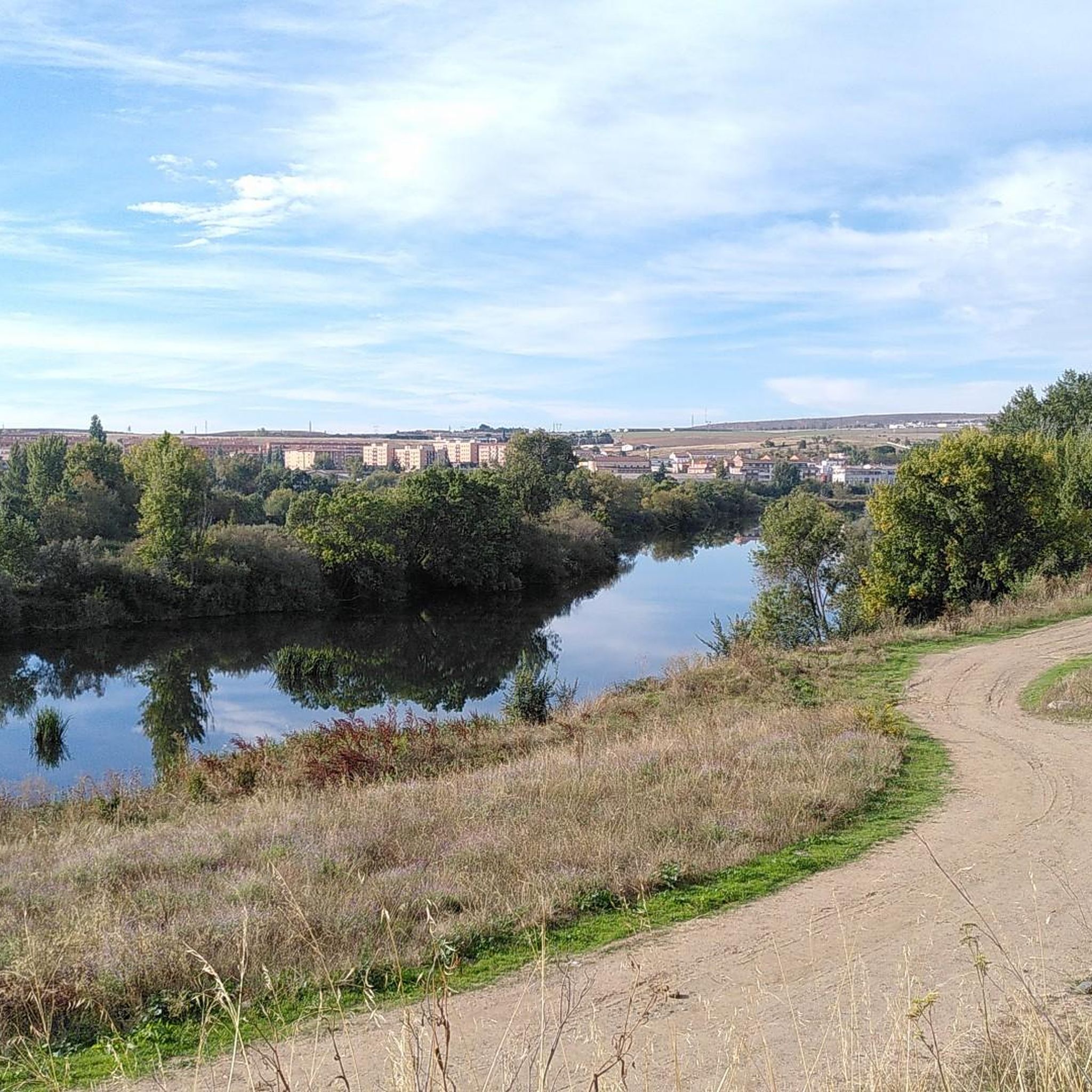
The Tormes is a river, a tributary of the Duero on its left bank, which runs through the provinces of Ávila, Salamanca and Zamora, in the autonomous community of Castilla y León,
3
0

Bridge that is located near the town of Villamayor and that passes over the Tormes River. This, with its great flow, offers incredible views of the banks of the same river.
0
1

As it passes through Salamanca, the Tormes River offers a very picturesque landscape that can be enjoyed walking the Paseo Fluvial path through the town of Villamayor and even reaching Salamanca following the course of the river.
1
1
Frequently Asked Questions
How many running routes are available in Galindo y Perahuy?
There are over 70 running routes around Galindo y Perahuy, offering a wide variety of options for different preferences and fitness levels.
What kind of terrain can I expect on the running trails around Galindo y Perahuy?
The terrain in Galindo y Perahuy is characterized by the distinctive dehesa ecosystem of the Campo Charro region. You'll find gently rolling hills and extensive plains, with routes often following municipal paths and rural roads through open woodlands of holm oaks and cork oaks, interspersed with pastures and meadows. This provides a visually appealing and varied backdrop for your runs.
Are there running routes suitable for beginners in Galindo y Perahuy?
Yes, Galindo y Perahuy offers several easy running routes perfect for beginners. The gentle topography of the Campo Charro region, with its largely flat or mildly undulating paths, is ideal for those new to running or looking for a relaxed jog. There are 7 easy routes available, such as the Running loop from Peñasolana (Multiusos/Farmacia), which is a moderate 8.6 km loop.
What do other runners say about the trails in Galindo y Perahuy?
The running routes in Galindo y Perahuy are highly rated by the komoot community, with an average score of 4.1 stars from over 20 reviews. More than 1900 runners have used komoot to explore the varied terrain, often praising the tranquil dehesa landscapes and the accessible rural paths.
Are there any circular running routes in the area?
Yes, many of the running routes around Galindo y Perahuy are designed as loops, allowing you to start and finish at the same point. For example, the Running loop from Aldeatejada is a moderate 13.5 km circular path, offering a great way to experience the local scenery.
Can I bring my dog on the running trails?
Many rural paths and trails in the Galindo y Perahuy area are suitable for running with dogs, especially those away from busy roads. Given the natural dehesa landscape, it's generally a dog-friendly environment. However, always ensure your dog is under control, and check for any local regulations or signage regarding pets, particularly near agricultural areas or protected zones.
Are there any interesting landmarks or sights to see along the running routes?
While the immediate running routes focus on natural landscapes, the broader region offers historical and cultural landmarks. You can find attractions like the Plaza Mayor of Salamanca, the House of Shells, and the Salamanca Cathedral nearby. These are generally located a short distance from the rural running paths, offering opportunities to combine your run with sightseeing.
What is the best time of year for running in Galindo y Perahuy?
The best time for running in Galindo y Perahuy is typically during spring and autumn. These seasons offer milder temperatures, making for more comfortable runs. Spring brings blooming aromatic flora like thyme and rockrose, adding a sensory dimension, while autumn provides pleasant weather and beautiful natural colors. Summer can be hot, so early morning or late evening runs are advisable, and winters are generally mild but can be damp.
Are there any long-distance running options available?
Yes, for those looking for longer runs, there are several routes that extend beyond 10 kilometers. For example, the Running loop from Aldeatejada covers 13.5 kilometers, providing a good challenge for endurance runners while showcasing the expansive dehesa landscape.
Are the running paths suitable for families with children?
Many of the gentler, flatter municipal paths and rural roads in Galindo y Perahuy are suitable for families with children, especially for a leisurely jog or walk. The easy difficulty routes, characterized by minimal elevation changes and generally traffic-free environments, are ideal for a family outing. Always check the specific route details for distance and terrain to ensure it matches your family's capabilities.
What are the typical elevation changes on the running trails?
The topography of the Campo Charro region around Galindo y Perahuy is largely flat or features gentle undulations. This means most running routes have relatively minor elevation changes, making them accessible for a wide range of runners. While some moderate routes might have slightly more varied terrain, you won't typically encounter steep or challenging ascents.
Are there any specific routes that follow water features?
Yes, some routes in the area follow the Tormes River, offering scenic riverside paths. While not within Galindo y Perahuy itself, nearby options like the Río Tormes Riverside Path loop from Hotel Doña Brígida provide a beautiful running experience alongside water. The dehesa landscape also features occasional 'charcas' (seasonal ponds) and 'arroyos' (streams) that add to the natural beauty.
Most popular routes around Galindo Y Perahuy
Most popular attractions around Galindo Y Perahuy

Get inspired with the komoot mobile app


Explore more
Browse the best Running Trails & Routes in other regions.
