The best cycling routes around Pozanco
21
riders
5
rides
Touring cycling routes around Pozanco are set within the province of Ávila, Spain, characterized by diverse terrain suitable for cycling. The region features the Adaja River and the Embalse de las Cogotas, alongside extensive holm oak groves, pastures, and agricultural land. Distinctive granite rock formations are present, with varied topography ranging from plains to hilly sections near the Sierra de Ávila. Quiet country roads offer tranquil routes through these scenic landscapes.
Best touring cycling routes around Pozanco
- The most popular…
Last updated: May 20, 2026
5
riders
30.7km
02:06
310m
310m
Moderate bike ride. Good fitness required. Mostly paved surfaces. Suitable for all skill levels.
4
riders
32.6km
02:28
200m
200m
Moderate bike ride. Good fitness required. Mostly paved surfaces. Suitable for all skill levels.

Sign up for free
3
riders
34.6km
02:41
400m
400m
Moderate bike ride. Good fitness required. Mostly paved surfaces. Suitable for all skill levels.
3
riders
27.0km
02:03
220m
220m
Moderate bike ride. Good fitness required. Mostly paved surfaces. Suitable for all skill levels.
2
riders
24.5km
01:57
150m
150m
Moderate bike ride. Good fitness required. Mostly paved surfaces. Suitable for all skill levels.
Our route recommendations are based on thousands of hikes, rides, and runs completed by other people on komoot.
Start today with a free account
Your next adventure awaits.
Login or Signup
Popular around Pozanco
Tips from the Community

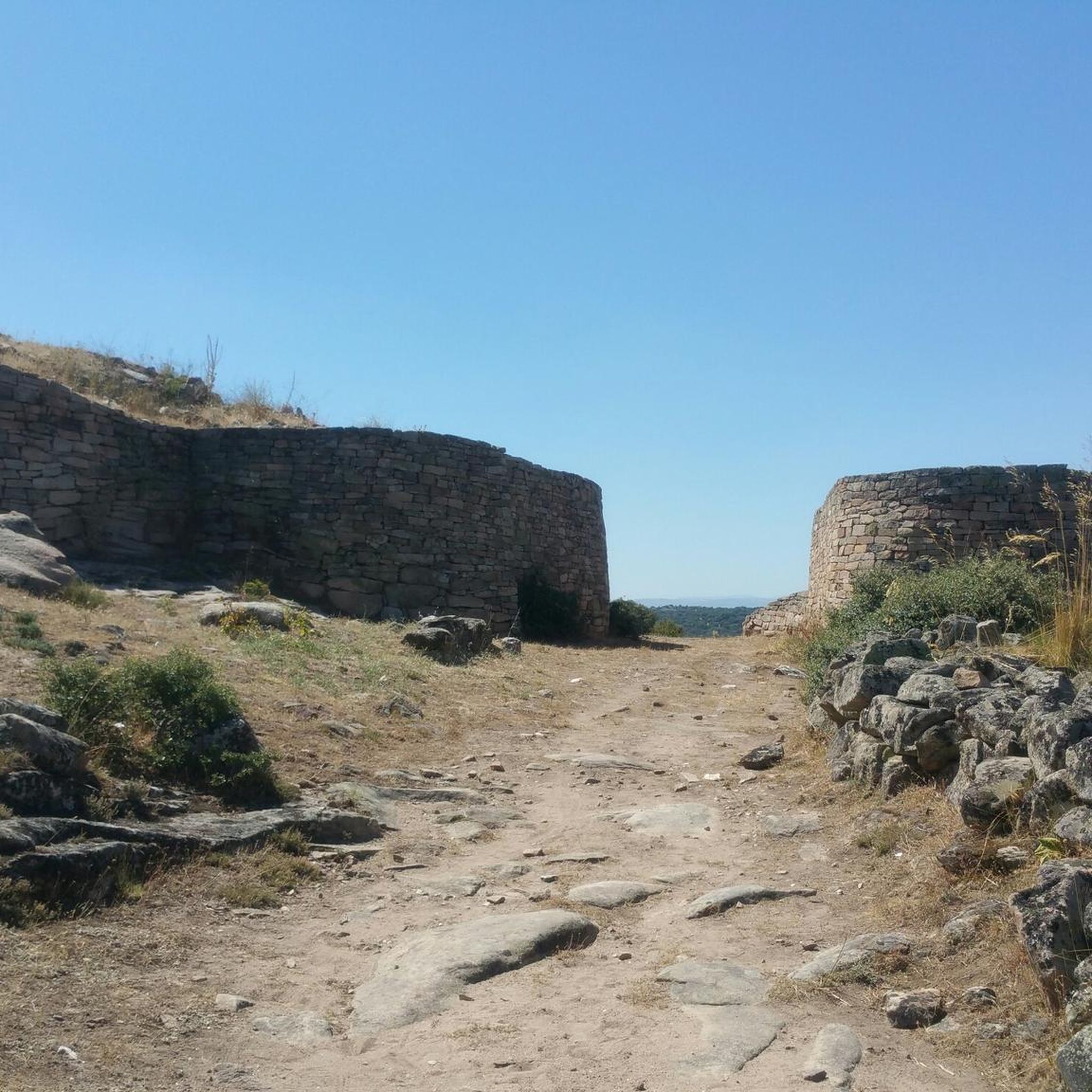
The Castro de Las Cogotas, located in the municipality of Cardeñosa (Ávila), is one of the most emblematic Iron Age archaeological sites on the Iberian Peninsula, especially linked to the Vetton people. It is situated on a hill next to the Adaja River, surrounded by holm oak groves, pastures, and fertile land. This location offered defensive advantages and abundant natural resources. The fort is open to the public and has an Interpretation Center that explains its history and characteristics. Periodic archaeological conferences are also held on the site.
2
0
The place name Mingorría retains Basque reminiscences, deriving from “mendi gorria,” which means “red mountain” or “red land.” This is observed in other cases in the province of Ávila, such as the town of Mendigorría in Navarra. In historical documents, Mingorría already appears as Ningorría, and it is believed that there was an assimilation due to the change of the liquid initials “M” to “N.” Another legend attributes the name of Mingorría to the notice that José Chinchurreta gave to monarch Felipe II, justifying the delay in the supply of granite during the works of the Monastery of El Escorial.
4
0

Three stone crosses located on a rocky outcrop near the Ermita del Berrocal, on the outskirts of Cardeñosa.
1
0

Cardeñosa is the ideal place to stop along the way and have a drink to continue the route. Here is the Castro Interpretation Center
1
0

Nucleus that has a great history behind it not only because Las Cogotas is located closer to the reservoir but also, for example, the Arco toral of the depopulated Conejeros.
1
0
Las Cogotas is an ancient walled enclosure that is currently an important archaeological site located north of the city of Ávila and right next to the Embalse del Castro de Las Cogotas.
0
1
A small town that is characterized by its location close to the banks of the Adaja river where it flows through the territory of the municipality. The surroundings of the town are beautiful, as is the church that is in the old center of the town.
2
0

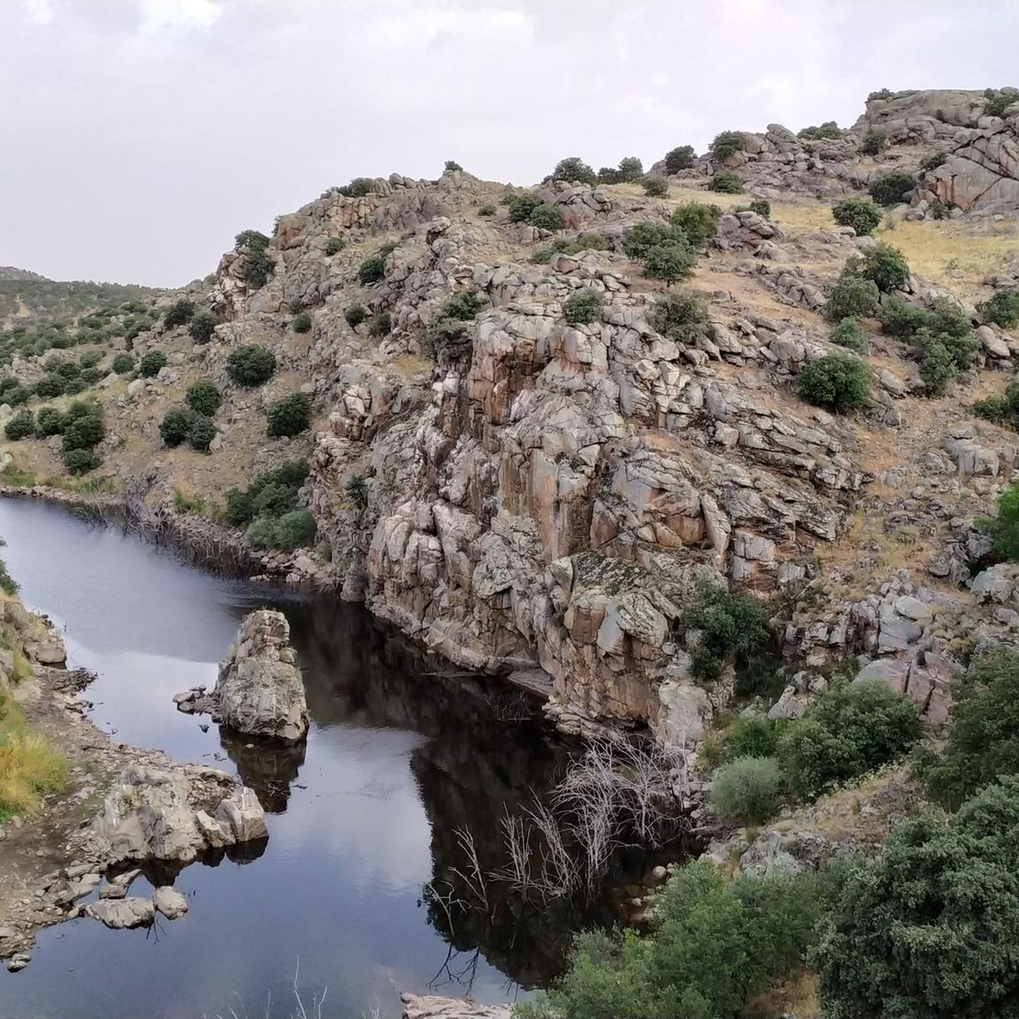
Near the Castro de las cogotas and the reservoir of the same name, we are located in the Peña Caballera, which is a spectacular rock formation.
1
0
Frequently Asked Questions
How many touring cycling routes are available around Pozanco?
There are 5 touring cycling routes documented on komoot around Pozanco. These routes are all rated as moderate difficulty, offering a consistent challenge for cyclists.
What kind of terrain can I expect on touring cycling routes near Pozanco?
The terrain around Pozanco is diverse, featuring extensive holm oak groves, verdant pastures, and fertile agricultural land. You'll also encounter distinctive granite rock formations and varied topography, ranging from gentle plains to more challenging hilly sections as you approach the Sierra de Ávila. Many routes offer tranquil rides on quiet country roads with scenic vistas.
Are there any circular touring cycling routes in the Pozanco area?
Yes, all the touring cycling routes listed for Pozanco are circular. For example, you can enjoy the Muñopedro Straights loop from Urb. Coto de Puenteviejo, which offers views of agricultural plains, or the Bike loop from Santo Domingo de las Posadas, traversing open countryside.
What interesting landmarks or natural features can I see along the cycling routes?
Many routes offer views of the Adaja River and the Embalse de las Cogotas. A notable historical attraction is the Castro de Las Cogotas, an Iron Age archaeological site near Cardeñosa. The Cardeñosa – Castro de Las Cogotas loop from Santo Domingo de las Posadas specifically leads through this historic area. You might also pass through charming settlements like Cardeñosa or Mingorría.
What is the best time of year to go touring cycling in Pozanco?
Pozanco offers good cycling conditions for much of the year. Spring and autumn generally provide the most pleasant temperatures for touring cycling, with comfortable weather and vibrant landscapes. Summer can be warm, but early mornings or late afternoons are often suitable. Winters are cooler but can still offer clear days for cycling.
How long are the touring cycling routes around Pozanco?
The touring cycling routes around Pozanco typically range from approximately 24.5 km (15.2 miles) to 34.6 km (21.5 miles) in length. The shortest is the Torreón loop from Urb. Coto de Puentevieji, while the longest is the Cardeñosa – Castro de Las Cogotas loop from Santo Domingo de las Posadas.
Are there any family-friendly touring cycling routes in Pozanco?
While all routes are rated moderate, the generally low traffic on country roads and the scenic, varied terrain can make them enjoyable for families with some cycling experience. Routes like the Adaja River (dam) loop from Santo Domingo de las Posadas offer pleasant rides through the landscape.
Where can I park my car when cycling near Pozanco?
For routes starting from Santo Domingo de las Posadas or Urb. Coto de Puenteviejo, you can typically find parking within these settlements. It's advisable to check local parking regulations upon arrival, especially in smaller villages, to ensure you park responsibly.
Can I reach the cycling routes by public transport with my bike?
Public transport options directly to the starting points of these specific routes with bikes may be limited. It's recommended to check local bus or train services in the Ávila province for bike carriage policies and schedules, as services to smaller municipalities like Pozanco might be infrequent or not accommodate bicycles easily. Driving to the starting points is often the most convenient option.
What are the difficulty levels of the touring cycling routes in Pozanco?
All touring cycling routes around Pozanco are classified as 'moderate' difficulty. This means they are suitable for cyclists with a reasonable level of fitness, featuring some elevation changes and distances that require a few hours to complete. For instance, the Muñopedro Straights loop from Urb. Coto de Puenteviejo involves over 300 meters of elevation gain.
What do other touring cyclists enjoy most about cycling in Pozanco?
Cyclists who have explored Pozanco often appreciate the tranquil routes through scenic landscapes, characterized by holm oak groves and agricultural land. The views of the Adaja River and the Embalse de las Cogotas are frequently highlighted, as is the opportunity to cycle on quiet country roads away from heavy traffic.
Are there places to eat or stay near the cycling routes?
While Pozanco itself is a small municipality, the broader Ávila province offers various options for refreshments and accommodation. You'll find cafes and restaurants in larger towns and villages within cycling distance or a short drive. It's advisable to plan your stops in advance, especially when cycling through more rural areas, as options might be sparse.
Most popular routes around Pozanco
Most popular attractions around Pozanco

Get inspired with the komoot mobile app


Explore more
Browse the best Cycling routes in other regions.
