The best road cycling routes around Chinchilla De Monte-Aragón
4.7
(16)
2,729
riders
61
rides
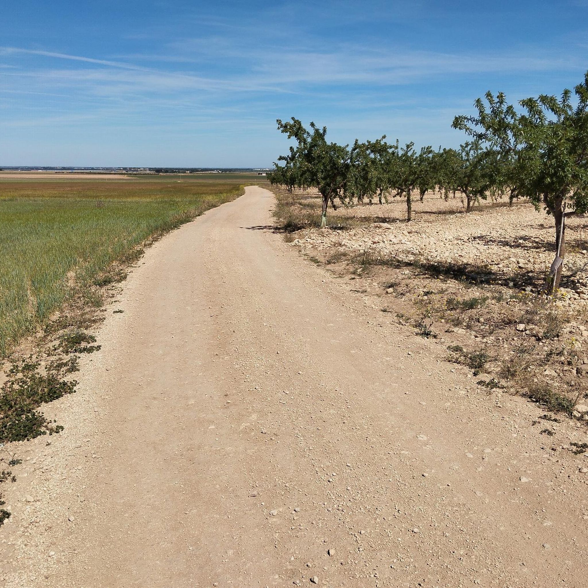
Road cycling routes around Chinchilla De Monte-Aragón traverse the expansive La Mancha plain, offering panoramic views and varied terrain. The region is characterized by mostly paved surfaces, with some routes including unpaved segments and significant elevation gains, particularly around the San Blas hill. This landscape provides a mix of flat, open stretches and more challenging climbs, catering to different cycling preferences.
Best road cycling routes around Chinchilla De Monte-Aragón
- The most popular road cycling route is Pétrola Lagoon Loop from…
Last updated: June 27, 2026
17
riders
84.1km
04:02
590m
590m
This moderate 52.3-mile road cycling route from Pozo Cañada explores the unique saline Laguna Salada de Pétrola, known for flamingos.
13
riders
76.5km
02:58
170m
170m
Moderate road ride. Good fitness required. Mostly well-paved surfaces and easy to ride.

Sign up for free
35.1km
01:25
180m
180m
This easy 21.8-mile road cycling route circles the unique Salty Lagoon of Pétrola, offering birdwatching and expansive views.
5.0
(2)
89
riders
36.0km
01:26
100m
100m
Easy road ride. Great for any fitness level. Mostly well-paved surfaces and easy to ride.
27
riders
56.1km
02:21
270m
270m
Moderate road ride. Good fitness required. Some segments of this route may be unpaved and difficult to ride.
Get access to more routes and recommendations from other explorers.
Sign up for free
Already have an account?
Our route recommendations are based on thousands of hikes, rides, and runs completed by other people on komoot.
Start today with a free account
Your next adventure awaits.
Login or Signup
Popular around Chinchilla De Monte-Aragón


Other adventures around Chinchilla De Monte-Aragón

Tips from the Community

It is the green lung of Albacete and the largest urban park in Castilla-La Mancha, covering 120,000 m² (12 ha). Located in the heart of Albacete, it is bordered by Avenida de España, Tesifonte Gallego, Paseo Simón Abril, and several squares. Inaugurated in 1911, during the mayorship of Abelardo Sánchez.
7
0
Tinajeros is a rural neighborhood (district) of Albacete (Castilla-La Mancha, Spain) located to the east of the city. It is 10.9 km from the capital in a northeasterly direction, with which it connects via the CM-3218 and CM-332 highways. It is located on the banks of the María Cristina Canal. Nearby is the Tinajeros aerodrome, the Albacete Aeroclub sports aerodrome, and also a municipal swimming pool. Its church, its park and its municipal swimming pool stand out.. 🌳🏊♂️🏢
1
0

Tinajeros is a very small town located approximately halfway between Albacete and Valdeganga. The route passes through the center of the town where there is a church, a garden and a bar. It is a strategic resting point, especially on hot summer days.
1
0

In addition to the restored mill, you will find in this beautiful park sculptures of Don Quixote and Sancho, another by Benjamín Palencia, an artist from this town, and a fountain, children's playground, tables for drinks and many almond trees.
1
1
A true symbol of the town of Pozo Cañada, an ancient windmill, restored. It is located on the hill of San Juan, which is the highest part of the town.
1
1
It is a lagoon a little smaller than the Pétrola lagoon, but of equal importance for the ecosystem of the area. The advantage is that you can observe the birds (for example flamingos) up close.
1
1
The Pétrola Lagoon is one of the most important wetlands in the province. The water becomes saltier than the sea! A perfect place for bird watching, including flamingos.
1
1
Huge urban park that you should not miss during your stay in Albacete. Several fountains, tobacconists and monuments, and above all, countless trees, make this park the favorite daily resting place for many people from Albacete.
4
1
Frequently Asked Questions
What kind of terrain can I expect on road cycling routes around Chinchilla De Monte-Aragón?
The region around Chinchilla De Monte-Aragón offers diverse terrain for road cycling. You'll find mostly paved surfaces, ideal for smooth rides across the expansive La Mancha plain, which provides panoramic views. Some routes also include unpaved segments and significant elevation gains, particularly around the San Blas hill, offering a mix of flat stretches and more challenging climbs.
Are there road cycling routes suitable for beginners or families in the Chinchilla De Monte-Aragón area?
Yes, there are several routes suitable for easier rides. For instance, the Laguna Salada de Pétrola Loop is an easy 21.8-mile (35.1 km) trail that takes about 1 hour 25 minutes to complete, leading through the unique Laguna Salada de Pétrola Nature Reserve. Overall, 13 easy routes are available in the region.
How many road cycling routes are available in the Chinchilla De Monte-Aragón region?
There are over 60 road cycling routes available around Chinchilla De Monte-Aragón. These routes cater to various fitness levels, including easy, moderate, and difficult options, ensuring there's something for every cyclist.
Are there challenging road cycling routes for experienced cyclists near Chinchilla De Monte-Aragón?
Yes, for experienced cyclists seeking a challenge, the region offers routes with significant elevation gains and varied terrain. While most routes are moderate, there are 4 difficult routes available. The "Chinchilla de Monte-Aragón and Camino de Levante Loop" (mentioned in region research) is a more difficult 48.8-mile touring route that traverses varied terrain and includes sections of the historic Camino de Levante pilgrimage route.
Can I find circular road cycling routes around Chinchilla De Monte-Aragón?
Yes, many of the road cycling routes in the area are circular. For example, the Pétrola Lagoon Loop from Pozo Cañada is a 52.3-mile (84.1 km) loop exploring the Laguna Salada de Pétrola Nature Reserve. Another popular option is the Barrax y La Herrera — circular desde Albacete, a moderate 47.5-mile (76.5 km) path offering varied terrain and open views.
What historical landmarks or scenic viewpoints can I see while road cycling in Chinchilla De Monte-Aragón?
Road cycling routes often provide views of significant landmarks. You can spot the prominent 15th-century Chinchilla Castle, which dominates the skyline from San Blas hill. The routes also offer panoramic views of the expansive La Mancha plain. The historic Plaza de la Mancha in the heart of Chinchilla is also a notable point of interest.
Are there any unique natural features accessible by road bike in the region?
Absolutely. Many routes, such as the Pétrola Lagoon Loop from Pozo Cañada, explore the unique Laguna Salada de Pétrola Nature Reserve. The vast La Mancha plain itself offers a sense of open routes and natural beauty. You can also find opportunities to explore the unique plant species and high plains of the Sierra Procomunal.
What is the best time of year to go road cycling in Chinchilla De Monte-Aragón?
The region is generally pleasant for cycling during spring and autumn when temperatures are milder. Summers can be hot on the open La Mancha plain, while winters are cooler. Checking local weather conditions before your ride is always recommended.
What do other road cyclists say about their experience in Chinchilla De Monte-Aragón?
The road cycling routes in Chinchilla De Monte-Aragón are highly rated by the komoot community, with an average score of 4.6 stars from 12 reviews. Over 2,600 road cyclists have used komoot to explore the varied terrain, often praising the open views and the mix of flat and challenging sections.
Where can I find parking when planning a road cycling trip in Chinchilla De Monte-Aragón?
Parking is generally available in and around the town of Chinchilla De Monte-Aragón, especially near the main squares or designated public parking areas. For routes starting from specific villages like Pozo Cañada, you can usually find parking in the village center.
Are there any cafes or places to rest near the road cycling trails?
While specific cafes directly on trails are rare, the town of Chinchilla De Monte-Aragón and other villages along the routes offer various establishments where you can find refreshments and rest. The Plaza de la Mancha in Chinchilla, for instance, is surrounded by amenities.
Can I combine road cycling with exploring historical sites in Chinchilla De Monte-Aragón?
Absolutely. The town of Chinchilla De Monte-Aragón itself is rich in history. You can cycle up to Chinchilla Castle for impressive vistas or explore the historic Plaza de la Mancha and the Church of Santa María del Salvador. The ancient Iberian Pozo Moro Mausoleum is also a significant archaeological landmark in the wider region.
Most popular routes around Chinchilla De Monte-Aragón
Most popular attractions around Chinchilla De Monte-Aragón

Get inspired with the komoot mobile app


Explore more
Browse the best Road cycling routes in other regions.
