Top 3 Lakes around Navalonguilla
Best lakes around Navalonguilla are found within a natural environment characterized by gorges, glacial lagoons, and natural pools. Navalonguilla, located in the western massif of Gredos in Ávila, Spain, offers diverse water bodies. These features provide opportunities for exploring unique glacial landscapes and enjoying clear waters. The region is known for its significant natural beauty and recreational value.
Best lakes around Navalonguilla
- The most popular lakes is Charco del Trabuquete, a waterfall that is one of the most frequented…
Last updated: May 17, 2026
Charco del Trabuquete
Highlight • Waterfall
Translated by Google •
Tip by

Laguna de la Nava
Highlight • Lake
Translated by Google •
Tip by
Sign up now to discover places like this
Get recommendations on the best single tracks, peaks, & plenty of other exciting outdoor places.
Sign up for free
Laguna de los Caballeros
Highlight • Lake
Translated by Google •
Tip by

Cirque of Laguna del Barco
Highlight • Lake
Translated by Google •
Tip by

Technical section
Highlight (Segment) • Climb
Translated by Google •
Tip by

Start today with a free account
Your next adventure awaits.
Login or Signup

Tips from the Community

the water is super cold even in summer!!!
0
0

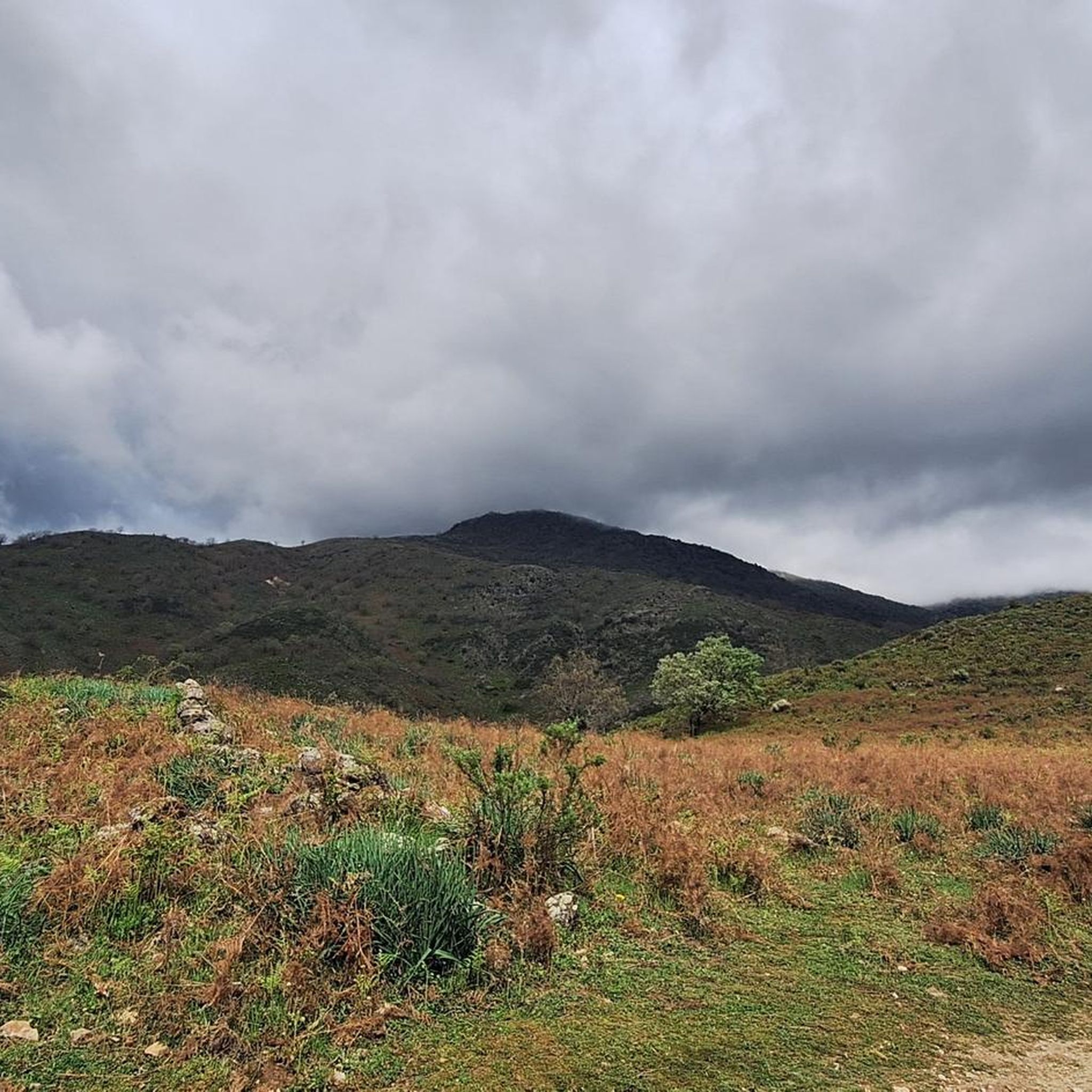
Located in the charming and quiet town of Guijo de Santa Bárbara, Charco del Trabuquete is a simple, although somewhat demanding, route that runs through the Jaranda Gorge. A route dotted with cliffs and cliffs through which streams and river gorges with crystal-clear waters flow. It is undoubtedly a natural environment of great beauty nestled between the Sierra de Gredos and the Sierra de Tormantos.
0
0

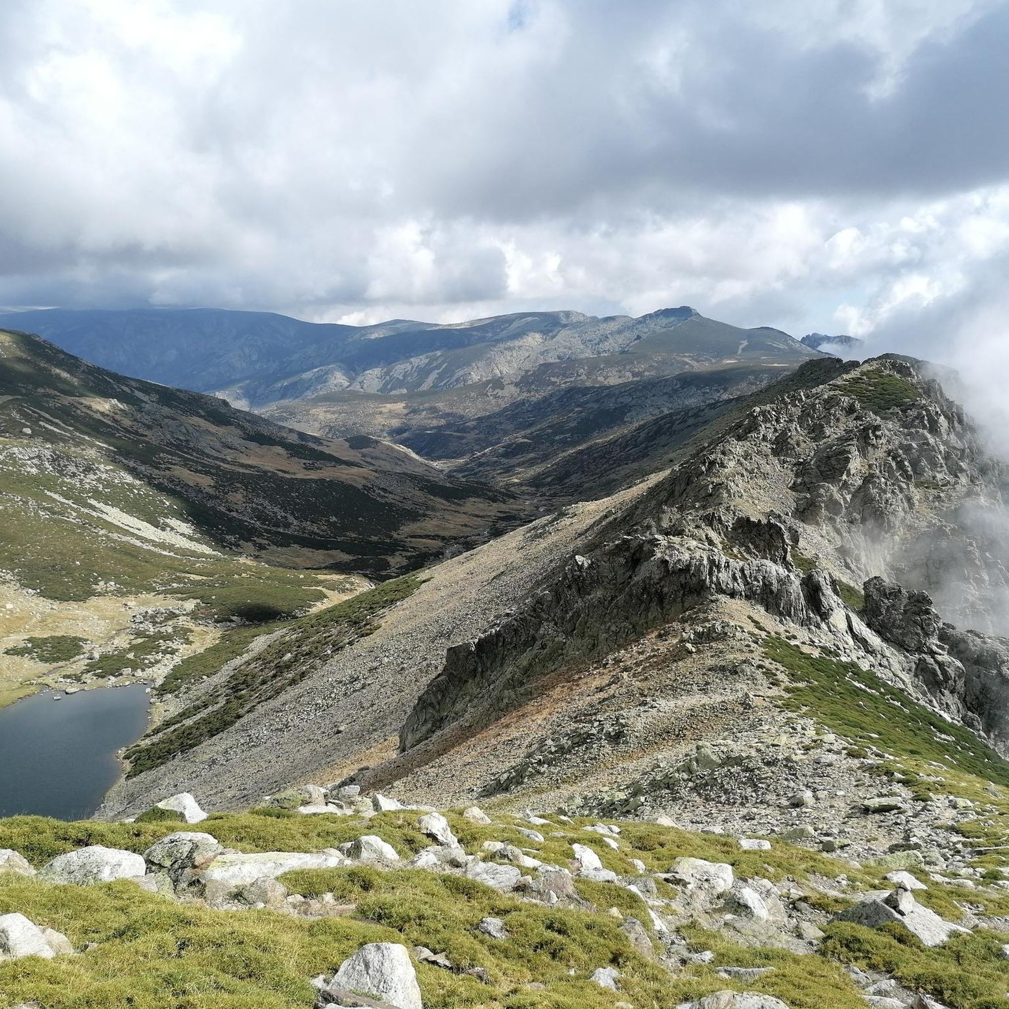
This lagoon is curious with respect to the rest since normally, glacial cirques tend to take a direction perpendicular to the ridge of the mountain, that is to say they descend in a north or south direction. This one, however, does it in an east direction, with the Covacha del Losar as the highest part!
0
1

Following the well-known Route of the Trabuquete you will find this wonderful pool with a natural waterfall on the river Garganta de Jaranda. Undoubtedly the highlight of the route, not only for its turquoise waters but also for the beautiful landscape that surrounds it.
1
1

The section between the Barco lagoon and the pass that separates the Covacha and Juraco summits is of great technical difficulty due to the unevenness and the type of surface. You have to face more than 500 meters of ascent in a matter of one kilometer and, in addition, the path is not marked. The line runs through a huge granite scree where there is little grip if the rock is wet. The section requires the occasional short climb.
2
0

The descent to the Barco lagoon follows a rough and delicate terrain through the Cuadrada lagoon to the shore of the great mountain lake where the Galín Gómez gorge begins. On the wall of the lagoon there is a mountain refuge and the short-distance path PR-AV 36 begins, which descends to the right of the glacial basin. The layout of the path improves immediately, especially when it reaches the terrain of the mountain pastures. At the Chozo de Anselmo de Las Escaleruelas you have to leave the short-distance trail, which follows the main lane to the left, and continue straight down towards the valley basin along a hillside complicated by vegetation. The path first passes over two ditches and a couple of bridges and then crosses the main stream of the valley, descending from the high peaks along the right bank of the gorge. The layout is imprecise at first and sometimes they get lost in the grassy fields.
0
0

The Laguna de los Caballeros is a lagoon of glacial origin located in the upper part of the gorge of the same name, in the western sector of the Sierra de Gredos, in the municipality of Navalonguilla, (Ávila, Castilla y León, Spain). The lagoon is located at an altitude of about 2,000 meters above sea level in an extensive glacial valley (one of the three located on the north face of La Covacha).1 La Covacha, with a height of 2,399 meters above sea level, constitutes the highest point in the western sector. of the Sierra de Gredos.2n. 1 Unlike the rest of the lagoons in the region, the Caballeros lagoon has not been artificially dammed.
1
0
The Laguna de la Nava, also known as the Nava del Barco lagoon, is a lagoon of glacial origin located in the upper part of the gorge of the same name, in the western sector of the Sierra de Gredos; It is located in the municipality of Nava del Barco, in the province of Ávila (Castilla y León, Spain). The lagoon is located at an altitude of about 1,950 meters above sea level at the bottom of a glacial cirque known as the Corral del Diablo.1 Presiding over this glacial cirque is the Alto del Corral del Diablo, with 2,366 meters above sea level.
1
0
Frequently Asked Questions
What are the main types of water bodies found around Navalonguilla?
Navalonguilla is characterized by its stunning natural environment, featuring significant glacial lagoons and numerous natural pools within its gorges. These offer unique glacial landscapes and opportunities for refreshing swims.
Which glacial lakes are notable in the Navalonguilla area?
Two prominent glacial lakes are Laguna de la Nava and Laguna de los Caballeros. Both are situated at high altitudes (around 2,000 meters) within the Sierra de Gredos, offering impressive natural stops with clear waters reflecting the surrounding peaks.
Where can I find natural pools for swimming near Navalonguilla?
The Garganta de los Caballeros, fed by the Laguna de los Caballeros, is a major attraction with numerous natural pools perfect for swimming. The water is clear and often cold, even in warmer months. A particularly popular bathing spot is located where the gorge intersects the road connecting Navalonguilla's main center and Navalguijo. Additionally, Charco del Trabuquete is a well-known natural pool with turquoise waters.
What makes Laguna de los Caballeros a significant natural site?
Laguna de los Caballeros is a pristine glacial lagoon located at 2,000 meters in a beautiful glacial cirque within the western Sierra de Gredos. It is the source of the Garganta de los Caballeros gorge and is surrounded by meadows and granite peaks, offering spectacular mountain views.
What kind of natural landscapes can I expect to see around these lakes?
The landscapes around Navalonguilla's lakes and gorges are diverse and stunning. You'll encounter glacial cirques, ancient oak and extensive pine forests, and rich riverside vegetation. The area is characterized by slopes shaped by ancient glaciations and dramatic granite peaks.
What is the best time of year to visit the lakes around Navalonguilla?
The warmer months are generally best for visiting, especially if you plan to swim in the natural pools. However, the clear, cold waters of the gorges provide refreshment even during summer. The area's natural beauty can be appreciated across seasons, with summer offering opportunities for grazing cows in meadows around glacial lagoons.
Are there hiking trails that lead to these lakes?
Yes, there are several hiking opportunities. For instance, access to Laguna de los Caballeros is possible via a path from Navalguijo. The PR-AV 40 short-distance trail runs 11 kilometers along the upper course of the Garganta de los Caballeros from Navalguijo to the lagoon. You can find more hiking options in the region by exploring the Running Trails around Navalonguilla guide.
Are the lakes around Navalonguilla suitable for families?
Many of the natural pools within the gorges, like those in the Garganta de los Caballeros, can be suitable for families looking for refreshing swims. Some trails leading to these spots, such as the route to Charco del Trabuquete, are described as simple, though some may be demanding. Always check the difficulty of specific routes before heading out with children.
Can I find opportunities for wild swimming in the area?
Absolutely. The natural pools within the Garganta de los Caballeros and spots like Charco del Trabuquete are prime locations for wild swimming in crystal-clear, albeit cold, waters.
What other outdoor activities can I do near the lakes?
Beyond hiking and swimming, the area offers various outdoor activities. You can explore cycling routes, including those for touring bicycles and mountain biking. For more details, refer to the Cycling around Navalonguilla guide and the MTB Trails around Navalonguilla guide.
Are there any regulations or permits needed for visiting the Gredos Regional Park?
The entire course of the Garganta de los Caballeros lies within the protected area of the Sierra de Gredos Regional Park. While specific permits for general access are not typically required, it's always advisable to check local regulations for activities like fishing (which has reserves without kill for trout) or camping within the park.
How accessible are the lakes around Navalonguilla?
Access to some glacial lagoons, like Laguna de los Caballeros, involves hiking paths, which can be demanding due to altitude and terrain. Natural pools in the gorges, such as those in the Garganta de los Caballeros, can be more accessible, with popular bathing spots located near roads.
What do visitors particularly enjoy about the lakes in Navalonguilla?
Visitors appreciate the stunning natural beauty, the unique glacial landscapes, and the opportunity for refreshing swims in crystal-clear waters. The tranquility and impressive mountain views, especially around high-altitude lakes like Laguna de la Nava, are frequently highlighted. The area's natural pools, like Charco del Trabuquete, are also very popular for their picturesque settings.
Are there any historical points of interest near the gorges or lakes?
Yes, along the Garganta de los Caballeros, there are remains of a rudimentary iron mine. This mine was exploited despite the challenging terrain, adding an interesting historical layer to the natural landscape.
Most popular attractions around Navalonguilla

Get inspired with the komoot mobile app


Explore more
Still not found your perfect lake around Navalonguilla? Check out the guides of these regions to see even more beautiful places.
