The best walks and hikes around Bruille-Lez-Marchiennes
4.5
(667)
3,096
hikers
148
hikes
Hiking around Bruille-Lez-Marchiennes offers diverse landscapes within the Scarpe-Escaut Regional Natural Park, characterized by serene plains, marshlands, and transformed industrial sites. The region features the alluvial valleys of the Scarpe and Escaut rivers, contributing to its biodiversity. Trails often traverse open fields, former mining spoil tips like Terril des Argales, and sections of the Forêt Domaniale de Marchiennes. This area provides a mix of flat, accessible paths and routes exploring local woodlands and natural reserves.
Best hiking trails around Bruille-Lez-Marchiennes
…Last updated: July 9, 2026
4.6
(53)
385
hikers
Easy hike. Great for any fitness level. Easily-accessible paths. Suitable for all skill levels.
4.6
(17)
63
hikers
Easy hike. Great for any fitness level. Easily-accessible paths. Suitable for all skill levels.

Sign up for free
4.6
(17)
71
hikers
Moderate hike. Good fitness required. Easily-accessible paths. Suitable for all skill levels.
16
hikers
3.73km
00:58
20m
20m
Easy hike. Great for any fitness level. Easily-accessible paths. Suitable for all skill levels.
4.0
(1)
10
hikers
10.3km
02:37
20m
20m
Moderate hike. Good fitness required. Easily-accessible paths. Suitable for all skill levels.
Get access to more routes and recommendations from other explorers.
Sign up for free
Already have an account?
Our route recommendations are based on thousands of hikes, rides, and runs completed by other people on komoot.
Start today with a free account
Your next adventure awaits.
Login or Signup


Tips from the Community

Beautiful walk on a magnificent site
0
0

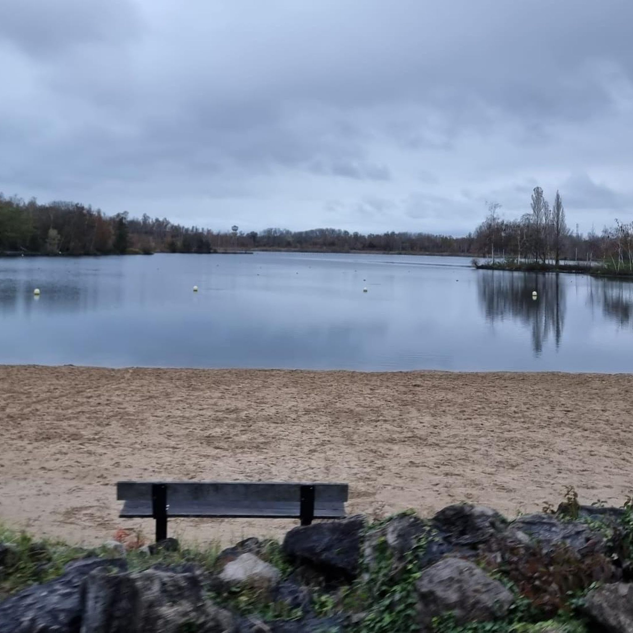
Great place to run on several routes or hike with the family
0
0


The Rieulay slag heap, also known as the Argales slag heap, is the largest in the region with its 140 hectares. Formerly an industrial site for the storage of waste rock from the surrounding mines, it has been converted into a protected natural area and a place for leisure.
0
0
view of Lake Argales and the surrounding towns, at the highest point without going up very high
0
0
The Argales de Rieulay slag heap, the largest in the region (140 ha), has long since closed its mining page. A new story has been unfolding for several years now. That of a successful reconversion.
0
0

Artificial beach on the body of water
0
0
Panoramic view of the Rieulay site
0
0
Frequently Asked Questions
How many hiking trails are available around Bruille-Lez-Marchiennes?
There are over 150 hiking routes around Bruille-Lez-Marchiennes, offering diverse options for all skill levels. These trails explore the unique landscapes of the Scarpe-Escaut Regional Natural Park, including marshlands, open fields, and redeveloped industrial sites.
Are there easy hiking trails suitable for families or beginners?
Yes, Bruille-Lez-Marchiennes offers a good selection of easy trails. Approximately 73 routes are classified as easy, often traversing flat terrain around lakes and through former mining areas. A great option for a relaxed walk is the Terril des Argales Beach – Viewpoint over the lake loop from Rieulay, which is just over 3 miles long.
What kind of natural attractions can I expect to see along the hiking trails?
The trails often lead through the alluvial valleys of the Scarpe and Escaut rivers, offering views of serene marshlands and open fields. You can also explore transformed industrial sites like the Étang des Argales and the unique landscape around the Terril des Argales Beach, a former mining spoil tip now redeveloped into a natural area. The Germignies Marsh and Spoil Heap is another interesting natural feature.
Are there any circular walks available in Bruille-Lez-Marchiennes?
Many of the hiking routes in the area are circular, allowing you to start and end at the same point. For example, the Lac des Argales – Étang des Argales loop from Rieulay is a moderate 6.3-mile (10.1 km) circular trail that takes you around the beautiful Argales lakes.
What do other hikers say about the trails in Bruille-Lez-Marchiennes?
The hiking routes in Bruille-Lez-Marchiennes are highly rated by the komoot community, with an average score of 4.5 stars from over 500 reviews. Hikers often praise the diverse landscapes, from tranquil marshlands to the unique redeveloped mining sites, and the accessibility of the paths.
Are the hiking trails in Bruille-Lez-Marchiennes dog-friendly?
Many trails in the Scarpe-Escaut Regional Natural Park are suitable for dogs, provided they are kept on a leash, especially in protected natural areas or near wildlife. It's always recommended to check specific route details for any restrictions, but generally, the open fields and woodland paths are welcoming for pets.
What is the best season for hiking in Bruille-Lez-Marchiennes?
The region offers pleasant hiking experiences throughout much of the year. Spring and autumn provide mild temperatures and beautiful scenery, with blooming flora or vibrant fall colors. Summer is also suitable, though some open sections might be exposed to the sun. Winter hiking is possible, especially on the flatter paths, but conditions can be muddy.
Are there any interesting landmarks or points of interest near the hiking routes?
Beyond the natural beauty, you can find interesting points like the Witches' Singletrack, a unique trail, or historical elements like the Pont Gibus (Pavé de Wallers à Hélesmes), a famous cobbled section. The Towpath Along the Scarpe also offers a glimpse into the region's historical waterways.
Is public transport available to access hiking trailheads in Bruille-Lez-Marchiennes?
While specific public transport options to individual trailheads can vary, the region is generally accessible. It's advisable to check local bus schedules or regional train connections to nearby towns like Rieulay, from where many popular trails, such as those around the Argales lakes, begin.
Are there any trails that offer scenic viewpoints?
Yes, several trails provide scenic vistas, particularly those that ascend the redeveloped mining spoil tips. The Viewpoint over the lake – Argales Pond loop from Rieulay is specifically designed to offer views over the redeveloped Terril des Argales lake, providing a unique perspective on the transformed landscape.
What is the typical terrain like for hiking in this area?
The terrain around Bruille-Lez-Marchiennes is generally varied but often features flat, accessible paths through open fields and marshlands. You'll also encounter sections through local woodlands and routes exploring former mining spoil tips, which can offer gentle ascents and descents, providing a mix of surfaces from dirt paths to gravel.
Most popular routes around Bruille-Lez-Marchiennes
Most popular attractions around Bruille-Lez-Marchiennes

Get inspired with the komoot mobile app


Explore more
Browse the best Hikes in other regions.
