The best mountain hikes around Freissinières
4.9
(9)
56
hikers
10
hikes
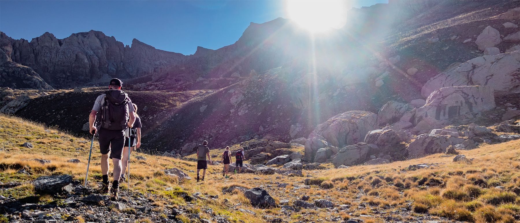
Mountaineering around Freissinières is set within a dramatic glacial valley in the French Alps, characterized by towering ridges and peaks often exceeding 3,000 meters. The landscape features high mountain lakes, cascading waterfalls, and a mix of larch forests and alpine meadows. This rugged terrain provides diverse opportunities for high-altitude exploration and challenging ascents.
Best mountaineering routes around Freissinières
- The most popular mountaineering route is Palluel Lake loop from Parking riverains, an 8.5 miles (13.6 km) trail that takes 6…
Last updated: May 20, 2026
9
hikers
3.84km
02:19
350m
350m
Hard mountaineering route. Good fitness required. Sure-footedness, sturdy shoes and alpine experience required.
5.0
(3)
8
hikers
8.36km
03:14
390m
390m
Moderate mountaineering route. Good fitness required. Mostly accessible paths. Sure-footedness required.

Sign up for free
5.0
(1)
6
hikers
12.5km
07:38
1,540m
1,540m
Hard mountaineering route. Very good fitness required. Mostly accessible paths. Sure-footedness required.
8
hikers
9.29km
03:55
770m
770m
Moderate mountaineering route. Good fitness required. Easily-accessible paths. Suitable for all skill levels.
5.0
(2)
5
hikers
Moderate mountaineering route. Good fitness required. Mostly accessible paths. Sure-footedness required.
Get access to more routes and recommendations from other explorers.
Sign up for free
Already have an account?
Our route recommendations are based on thousands of hikes, rides, and runs completed by other people on komoot.
Start today with a free account
Your next adventure awaits.
Login or Signup
Other adventures around Freissinières

Tips from the Community


The Tête d'Amont is one of the most striking peaks in the Écrins. It rises steeply and impressively above the Vallouise valley, with a massive, almost vertical limestone face rising from the landscape like a massive wall. From its high flanks and summit, spectacular views unfold across the entire Montbrison and Écrins massifs.
0
0

A nice place for a well-deserved break...
0
0

A via ferrata course rated blue, traversing a cliff above a spectacular valley of forested peaks.
1
0

Great spot, really friendly, very helpful staff. BUT - call ahead to make a reservation if you want to eat their food (though I saw people using tables, with their own food). AND - take cash if you've planned to eat there (they don't take cards).
0
0

Very pretty little lake and associated wetland
0
0

This path located below the Col de la Pousterle offers beautiful views of the Écrins. The path is not difficult and allows you to raise your head without risk of falling!
0
0
Frequently Asked Questions
How many mountaineering routes are available in Freissinières?
There are 13 mountaineering routes around Freissinières listed on komoot, offering a range of experiences from moderate to difficult. These routes are highly rated by the komoot community, with an average score of 4.9 stars.
Are there any moderate mountaineering routes suitable for those looking for a less strenuous challenge?
Yes, Freissinières offers several moderate routes. For instance, the Refuge du Tourond loop from Champoléon is an 8.4 km trail that takes about 3 hours 14 minutes to complete, leading through varied alpine terrain. Another moderate option is the View of Clot de la Siva loop from Les Vigneaux, which covers 10 km.
What kind of natural features can I expect to see on mountaineering routes in Freissinières?
Freissinières is renowned for its dramatic glacial valley, towering ridges, and high mountain lakes. You'll encounter stunning features like the glacial lakes Palluel, Faravel, Lauzes, and Fangeas, as well as numerous cascading waterfalls, especially during spring and early summer. The landscape also includes beautiful larch forests, alpine meadows, and moraines, offering a truly wild and preserved setting.
Are there any circular mountaineering routes in the area?
Yes, many routes in Freissinières are designed as loops. A popular difficult circular route is the Palluel Lake loop from Parking riverains, an 13.6 km trail offering expansive views of the high mountain lakes. For a shorter, challenging loop, consider La Falaise loop from Freissinières.
What are some notable landmarks or points of interest along the mountaineering trails?
The Freissinières region is rich in natural and historical landmarks. You might pass by the historic Lebrun Castle or reach viewpoints like Tête d'Oréac. The area also features several mountain passes, such as Col de la Pousterle, and various huts like the Dormillouse - School guesthouse, which is part of the unique, car-free hamlet of Dormillouse.
What is the best time of year for mountaineering in Freissinières?
The best time for mountaineering in Freissinières generally depends on your activity. For high-altitude routes and glacier progression, summer (July to September) offers the most favorable conditions. However, the region is also internationally renowned for ice climbing in winter, with spectacular ice formations and dedicated facilities like the Ice Tower of Freissinières. Spring and autumn provide beautiful scenery for lower-altitude hikes.
Are there any particularly challenging mountaineering routes for experienced climbers?
Yes, Freissinières offers several difficult routes for experienced mountaineers. The Tête d'Amont loop from Puy-Saint-Vincent is a demanding 12.47 km route with significant elevation gain, providing a substantial challenge and rewarding views over the valley and surrounding peaks.
Is there parking available at the trailheads in Freissinières?
Parking is generally available near the starting points of many popular trails in Freissinières. For example, the Palluel Lake loop starts from 'Parking riverains', indicating designated parking facilities. It's always advisable to check specific route details for precise parking information before your trip, especially during peak seasons.
What makes the Freissinières region unique for mountaineering?
Freissinières stands out due to its dramatic glacial valley, encircled by towering ridges often exceeding 3,000 meters, within the pristine Écrins National Park. It offers a unique blend of high-altitude exploration, diverse terrain from larch forests to alpine meadows, and a sense of wild isolation. Beyond traditional mountaineering, it's also a world-class destination for ice climbing, adding to its distinct character.
What do other mountaineers say about their experience in Freissinières?
The mountaineering routes in Freissinières are highly rated by the komoot community, with an impressive average score of 4.9 stars from over 20 reviews. Mountaineers often praise the expansive views of the high mountain lakes, the challenging ascents with rewarding vistas over the valley, and the varied alpine terrain that makes each route a unique adventure.
Are there any huts or refuges available for overnight stays on longer routes?
Yes, the Freissinières area, being part of the Écrins National Park, has several huts and refuges that can be used for overnight stays or as rest points. Notable options include the Refuge des Bans and the Grands Plans Hut. These facilities are essential for multi-day mountaineering trips and provide a base in the high mountains.
Most popular routes around Freissinières
Most popular attractions around Freissinières

Get inspired with the komoot mobile app


Explore more
Browse the best Mountain Hikes & Routes in other regions.
