The best walks and hikes around Allonzier-La-Caille
4.5
(1678)
23,715
hikers
319
hikes
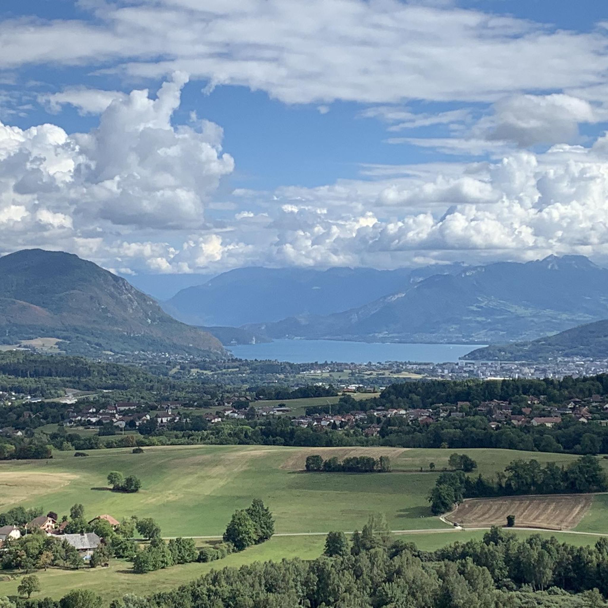
Hiking around Allonzier-La-Caille offers a variety of trails through a landscape characterized by rolling hills, forested areas, and open country. The region provides opportunities for views of surrounding valleys and distant lakes. Many routes are circular, starting and ending in the village or nearby settlements. The terrain includes both gentle paths and moderate ascents, suitable for different hiking preferences.
Best hiking trails around Allonzier-La-Caille
- The most popular hiking route is Caille Bridge loop from Allonzier-la-Caille, a 4.3 miles (6.9 km) trail that takes 2 hours 19 minutes to complete. This route features the historic Caille Bridge and offers a circular path from the village.
- Another top favourite among local hikers is Resistance shelter 1944 – Tête de la Mandallaz loop from Allonzier-la-Caille, a moderate 9.4 miles (15.2 km) path. This trail explores historical sites and includes ascents to the Tête de la Mandallaz hill.
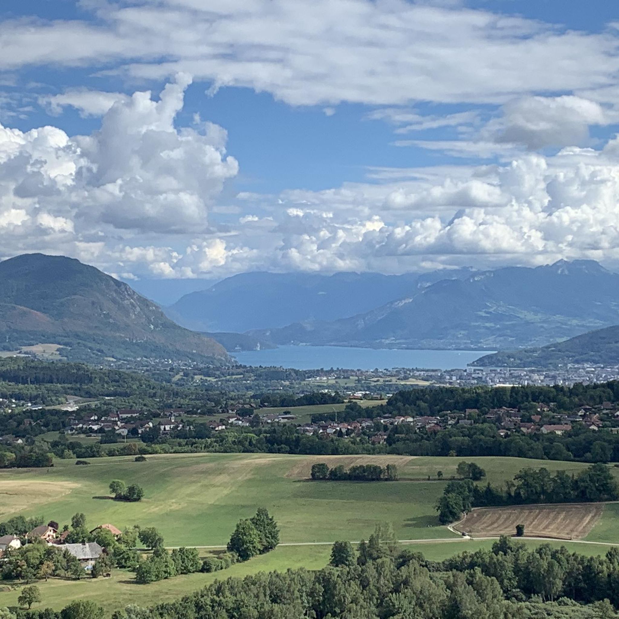
- Local hikers also love the View of Annecy and Lake Annecy loop from Allonzier-la-Caille, a 5.8 miles (9.3 km) trail leading through varied terrain with panoramic views of Annecy and Lake Annecy, often completed in about 2 hours 50 minutes.
- Hiking around Allonzier-La-Caille is defined by its network of trails offering views of Lake Annecy, forested hills, and local landmarks like the Caille Bridge. The area provides options for easy hikes as well as more challenging moderate routes.
- The routes in Allonzier-La-Caille are highly rated by the komoot community with an average score of 4.5 stars from over 1,600 reviews. More than 24,000 hikers have used komoot to explore Allonzier-La-Caille's varied terrain.
Last updated: July 2, 2026
3.6
(5)
58
hikers
7.93km
02:38
320m
320m
Moderate hike. Good fitness required. Mostly accessible paths. Sure-footedness required.
5.0
(3)
32
hikers
Moderate hike. Good fitness required. Mostly accessible paths. Sure-footedness required.

Sign up for free
4.5
(2)
36
hikers
9.02km
02:36
230m
230m
Moderate hike. Good fitness required. Easily-accessible paths. Suitable for all skill levels.
5.0
(4)
23
hikers
9.28km
02:51
280m
280m
Moderate hike. Good fitness required. Mostly accessible paths. Sure-footedness required.
4.7
(3)
20
hikers
7.86km
02:10
130m
130m
Moderate hike. Good fitness required. Easily-accessible paths. Suitable for all skill levels.
Get access to more routes and recommendations from other explorers.
Sign up for free
Already have an account?
Our route recommendations are based on thousands of hikes, rides, and runs completed by other people on komoot.
Start today with a free account
Your next adventure awaits.
Login or Signup

Tips from the Community

A beautiful route between Yvoire and Annecy mostly via cycle paths and country roads.
0
0

Great view of Annecy and the lake
0
0

It is difficult to recommend or not this trail which is nevertheless beautiful. It is difficult, in one direction as in the other. It is narrow, difficult, with steep overhangs, and it lacks maintenance. Do not embark on it thinking that it will be a walk in the park!
0
0
Hidden in the forest, a small chapel awaits around a bend.
0
0
Here lived free from May 12 to August 19, 1944 the maquisards of the secret army of the Megevant group, called "PAN PAN". A little history, even during a mountain bike outing, doesn't hurt!
0
0
Head of Mandallaz and Sillingy fault mirror
0
0

Was our rescue after the hail, small bistro with many different beers
0
0

Mandallaz Mountain, also known as Mandallaz Mountain (pronounced Mandalle), or Balme Mountain, is a mountain in the Prealps located in the Haute-Savoie department (France). The word mandallaz comes from the Old French muer, which gave rise to the verbs "remer" and "mouvoir," and more specifically the noun remue. It thus refers to a small chalet located in an alpine pasture, and in Savoyard, muanda, with the diminutive suffix -allaz. The mountain is locally known as Balme Mountain or La Balme-de-Sillingy, from the name of the eponymous commune. In a transcript of a meeting of the Florimontane Academy (1912), a note states that "Mandallaz is wrongly called the mountain of Balme de Sillingy." It can also be called Mandallaz Mountain or simply La Mandallaz. The Mandallaz Mountains are a small pre-Alpine massif, eight kilometers long and three to four kilometers wide, located northwest of the Annecy basin. It extends through the communes of Annecy (formerly Pringy), Choisy, Cuvat, Épagny-Metz-Tessy, La Balme-de-Sillingy, Sillingy, and Allonzier-la-Caille. Its most prominent peak, the Tête de la Mandallaz, at the southern end of the mountain overlooking La Balme-de-Sillingy and Épagny-Metz-Tessy at an altitude of 900 meters, is not its highest point; the highest point is located in the center of the mountain at 923 meters. The Mandallaz offers panoramic views of the Annecy metropolitan area, Lake Annecy, the Alps, the Montagne d'Âge, and the surrounding countryside.
2
1
Frequently Asked Questions
How many hiking trails are available around Allonzier-La-Caille?
There are over 270 hiking routes in the Allonzier-La-Caille area, offering a wide variety of options for different skill levels and preferences.
Are there easy hiking trails suitable for beginners or families in Allonzier-La-Caille?
Yes, the region offers nearly 100 easy hiking routes. An example of an easy trail is the Charvonnex by DH – Frétallaz Pass loop from Saint-Martin-Bellevue, which is just under 6 km long and features gentle ascents.
What kind of views can I expect on hikes around Allonzier-La-Caille?
Many trails offer panoramic views of surrounding valleys, forested areas, and distant lakes. For example, the View of Annecy and Lake Annecy loop from Allonzier-la-Caille provides stunning vistas of Lake Annecy and the city.
Are there any circular hiking routes in Allonzier-La-Caille?
Yes, many routes in the area are circular, starting and ending in the village or nearby settlements. A popular circular option is the Caille Bridge loop from Allonzier-la-Caille, which takes you past the historic Caille Bridge.
What are some interesting landmarks or attractions to see while hiking?
Hikers can explore historical sites and natural beauty. The Resistance shelter 1944 – Tête de la Mandallaz loop from Allonzier-la-Caille takes you to a historical shelter and includes ascents to the Tête de la Mandallaz hill. You can also find highlights like the Cycle path with the best views of Lake Annecy nearby.
What is the best time of year to go hiking in Allonzier-La-Caille?
The region is generally pleasant for hiking from spring through autumn, when the weather is mild and the trails are clear. The landscape of rolling hills and forested areas is particularly beautiful during these seasons.
Are there any challenging or advanced hiking trails in the area?
Yes, for experienced hikers, there are 18 difficult routes available. These trails typically feature more significant elevation gains and longer distances, offering a greater challenge.
What do other hikers say about the trails in Allonzier-La-Caille?
The hiking routes in Allonzier-La-Caille are highly rated by the komoot community, with an average score of 4.5 stars from over 1,600 reviews. Hikers often praise the varied terrain, the beautiful views of Lake Annecy, and the well-maintained paths.
Is there parking available at the trailheads in Allonzier-La-Caille?
While specific parking details vary by trailhead, Allonzier-La-Caille and surrounding villages typically offer public parking options. It's advisable to check the tour details on komoot for specific starting points and potential parking information.
Can I access hiking trails in Allonzier-La-Caille using public transport?
Allonzier-La-Caille is connected by local bus services, which can provide access to the village center. From there, many trails are accessible on foot. For routes starting further afield, checking local bus schedules for nearby villages is recommended.
Are there any hikes that pass by lakes or offer water views?
Absolutely. The region is close to Lake Annecy, and several hikes offer views of the lake. The View of Annecy and Lake Annecy loop from Allonzier-la-Caille is a prime example, providing excellent lake vistas.
Can I find hikes that include historical sites or cultural points of interest?
Yes, the area has historical significance. The Resistance shelter 1944 – Tête de la Mandallaz loop from Allonzier-la-Caille is one such route that combines hiking with a visit to a historical shelter.
Most popular routes around Allonzier-La-Caille
Most popular attractions around Allonzier-La-Caille

Get inspired with the komoot mobile app


Explore more
Browse the best Hikes in other regions.
