The best walks and hikes around Coise-Saint-Jean-Pied-Gauthier
4.4
(565)
6,668
hikers
230
hikes
Hiking around Coise-Saint-Jean-Pied-Gauthier offers diverse landscapes within the Savoie department of the Auvergne-Rhône-Alpes region. The area features a blend of agricultural territories, extensive forests, and semi-natural environments. It is situated near the Massif des Bauges Regional Nature Park and the Chartreuse Regional Nature Park, providing access to protected natural beauty and mountainous terrain. The Chéran River forms the commune's western border, contributing to local biodiversity and varied terrain.
Best hiking trails around Coise-Saint-Jean-Pied-Gauthier
- The most popular hiking route is Pierre Besse – Col du Potat loop from Saint-Pierre-d'Albigny, a 14.0 miles (22.5 km) trail that takes 10 hours 21 minutes to complete. This difficult route features significant elevation gain and varied mountain terrain.
- Another top favourite among local hikers is Col de Cochette (587 m) – Tower loop from Villard-d'Héry, a moderate 4.5 miles (7.3 km) path. This route offers views of the surrounding hills and valleys.
- Local hikers also love the Tower – Scenic Pathway loop from Saint-Pierre-de-Soucy, a 6.2 miles (10.0 km) trail leading through forested paths and scenic viewpoints, often completed in about 3 hours 24 minutes.
- Hiking around Coise-Saint-Jean-Pied-Gauthier is defined by agricultural territories, extensive forests, and mountainous terrain. The network offers options for various ability levels, from easy walks to challenging mountain routes.
- The routes in Coise-Saint-Jean-Pied-Gauthier are highly rated by the komoot community with an average score of 4.4 stars from over 500 reviews. More than 6000 hikers have used komoot to explore Coise-Saint-Jean-Pied-Gauthier's varied terrain.
Last updated: July 1, 2026
4.8
(9)
69
hikers
13.1km
06:21
1,010m
1,010m
Hard hike. Very good fitness required. Mostly accessible paths. Sure-footedness required.
5.0
(1)
27
hikers
2.29km
00:35
10m
10m
Easy hike. Great for any fitness level. Easily-accessible paths. Suitable for all skill levels.

Sign up for free
4.8
(4)
25
hikers
7.35km
02:23
210m
210m
Moderate hike. Good fitness required. Mostly accessible paths. Sure-footedness required.
7
hikers
10.00km
03:25
470m
470m
Moderate hike. Good fitness required. Mostly accessible paths. Sure-footedness required.
5.0
(1)
9
hikers
8.01km
02:37
380m
380m
Moderate hike. Good fitness required. Mostly accessible paths. Sure-footedness required.
Get access to more routes and recommendations from other explorers.
Sign up for free
Already have an account?
Our route recommendations are based on thousands of hikes, rides, and runs completed by other people on komoot.
Start today with a free account
Your next adventure awaits.
Login or Signup
Popular around Coise-Saint-Jean-Pied-Gauthier
Road Cycling Routes around Coise-Saint-Jean-Pied-Gauthier
Cycling around Coise-Saint-Jean-Pied-Gauthier
MTB Trails around Coise-Saint-Jean-Pied-Gauthier
Running Trails around Coise-Saint-Jean-Pied-Gauthier

Gravel biking around Coise-Saint-Jean-Pied-Gauthier
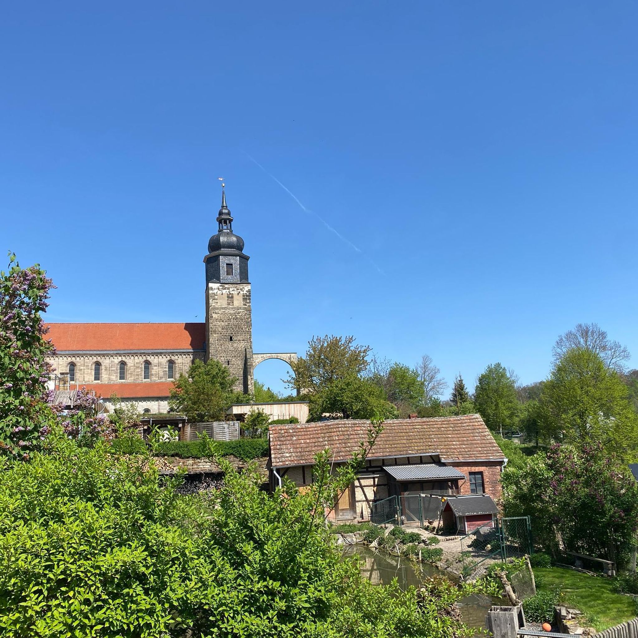
Mountain Hikes around Coise-Saint-Jean-Pied-Gauthier
Tips from the Community

just magnificent, keep it secret or almost....
0
0


The Col de Cochette from La Trinité is 2.99 km long with a total drop of 237 m. The average gradient is 7.9% with maximum gradients of 10%. From Villard-d'Héry, it is 1.89 km with an average gradient of 7.8%. There is a total drop of 148m.
2
0

Point of view not easy to access for everyone but very nice!
1
0

The trip there is not always easy. We did it with 3 kids (age 3, 5 and 7). The view at the top is really amazing!
1
0
Frequently Asked Questions
How many hiking trails are available around Coise-Saint-Jean-Pied-Gauthier?
There are over 220 hiking routes in the vicinity of Coise-Saint-Jean-Pied-Gauthier, offering a wide range of options for different skill levels and preferences.
What kind of landscapes can I expect to see while hiking in this region?
The region features a diverse blend of agricultural territories, extensive forests, and semi-natural environments. You'll find mountainous terrain, especially near the Massif des Bauges Regional Nature Park and the Chartreuse Regional Nature Park, as well as picturesque riverside walks along the Chéran River.
Are there easy hiking options suitable for beginners or families?
Yes, there are over 50 easy routes available. For a gentle walk, consider the Lake Carouge loop from Châteauneuf, which is a short and relatively flat path perfect for a relaxed outing.
Are there challenging hikes for experienced trekkers?
Absolutely. The area offers over 40 difficult routes. A notable challenging option is the Pierre Besse – Col du Potat loop from Saint-Pierre-d'Albigny, which covers 22.5 km with significant elevation gain through varied mountain terrain.
Can I find circular hiking routes in Coise-Saint-Jean-Pied-Gauthier?
Many of the trails in the region are circular. For example, the Col de Cochette (587 m) – Tower loop from Villard-d'Héry is a moderate 7.3 km loop offering views of the surrounding hills and valleys.
What notable natural features or landmarks can I see along the trails?
You can explore various natural and historical points of interest. The region is close to several beautiful lakes like Lake Saint-André and Lac de la Thuile. There are also mountain passes such as Marocaz Pass and Col du Frêne (950 m), offering scenic views.
Is the area suitable for hiking with dogs?
While specific dog-friendly regulations vary by trail and protected area, many natural paths in the forests and agricultural territories are generally suitable for dogs, provided they are kept under control. Always check local signage, especially within the Regional Nature Parks, for any specific restrictions.
What is the best time of year to go hiking in Coise-Saint-Jean-Pied-Gauthier?
The region is enjoyable for hiking across multiple seasons. Spring and autumn offer pleasant temperatures and vibrant scenery, while summer is ideal for higher-altitude routes. Winter hiking is possible, but some trails may require specific gear due to snow and ice, especially in mountainous areas.
Where can I find parking for trailheads?
Many trailheads in and around Coise-Saint-Jean-Pied-Gauthier, particularly those starting from villages like Saint-Pierre-d'Albigny, Villard-d'Héry, or Saint-Pierre-de-Soucy, offer designated parking areas. It's advisable to check the specific route details on komoot for parking information related to your chosen trail.
How do other hikers rate the trails in Coise-Saint-Jean-Pied-Gauthier?
The trails in Coise-Saint-Jean-Pied-Gauthier are highly rated by the komoot community, with an average score of 4.4 stars from over 500 reviews. Hikers often praise the varied terrain, from quiet woodlands to scenic viewpoints, and the well-maintained paths.
Are there options for longer, full-day hikes?
Yes, for those seeking a full-day adventure, routes like the Watch Rock – Manettaz Rock loop from Le Pray offer a substantial challenge. This difficult 13 km route involves over 1000 meters of elevation gain and typically takes several hours to complete.
Can I find routes that offer panoramic views?
Yes, the mountainous character of the region and its proximity to the Bauges and Chartreuse Regional Nature Parks mean many trails offer stunning panoramic views. Look for routes that ascend to higher elevations or pass by viewpoints like the View of Lake Saint-André and the Belledonne Range.
Most popular routes around Coise-Saint-Jean-Pied-Gauthier
Most popular attractions around Coise-Saint-Jean-Pied-Gauthier

Get inspired with the komoot mobile app


Explore more
Browse the best Hikes in other regions.
