The best cycling routes around Saint-Sulpice-De-Royan
4.3
(1196)
9,819
riders
268
rides
Touring cycling routes around Saint-Sulpice-De-Royan traverse a landscape defined by the Seudre and Gironde estuaries, offering diverse terrain. The region features coastal paths, extensive forests, and marshlands, with a mix of paved surfaces and dedicated cycle paths. The topography is gently undulating to slightly hilly, interspersed with agricultural plains.
Best touring cycling routes around Saint-Sulpice-De-Royan
- The most popular touring cycling route is Côte sauvage – Ocean Path at Les Mathes loop from Église Saint-Vivien, a 27.6 miles (44.5 km) trail that takes 2 hours 37 minutes to complete. This route offers coastal views and ocean paths.
- Another top favourite among local touring cyclists is L'Éguille-sur-Seudre – Riberou Port loop from L'Éguille, a moderate 20.8 miles (33.5 km) path. This trail explores the gentle waters of the Seudre estuary and its oyster ports.
- Local touring cyclists also love the Bike loop from Saint-Sulpice-de-Royan, a 15.3 miles (24.6 km) trail leading through varied local landscapes, often completed in about 1 hour 47 minutes.
- Touring cycling around Saint-Sulpice-De-Royan is defined by coastal routes, forest paths, and estuary landscapes. The network offers options for various ability levels, from easy family rides to more challenging routes.
- The routes in Saint-Sulpice-De-Royan are highly rated by the komoot community with an average score of 4.4 stars from over 1400 reviews. More than 11000 touring cyclists have used komoot to explore Saint-Sulpice-De-Royan's varied terrain.
Last updated: July 3, 2026
4.4
(8)
38
riders
15.8km
01:10
20m
20m
Easy bike ride. Great for any fitness level. Mostly paved surfaces. Suitable for all skill levels.
4.0
(1)
6
riders
Moderate bike ride. Good fitness required. Mostly paved surfaces. Suitable for all skill levels.

Sign up for free
4.5
(2)
8
riders
Easy bike ride. Great for any fitness level. Mostly paved surfaces. Suitable for all skill levels.
5.0
(1)
15
riders
31.4km
01:59
180m
180m
Moderate bike ride. Good fitness required. Mostly paved surfaces. Suitable for all skill levels.
3.0
(1)
11
riders
24.0km
01:26
110m
110m
Easy bike ride. Great for any fitness level. Mostly paved surfaces. Suitable for all skill levels.
Get access to more routes and recommendations from other explorers.
Sign up for free
Already have an account?
Our route recommendations are based on thousands of hikes, rides, and runs completed by other people on komoot.
Start today with a free account
Your next adventure awaits.
Login or Signup

Tips from the Community

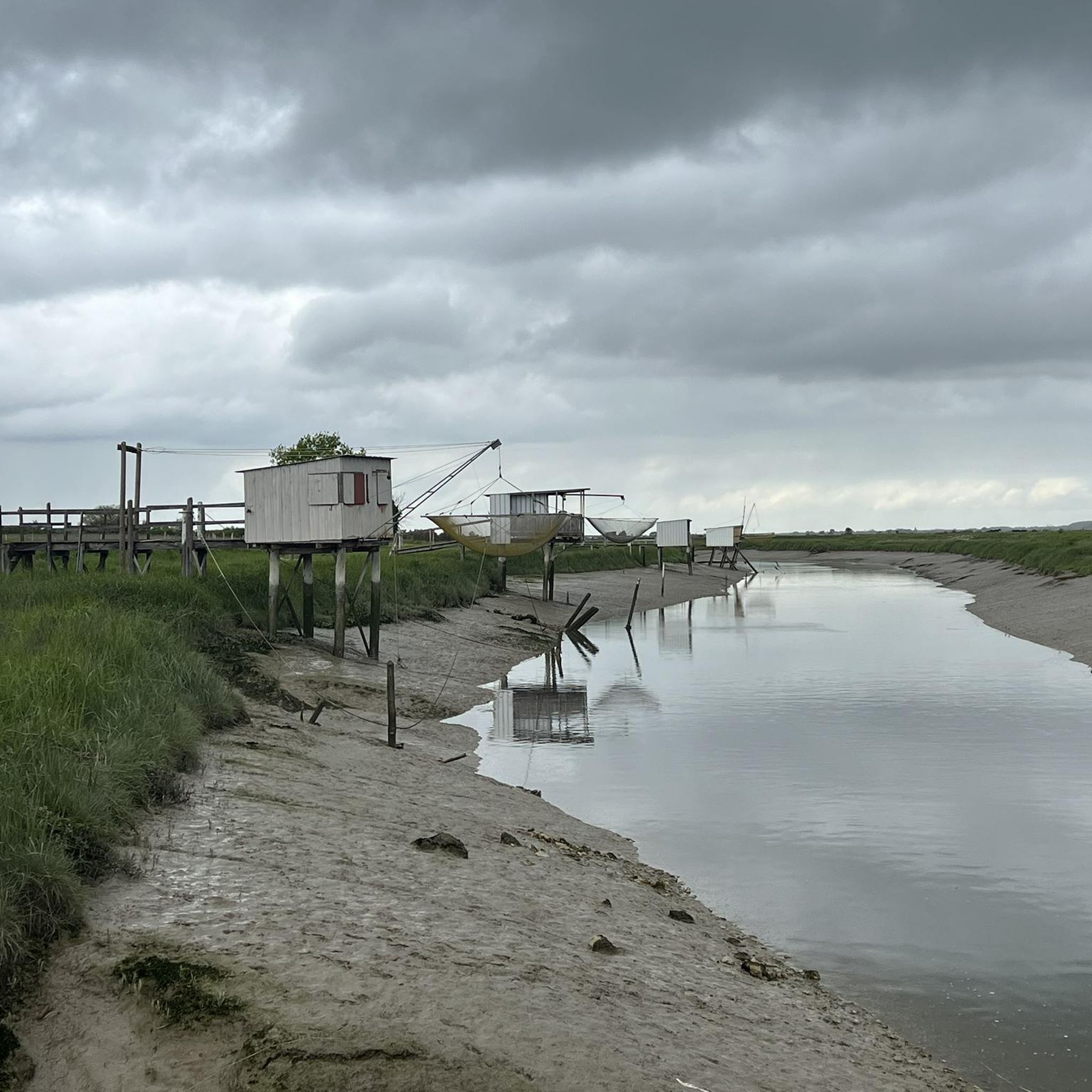
The port of Ribérou is a major heritage site in Saujon, bearing witness to a prosperous maritime past linked to the salt and wine trade. Transformed in the 19th century by ambitious works, it has now been reinvented as a place for living, relaxation, and preserving local history. 🛶 Origins and the Middle Ages The port of Ribérou takes its name from the Latin word ripa ("riverbank") or the Occitan word ribèira ("river"). It is located at the head of the Seudre estuary. It existed as early as the 11th century and became an important river and sea port thanks to its strategic position at the head of the estuary, used particularly for the salt trade—then called "white gold"—a highly sought-after product for preserving food. 🚢 Medieval Period and International Trade With the opening of British markets during the reigns of Eleanor of Aquitaine and Henry II Plantagenet, ships laden with wool, salt, wine, and other goods flocked to Ribérou. In the 16th century, the port exported local wines (such as cognac and pineau) throughout Europe. In 1577, during the Wars of Religion, the port was a strategic site: troops were stationed there, and battles took place. 🏗️ Decline, Reconstruction, and the 19th Century The estuary gradually silted up, making navigation difficult. By 1691, only smaller vessels could dock there. During the French Revolution, the sale of the tidal mill, which helped remove sediment, worsened the silting, leading to the port's decline. A modernization project began in 1822, but it wasn't until 1839 that an ambitious program was launched under the impetus of Jules Dufaure—a native of Saujon and Minister of Public Works—with the construction of sturdy quays, slipways, a lock bridge (marking the boundary between fresh and salt water), and reception facilities. In 1842, the work was completed, and the main quay was named Quai Dufaure in honor of this political support. 📉 Gradual Decline and Modernization The arrival of the railway in 1876 and the persistent problems of silting led to a decline in the port's traditional commercial activity, already facing competition from other transport networks. In the 20th century, the port gradually lost its economic importance but remained active for traditional fishing and became a place for pleasure boating, leisure, and local culture. Urban and tourism development projects (particularly in 2011–2012) modernized the port while preserving its historical charm. 🌊 Today The port of Ribérou is now a small fishing and pleasure port, much appreciated for its walks along the Seudre River, water sports (canoeing, kayaking, paddleboarding, etc.), and seasonal events.
0
0
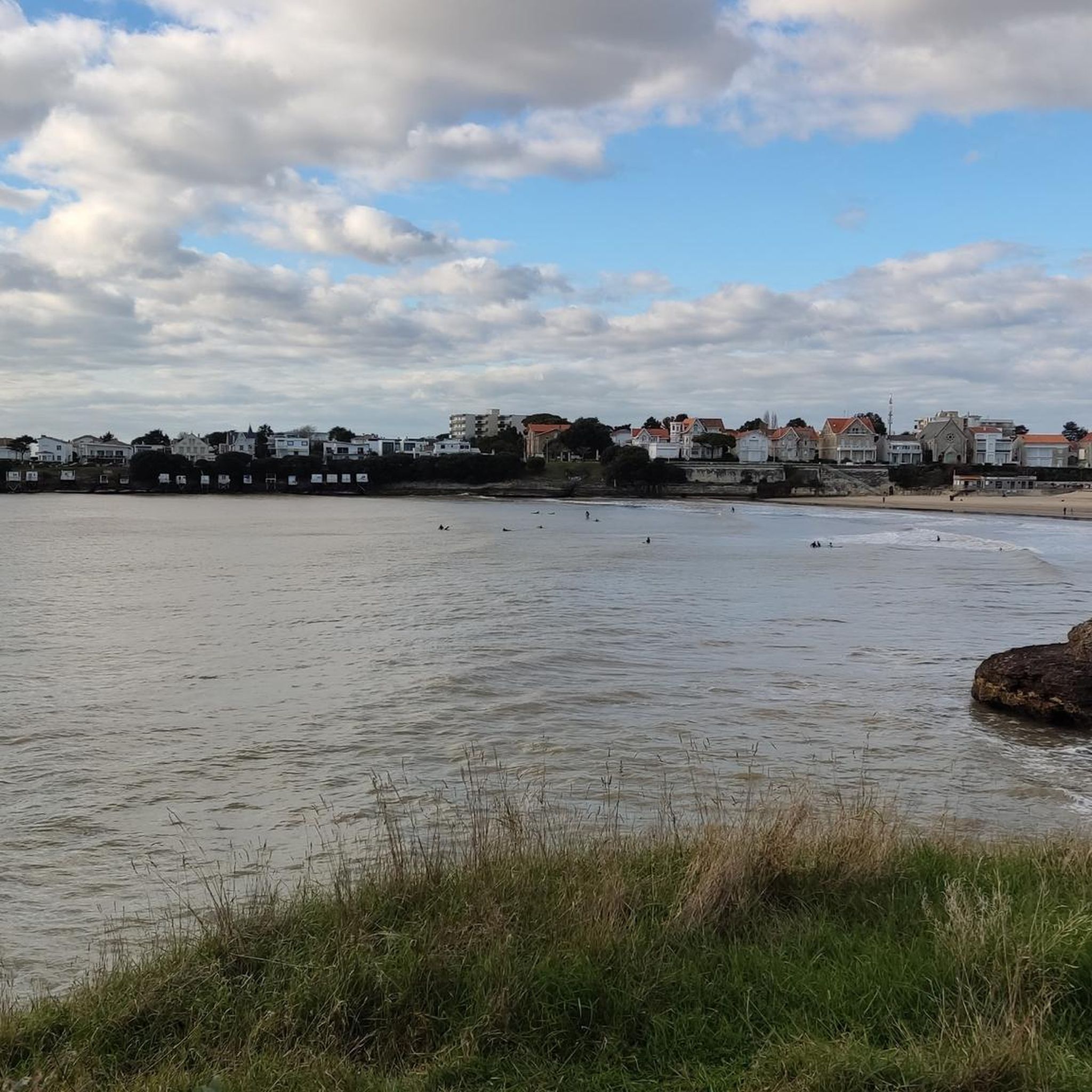
📍 Introducing the Gilet Cove The Gilet Cove is a small, natural beach on the oceanfront, located on Boulevard de la Conche de Gilet / Boulevard de la Falaise, in the town of Vaux-sur-Mer, just before Royan. 🌿 It's a sheltered, rocky cove, appreciated for its tranquility and more intimate setting compared to the larger urban beaches nearby. 🏖️ At high tide, the sea can completely cover this small beach, making the space very limited; at low tide, you can enjoy a patch of sand and rocks for relaxing or swimming. 🧭 Features & Tips 📍 Type of place: small, unsupervised beach, nestled among the rocks with sand and cliffs. 🏖️ Tides: access is best at low tide — at high tide the beach can disappear underwater. 🐶 Animals: prohibited from April 1st to September 30th (subject to municipal regulations). 👣 Access: via stairs from the boulevard above, surrounded by villas with sea views. 🚫 Lifeguard services: no lifeguard station or marked services. 📍 Location La Conche de Gilet is often considered the last small beach in Vaux-sur-Mer before reaching Royan/Pontaillac when following the coastline from Saint-Palais-sur-Mer.
0
0
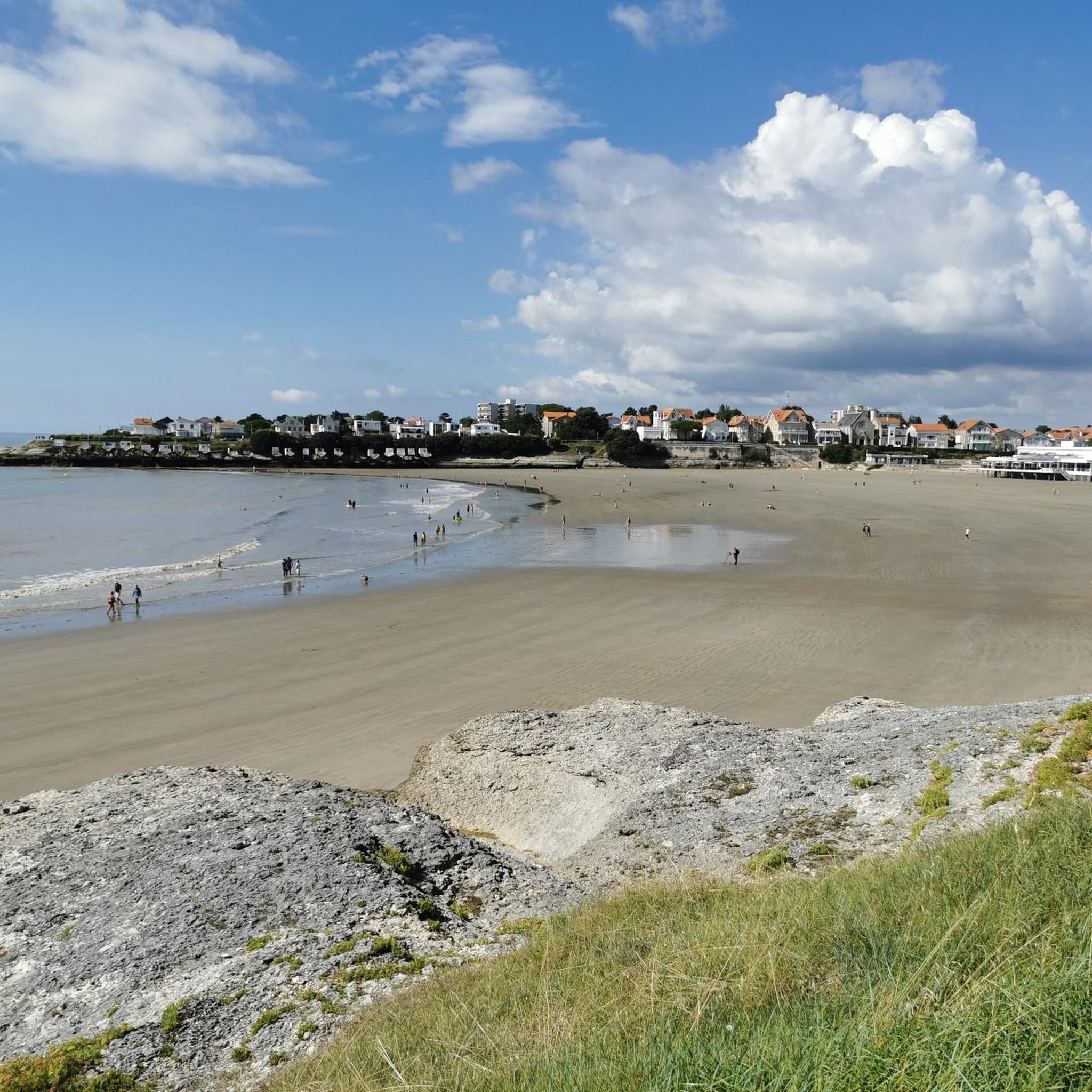
🏖️ General Overview Chay Beach is a family-friendly, fine sandy beach located in Royan (Charente-Maritime), on the Côte d’Argent promenade between Pigeonnier Beach and Pointe du Chay. It stretches for approximately 200 meters and boasts a pleasant natural setting, with a cove bordered by rocks typical of the Charente coastline. 🏝️ Features • 🌊 Beach type: fine sand, sheltered cove. • 🏄♂️ Atmosphere: relatively calm and family-friendly, ideal for children and vacationers seeking relaxation away from the large urban beaches. • 🐾 Pets: prohibited from April 1st to September 30th. • 🫧 Water quality: excellent (Blue Flag label awarded for 2025). 🧭 Lifeguard and Safety • Swimming is supervised during the season (June to early September), with areas marked by red and yellow flags. • The area is classified as a Category 3 "Supervised Beach" and lifeguards are present during the indicated hours. 🪑 Amenities On-site, you can find: • 🏖️ Sun loungers, parasols, and mattresses for rent. • 🚿 Foot rinse and public restrooms. • 📶 Wi-Fi access, first aid station, and an area accessible to people with reduced mobility (assistance may be required depending on the slope). • 🍴 Beachfront restaurant ("Le Chay" bar-restaurant with sea views). 🚶♂️ Atmosphere and Activities • 🎈 Ideal for families and leisurely strolls. • 🌞 People come here for swimming, playing on the sand, flying kites, or simply relaxing by the ocean. • 🅿️ Parking is available nearby, and the beach is easily accessible on foot or by bike from Royan town center in just a few minutes. 🧭 Practical Tips • 📆 Best time to visit: summer for supervised swimming and full services, but also during the off-season for a more peaceful atmosphere. • ☀️ Arriving early in the morning makes parking easier during peak season. • 🐶 Dogs are not allowed during the summer season; check the signs on site during the off-season.
0
0


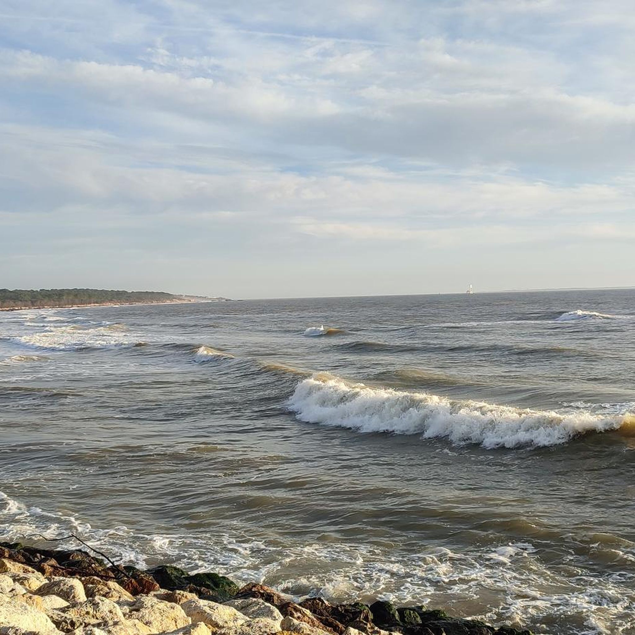
for a typical view here on the coast.. the cycle path along the shore is also worth it
0
0

The port of Royan is located between the Foncillon district and the Grande Conche beach, in the heart of the city. Ideally located at the mouth of the Gironde, in the immediate vicinity of the Atlantic Ocean and opposite Port-Médoc, it consists of a marina with a thousand rings and a fishing port, specializing in “noble” species (sole, meagre, sea bass, etc.). You will find the harbor master's office, the Fishing Port and the auction, as well as a covered shopping arcade, “Les voûtes du Port”, which extends the shopping arcades of the “Front de Mer”. Port, 1100 sheltered places – Reception pontoon – Secure pontoons. Access pass is 0.30 m above the zero of the nautical charts. Basins after dredging 2.30 m from the zero of the nautical charts. Services: water, electricity (220 V) on pontoon, toilets, WC, showers, handling in closed technical area, recovery of careening water, grey water and black water pumps, maintenance and ship repair workshops, ship chandlers on the port, wifi, 24/24 CB fuel, slipway. V.H.F. 9. The port is sheltered from all winds because it is protected by the landing stage of the ferries which ensure the crossing of the Gironde for the crossings to the Pointe de Grave/Le Verdon-sur-Mer.
1
0
Of the first star-shaped fort (1811), only a few things remain today. In 1859 its plan was redesigned with a solid ground facing the sea separated by a large ditch cutting the fort in two. The redoubt is cut off and allows the access bridge located to the north to be monitored. This redoubt has the particularity of having a specific plan. It only has a machicolation on three of its sides to the north (inland side) and on its two short sides (east and west). The tour of the solid ground is reinforced by a large masonry wall now. At the rear, the star-shaped device protects against attacks coming from the land. The site was affected by erosion and especially lost its relief after the Second World War. The battery line is still visible from the air and on the ground, only a few German and French bunkers are still outcropping. They are inaccessible. Transformed into a promenade, the site borders the coastal path that starts from the port of Royan and continues to the Grande Côte. Today, nearly 75% of the militarized surface of the late 19th century is occupied by residences and the Cordouan Thalazur hotel. The site still has some visible remains, mainly of French origin
0
0
Frequently Asked Questions
How many touring cycling routes are available in Saint-Sulpice-de-Royan?
There are over 260 touring cycling routes around Saint-Sulpice-de-Royan, offering a wide variety of options for different skill levels and preferences. The region is known for its diverse landscapes, including coastal paths, forests, and marshlands.
Are there easy touring cycling routes suitable for beginners or families?
Yes, Saint-Sulpice-de-Royan offers a significant number of easy routes, with over 140 trails suitable for beginners or families. For example, the Port of Ribérou loop from L'Éguille is an easy 15.3 km path exploring the gentle Seudre estuary and its oyster ports. The Forêt domaniale de la Coubre also features a very easy 36 km bike loop, with 80% dedicated cycle paths, ideal for families.
What kind of landscapes can I expect to see on touring cycling routes in this region?
The touring cycling routes around Saint-Sulpice-de-Royan offer a rich tapestry of landscapes. You can expect to cycle along the 'Côte sauvage' with sea spray and pine scents, through extensive forests like the Forêt domaniale de la Coubre, and across marshlands and fields. The area is nestled between the Seudre and Gironde estuaries, providing unique natural scenery with a slightly hilly topography.
Are there any challenging touring cycling routes for experienced cyclists?
Yes, for more experienced cyclists seeking a challenge, there are 14 difficult touring cycling routes available. One such route is the Bike loop from Saint-Sulpice-de-Royan, which covers 24.6 km with notable elevation gains, providing a more demanding experience.
What are some interesting places to explore or landmarks to see along the cycling routes?
While cycling, you can discover various attractions. The town of Saint-Sulpice-de-Royan itself boasts a remarkable 12th-century Romanesque church and a medieval garden. Routes often pass by coastal features like Saint-Georges-de-Didonne Beach or Chay Beach. You might also encounter historical sites such as the Bunkers at Pointe de Suzac or natural viewpoints like the View of the estuary and white cliffs at Parc de l'Estuaire. The nearby town of Mornac-sur-Seudre, recognized as a 'Most Beautiful Village', is also accessible via routes like the White Path in the Woods – The market halls in Mornac-sur-Seudre loop from Église Saint-Vivien.
Are there any circular touring cycling routes available?
Yes, many of the touring cycling routes in Saint-Sulpice-de-Royan are designed as loops, allowing you to start and end at the same point. Examples include the Côte sauvage – Ocean Path at Les Mathes loop from Église Saint-Vivien, which offers coastal views, and the L'Éguille-sur-Seudre – Riberou Port loop from L'Éguille, exploring the Seudre estuary.
What do other touring cyclists enjoy most about cycling in Saint-Sulpice-de-Royan?
The area is highly rated by the komoot community, with an average score of 4.4 stars from over 1400 reviews. Touring cyclists often praise the region's diverse terrain, which includes coastal paths, forest trails, and estuary routes, catering to various abilities. The well-developed cycling infrastructure and the blend of natural beauty with charming villages are frequently highlighted.
Is public transport available to access the cycling routes?
Saint-Sulpice-de-Royan's central location provides good access to nearby towns like Royan. While specific public transport links directly to trailheads may vary, Royan offers transport options that can help you get closer to the starting points of many routes in the wider Royan Atlantique territory.
What is the best time of year for touring cycling in Saint-Sulpice-de-Royan?
The region is generally pleasant for cycling for much of the year. Spring and autumn offer mild temperatures and beautiful scenery, making them ideal. Summer is also popular, especially for coastal routes, though it can be warmer. The diverse landscapes, from coastal paths to forests, provide options that can be enjoyed across different seasons.
Are there specific routes that offer scenic viewpoints?
Many routes in the region offer scenic viewpoints, particularly those along the coast and estuaries. The 'Côte sauvage' routes provide breathtaking ocean views. Additionally, the View of the estuary and white cliffs at Parc de l'Estuaire is a specific highlight offering panoramic vistas of the Gironde estuary.
Most popular routes around Saint-Sulpice-De-Royan
Most popular attractions around Saint-Sulpice-De-Royan

Get inspired with the komoot mobile app


Explore more
Browse the best Cycling routes in other regions.
