The best walks and hikes around Saint-Sulpice-De-Royan
4.5
(547)
5,538
hikers
236
hikes
Hiking around Saint-Sulpice-De-Royan offers routes through varied landscapes, including extensive marshlands and wooded massifs like the forest of Chatelard. The region is situated between the Val de Seudre and the Gironde estuary, providing coastal proximity and estuary views. Terrain is generally gently undulating with minimal elevation changes, making it suitable for various fitness levels. Wetlands and woodlands to the west and north are classified as natural areas of ecological interest.
Best hiking trails in Saint-Sulpice-De-Royan
- The most popular hiking route…
Last updated: July 1, 2026
4.2
(9)
37
hikers
8.20km
02:05
20m
20m
Moderate hike. Good fitness required. Easily-accessible paths. Suitable for all skill levels.
3.9
(13)
110
hikers
Moderate hike. Good fitness required. Easily-accessible paths. Suitable for all skill levels.

Sign up for free
5.0
(2)
28
hikers
Easy hike. Great for any fitness level. Easily-accessible paths. Suitable for all skill levels.
5.0
(6)
23
hikers
8.87km
02:18
50m
50m
Moderate hike. Good fitness required. Easily-accessible paths. Suitable for all skill levels.
4.8
(5)
22
hikers
11.6km
02:55
10m
10m
Moderate hike. Good fitness required. Easily-accessible paths. Suitable for all skill levels.
Get access to more routes and recommendations from other explorers.
Sign up for free
Already have an account?
Our route recommendations are based on thousands of hikes, rides, and runs completed by other people on komoot.
Start today with a free account
Your next adventure awaits.
Login or Signup

Tips from the Community

The port of Ribérou is a major heritage site in Saujon, bearing witness to a prosperous maritime past linked to the salt and wine trade. Transformed in the 19th century by ambitious works, it has now been reinvented as a place for living, relaxation, and preserving local history. 🛶 Origins and the Middle Ages The port of Ribérou takes its name from the Latin word ripa ("riverbank") or the Occitan word ribèira ("river"). It is located at the head of the Seudre estuary. It existed as early as the 11th century and became an important river and sea port thanks to its strategic position at the head of the estuary, used particularly for the salt trade—then called "white gold"—a highly sought-after product for preserving food. 🚢 Medieval Period and International Trade With the opening of British markets during the reigns of Eleanor of Aquitaine and Henry II Plantagenet, ships laden with wool, salt, wine, and other goods flocked to Ribérou. In the 16th century, the port exported local wines (such as cognac and pineau) throughout Europe. In 1577, during the Wars of Religion, the port was a strategic site: troops were stationed there, and battles took place. 🏗️ Decline, Reconstruction, and the 19th Century The estuary gradually silted up, making navigation difficult. By 1691, only smaller vessels could dock there. During the French Revolution, the sale of the tidal mill, which helped remove sediment, worsened the silting, leading to the port's decline. A modernization project began in 1822, but it wasn't until 1839 that an ambitious program was launched under the impetus of Jules Dufaure—a native of Saujon and Minister of Public Works—with the construction of sturdy quays, slipways, a lock bridge (marking the boundary between fresh and salt water), and reception facilities. In 1842, the work was completed, and the main quay was named Quai Dufaure in honor of this political support. 📉 Gradual Decline and Modernization The arrival of the railway in 1876 and the persistent problems of silting led to a decline in the port's traditional commercial activity, already facing competition from other transport networks. In the 20th century, the port gradually lost its economic importance but remained active for traditional fishing and became a place for pleasure boating, leisure, and local culture. Urban and tourism development projects (particularly in 2011–2012) modernized the port while preserving its historical charm. 🌊 Today The port of Ribérou is now a small fishing and pleasure port, much appreciated for its walks along the Seudre River, water sports (canoeing, kayaking, paddleboarding, etc.), and seasonal events.
0
0
The Church of the Assumption of Our Lady, also known as the Pontaillac Chapel, is a small 19th-century chapel built to serve the parishioners of the Pontaillac seaside district. Replaced around 1890 by a larger chapel (Our Lady of the Angels), it was deconsecrated and converted into a private residence, while retaining its heritage exterior: a discreet yet significant witness to the religious and urban history of Royan and its beaches. 📍 Location and context • The building is located on Boulevard de la Falaise in Royan, facing the ocean, in the Pontaillac/Vaux-sur-Mer district, right on the beach. 🏛️ Origins and Religious History 🛠️ Construction • Faced with the rise of seaside tourism in the mid-19th century, the Catholic community of Pontaillac wanted a place of worship near the beaches and the developing villas. • After disagreements with the parish priest of Royan regarding the location of a church, parishioners had this small Neo-Romanesque/Neo-Gothic chapel built in 1870 on the cliff, then administratively within the territory of Vaux-sur-Mer (and therefore outside the parish jurisdiction of Royan). 🙏 Liturgical Role and Replacement • For a few years, it served as the local place of worship for the faithful of the seaside district. • With the development of Pontaillac, the building proved too small and too far from the town center. • Thus, the construction of the larger Notre-Dame-des-Anges Chapel (still a Catholic chapel today) in the center of Pontaillac in 1891 eventually replaced this first place of worship. 🏗️ Deconsecration and Transformation 🏡 End of Religious Function • Once the new chapel (Notre-Dame-des-Anges) was built, the old chapel on the cliff gradually lost its religious function and ceased to be used for regular services. 🏠 Conversion into a Private Residence • The building was then deconsecrated (that is, removed from official Catholic worship) and transformed into a private residence. • Today, while the exterior still reflects its original function with its simple and traditional architecture, the interior has been adapted for residential use, having lost its liturgical purpose. 🗺️ Architecture and Style 🧱 Original Style The chapel features modest architecture, typical of small rural/seaside chapels of the 19th century: simple volumes, use of local materials, and small proportions suited to a limited community. • In the Neo-Gothic style, it forms a single nave of five bays, lit by a series of round-arched windows. • The façade, pierced by a rose window, is flanked by two buttresses and surmounted by a simple stone cross. 🏖️ Landscape Setting • Perched on the cliff above the beach, the building formerly offered worshippers a direct view of the ocean, a setting very characteristic of seaside chapels on the Atlantic coast. 📌 Historical and Heritage Significance • The former chapel illustrates the beginnings of organized religious life in Pontaillac before the growth and complete urban development of the area. • It is an architectural and historical testament to the first phase of the local community's development, before the construction of larger buildings in the town center. • Its conversion into a residence reflects the evolving uses of religious heritage in areas where the population and needs have changed over time.
0
0
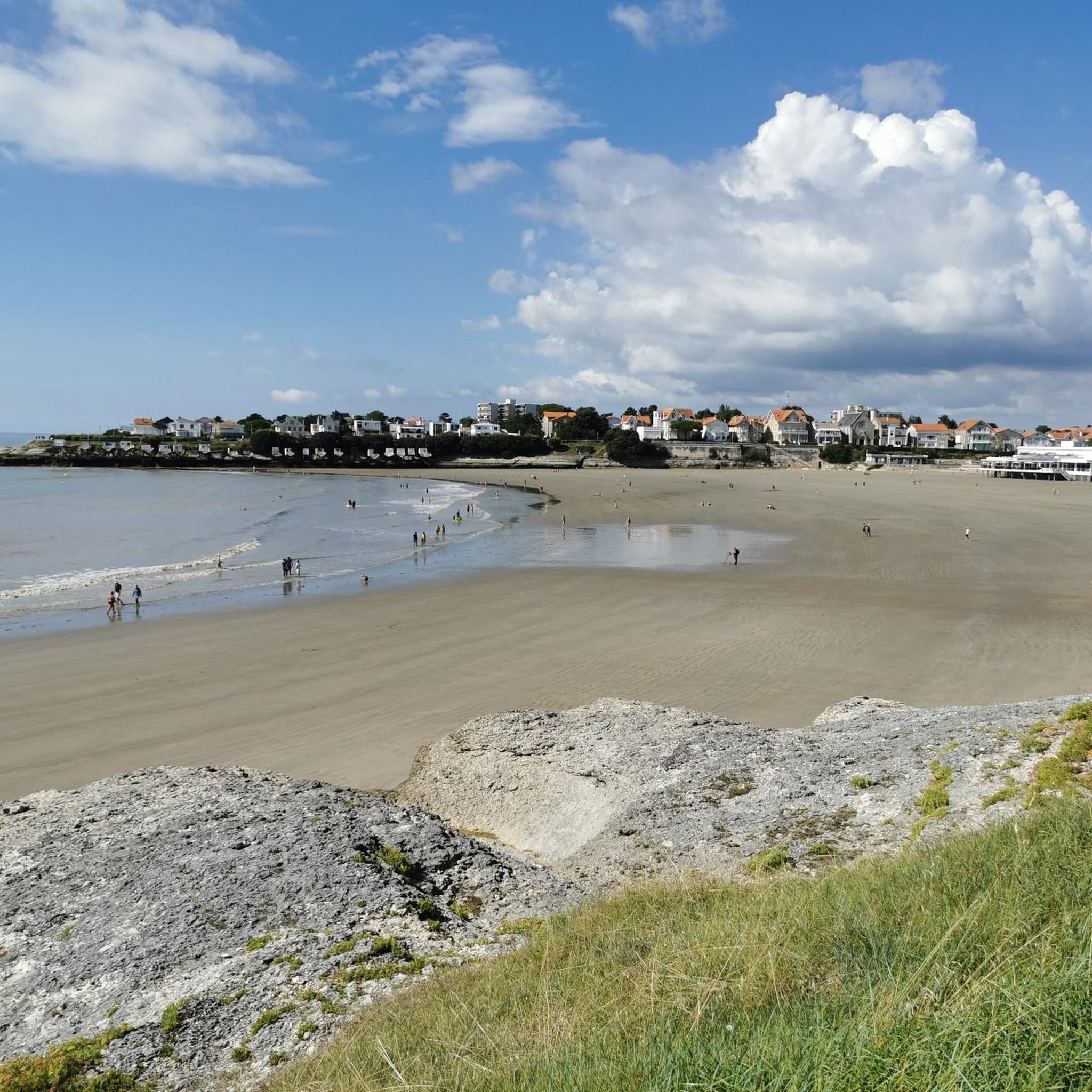
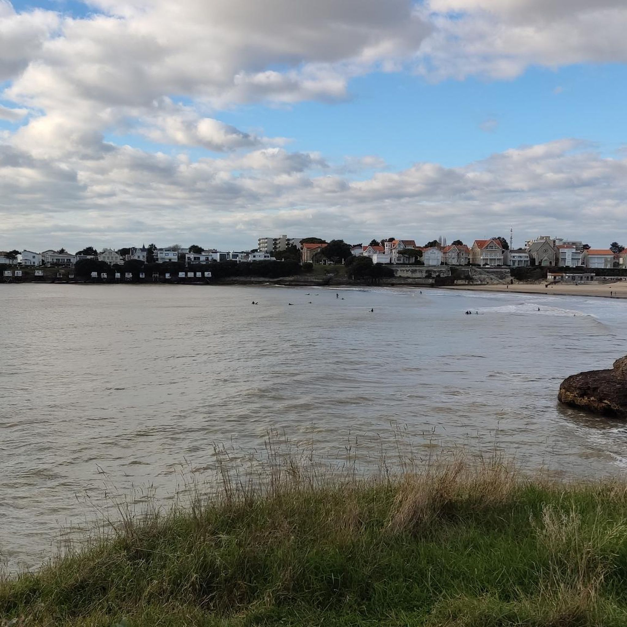
📍 Introducing the Gilet Cove The Gilet Cove is a small, natural beach on the oceanfront, located on Boulevard de la Conche de Gilet / Boulevard de la Falaise, in the town of Vaux-sur-Mer, just before Royan. 🌿 It's a sheltered, rocky cove, appreciated for its tranquility and more intimate setting compared to the larger urban beaches nearby. 🏖️ At high tide, the sea can completely cover this small beach, making the space very limited; at low tide, you can enjoy a patch of sand and rocks for relaxing or swimming. 🧭 Features & Tips 📍 Type of place: small, unsupervised beach, nestled among the rocks with sand and cliffs. 🏖️ Tides: access is best at low tide — at high tide the beach can disappear underwater. 🐶 Animals: prohibited from April 1st to September 30th (subject to municipal regulations). 👣 Access: via stairs from the boulevard above, surrounded by villas with sea views. 🚫 Lifeguard services: no lifeguard station or marked services. 📍 Location La Conche de Gilet is often considered the last small beach in Vaux-sur-Mer before reaching Royan/Pontaillac when following the coastline from Saint-Palais-sur-Mer.
0
0

The port of Ribérou is a fishing and pleasure port located at the end of the Seudre estuary, in Saujon. It is one of the two ports in the city, along with that of Breuil, a little downstream. Active since the 11th century, it took on its current appearance from 1842, under the impetus of the Minister of Public Works at the time, Jules Dufaure, a "local boy", who thus attempted to revive maritime trade and fishing activities, which were then in decline. Ideally located, on the edge of the city center, the La Lande leisure center and the preserved areas of the Seudre marshes (towpaths transformed into walking trails), it has become one of the major tourist attractions in Saujon, where theme evenings and the July 14 fireworks are organized. In 2011, the municipality began a renovation program for the port site, entrusted to the architect-urban planner Sophie Blanchet. It consists of transforming the old car parks into a pedestrian esplanade, a real meeting place with modern street furniture and, in the long term, green spaces. From the quays, lined with bourgeois buildings, small picturesque streets lined with hollyhocks allow you to crisscross the district and reach the city centre. The Ribérou lock bridge, known as the "bridge of opposing waters", was renovated in 2010. It marks the separation between the waters of the estuary (port side: brackish water) and the waters of the river (retention basin side: fresh water). Ribérou is a starting point for certain water sports (canoeing and kayaking). It is approximately 250 metres long and 40 metres wide. From Ribérou, it is possible to reach successively the ports of Breuil (Saujon), L'Éguille, Mornac, Chaillevette, Chatressac (Chaillevette), Grandes Roches and Orivol (Étaules), La Grève in Duret and Coux (Arvert), La Grève (La Tremblade) and La Cayenne (Marennes).
0
0
The SAINT-PIERRE church dominates the village from its fortified bell tower. Original in many ways, the Romanesque building houses a holy water font made of a real shell. From the side, you reach the small garden of the chevet, well hidden. Stone sarcophagi (Merovingian or Carolingian depending on the source) bear witness to the archaeological excavations that the church has undergone. There are many stories in Mornac but that of the fire of August 2, 1943 marked the identity of the village. Indeed, the bell tower has not always had this appearance. It had the more traditional shape of a spire until lightning struck it. Many young students come to Mornac-sur-Seudre to participate in the clearing and the excavations that follow. Seduced by the local atmosphere, many of them stayed and opened the first craft workshops in the village, some of which are still present, such as pottery and leather.
0
0
The line was opened to traffic in 1876 by the Compagnie du chemin de fer de la Seudre, and then extended to the channel of La Grève at La Tremblade. In 1880, the line was bought by the State Railways Administration, which absorbed the bankrupt Compagnie des chemins de fer de l'Ouest in 1908. The State Network, after its merger with the other national railway companies in 1938, became the Société nationale des chemins de fer français (SNCF). In 1939, the line was closed to passenger traffic, but continued its activity for the transport of goods until 1980. Tourist service In 1984, the association of the Seudre Tourist Railway (CFTS) started running a tourist train again but stopped tourist operation in 2002. The infrastructure (track, stations and Chaillevette depot) was then bought by the department of Charente-Maritime. Between 2004 and 2006, the operation of the line was entrusted to CFTA, a subsidiary of Véolia Transport, but ceased in 2007. In 2008, the association Trains & Traction was entrusted with the operation of the line, and has continued the activity since then. Tourist operation takes place from the beginning of May to the end of September with daily traffic in July and August. Some special trains are organized in season or out of season like the "Train des Loupiottes1" or the "Train Éclade de moules". Most recently, the Train des Mouettes has opened up to gastronomy with refined meals with its restaurant train the "Seudre Océan Express", reviving the myth of rail travel for the time of a refined meal (reservation required by telephone). The office is at the Saujon Chemin Vert station, and the workshop is in Chaillevette, in the middle of the line. The following equipment is currently operated by volunteers Steam locomotives • Schneider (no. 2503), 1891 - Arrived at Chaillevette in 1984. In service since 2004. • Henschel, 1912 - Arrived at Chaillevette in 1984. Inaugurated (being heated) on 20 June 2015. • Fives-Lille (no. 3716), 1910 - Out of service (undergoing complete restoration). • Borsig (type T 3 Prussian (de)), 1906 - Out of service (undergoing complete restoration). Diesel locomotives • Decauville, 1960 - Operational • Blanc-Misseron, 1958 - Out of service (undergoing complete restoration). • SACM (no. 10019), 1956 - Operational • Moyse, 1968 – Operational • Brissonneau and Lotz, 1971 - Operational • CFD, 1965 - Operational • CFD, 1965 - Out of service (undergoing complete restoration). • SACM/Alstom/CAFL, 1956 Decauville, 1967 – Out of service (undergoing complete restoration).Baudet, Donon and Roussel – Shunter rebuilt to SACM plans in 1961 with a Baudouin engine. - Operational • Decauville, 1967 – Shunter Operational Accumulator locomotive • Orenstein & Koppel no. 320 13-ton accumulator locomotive, from a foundry in Niederbronn-les-Bains. Railcars • X 5822 - Out of service (undergoing complete restoration). • Billard railcar no. 902, type A 75 D built in 1947, ex-CFD of Indre-et-Loire, entrusted by the FACS; • X 2208 ex-Limoges depot, entrusted under agreement with the SNCF, on loan to the Central Brittany railways; • X 2251 ex-Limoges depot, entrusted under agreement with the SNCF, on loan to the Central Brittany railways.
0
0

small round trip between the éguille and Ribérou
0
0
Frequently Asked Questions
How many hiking trails are available in Saint-Sulpice-De-Royan?
There are over 200 hiking trails around Saint-Sulpice-De-Royan, offering a wide variety of options for all skill levels. The region features a mix of coastal paths and marshland routes.
Are there easy hiking trails suitable for beginners or families in Saint-Sulpice-De-Royan?
Yes, Saint-Sulpice-De-Royan is well-suited for beginners and families, with 137 easy trails. A great option is The market halls in Mornac-sur-Seudre – Mornac-sur-Seudre Marshes loop, an easy 2.2-mile (3.5 km) route that takes about 53 minutes to complete.
What kind of terrain can I expect on hikes in Saint-Sulpice-De-Royan?
The terrain in Saint-Sulpice-De-Royan is generally flat, characterized by coastal paths along the Atlantic and trails through the Seudre estuary marshlands. Elevation changes are minimal, making most routes accessible.
Are there any circular walks in the area?
Yes, many routes in Saint-Sulpice-De-Royan are circular, allowing you to start and end at the same point. For instance, the The market halls in Mornac-sur-Seudre – Mornac-sur-Seudre Town Hall loop is an easy 2.5-mile (4.1 km) circular trail.
What are some scenic viewpoints or natural attractions to see while hiking?
Hikers can enjoy various scenic spots. Consider visiting View of the estuary and white cliffs at Parc de l'Estuaire for panoramic views, or explore the natural beauty of Suzac Forest. Many trails also offer views of the Atlantic coast and the Seudre estuary.
Are there any historical landmarks or interesting places to explore near the trails?
Absolutely. You can discover historical sites like the Bunkers at Pointe de Suzac with a View of the Gironde Estuary. The charming village of Mornac-sur-Seudre, with its market halls, is also a popular point of interest along several routes.
What do other hikers enjoy the most about hiking in Saint-Sulpice-De-Royan?
The area is highly rated by the komoot community, with an average score of 4.5 stars from over 500 reviews. Hikers often praise the diverse coastal paths, tranquil marshland trails, and the generally flat, accessible terrain.
Can I bring my dog on the hiking trails in Saint-Sulpice-De-Royan?
Many trails in the Saint-Sulpice-De-Royan region are dog-friendly, especially those through the marshlands and along coastal paths. It's always recommended to keep your dog on a leash and respect local regulations, particularly in nature reserves or populated areas.
Are there any routes that pass by beaches or offer opportunities for a dip?
Yes, several trails are close to the coast. You might find yourself near Saint-Georges-de-Didonne Beach or Conche de Gilet, offering opportunities to enjoy the seaside. Always check local signage for swimming conditions.
What is a good moderate hike to experience the marshlands?
For a moderate experience of the marshlands, consider the Mornac-sur-Seudre Marshes Loop. This 5.1-mile (8.2 km) trail takes approximately 2 hours and 5 minutes, offering immersive views of the unique marshland environment.
Are there any longer routes for experienced hikers?
While the region is known for its generally flat terrain, there are longer routes available. For example, the Mornac-sur-Seudre Marshes – Mornac-sur-Seudre Market loop is a moderate 5.0-mile (8.0 km) path that provides a good extended walk through the marshlands.
Most popular routes around Saint-Sulpice-De-Royan
Most popular attractions around Saint-Sulpice-De-Royan

Get inspired with the komoot mobile app


Explore more
Browse the best Hikes in other regions.
