The best walks and hikes around Meschers-Sur-Gironde
4.6
(133)
1,012
hikers
26
hikes
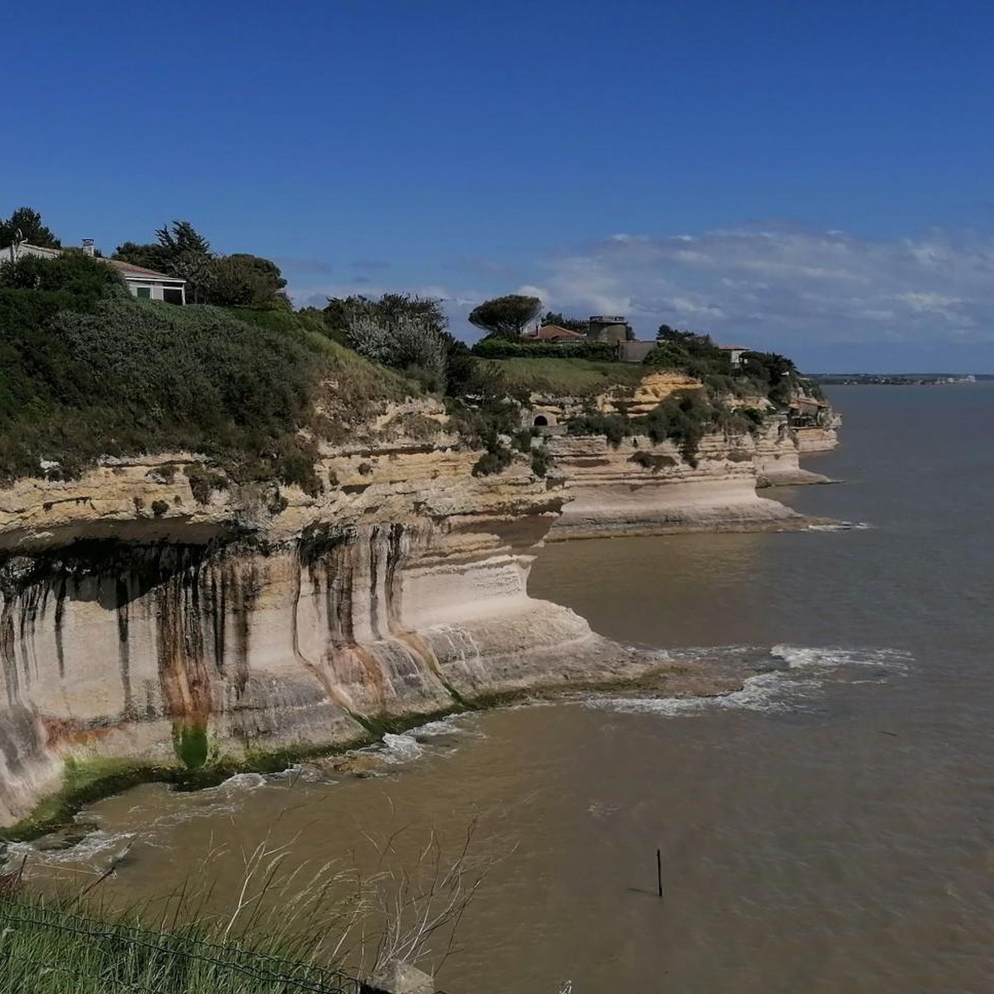
Hiking around Meschers-Sur-Gironde offers diverse landscapes at the mouth of the Gironde estuary. The region is characterized by dramatic limestone cliffs overlooking the estuary, sandy beaches, and the tranquil Suzac Forest. Trails often combine coastal paths with shaded forest routes, providing varied terrain for exploration. This area presents a blend of natural beauty and historical sites, including ancient troglodyte caves.
Best hiking trails around Meschers-Sur-Gironde
- The most popular hiking route is Fort and Forest of Suzac Trail, a 5.1 miles (8.3 km) trail that takes 2 hours 10 minutes to complete. This moderate route explores both the historic fort and the natural forest.
- Another top favourite among local hikers is View of Suzac Beach – View from the Cliffs loop from Parc de l'Estuaire, an easy 3.9 miles (6.3 km) path. This trail leads through coastal paths and offers panoramic views from the cliffs.
- Local hikers also love the View over Talmont-sur-Gironde – Le Port loop from Meschers-sur-Gironde, a 7.9 miles (12.8 km) trail leading through coastal scenery with views of Talmont-sur-Gironde, often completed in about 3 hours 14 minutes.
- Hiking around Meschers-Sur-Gironde is defined by coastal paths, limestone cliffs, and dense woodlands. The network offers options for different ability levels, from easy beach walks to more challenging forest routes.
- The routes in Meschers-Sur-Gironde are highly rated by the komoot community with an average score of 4.5 stars from over 120 reviews. More than 900 hikers have used komoot to explore Meschers-Sur-Gironde's varied terrain.
Last updated: July 7, 2026
4.5
(39)
185
hikers
8.27km
02:10
70m
70m
Hike the Saint-Georges-de-Didonne loop, a moderate 5.1-mile trail through Suzac Forest with coastal views and historic villas.
4
hikers
24.8km
06:20
90m
90m
Tackle the difficult 15.4-mile Meschers-sur-Gironde loop hike, offering coastal views and estuary scenery over 6 hours and 20 minutes.

Sign up for free
4.7
(9)
77
hikers
Moderate hike. Good fitness required. Easily-accessible paths. Suitable for all skill levels.
4.8
(9)
44
hikers
Easy hike. Great for any fitness level. Easily-accessible paths. Suitable for all skill levels.
4.8
(6)
38
hikers
17.4km
04:36
170m
170m
Moderate hike. Good fitness required. Easily-accessible paths. Suitable for all skill levels.
Get access to more routes and recommendations from other explorers.
Sign up for free
Already have an account?
Our route recommendations are based on thousands of hikes, rides, and runs completed by other people on komoot.
Start today with a free account
Your next adventure awaits.
Login or Signup

Tips from the Community

Exceptional view, the most beautiful village in France.
0
0

Bright limestone cliffs, small whitewashed houses, a Romanesque sandstone church, and the waters of the Gironde River far below: Talmont-sur-Gironde is a picture-perfect village. And during the peak summer season, it's a tourist magnet, as one of the most beautiful villages in France. If you don't arrive early, you'll have trouble getting through the entrance gate. The large parking lot, which has long since taken up more space than the village itself, is full until late into the evening.
0
0

A small, pedestrian-only craft village. The site is magnificent, located on the Gironde estuary.
0
0

🏠 What are carrelets? • Wooden huts built on stilts directly on the water • Connected by a long wooden walkway from the shore or cliffs • Equipped with a large square net that is lowered into the water and raised again by a winch 🌊 What are they used for? • Traditional fishing method at high tide • Catches include plaice, mullet, shrimp, and eels • Today, they are often used as a retreat for leisure, birdwatching, or simply enjoying the sunset
0
0

Built on a cliff overlooking the Gironde estuary, the Catholic Church of Sainte-Radegonde is sometimes considered the archetype of the Saintonge Romanesque style. The view of the Gironde estuary and the surrounding rivers is spectacular.
0
0

Overlooking the Gironde estuary, the Sainte-Radegonde church, in the picturesque village of Talmont-sur-Gironde, is an almost thousand-year-old place, worked by the sea and the winds. On the edge of a cliff, the site offers an exceptional panoramic view of the Gironde. These stones, hollowed out by the centuries, have seen pilgrims pass by, risking their lives to reach the Bay of Biscay and reach the tomb of Saint Jacques de Compostelle, in Galicia. The Sainte-Radegonde church, a jewel of Romanesque art in Saintonge, was listed as a Historic Monument in 1890. The building bears the name of a famous saint venerated since the 6th century in Poitou-Charentes. Daughter of the King of Thuringia, Radegonde was forced to marry the son of Clovis and King of the Franks, Clotaire I. After her brother was assassinated, she asked the Bishop of Noyon, Saint Médard, to give up her role as queen to devote herself to God. She retired to the monastery of Poitiers, where she welcomed the poor and the sick. After her death in 587, she was buried in Poitiers. Protector of sailors, a statue of the saint stands in the church of Talmont-sur-Gironde. A first building is mentioned as early as 1094, when Archpriest Guillaume Laier gave the peninsula to the Benedictine abbey of Saint-Jean-d'Angély. Tombs located at the foot of the church, dating from the Carolingian era, bear witness to the antiquity of this place, steeped in history. Pilgrims on their way to Santiago de Compostela from Aulnay and Saintes took this route before reaching Soulac by sea or Bordeaux by land. Between 1140 and 1170, Benedictine monks built a church in the Romanesque style. Only simple bays let in light, illuminating the white stone of Saintonge. The chevet, with its buttress columns, is decorated with checkerboards and sculpted figures. These decorative elements, taken from the medieval bestiary, can be found on the voussures, as well as on the capitals that support the pointed arches. The wind and the sea have continued to erode these stone ornaments. The nave collapsed in the 15th century, due to the fragile construction of the crypt, located below. In 1284, the town of Talmont was purchased by the King of England and Duke of Aquitaine, Edward I. Transformed into a real fortress from the 13th century, the soldiers stood on the crenellated heights of the church. In the 15th century, cannons were installed on this platform, facing the sea, to dissuade ships from attacking Bordeaux. From the 14th to the 17th century, the church was the victim of violent clashes between the English, French, Huguenots, Catholics, Basques and Spanish. After the closure of this place of worship in 1794, extensive restoration work began in the mid-19th century. The cliff that supports the church was reinforced to protect it from the tides. The work undertaken in the 1930s aimed to harmonize the building and restore its original form. The platform used for military defense and the patrol path were removed to make way for a square tiled bell tower.
0
0

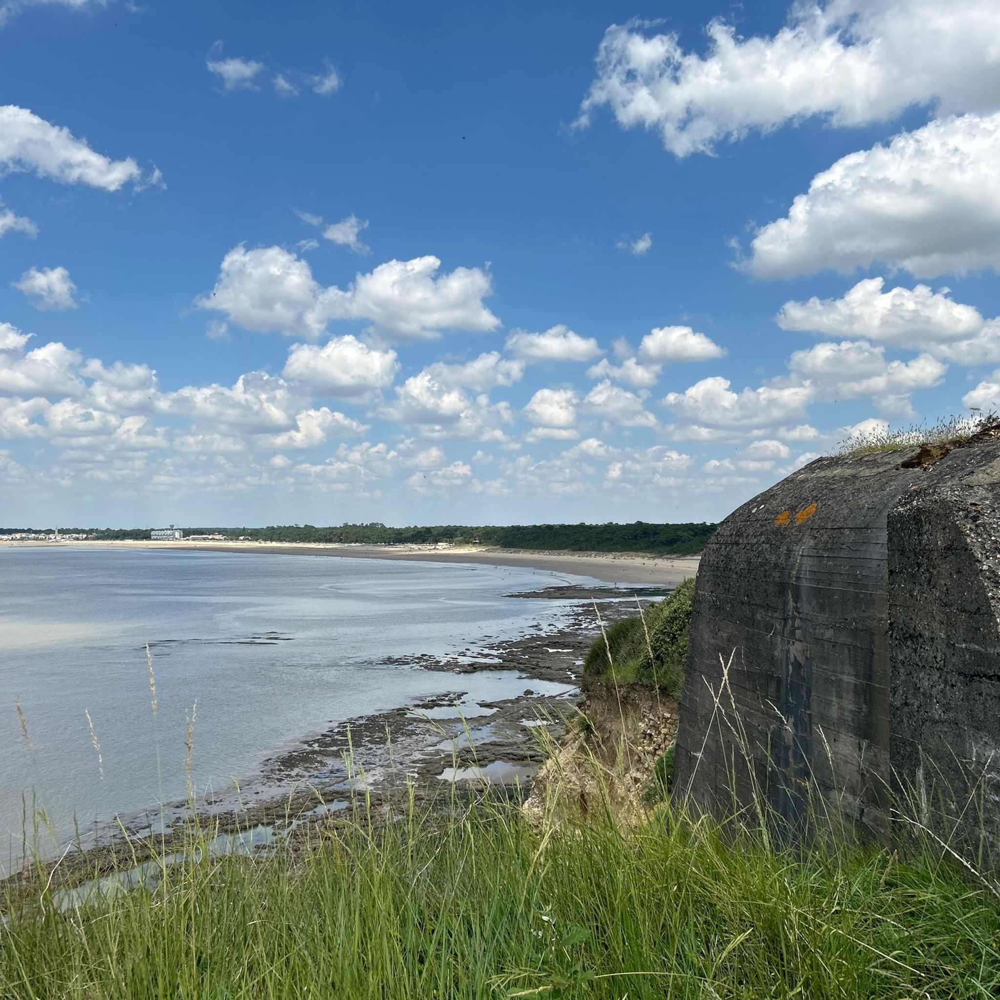
Remains of fortifications from the 19th century and World War II in a beautiful landscape
0
0

Frequently Asked Questions
How many hiking trails are available in Meschers-Sur-Gironde?
Meschers-Sur-Gironde offers a wide selection of hiking trails, with over 25 routes to explore. These range from easy coastal walks to more challenging forest paths, ensuring options for various fitness levels.
Are there any easy hiking trails suitable for beginners or families in Meschers-Sur-Gironde?
Yes, Meschers-Sur-Gironde has 12 easy hiking routes, perfect for beginners or families. An excellent option is the View of Suzac Beach – View from the Cliffs loop from Parc de l'Estuaire, which is 6.3 km long and offers panoramic coastal views.
What kind of natural attractions can I expect to see along the hiking trails?
The trails in Meschers-Sur-Gironde showcase a diverse landscape. You can explore dramatic limestone cliffs, sandy beaches like Saint-Georges-de-Didonne Beach, and tranquil woodlands such as the Suzac Forest. The region is also famous for its ancient troglodyte caves, including the Grottes de Matata.
Are there any circular walks in Meschers-Sur-Gironde?
Yes, many routes in Meschers-Sur-Gironde are circular, allowing you to start and end at the same point. For example, the The Matata Caves – Le Port loop from Meschers-sur-Gironde is a popular circular path that takes you past the famous caves and offers estuary views.
What do other hikers enjoy most about hiking in Meschers-Sur-Gironde?
The hiking trails in Meschers-Sur-Gironde are highly rated by the komoot community, with an average score of 4.5 stars from over 130 reviews. Hikers often praise the region's unique blend of coastal scenery, historic caves, and peaceful forest paths, offering varied terrain and stunning viewpoints.
Are there any longer or more challenging hikes for experienced trekkers?
For experienced trekkers seeking a longer challenge, the Meschers-sur-Gironde Loop is a difficult 24.8 km route. This trail provides an extensive exploration of the region's diverse landscapes.
Can I find trails with good viewpoints over the Gironde estuary?
Absolutely. The coastline of Meschers-Sur-Gironde features imposing limestone cliffs that offer spectacular panoramic views over the Gironde estuary. Trails like the View of Suzac Beach – View from the Cliffs loop from Parc de l'Estuaire are specifically designed to highlight these breathtaking vistas.
Are there any trails that combine historical sites with natural beauty?
Yes, Meschers-Sur-Gironde is rich in both natural beauty and historical intrigue. Many trails, such as Fort and Forest of Suzac Trail, explore historic forts and ancient troglodyte caves carved into the cliffs, offering a unique blend of history and nature.
What is the best time of year to go hiking in Meschers-Sur-Gironde?
Meschers-Sur-Gironde offers pleasant hiking conditions for much of the year. Spring and autumn provide mild temperatures ideal for exploring, while summer allows for combining hikes with visits to the sandy beaches. Even in winter, the coastal paths and forests offer a refreshing experience.
Are there any hiking routes that pass by the famous Matata Caves?
Yes, the famous Matata Caves are a key highlight in the region. You can explore them directly on the The Matata Caves – Le Port loop from Meschers-sur-Gironde trail, which offers a unique glimpse into local history and geology.
Are there any trails that lead through the Suzac Forest?
Yes, the tranquil Foret de Suzac is a significant natural site with trails winding through it. The Fort and Forest of Suzac Trail is an excellent option that explores both the historic fort and the refreshing forest paths.
Most popular routes around Meschers-Sur-Gironde
Most popular attractions around Meschers-Sur-Gironde

Get inspired with the komoot mobile app


Explore more
Browse the best Hikes in other regions.
