The best walks and hikes around Chichilianne
4.5
(499)
3,872
hikers
77
hikes
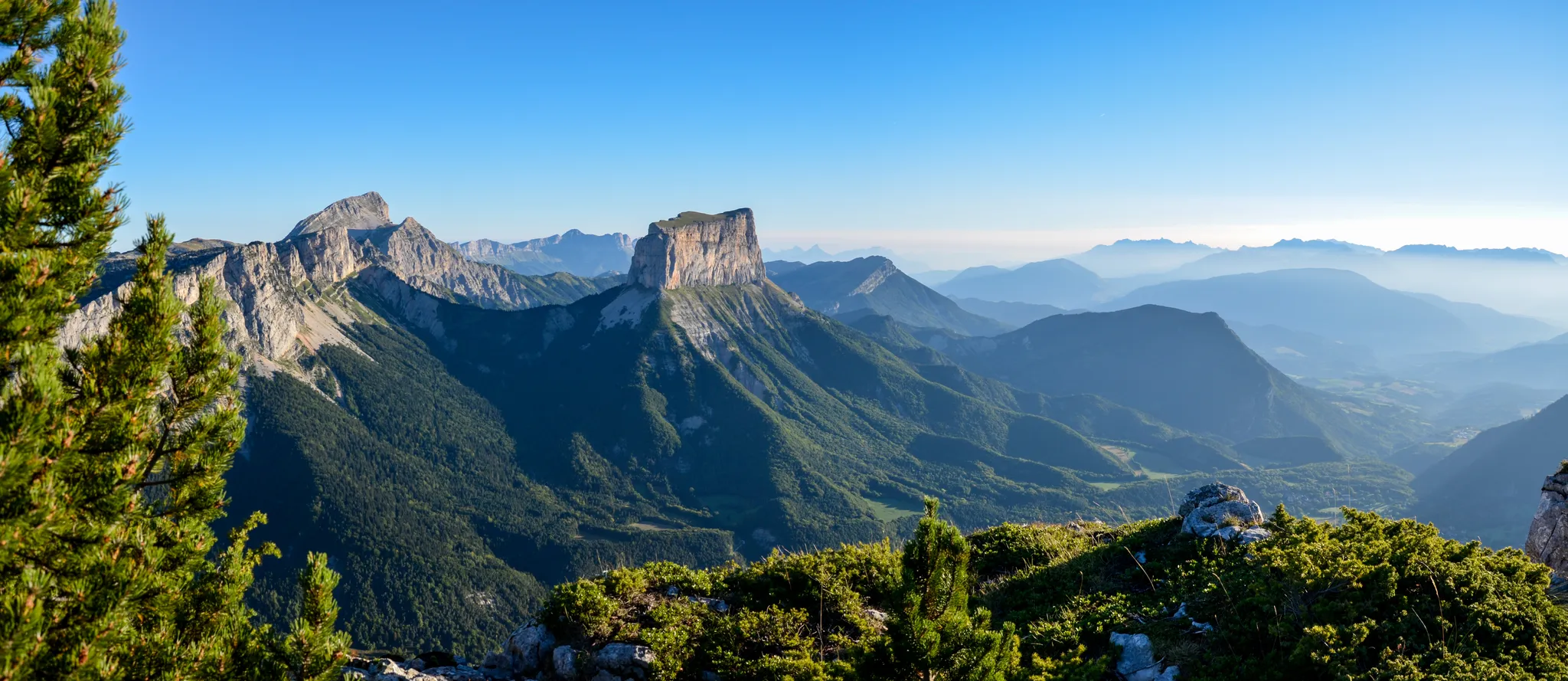
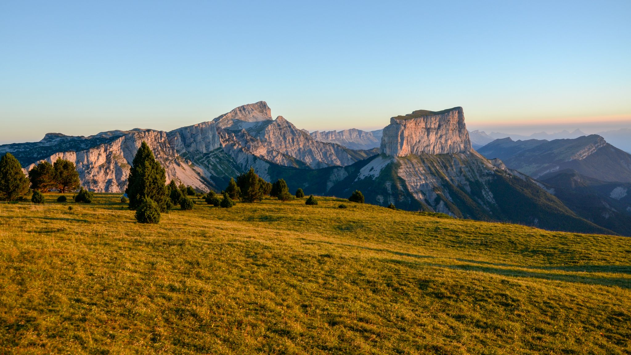
Hiking trails around Chichilianne are set within the Trièves region, characterized by the dramatic limestone peak of Mont Aiguille and its proximity to the Vercors High Plateaux Nature Reserve. The landscape features diverse forests, high plateaus, and various mountain passes. This area offers a range of elevations and terrain, from valley paths to more challenging ascents within the Vercors massif.
Best hiking trails around Chichilianne
- The most popular hiking route is Tour of Mont Aiguille, a 10.8 miles (17.3…
Last updated: October 11, 2026
4.6
(76)
484
hikers
17.3km
06:32
950m
950m
Hard hike. Very good fitness required. Mostly accessible paths. Sure-footedness required.
4.3
(16)
122
hikers
16.7km
06:00
860m
870m
Hard hike. Very good fitness required. Mostly accessible paths. Sure-footedness required.

5.0
(2)
12
hikers
15.0km
05:24
740m
740m
Hard hike. Very good fitness required. Mostly accessible paths. Sure-footedness required.
4.8
(16)
163
hikers
9.79km
03:47
460m
470m
Moderate hike. Good fitness required. Mostly accessible paths. Sure-footedness required.
4.9
(7)
137
hikers
16.8km
06:29
920m
930m
Hard hike. Very good fitness required. Sure-footedness, sturdy shoes and alpine experience required.
Get access to more routes and recommendations from other explorers.
Already have an account?
Our route recommendations are based on thousands of hikes, rides, and runs completed by other people on komoot.
Start today with a free account
Your next adventure awaits.
Popular around Chichilianne
Grand Tour of the Vercors – first section
The cradle of mountaineering – Vercors Trièves' mountains

France — two weeks of hiking at its best!
Road Cycling Routes around Chichilianne
MTB Trails around Chichilianne
Running Trails around Chichilianne
Cycling around Chichilianne

Gravel biking around Chichilianne

Mountain Hikes around Chichilianne


Tips from the Community

Memorial of the resistance, always flowery
0
0
It's a small summit in the Trièves region, easily accessible from Chichiliane. From the top, there's a 360° view of the Vercors, the Dévoluy, the Taillefer...
0
0
the waterfall doesn't seem to flow in summer
1
0


magnificent view. watch out for the water
1
0

Refuge near the Pas de l'Aiguille. From this refuge, you have unique views of Mont Aiguille.
0
0
Frequently Asked Questions
How many hiking trails are available around Chichilianne?
Chichilianne offers a wide variety of hiking experiences, with over 60 trails available. These routes cater to different skill levels, from easy walks to challenging mountain ascents within the Vercors massif.
Are there easy hiking trails suitable for beginners in Chichilianne?
Yes, Chichilianne has 13 easy hiking trails perfect for beginners or those looking for a relaxed walk. While specific easy routes aren't detailed, the region offers gentle paths that allow you to enjoy the scenery without significant elevation gain. For a moderate option with magnificent panoramic views, consider the Platary Ridge, which leads to a mountain pasture.
Can I find family-friendly hiking routes in the Chichilianne area?
The Chichilianne area, with its diverse terrain, offers options suitable for families. While specific 'family-friendly' routes are not explicitly detailed in the data, the 13 easy trails available are generally a good starting point for families. Look for routes with lower elevation gain and shorter distances for a pleasant outing with children.
Are there any circular hiking routes around Chichilianne?
Yes, many trails in the Chichilianne region are designed as circular routes, allowing you to start and end at the same point. For instance, the Essaure Pass – Vallon de Combeau loop from Halle Fernand Fort is a moderate circular hike, and the Bachassons Pass – Aupet Pass loop from Les Fourchaux offers a more challenging circular experience.
What kind of wildlife can I expect to see while hiking in the Vercors High Plateaux Nature Reserve?
The Vercors High Plateaux Nature Reserve, accessible from Chichilianne, is a haven for wildlife. Hikers often spot marmots and ibex. The reserve is also home to 120 animal species, including six ungulates like deer, chamois, roe deer, mouflon, and wild boar, as well as various birds of prey such as golden eagles and peregrine falcons.
Are there any notable landmarks or attractions to see along the trails?
Absolutely. The most iconic landmark is Mont Aiguille, a spectacular pyramid-like peak visible from many trails. You can also explore several mountain passes like Col de l'Allimas and Pas de la Ville Pass. For a unique experience, visit the Ebron Footbridge, a 180-meter-long Himalayan-style bridge offering magnificent views of the Ebron Gorge.
What is the best time of year to go hiking in Chichilianne?
The best time for hiking in Chichilianne is generally from spring to autumn, when the weather is mild and the trails are clear of snow. During these seasons, you can fully appreciate the diverse flora, including wild tulips, orchids, and gentians, and enjoy the region's natural beauty. Summer offers warmer temperatures, while spring and autumn provide vibrant colors and fewer crowds.
Is it possible to hike in Chichilianne during winter?
Yes, Chichilianne transforms into a Nordic site in winter. While some higher-altitude hiking trails may be inaccessible due to snow, the area offers 28 kilometers of dedicated snowshoeing itineraries. This provides a unique opportunity to explore the snowy landscapes and even try horse riding in the snow.
Are dogs allowed on the hiking trails around Chichilianne?
While the general rules for dogs on trails can vary, it's important to be aware that Chichilianne is a gateway to the Vercors High Plateaux Nature Reserve, a protected area. In such reserves, regulations regarding dogs (often requiring them to be on a leash or restricting access in certain zones to protect wildlife) are common. Always check local signage or specific trail guidelines before heading out with your dog.
Where can I find parking for hiking trails near Chichilianne?
Parking is generally available at common starting points for popular trails around Chichilianne. For example, routes like the Essaure Pass – Vallon de Combeau loop often start from designated areas like Halle Fernand Fort, where parking facilities are typically provided. It's advisable to check the specific tour details on komoot for parking information related to your chosen route.
How can I reach the hiking trails around Chichilianne using public transport?
While Chichilianne is a rural area, some public transport options might connect to nearby towns. However, direct public transport to specific trailheads can be limited. For optimal flexibility and access to the diverse range of trails, especially those deeper within the Vercors massif, traveling by car is often the most convenient option. Always check local bus schedules for connections to Chichilianne from larger regional hubs.
What makes the hiking experience in Chichilianne unique according to other hikers?
The hiking experience in Chichilianne is highly rated by the komoot community, with an average score of 4.5 stars from over 350 reviews. Hikers frequently praise the dramatic limestone formations, especially the iconic Mont Aiguille, and the rich biodiversity of the Vercors High Plateaux Nature Reserve. The varied terrain, from diverse forests to high plateaus and mountain passes, also contributes to its appeal.
Are there any challenging hikes for experienced hikers?
Yes, Chichilianne offers 28 difficult trails for experienced hikers seeking a challenge. Routes like the Tour of Mont Aiguille and Tête Chevalière involve significant elevation gain and longer distances, providing panoramic views over the Vercors massif. The route from Chichilianne to Bénevise via the Pas de l'Essaure and the Vallon Combau is also recommended for a deep dive into the Vercors National Nature Reserve.
Most popular routes around Chichilianne
Most popular attractions around Chichilianne

Get inspired with the komoot mobile app


Explore more
Browse the best Hikes in other regions.
