The best running trails in the Sapphire Mountains
5.0
(2)
273
runners
20
runs
Jogging in the Sapphire Mountains offers diverse landscapes, transitioning from rolling foothills to steep ridges and peaks, with several summits exceeding 8,000 feet. The region is characterized by dense pine, fir, and spruce forests, alongside large grassy meadows and sagebrush-covered lands. Numerous rivers and streams, including Rock Creek and Skalkaho Creek, crisscross the area, providing scenic routes for runners.
Best jogging routes in the Sapphire Mountains
- The most popular jogging route is Mount Sentinel loop from University of Montana,…
Last updated: June 25, 2026
20
runners
11.1km
01:09
40m
40m
Moderate run. Good fitness required. Mostly paved surfaces. Suitable for all skill levels.
13
runners
17.4km
02:26
700m
700m
Hard run. Very good fitness required. Mostly paved surfaces. Suitable for all skill levels.

Sign up for free
10
runners
16.7km
02:54
1,200m
1,200m
Hard run. Very good fitness required. Mostly paved surfaces. Suitable for all skill levels.
6
runners
18.0km
02:41
910m
910m
Hard run. Very good fitness required. Mostly paved surfaces. Suitable for all skill levels.
4
runners
14.6km
01:31
40m
40m
Moderate run. Good fitness required. Mostly paved surfaces. Suitable for all skill levels.
3
runners
2.97km
00:18
0m
0m
Easy run. Great for any fitness level. Mostly paved surfaces. Suitable for all skill levels.
3
runners
5.16km
00:36
100m
100m
Moderate run. Good fitness required. Mostly paved surfaces. Suitable for all skill levels.
11
runners
Moderate run. Good fitness required. Mostly paved surfaces. Suitable for all skill levels.
3
runners
4.67km
00:39
190m
190m
Moderate run. Good fitness required. Mostly paved surfaces. Suitable for all skill levels.
3
runners
11.7km
01:45
580m
580m
Hard run. Very good fitness required. Mostly paved surfaces. Suitable for all skill levels.
Get access to more routes and recommendations from other explorers.
Sign up for free
Already have an account?
Our route recommendations are based on thousands of hikes, rides, and runs completed by other people on komoot.
Start today with a free account
Your next adventure awaits.
Login or Signup

Tips from the Community

Jacob's Island is a dog park on the banks of Clark Fork River. The park is 6-acres and the river works as a beautiful natural barrier for the dogs. It also offers a series of paved and unpaved trails, benches, picnic tables and dog-waste bags.
0
0
Jacob's Island is a dog park on the banks of Clark Fork River. The park is 6 acres and the river works as a beautiful natural barrier for the dogs. It also offers a series of paved and unpaved trails, benches, picnic tables and dog-waste bags.
0
0

McCormic Park marks the western terminus of the Kim Williams Trail and the eastern terminus of the Milwaukee Trail. The park has some playing fields, open space, picnic areas, and is nestled up right next to the river.
0
0

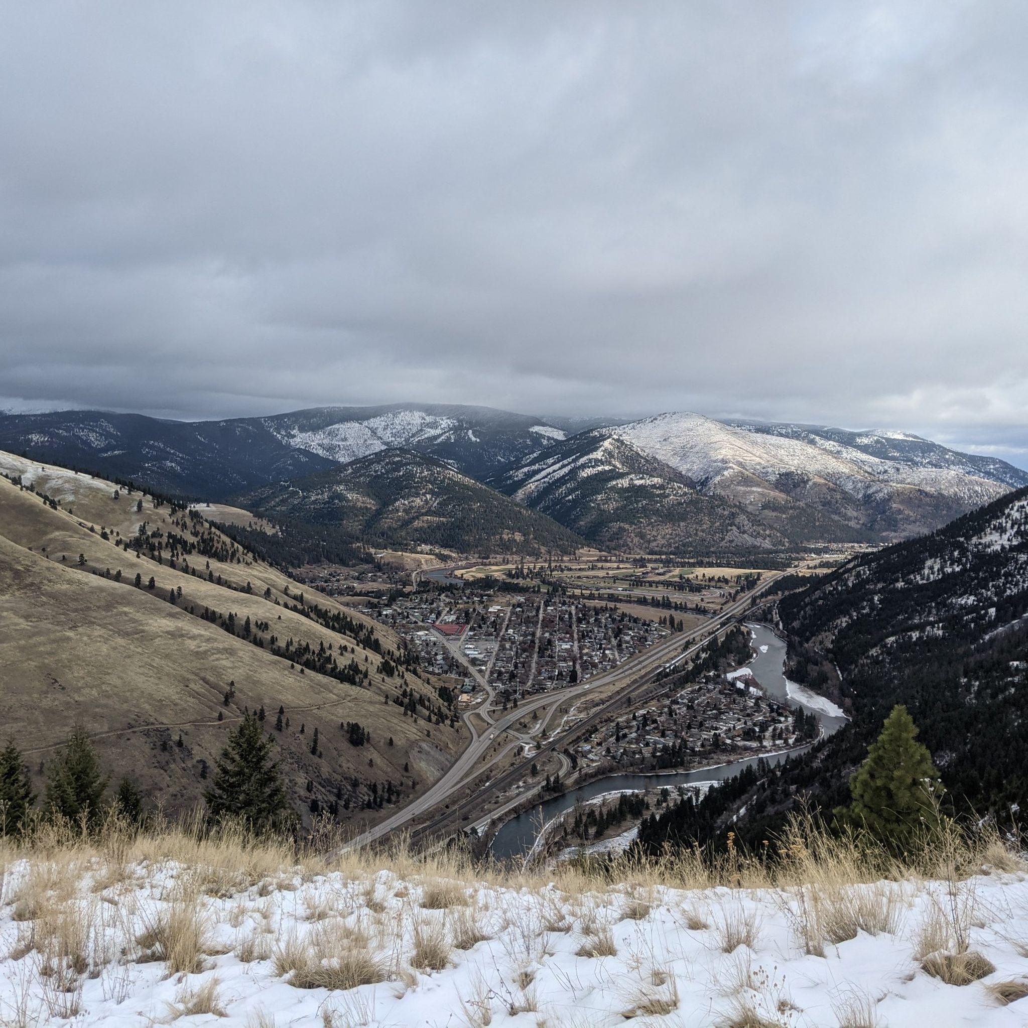
The "M" on the west face of Mount Sentinel has been a Missoula landmark since 1908, when Forestry Club members forged a zigzag trail up the mountain and students carried up stones to shape the symbol of the University of Montana. The "M" Trail is a very popular area for hiking and running, so you'll likely encounter other people while exploring. Dogs are welcome, but must be on a leash. There are great views of Missoula and the entire valley from the trail, but should be noted that there is no shade, so try and get there early! Being that this trail can get crowded, there are two alternative trails back down the mountain, one in the north towards the tree-line, and a slightly longer detour trail in the south if you continue on Evan's Trail.
0
0

A park with sports fields, trails, a fishing pond & pool. Lots of water fountains, benches and grassy areas.
1
0


The Clark Fork is the river that runs through Missoula. The Kim Williams Trail runs parallel to its course. Many parks and walking and cycling paths border the river.
0
0
Frequently Asked Questions
How many running routes are available in the Sapphire Mountains?
Komoot offers a selection of 19 diverse running routes in the Sapphire Mountains. These range from easy paths to more challenging mountain ascents, catering to various fitness levels.
Are there easy running routes for beginners in the Sapphire Mountains?
Yes, the Sapphire Mountains offer several easy running options suitable for beginners. For instance, the Running loop from Orchard Homes is a gentle 1.8-mile (3.0 km) trail that takes about 18 minutes to complete, leading through residential areas and green spaces.
Can I bring my dog on the running trails in the Sapphire Mountains?
Many trails in the Sapphire Mountains, particularly those within the Lolo National Forest and Beaverhead-Deerlodge National Forest, are generally dog-friendly. However, it's always best to check specific trail regulations before heading out, especially in designated wilderness areas or wildlife management areas like the Threemile Wildlife Management Area, where rules may vary. Always keep your dog on a leash and practice Leave No Trace principles.
Are there family-friendly running paths in the Sapphire Mountains?
For families looking for an accessible and safe running experience, the Bitterroot Trail is an excellent choice. This paved, traffic-free trail stretches over 50 miles between Hamilton and Missoula, offering flat terrain and scenic views of both the Bitterroot and Sapphire Mountains, perfect for a leisurely family jog.
What scenic views or attractions can I expect along the running routes?
The Sapphire Mountains boast breathtaking scenery. You can enjoy expansive views of the Bitterroot Mountains and the Rock Creek Drainage. Notable attractions include Mount Sentinel, which offers panoramic vistas over the Missoula Valley, and the Barmeyer Loop and Scenic Overlook. The region is also rich in natural features like dense forests, grassy meadows, and sagebrush-covered lands.
Are there any circular running routes in the Sapphire Mountains?
Yes, many routes in the Sapphire Mountains are designed as loops, offering varied scenery without retracing your steps. A popular option is the Clark Fork River – Kim Williams Trail loop from 39th St & Russell, a moderate 9.0-mile (14.5 km) path that follows the scenic Clark Fork River.
What's the best time of year for running in the Sapphire Mountains?
The best time for running in the Sapphire Mountains is typically from late spring through early fall (May to October) when trails are clear of snow and weather conditions are mild. Summer offers lush greenery and full access to higher elevations. While winter running is possible, many trails, especially at higher altitudes, may be covered in snow and ice, requiring appropriate gear and caution.
Are there routes with waterfalls or significant water features?
Absolutely. The Sapphire Mountains are home to picturesque cascades like Skalkaho Falls, which is directly accessible from Skalkaho Pass Road. Numerous lakes, rivers, and streams, including Rock Creek and Skalkaho Creek, crisscross the area, offering beautiful water features along many routes. Mud Lake, near Skalkaho Pass, also features an interesting natural boardwalk trail.
What kind of wildlife might I encounter while running?
The Sapphire Mountains are rich in wildlife. Runners might encounter populations of bear, moose, mountain lion, deer, elk, wolves, mountain goats, and bighorn sheep. It's always advisable to be aware of your surroundings, make noise on trails, and carry bear spray, especially in more remote areas.
What do other runners say about the Sapphire Mountains trails?
The running trails in the Sapphire Mountains are highly rated by the komoot community, with an average score of 5.0 stars. Reviewers often praise the diverse landscapes, from rolling foothills to steep ridges, and the extensive network of trails that offer options for various ability levels. The stunning views of the Bitterroot Mountains and the Rock Creek Drainage are frequently highlighted.
Are there less crowded running options available?
To find less crowded routes, consider exploring trails within the protected wilderness areas such as parts of the Welcome Creek Wilderness Area or the Anaconda-Pintler Wilderness Area. These areas offer thousands of roadless acres, providing opportunities for solitude. The Miller Creek Road trail might also offer a quieter experience compared to more popular routes.
Where can I find parking for the running trails?
Many trailheads throughout the Sapphire Mountains, especially those accessing national forest lands or popular recreation areas, offer designated parking. For routes like the Mount Sentinel loop from University of Montana, parking is often available near the University or at specific trail access points. Skalkaho Pass Road also provides access to numerous trails and primitive campsites with parking.
Most popular routes in the Sapphire Mountains
Most popular attractions in the Sapphire Mountains

Get inspired with the komoot mobile app


Explore more
Browse the best Running Trails & Routes in other regions.
