Top 8 Mountain Passes around Sainte-Léocadie
Best mountain passes around Sainte-Léocadie are situated in the Pyrénées-Orientales department of France, characterized by a mountainous landscape. The region features significant passes that connect different valleys and river basins. These passes offer routes through the Pyrenees, providing access to various natural and historical sites. The area is known for its geographical importance and diverse terrain.
Best mountain passes around Sainte-Léocadie
- The most popular mountain passes is Collada de Toses Pass, a mountain_pass that unites the Ripollès region with…
Last updated: September 29, 2026
Collada de Toses Pass
Highlight • Mountain Pass
Translated by Google •
Tip by

Col du Calvaire (Font-Romeu)
Highlight • Mountain Pass
Translated by Google •
Tip by

Sign up now to discover places like this
Get recommendations on the best single tracks, peaks, & plenty of other exciting outdoor places.
Col de la Perche (1,579 m)
Highlight • Mountain Pass
More information: quaeldich.de/paesse/col-de-la-perche
Translated by Google •
Tip by

Pas dels Lladres (2,534 m)
Highlight • Mountain Pass
Translated by Google •
Tip by

Coll d'Egat Ascent from Llívia via Estavar
Highlight (Segment) • Mountain Pass
Translated by Google •
Tip by

Sign up for free to discover even more mountain passes around Sainte-Léocadie.
Already have an account?
Start today with a free account
Your next adventure awaits.
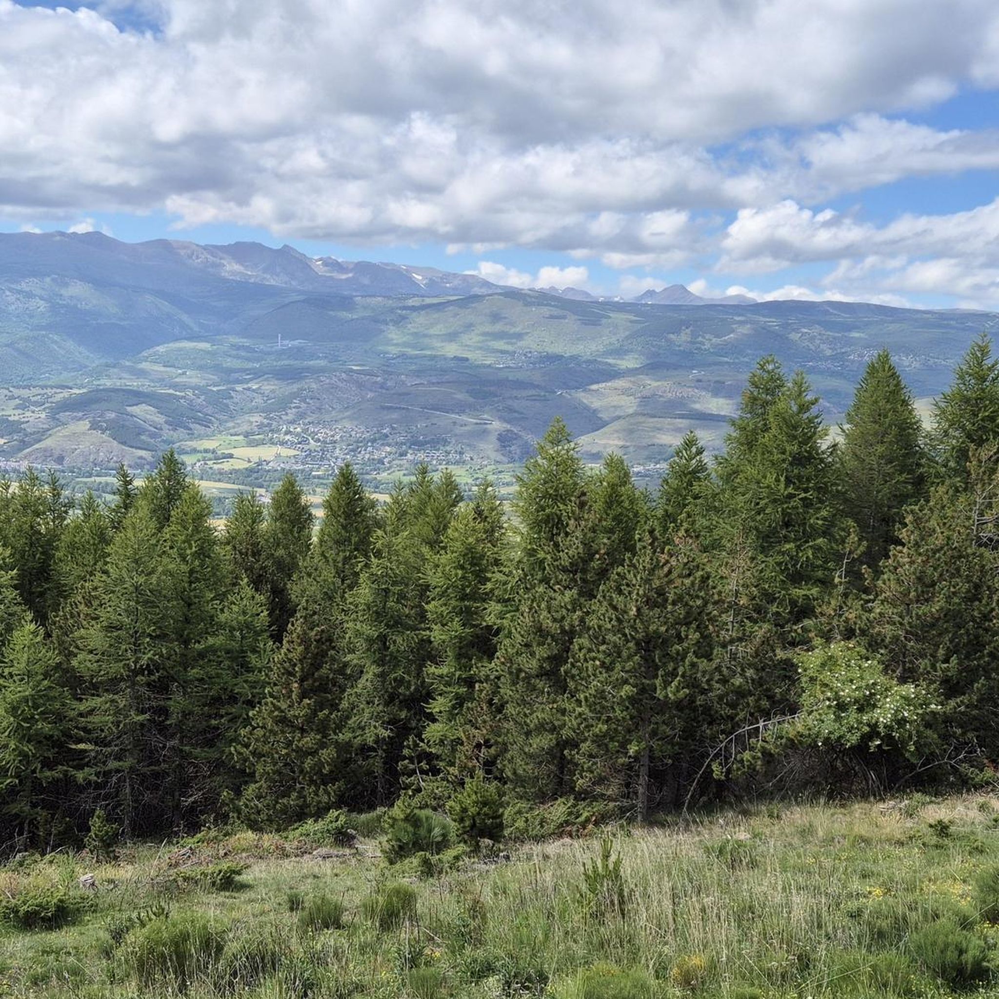
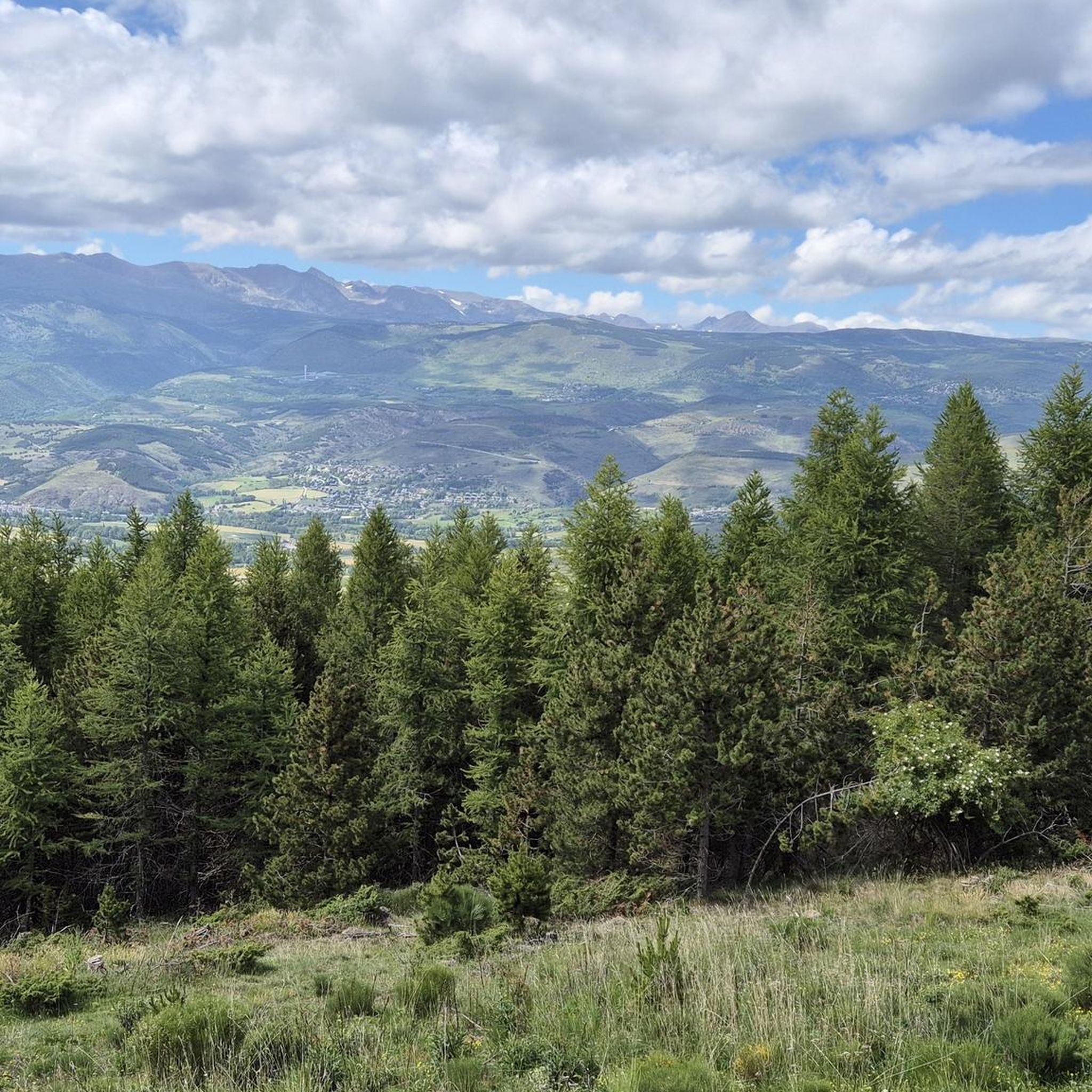
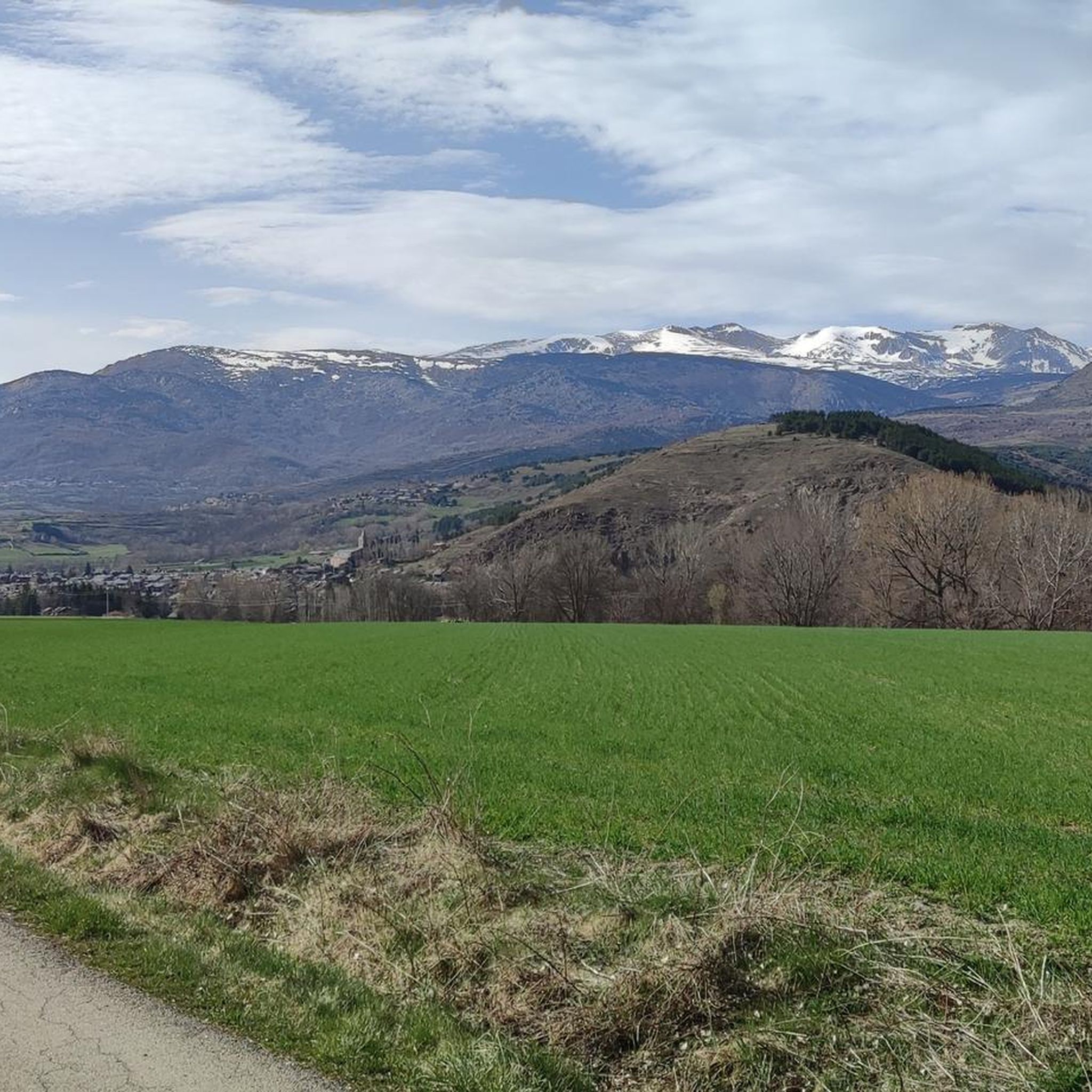

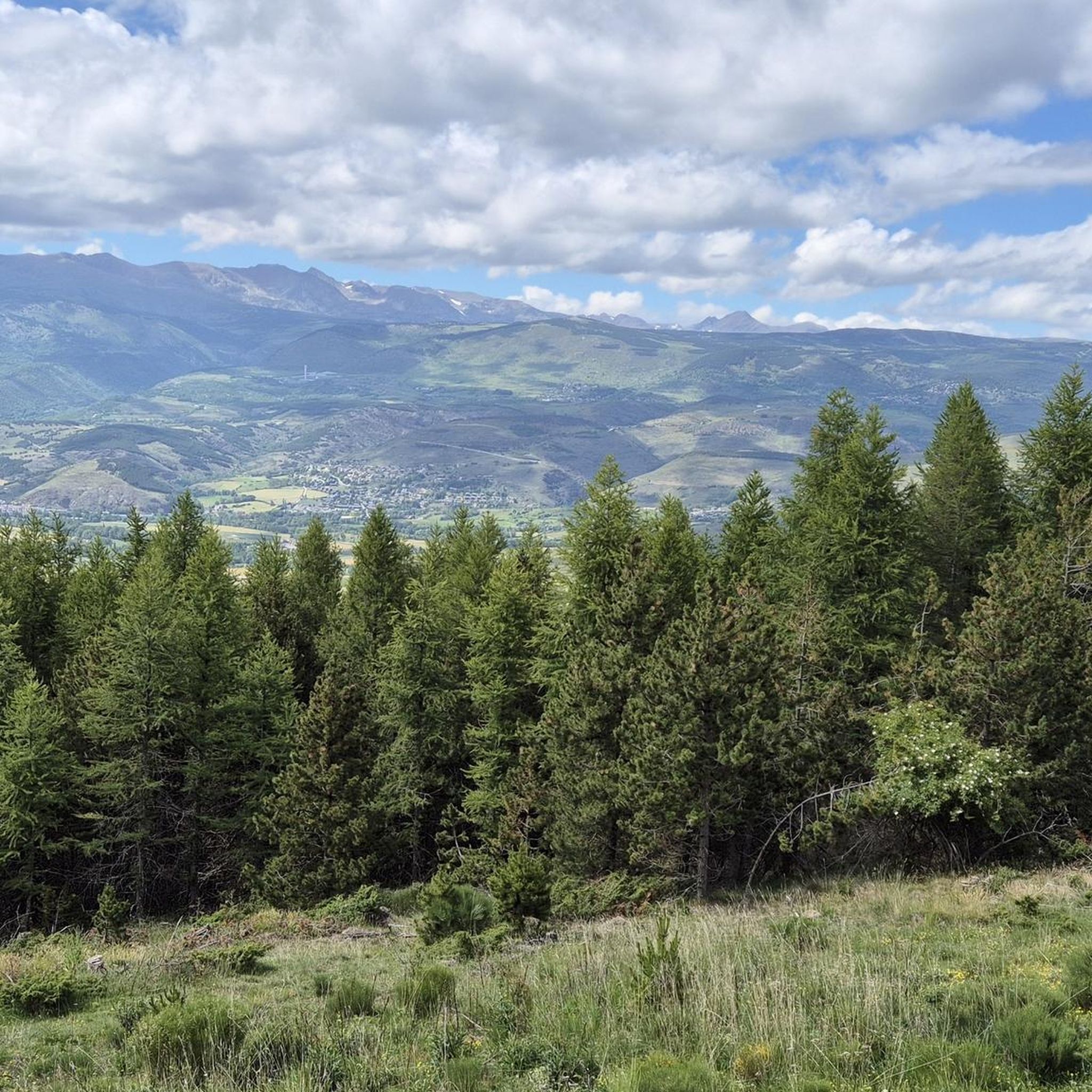

Tips from the Community

Regular asphalt if it's downhill Bones vistas
0
0

Well, starting from Font Romeu and breaking legs from Mont Louis
0
0

Second port of the 4cims. Long but very laid out. It is worth enjoying its views without putting down the big plate at many times. :)
0
0

The Col de la Calvaire de Font Romeu is a mountain pass in French Cerdanya, next to the town and ski resort of Font Romeu. This port connects the Bolquère valley with the Cerdanya valley. The port is within the same town of Font Romeu, next to the station's ski lifts. There are many slopes to reach Col de la Calvaire: - the western slope that starts from Ur is approximately 16 km and crosses the town of Targasone and the Col d'Egat. It is a very steep climb along a road in perfect condition, although on holidays there is a lot of traffic. - The southern slope starts from Llívia and crosses Estavar and joins the previous one at the Col d'Egat. Unlike the first, the first section of the climb is very hard, with several horseshoe curves and with wonderful views of the entire Cerdanya and the Tosa d'Alp. - The eastern slope stops at Olette, and after approximately 28 km it reaches the top of the pass, passing through the town of Mont-Louis and Bolquère. It is a very steep climb, like the first, on a road in perfect condition but with a lot of traffic. I don't like going up here. - the eastern slope that starts from Olette and passes through the Col de la Perche, reaching the town of Font-Romeu and from there to the top. Of all the slopes, the one I like the most is the slope that starts from Llívia and crosses Estavar.
0
0

Culminating at 1,579 meters above sea level, the Col de la Perche can be climbed by four routes in total. Each of them includes relatively gentle slopes. At the top, the view of the surrounding area is splendid and rewards your efforts!
0
0

Coll de Muntanya is a mandatory pass between Cerdanya, Ripollès and Berguedà. Its slopes offer long ports (15-20 kms) and with a good gradient (+700). The descent to Ribes de Freser is spectacular. Crossing point for routes such as the 4 Peaks or the RAG.
0
1

It's probably not the most spectacular pass in the Pyrenees, but it has its charms. Its position, in the middle of the Catalan Pyrenees natural park, makes it a privileged passage for admiring 360° of the mountains, valleys and plains of this protected area. If you pass by, take the time to look around for yourself and enjoy the view.
0
0
It is a mountain pass that connects Conflent with Cerdanya. It can be reached in a multitude of variants. For me there are 4 clear aspects: - Eastern slope - from Olette along the main road N116 - West slope - from Sallagosa on the main road N116 - West slope - from Sallagosa along the secondary road that crosses the Col de Llo and the town of Eyne - West slope - from Llivia crossing Estavar and the Col d'Egat. With some nuances, in general the 4 slopes are soft and long. The views from the port on both sides are beautiful, especially towards the Eyne ski resort. It must be taken into account that the two slopes that run along the N116 highway have a lot of traffic, with motorcycles and trucks.
1
0
Frequently Asked Questions
What kind of views can I expect from the mountain passes in this region?
The mountain passes around Sainte-Léocadie offer diverse and splendid panoramic views. For instance, Col de la Perche (1,579 m) provides 360-degree vistas of the surrounding mountains, valleys, and plains within the Pyrénées Catalanes Regional Natural Park. The Col de Puymorens also offers picturesque mountain scenery, and its location is recognized in the National Inventory of Natural Heritage for its panoramic views.
Are there mountain passes with historical significance near Sainte-Léocadie?
Yes, several passes have rich historical backgrounds. The area around the Col de la Perche has historical depth, cited in papal bulls as early as 897 and serving as the location for the Battle of Col de la Perche in 1793. An ancient hospice for travelers once stood there. The Col de Puymorens was historically a significant passage through the Pyrenees, marking the border between the Kingdom of France and the Principality of Catalonia before the Treaty of the Pyrenees in 1659.
What outdoor activities can I do near the mountain passes around Sainte-Léocadie?
The region offers a variety of outdoor activities. You can explore numerous hiking trails, with options ranging from easy to moderate, such as the 'Err loop from Err' or 'Refuge du Puigmal – Err loop from Err'. For cyclists, there are challenging routes like the 'Coll d'Egat Ascent from Llívia via Estavar'. You can find more details on specific routes in the Hiking around Sainte-Léocadie, Cycling around Sainte-Léocadie, and Gravel biking around Sainte-Léocadie guides.
What is the difficulty level of mountain passes around Sainte-Léocadie?
The mountain passes in the area cater to various skill levels. Passes like Col de la Perche (1,579 m) are considered intermediate with relatively gentle slopes, making them appealing to cyclists of varying skill levels. Other routes, such as the 'Coll d'Egat Ascent from Llívia via Estavar', are described as challenging, featuring very steep climbs and strong winds.
Are there family-friendly options among the mountain passes?
While specific passes aren't categorized as 'family-friendly' in the data, the relatively gentle slopes of passes like Col de la Perche (1,579 m) can be suitable for families looking for scenic drives or easier cycling. For hiking, there are easy routes like the 'Err loop from Err' which might be suitable for families.
What are the accessibility options for reaching these mountain passes?
Many passes are easily accessible by road. For example, the Col de la Perche is accessible via the N116, D33, and D10. It is also crossed by TER Languedoc-Roussillon trains on the Cerdagne line, being the highest point on the SNCF network. The Col de Puymorens is traversed by the RN 320, and a toll tunnel, the Tunnel du Puymorens, provides an alternative route, generally open almost year-round except during heavy snow.
When is the best time to visit the mountain passes around Sainte-Léocadie?
The Col de Puymorens is generally open for vehicle traffic almost year-round, except during periods of heavy snow. For cycling and hiking, the warmer months from late spring to early autumn typically offer the best conditions, though some passes like Collada de Toses Pass are frequented by skiers in winter, indicating year-round appeal depending on the activity.
What natural features define the landscape around these mountain passes?
The region is characterized by a mountainous landscape within the Pyrénées Catalanes Regional Natural Park. Passes like Col de la Perche mark watershed divides between major river basins (Sègre and Têt). The Col de Puymorens links the Garonne and Ebro river basins and lies on the watershed between the Atlantic and the Mediterranean. Glacial moraines can still be observed near the Col de Puymorens, indicating past geological activity.
Where can I find less crowded mountain passes for a quieter experience?
While specific 'less crowded' passes aren't explicitly highlighted, the Col de la Perche (1,579 m), despite its accessibility, is noted for its charm and position within the natural park, offering a chance to enjoy 360° views. Exploring some of the less-trafficked routes to passes like Col du Calvaire (Font-Romeu), particularly the southern slope from Llívia, might offer a quieter experience compared to main roads.
What do visitors particularly enjoy about the mountain passes in this area?
Visitors appreciate the diverse experiences offered by the mountain passes. The Col de la Perche (1,579 m) is loved for its splendid 360-degree panoramic views. The Collada de Toses Pass is popular for its spectacular north side, especially among skiers in winter. The challenging climbs and beautiful views of the Cerdanya from routes like the 'Coll d'Egat Ascent from Llívia via Estavar' are also highly regarded by the komoot community.
Can I find accommodation or dining options near the mountain passes?
Yes, the Col de Puymorens is a significant tourist destination with hotel facilities available on both sides of the pass. While specific cafes or pubs near other passes are not detailed, the proximity to towns like Font-Romeu (near Col du Calvaire) suggests that dining and accommodation options are available within a short distance.
How do the mountain passes connect different regions or river basins?
The mountain passes serve as crucial geographical connectors. The Col de la Perche forms a vital link between the Conflent region (Têt valley) and Cerdagne (Sègre valley), marking the watershed divide between the Sègre and Têt river basins. Similarly, the Col de Puymorens links the Garonne and Ebro river basins, lying on the watershed between the Atlantic and the Mediterranean.
Are there any unique geological features to observe at these passes?
Yes, the region offers interesting geological insights. Near the Col de Puymorens, glacial moraines can still be observed, remnants from periods when the area was covered by thick layers of ice. The pass itself is recognized for its glacial geomorphology. Additionally, the former iron mine of Puymorens, which operated until 1966, is located near the pass at approximately 2,100 meters altitude.
Most popular routes around Sainte-Léocadie
Most popular attractions around Sainte-Léocadie

Get inspired with the komoot mobile app


Explore more
See even more epic mountain passes by checking out these guides around Sainte-Léocadie:
