The best road cycling routes around Encourtiech
4.6
(93)
3,605
riders
109
rides
Road cycling routes around Encourtiech are characterized by their challenging mountain passes and scenic loops through the Ariège Pyrenees. The terrain features significant elevation changes, with routes often ascending cols and traversing valleys. This region offers a diverse landscape for road cyclists, from rolling hills to demanding climbs. The area's road network provides access to both tranquil countryside and more strenuous mountain ascents.
Best road cycling routes around Encourtiech
- The most popular road cycling route is Saint-Lizier and Cazavet Loop…
Last updated: July 4, 2026
4.3
(4)
56
riders
36.5km
01:34
290m
290m
An easy 22.7-mile road cycling route along the Salat River from Saint-Girons, featuring scenic Pyrenean foothills and historic landmarks.
4.4
(5)
128
riders
57.9km
02:57
930m
930m
Hard road ride. Very good fitness required. Some segments of this route may be unpaved and difficult to ride.

Sign up for free
5.0
(1)
49
riders
73.0km
04:11
1,620m
1,620m
Hard road ride. Very good fitness required. Some segments of this route may be unpaved and difficult to ride.
37
riders
Moderate road ride. Good fitness required. Mostly well-paved surfaces and easy to ride.
4.0
(3)
23
riders
79.3km
04:52
2,140m
2,140m
Hard road ride. Very good fitness required. Mostly well-paved surfaces and easy to ride.
Get access to more routes and recommendations from other explorers.
Sign up for free
Already have an account?
Our route recommendations are based on thousands of hikes, rides, and runs completed by other people on komoot.
Start today with a free account
Your next adventure awaits.
Login or Signup




Tips from the Community

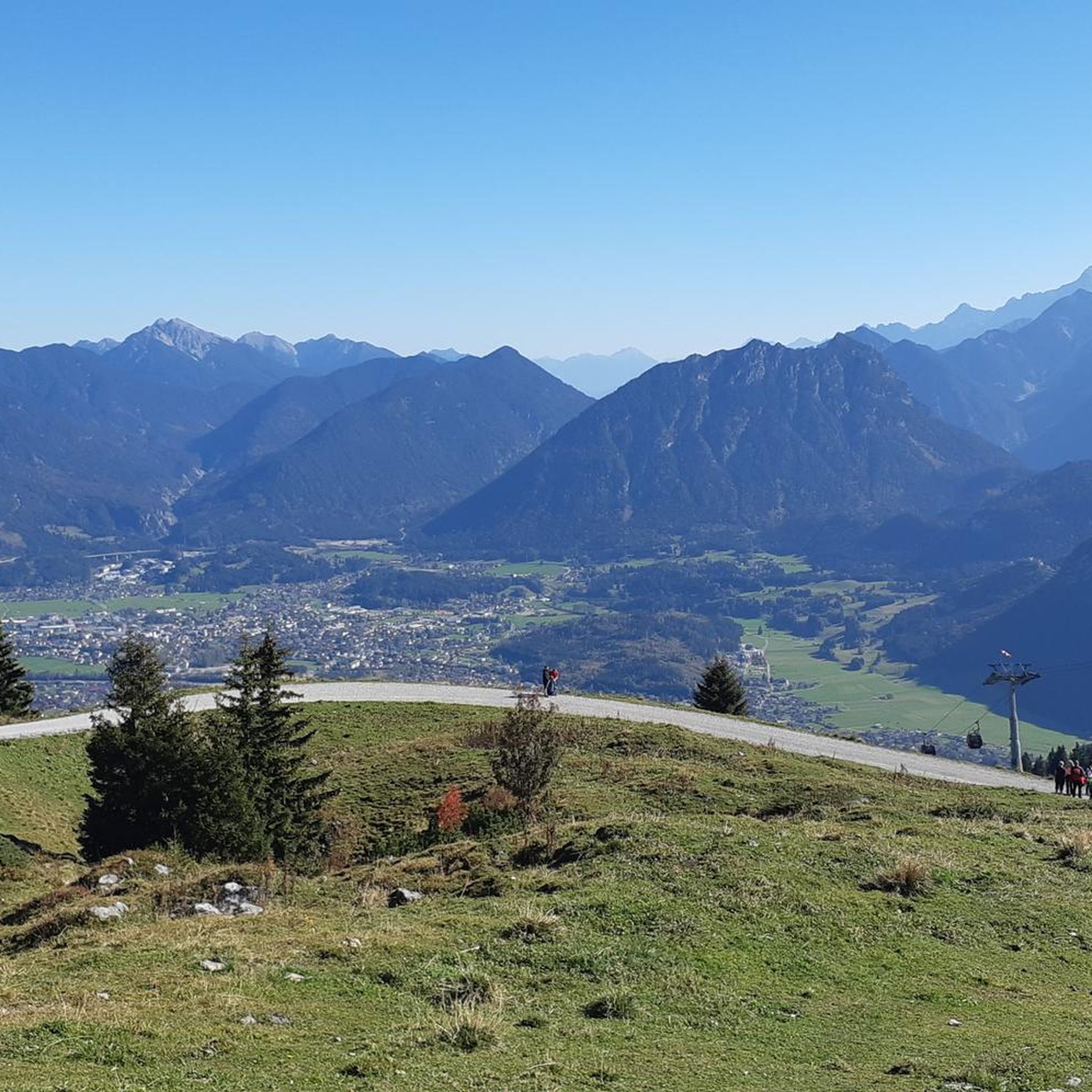
Saint-Girons is a charming small town at the foot of the Pyrenees in the Ariège department in southern France. It is considered the gateway to the wild and authentic landscapes of Couserans. The town is particularly known for its lively weekly market, its cozy alleys, and its relaxed atmosphere. Hikers and nature lovers appreciate Saint-Girons as an ideal starting point for tours in the surrounding mountains. The mix of French flair, history, and nature makes the town a worthwhile destination.
2
0

I climbed it from its easier side, the one that starts from Foix and stretches for 28 kms, crossing the Col de Marrous. It's a steady climb, with a few tough kilometers, and very pleasant. It's the side used by the Tour de France to descend it. The best thing about the Mur de Peguère are the views from its summit.
0
0
I can only speak about my experience descending it from the south side, the one that starts in the village of Biert. It's simply a great pass, with a very tough final section, very similar to its close brother Mur de Peguère. With hardly any traffic, it has the appeal that the road is very narrow and very winding, which helps mentally.
0
0


The road is a bit chilly in winter, near the start of the climb to Cachaudegé and the Portech pass.
0
0

Be careful, since yesterday, June 19th, the descent to Rivèrenert has been freshly graveled and dangerous. I had a rear puncture due to small, sharp gravel sticking to the tire when braking. So, don't go crazy on this descent, friends.
2
0
Because around 12pm and >31°C, the climb from Biert is mostly in the shade, and this pass generally ends a series of small linked passes (like Portech, Catchaudégué or La Core, Saraillé, etc.). And the challenge of the last 3 km is worth experiencing to strengthen your mental strength. Get to your pedals
0
0

A little past the summit sign of the Col du Saraillé on the way down towards the valley or Aulus is a section where the road opens up in front of your reveiling a stunning view of the mountains with a few houses in the foreground. On the left at the intersection is a little viewing platform with a picnic table where you could relax and take in the view. Or you can also take in the view as you zigzag down the moutain into the valley.
0
0
Frequently Asked Questions
How many road cycling routes are available around Encourtiech?
There are over 110 road cycling routes around Encourtiech, offering a wide range of options for cyclists of all abilities. These routes are highly rated by the komoot community, with an average score of 4.6 stars.
What kind of terrain can I expect on road cycling routes near Encourtiech?
The region around Encourtiech, nestled in the Ariège Pyrenees, is characterized by diverse terrain. You'll find challenging mountain passes, significant elevation changes, and scenic loops through valleys. Routes can transition from rolling hills to demanding mountain ascents, providing a varied landscape for road cyclists.
Are there any easy road cycling routes suitable for beginners or families?
Yes, while the region is known for its challenging climbs, there are easier options. For instance, the Saint-Lizier and Cazavet Loop is an easy 22.7-mile (36.5 km) route that offers a pleasant ride through the local countryside with minimal elevation gain.
Which challenging mountain passes can I cycle near Encourtiech?
Encourtiech provides access to several demanding mountain passes. Notable routes include the Core Pass – Seix loop from Saint-Girons, a 61.5-mile (99.0 km) trail leading through high mountain passes, and the Col de Port – Fountain at Col de Port loop from Eycheil, which features substantial climbs. The Col de Saraillé – Biert Village loop from Eycheil is another difficult route with significant ascents and descents.
What is the best time of year for road cycling in the Ariège Pyrenees?
The best time for road cycling in the Ariège Pyrenees, including Encourtiech, is generally from spring through autumn. During these seasons, the weather is more favorable, and mountain passes are typically clear of snow. Summer offers warmer temperatures, while spring and autumn provide cooler rides and beautiful scenery. It's advisable to check local weather and road conditions, especially for high mountain passes, as seasonal closures can occur.
Are there any scenic viewpoints or natural attractions along the road cycling routes?
The region offers breathtaking panoramic views of the entire Couserans region and the majestic Pyrenees mountain range, including peaks like Garrié and Tête d'Ane. While cycling, you'll encounter diverse scenery from plains to foothills and high mountains. The Ariège Pyrenees Regional Natural Park provides a remarkable backdrop with its rich biodiversity, forests, and high-altitude pastures.
Can I access the Voie Verte (Greenway) from Encourtiech for cycling?
Yes, the region is close to the Foix–Saint-Girons Greenway (V81), which offers a flatter, car-free cycling experience. You can access sections like Foix–Saint-Girons Greenway or explore The tunnels of Véloroute 81. This is a great option for a more relaxed ride or for families.
Are there any historical sites or landmarks to see while cycling near Encourtiech?
Yes, Encourtiech itself has historical significance with the fortifications and ruins of its castle, dating back to the late 13th or early 14th century. A historic path, "Camin deth castèlh," connects the castle to an old water mill, offering a panoramic view of the Valier massif. Additionally, the Saint-Lizier Historic Village is a notable highlight in the area, offering a glimpse into local heritage.
What do other road cyclists enjoy most about road cycling in Encourtiech?
The area is highly rated by the komoot community, with an average score of 4.6 stars from over 70 reviews. Cyclists often praise the challenging mountain passes, the stunning natural beauty of the Pyrenees, and the diverse landscapes that make each ride unique and rewarding.
Are there any circular road cycling routes available?
Yes, many of the routes around Encourtiech are designed as loops, allowing you to start and finish in the same location. Examples include the Saint-Lizier and Cazavet Loop, the Core Pass – Seix loop from Saint-Girons, and the Core Pass – Col de Saraillé loop from Eycheil, providing varied distances and difficulties for a full circular experience.
Is there parking available for cyclists in Encourtiech?
While specific cyclist parking areas in Encourtiech are not detailed, as a destination for outdoor activities, you can typically find public parking in and around the village. It's advisable to check local signage upon arrival for the most convenient spots to begin your ride.
Are there any cycling-friendly amenities or services in Encourtiech?
Encourtiech and the broader Couserans Pyrenees region embrace a "Passion Outdoor" theme, which includes cycling. While specific amenities like dedicated bike shops in Encourtiech itself might be limited, you'll find a supportive environment for cyclists. Nearby larger towns like Saint-Girons will offer more comprehensive services, including cafes, restaurants, and potentially bike repair shops.
Most popular routes around Encourtiech
Most popular attractions around Encourtiech

Get inspired with the komoot mobile app


Explore more
Browse the best Road cycling routes in other regions.
