The best walks and hikes around Roche-Charles-La-Mayrand
4.5
(574)
4,520
hikers
107
hikes
Hiking around Roche-Charles-La-Mayrand offers diverse terrain, characterized by its altitude of approximately 1100 meters and rugged landscapes. The region features dark forests, cold valleys, and expansive plateaus, providing varied hiking terrain. Hikers can experience views of the Chaîne des Puys, the Massif du Sancy, and the Massif du Cézallier, alongside the Gorges du Sault. This area's geological history includes volcanic formations and features shaped by past glaciations.
Best hiking trails around Roche-Charles-La-Mayrand
- The most popular hiking route is Courgoul loop…
Last updated: June 29, 2026
4.7
(3)
42
hikers
17.5km
05:03
430m
430m
Hard hike. Very good fitness required. Easily-accessible paths. Suitable for all skill levels.
4.3
(6)
19
hikers
9.93km
02:42
140m
140m
Moderate hike. Good fitness required. Easily-accessible paths. Suitable for all skill levels.

Sign up for free
4.0
(1)
14
hikers
4.98km
01:26
130m
130m
Easy hike. Great for any fitness level. Easily-accessible paths. Suitable for all skill levels.
5.0
(1)
12
hikers
12.0km
04:12
580m
580m
Moderate hike. Good fitness required. Mostly accessible paths. Sure-footedness required.
12
hikers
10.1km
02:55
260m
260m
Moderate hike. Good fitness required. Easily-accessible paths. Suitable for all skill levels.
Get access to more routes and recommendations from other explorers.
Sign up for free
Already have an account?
Our route recommendations are based on thousands of hikes, rides, and runs completed by other people on komoot.
Start today with a free account
Your next adventure awaits.
Login or Signup
Tips from the Community


After the difficult climb through the forest, we arrive at Lake Bourdouze
0
0
Difficult to access and wild, this lake is nevertheless worth the detour
0
0

7/2023 - again a subsequent bathing ban with many signs, there is nobody in the water either
0
0

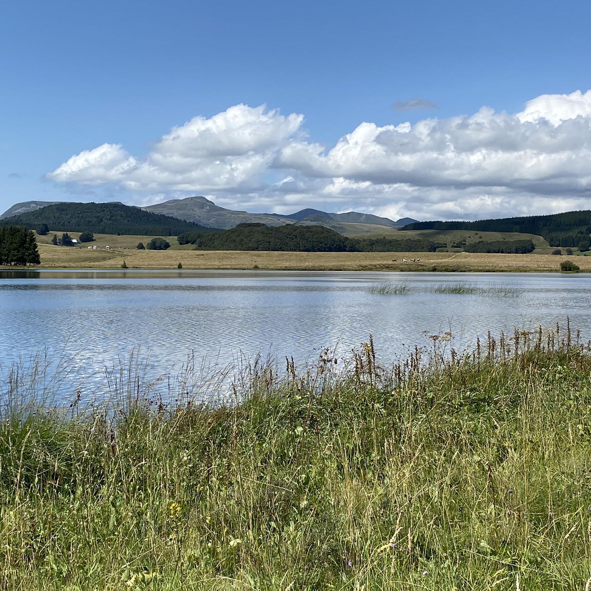
The Lac de Bourdouze is located at an altitude of 1170 meters, in the Massif du Sancy. You can get a good view from the road, and if you want to get closer you can, but it will be on a gravel road. You can access the lake year-round, but it freezes during the winter months.
1
0

The Puy de Montcineyre, at the time of its formation, blocked the course of a river, and formed this large lake in the shape of a crescent. Although it was not formed during a volcanic explosion, its depth of 20 meters is significant.
2
0

Lake of glacial origin, formed 12,000 years ago; partly covered by a bog. Lake Bourdouze in figures: surface area of 25 ha, altitude of 1150 meters and maximum depth of 4 meters. Fishing possible (pike and fried fish). Pedestrian path towards Lake Montcineyre, but no route to go around the lake (peat bog area). Parking nearby. Access : From Besse, follow the road to Compains for 7 km. The Lac de Bourdouze site is then indicated on the left. Opening: All year. Subject to favorable snow and weather conditions. Car park
1
0

Nice quiet lake but where it is impossible to swim.
2
0
Frequently Asked Questions
How many hiking trails are available around Roche-Charles-La-Mayrand?
There are over 100 hiking routes in the Roche-Charles-La-Mayrand area, catering to various skill levels. You'll find a wide selection, from easy strolls to challenging ascents through volcanic landscapes and deep gorges.
What kind of terrain can I expect on hikes in Roche-Charles-La-Mayrand?
The terrain around Roche-Charles-La-Mayrand is incredibly diverse, shaped by its volcanic history and high altitude. Expect to traverse dark forests, cool valleys, and expansive, windswept plateaus. Some trails, especially those leading to the Chapel of Roche-Charles, can be steep and slippery after rain, requiring appropriate footwear.
Are there any easy hiking routes suitable for beginners or families?
Yes, the region offers nearly 40 easy routes. For a pleasant, shorter walk through rural landscapes, consider the Stone bridge loop from Compains, which is about 5 km long and takes less than two hours to complete.
What are some notable landmarks or viewpoints I can discover on a hike?
Many trails offer stunning panoramic views of the Chaîne des Puys, the Sancy massif, and the Cézallier mountains. A significant landmark is the 12th-century Chapel of Roche-Charles, dramatically perched on a rocky outcrop overlooking the Sault ravine. You can also find natural features like the impressive Mottes Cliffs and the unique Fairy Chimneys of the Vallon des Fosses.
Are there any circular walks available in the area?
Yes, many of the trails in Roche-Charles-La-Mayrand are circular, allowing you to start and end at the same point. An example is the Lake Bourdouze – Lac de Bourdouze loop from Valbeleix, a challenging 17.5 km route that offers beautiful lake views.
What is the best time of year to go hiking in Roche-Charles-La-Mayrand?
The region is beautiful throughout the warmer months, typically from late spring to early autumn. During this time, the weather is generally favorable for exploring the diverse landscapes, from lush valleys to expansive plateaus. Always check local weather conditions before heading out, as paths can be slippery after rain.
What kind of natural features can I expect to see while hiking?
Hikers will encounter a rich variety of natural features, including the impressive Gorges du Sault, which provide a dramatic backdrop for many trails. The area's volcanic past is evident in the landscapes, and you can also explore features shaped by the last ice age, such as moraines. The region is also home to the beautiful Lake Pavin.
What do other hikers say about the trails in Roche-Charles-La-Mayrand?
The trails in Roche-Charles-La-Mayrand are highly rated by the komoot community, with an average score of 4.5 stars from over 500 reviews. Hikers often praise the stunning panoramic views, the diverse volcanic landscapes, and the sense of tranquility found on the trails.
Are there any challenging hikes for experienced trekkers?
Absolutely. For experienced hikers seeking a challenge, there are 11 difficult routes available. The View of Lake Pavin – Lake Pavin viewpoint loop from Compains is a demanding 28.6 km trail with significant elevation gain, offering expansive views of the volcanic landscape.
Are there any trails that pass by lakes or water features?
Yes, several routes incorporate beautiful water features. For example, the Lake Bourdouze – Lac de Bourdouze loop from Les Chirouzes is a moderate 9.9 km trail that takes you around the scenic Lake Bourdouze. The Gorges du Sault also feature prominently in some routes, offering dramatic river views.
What are some nearby attractions or villages worth visiting after a hike?
Beyond the trails, the region offers several charming villages and historical sites. You could visit Besse or Besse-et-Saint-Anastaise. The Parc des Volcans d'Auvergne is also just 16 km away, offering further opportunities to explore volcanic scenery. Other notable sites include the Romanesque Church of St-Nectaire-le-Haut and the Chateau de Murol, both within a short drive.
What should I wear or bring for hiking in Roche-Charles-La-Mayrand?
Given the varied terrain and potential for slippery paths, especially after rain, appropriate footwear with good grip is essential. Layers of clothing are recommended to adapt to changing weather conditions at altitude. Always carry enough water, snacks, and a map or GPS device, as some areas can be remote.
Most popular routes around Roche-Charles-La-Mayrand
Most popular attractions around Roche-Charles-La-Mayrand

Get inspired with the komoot mobile app


Explore more
Browse the best Hikes in other regions.
