The best MTB trails around Puyvalador
4.3
(342)
2,415
riders
92
rides
Mountain biking around Puyvalador offers diverse landscapes, from artificial lakes to dense forests and mountainous terrain. The region is characterized by significant elevation changes, with routes ascending over 3,000 feet in some areas. Trails often feature a mix of shaded and sunny paths, providing varied riding experiences. The area's natural features, including the Puyvalador Dam and its lake, contribute to scenic viewpoints along many routes.
Best mountain bike trails around Puyvalador
- The most popular mountain bike trail is Lac d'Aude…
Last updated: August 14, 2026
5.0
(2)
12
riders
7.04km
00:36
80m
80m
Easy mountain bike ride. Great for any fitness level. Suitable for all skill levels.
5.0
(2)
12
riders
7.35km
00:37
80m
80m
Easy mountain bike ride. Great for any fitness level. Suitable for all skill levels.

Sign up for free
4.7
(6)
18
riders
39.2km
03:52
830m
830m
Moderate mountain bike ride. Good fitness required. Suitable for all skill levels.
1.0
(1)
6
riders
14.8km
01:30
330m
330m
Moderate mountain bike ride. Good fitness required. Suitable for all skill levels.
9
riders
61.2km
06:24
1,660m
1,660m
Hard mountain bike ride. Very good fitness required. Advanced riding skills necessary.
Get access to more routes and recommendations from other explorers.
Sign up for free
Already have an account?
Our route recommendations are based on thousands of hikes, rides, and runs completed by other people on komoot.
Start today with a free account
Your next adventure awaits.
Login or Signup


Tips from the Community

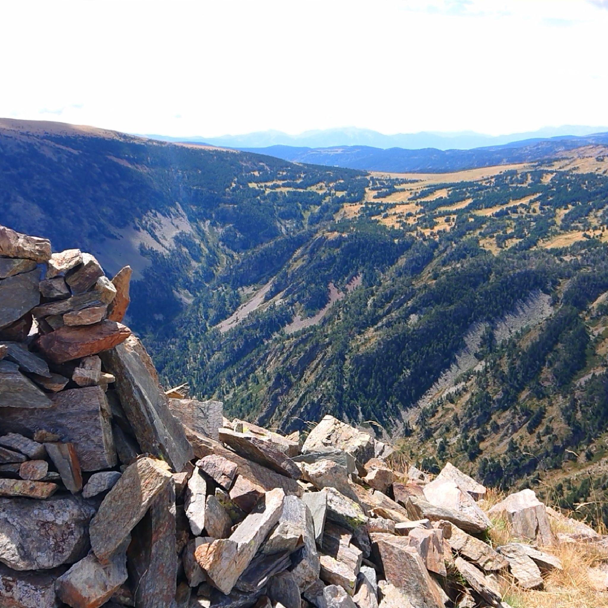
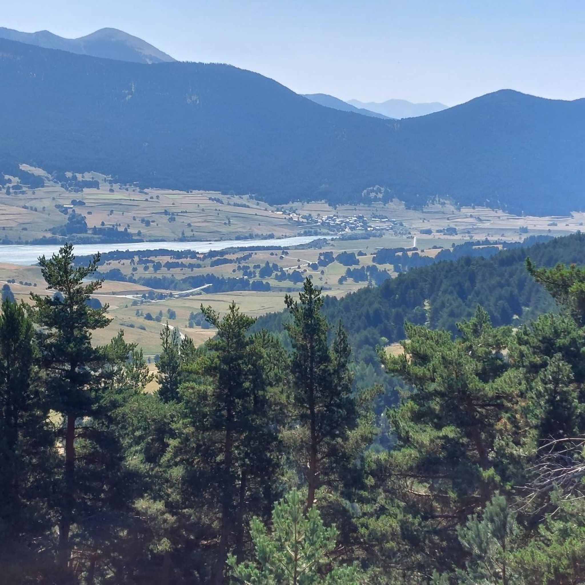
This super panoramic trail overlooks the El Galba watercourse, and offers all along a superb panorama of the Galbe valley. You are thus accompanied by fir trees, large green meadows and the mineral, snow-capped peaks in the background.
0
0
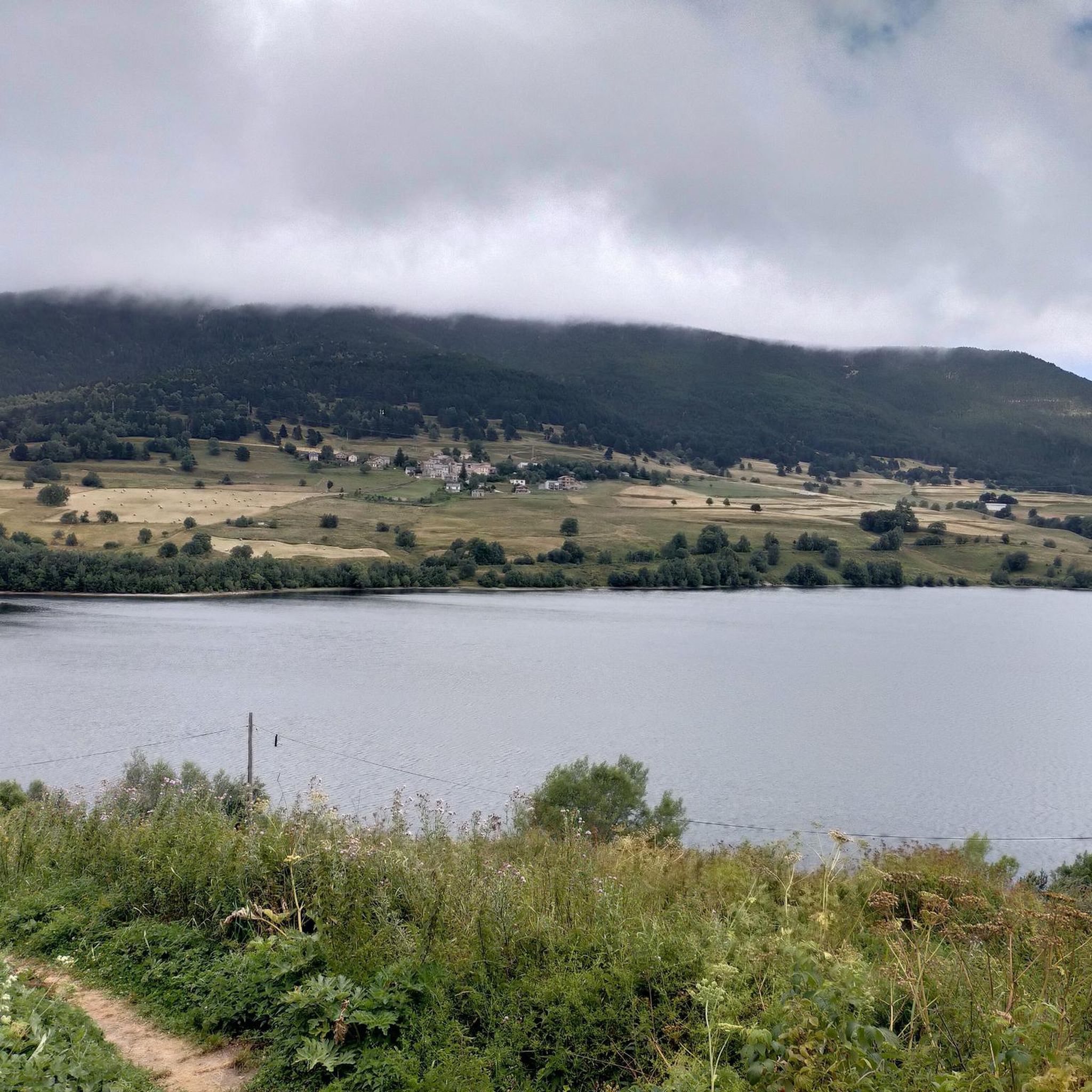
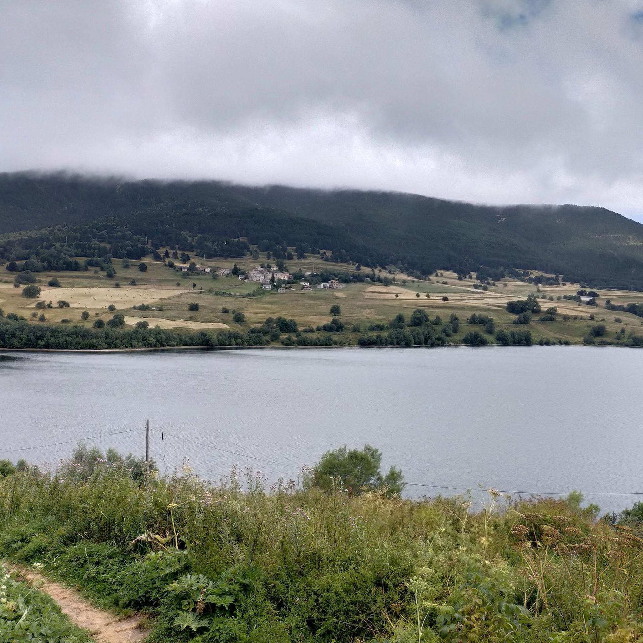
The Puyvalador dam is 160 meters long and 39 meters high. This concrete structure is used to regulate the waters of the Aude river to produce electricity. From the dam, the view is exceptional.
0
0

A superb view, only available to the most persistent
1
0


It is a simply spectacular port that unites the regions of Conflent and Capcir. It is one of the most beautiful ports in the easternmost Pyrenees. It is very close to the Col de la Llosa, and you can take a circular route that is known as the "Route des Cols". It is also indicated on nearby road signs. The hardest slope is the one that begins in Olette (Conflent) and goes up through Aiguatèbia. There are almost 22 km of ascent and 1,089 meters of elevation gain. It has 3 very different zones: (1) the first is a constant 5 km at 7%; (2) the second is 10 km at 4% and with some very pleasant rest areas, with beautiful views; (3) The final part is 6 km on average at 7%, since it passes the town of Railleu, although the hard part is the last 3 km, with several ramps that exceed 10%. The road is narrow and has uneven asphalt, with hardly any cars and motorcycles. For me, the final part of this port is truly spectacular and should not be missed. The west slope begins in the town of Matamala (Capcir) and is 3 km with an average of close to 8%. It is a long irregular stretch along a narrow and very quiet road, with panoramic views of the valley when the thick black pine forest gives some opportunity.
0
0

A little disappointing: the pass is in the middle of the forest and offers no view. The climb from (and to!) Railleu is nevertheless superb. A nice picnic area to have a bite to eat.
1
0
High mountain town known for the ski resort in its vicinity. It is a town with various services in case water needs to be replenished.
0
0

A very quiet and beautiful corner
0
0
Frequently Asked Questions
How many mountain bike trails are available in Puyvalador?
Puyvalador offers a wide network of over 90 mountain bike trails. These routes cater to various skill levels, from easy lakeside loops to challenging mountain ascents.
Are there easy mountain bike trails suitable for beginners or families in Puyvalador?
Yes, Puyvalador has several easy mountain bike trails perfect for beginners or family outings. A great option is the Cascade du Galbe – Cascade sur le Galbe loop from Réal, an 18.7 km path with moderate elevation changes. The area around Lac de Puyvalador also features tranquil paths with gentle slopes, ideal for a relaxed ride.
What are some challenging mountain bike routes for experienced riders in Puyvalador?
For experienced riders seeking a challenge, Puyvalador offers demanding trails with significant elevation gains. The Col de la Creu – Lake Calvet loop from Formiguères is a difficult 49.1 km trail leading through high mountain passes with expansive views. Another demanding option is the Camporells Refuge – Lake Aude loop from Formiguères, which covers 38.7 km with over 1000 meters of elevation gain.
What kind of landscapes can I expect to see while mountain biking in Puyvalador?
Mountain biking in Puyvalador offers diverse landscapes, including artificial lakes like Lac de Puyvalador, dense forests, and significant mountainous terrain. You'll ride through the stunning Capcir plateau, experiencing varied terrain and breathtaking vistas. Many routes also feature scenic viewpoints of the Pyrénées Catalanes.
Are there mountain bike trails that are loop routes in Puyvalador?
Yes, many mountain bike trails in Puyvalador are designed as loops, allowing you to start and finish at the same point. Examples include the easy Lake Matemale – Lake Matemale loop from Formiguères and the more challenging On the road to Camporells – Camporells loop from Formiguères.
What do other mountain bikers say about the trails in Puyvalador?
The mountain bike trails in Puyvalador are highly rated by the komoot community, with an average score of 4.4 stars from over 300 reviews. Riders often praise the diverse terrain, the significant elevation changes that offer a good challenge, and the scenic beauty of the artificial lakes and dense forests.
What are some notable natural features or landmarks to see along the mountain bike routes?
While mountain biking in Puyvalador, you can encounter several natural features and landmarks. The region is known for the picturesque Lac de Puyvalador and the high-altitude Capcir Plateau. You might also pass by mountain passes like Pailhères Pass or see peaks such as Pic de Tarbesou. Some routes also offer views of the Pyrénées Catalanes from spots like Refuge d'Oller.
Are there any huts or refuges along the mountain bike trails in Puyvalador?
Yes, the region around Puyvalador features several huts and refuges that can be found along or near mountain bike routes. Notable ones include Camporells Refuge, Balmeta Hut, and Refuge d'Oller, offering potential rest stops or scenic points.
What is the best season for mountain biking in Puyvalador?
Given Puyvalador's location on the high-altitude Capcir plateau and its mountainous terrain, the best season for mountain biking is typically from late spring through early autumn. During these months, the weather is generally more favorable, and trails are clear of snow, offering optimal conditions for riding.
Do mountain bike trails in Puyvalador offer good viewpoints?
Absolutely. Many mountain bike trails in Puyvalador provide stunning viewpoints, especially those that ascend to higher elevations or traverse mountain passes. The Capcir plateau itself offers expansive vistas, and routes like the Col de la Creu – Lake Calvet loop are known for their panoramic views of the surrounding mountains and valleys.
Most popular routes around Puyvalador
Most popular attractions around Puyvalador

Get inspired with the komoot mobile app


Explore more
Browse the best MTB trails in other regions.
